
Need this for sure.
September 2020:
-
Rip76

- Posts: 2125
- Joined: Mon Feb 15, 2010 12:38 am
- Location: The Woodlands
- Contact:
-
Scott747
- Posts: 1648
- Joined: Tue Feb 23, 2010 9:56 am
- Location: Freeport/Surfside Beach
- Contact:
0z Euro is a little quicker then the GFS but makes partial landfall just n of Matagorda Bay as a weak to moderate ts before beginning to lift out ne along the coast to the tx/la border.
-
Cpv17
- Posts: 7090
- Joined: Fri Aug 31, 2018 1:58 pm
- Location: El Campo/Wharton
- Contact:
Well it looks like we’re in play for this one:

My goodness, look at the rain. Holy cow!
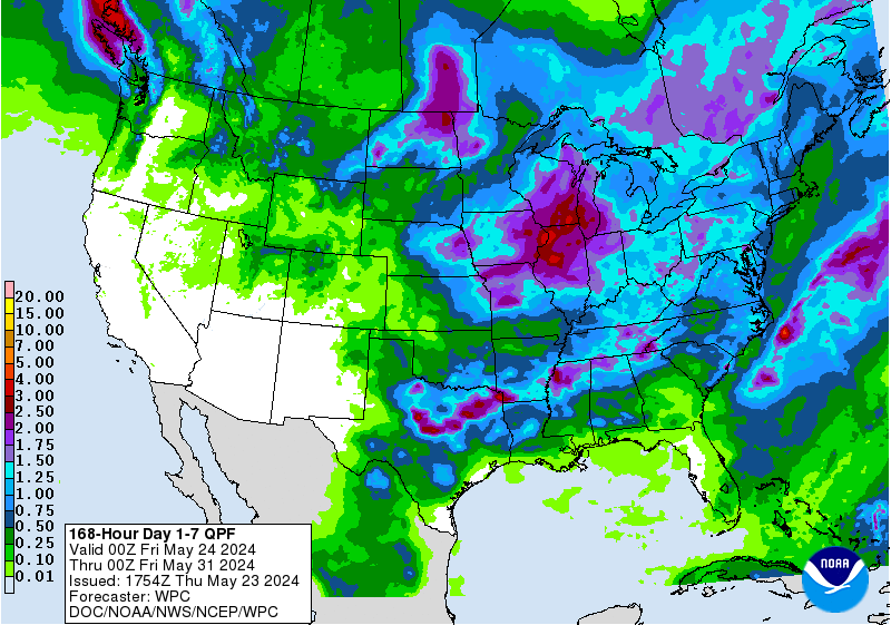
My goodness, look at the rain. Holy cow!
-
Stormlover2020
- Posts: 565
- Joined: Mon Jun 01, 2020 6:04 pm
- Contact:
If it keeps showing it riding the coast it will be more than that
-
TexasBreeze
- Posts: 1026
- Joined: Sun Sep 26, 2010 4:46 pm
- Location: NW Houston, TX
- Contact:
Cpv17 even has plenty for your area, but Dr.Mu not as much. The widespread yellow and infamous pink color reminds me of something in the past, but at least most of that is offshore.
The Euro model takes it to the TX LA border, but still has plenty of rainfall inland. GFS does too on the coast and makes multiple landfalls.
The Euro model takes it to the TX LA border, but still has plenty of rainfall inland. GFS does too on the coast and makes multiple landfalls.
-
Stormlover2020
- Posts: 565
- Joined: Mon Jun 01, 2020 6:04 pm
- Contact:
They are being conservative right now
-
tireman4

- Global Moderator

- Posts: 7120
- Joined: Wed Feb 03, 2010 9:24 pm
- Location: Humble, Texas
- Contact:
We might need a boat. LOL. As I have stated..This one will give forecasters fits. Goodness
-
tireman4
- Global Moderator
- Posts: 7120
- Joined: Wed Feb 03, 2010 9:24 pm
- Location: Humble, Texas
- Contact:
000
FXUS64 KHGX 181129
AFDHGX
Area Forecast Discussion
National Weather Service Houston/Galveston TX
629 AM CDT Fri Sep 18 2020
AVIATION [12Z TAF Issuance]...
VFR conditions are expected through the TAF period. Scattered
showers and thunderstorm over the Gulf waters are expected to
remain offshore, out of the coastal terminals. The rest of the
TAF period looks relatively dry. The main aviation concern will be
winds. North to northeast winds up to 15 knots, gusting around 20
knots are expected today. Higher gusts expected in the afternoon.
&&
.PREV DISCUSSION... /ISSUED 428 AM CDT Fri Sep 18 2020/
SHORT TERM [Tonight Through Saturday]...
Scattered showers and thunderstorms continue to develop over the
nearshore waters early this morning. This is in response to a weak
inverted surface trough and decent upper jet support. This
activity will remain over the Gulf waters, slowly moving offshore
through the day.
If you have outdoor plans, today and Saturday look like the best
period to do so.The weather along the coast and further inland is
shaping up to be quieter through Saturday evening. Northeast
surface flow and a drier airmass will filter in, bringing
dewpoints mainly in the 60s to lower 70s. This dry airmass will
persist through Saturday with a reinforcing surface high pressure.
Dewpoint values on Saturday could range in the upper 50s across
our far northern counties. With PWATs in the 1.15-1.50 inches and
limited forcing, little to no precipitation is anticipated today
and Saturday. Soundings suggest breezy conditions today, but even
breezier on Saturday with gusts around 15 to 20 knots at the top
of the boundary layer.
LONG TERM [Saturday Night through Thursday Night]...
This part of the forecast continues to be highly uncertain as we
monitor the progress of current Tropical Depression Twenty-Two.
The latest forecast from the National Hurricane Center brings this
system to the NNE over the next two days then edges it westward
during days three and four to a location generally off the lower
Texas coast. During this period, the depression is forecasted to
strengthen into a tropical storm, and further strengthening could
bring this system up to hurricane strength before some weakening
occurs. Since this tropical cyclone will not be moving anywhere
very quickly well into next week, this creates significant
forecast issues for our area. So based on the current track and
intensity forecast (which is highly subject to change), we will
show gradually increasing rain chances (showers with isolated
thunderstorms) across our coastal waters beginning late Saturday
afternoon and on into Saturday night as deeper moisture and
associated outer bands begin to edge into our area. As the system
begins its westward track, these bands should begin to spread
inland starting on Sunday, and additional bands should work their
way through the waters and onshore through at least into the first
couple days of the upcoming week. There could end up being a
pretty sharp gradient with higher rainfall totals near the coast
and especially offshore and much lower totals the further inland
you go. It must be emphasized that rainfall totals for this event
will be highly dependent on the track and movement of the cyclone,
and will likely change over the next several days. For now, we
are showing amounts for this event (over the next seven days)
possibly getting up to 10 to 15 inches along the coast with totals
closer to 1 to 2 inches up across our northern counties.
MARINE AND TROPICAL...
Attention is focused on marine and tropical weather as the
backdoor surface cool front moves over the waters and Tropical
Depression 22 slowly strengthens over the wester Gulf of Mexico.
Moderate northeast flow, gusting to 20 knots, is expected today
as the aforementioned front moves through. Small Craft Should
Exercise Caution flags are in effect and an upgrade to Small Craft
Advisory will be needed tonight into Saturday as gusty winds
continues and seas increases around 4 to 7 ft.
Marine conditions will continue to deteriorate as we head towards
next week. The Tropical Depression 22 is forecast to become a
tropical storm later today and could become a hurricane by Sunday.
While details on track and strength are still uncertain, this
system could potentially bring a prolonged period of strong
easterly winds, large seas and surf and above normal tides.
Given the prolonged and significant period of hazardous marine
conditions, impacts are not only possible over the waters, but
also along the coast. Minor coastal flooding may worsen over the
next several days. Will continue the Coastal Flood Statement for
all our coastal Counties. An upgrade on headlines will be possible
during the day.
&&
.PRELIMINARY POINT TEMPS/POPS...
College Station (CLL) 88 64 85 62 84 / 0 0 0 0 20
Houston (IAH) 90 68 88 68 83 / 0 0 0 10 40
Galveston (GLS) 88 75 87 75 83 / 30 10 10 30 70
&&
.HGX WATCHES/WARNINGS/ADVISORIES...
TX...NONE.
GM...NONE.
&&
$$
SHORT TERM...05
LONG TERM...42
AVIATION...05
MARINE...05
-
Pas_Bon
- Posts: 947
- Joined: Tue Sep 11, 2018 7:58 am
- Location: League City, TX
- Contact:
Son of Harvey. Dang.
Model output looks eerily similar at this juncture.
Model output looks eerily similar at this juncture.
-
tireman4
- Global Moderator
- Posts: 7120
- Joined: Wed Feb 03, 2010 9:24 pm
- Location: Humble, Texas
- Contact:
From Wxman57 on Storm 2K...
I was thinking that this reminds me of Edith in 1971, which bounced off NE Mexico then turned NE to track right over me in Lafayette, LA. Upper low steers it NNE next 36 hours, high builds in to the north and shoves it west toward (or into) TX Sun/Mon. Best time for hurricane strength is during the west movement. After Monday, trof digs down into TX and begins steering it NE, at which point it may suck in a good bit of dry air from Texas and weaken. I sure hope it just continues moving west into TX and dissipates by Tuesday, but I'm not holding my breath on that one.
https://en.wikipedia.org/wiki/Hurricane_Edith_(1971)
By the way, I'm not sure if this will be Wilfred or Alpha. NHC may name the system by Africa Wilfred first. It may come down to when the next scatterometer pass hits it.
Also, that 85kt SFMR wind with 5-10 kt FL winds all around looks kind of suspicious.
-
TexasBreeze
- Posts: 1026
- Joined: Sun Sep 26, 2010 4:46 pm
- Location: NW Houston, TX
- Contact:
Safe to say that TX has never had a Greek named system make landfall!
NHC has it slowly following the coastline.
They also pulled the trigger on Wilfred out by Africa.
NHC has it slowly following the coastline.
They also pulled the trigger on Wilfred out by Africa.
Last edited by TexasBreeze on Fri Sep 18, 2020 10:14 am, edited 1 time in total.
-
tireman4
- Global Moderator
- Posts: 7120
- Joined: Wed Feb 03, 2010 9:24 pm
- Location: Humble, Texas
- Contact:
Let the Greek Festival begin shortly. Wow. Just wow. We are at the height of the Cape Verde Season and we are at W. What will October bring? Gracious
-
javakah
- Posts: 142
- Joined: Thu Jun 02, 2016 9:20 pm
- Location: Fulshear
- Contact:
Looks like NHC has named the eastern tropical atlantic storm Wilfred.
https://twitter.com/NHC_Atlantic/status ... 1246761987
So the system by us will likely be Alpha.
So one question I have had in terms of names. They usually retire the names of strong/very destructive storms. What would happen if one of these greek alphabet storms fits the bill?
https://twitter.com/NHC_Atlantic/status ... 1246761987
So the system by us will likely be Alpha.
So one question I have had in terms of names. They usually retire the names of strong/very destructive storms. What would happen if one of these greek alphabet storms fits the bill?
Last edited by javakah on Fri Sep 18, 2020 10:30 am, edited 1 time in total.
-
snowman65

- Posts: 1415
- Joined: Thu Feb 04, 2010 6:39 am
- Location: Orange, Tx
- Contact:
I'm afraid this is life on the Gulf Coast now. only going to get worse over the years. I suggest you move (like me) if you don't like floods and tarps and rebuilding.....oh..and insurance you can't afford lol...
-
tireman4
- Global Moderator
- Posts: 7120
- Joined: Wed Feb 03, 2010 9:24 pm
- Location: Humble, Texas
- Contact:
000
FXUS64 KHGX 181129
AFDHGX
Area Forecast Discussion
National Weather Service Houston/Galveston TX
629 AM CDT Fri Sep 18 2020
AVIATION [12Z TAF Issuance]...
VFR conditions are expected through the TAF period. Scattered
showers and thunderstorm over the Gulf waters are expected to
remain offshore, out of the coastal terminals. The rest of the
TAF period looks relatively dry. The main aviation concern will be
winds. North to northeast winds up to 15 knots, gusting around 20
knots are expected today. Higher gusts expected in the afternoon.
-
Scott747
- Posts: 1648
- Joined: Tue Feb 23, 2010 9:56 am
- Location: Freeport/Surfside Beach
- Contact:
12z GFS is much stronger this run with a strong TS,weak cane slowly approaching Brownsville on Monday.
-
Scott747
- Posts: 1648
- Joined: Tue Feb 23, 2010 9:56 am
- Location: Freeport/Surfside Beach
- Contact:
Begins to slowly turn n, just offshore Baffin Bay Monday night.
-
Scott747
- Posts: 1648
- Joined: Tue Feb 23, 2010 9:56 am
- Location: Freeport/Surfside Beach
- Contact:
Slowly moves up the coast and looks like it might eject out to the NE early Wednesday
-
Scott747
- Posts: 1648
- Joined: Tue Feb 23, 2010 9:56 am
- Location: Freeport/Surfside Beach
- Contact:
Nope. Creeping up the coast near Matagorda Bay by Wednesday night.
-
Scott747
- Posts: 1648
- Joined: Tue Feb 23, 2010 9:56 am
- Location: Freeport/Surfside Beach
- Contact:
Strengthening hurricane just offshore of Surfside early Thursday.