
The WPC broke out the pink color too with Harvey.djmike wrote:I noticed the infamous "pink" color was back on qpf. Isn't that the new color they had to create for Harvey because Harvey was "off the charts" on rainfall?
SEPTEMBER 2018 - Very Wet Month Wrap Up
-
Cpv17
- Posts: 7095
- Joined: Fri Aug 31, 2018 1:58 pm
- Location: El Campo/Wharton
- Contact:
-
Andrew
- Site Admin

- Posts: 3508
- Joined: Wed Feb 03, 2010 9:46 pm
- Location: North-West Houston
- Contact:
We have to be careful with the forecasted precip because if this system remains sheared and relatively disorganized a lot more precipitation will filter north into central and southeast Texas. WPC seems to highly reflect the ECMWF, but even with that said it seems a little conservative. As usual, a more organized system would result in higher totals near the center.
For Your Infinite Source For All Things Weather Visit Our Facebook
-
mcheer23
- Global Moderator

- Posts: 606
- Joined: Fri Jan 11, 2013 11:15 am
- Location: Missouri City/ Sugar Land
- Contact:
Very conservative.Andrew wrote:We have to be careful with the forecasted precip because if this system remains sheared and relatively disorganized a lot more precipitation will filter north into central and southeast Texas. WPC seems to highly reflect the ECMWF, but even with that said it seems a little conservative. As usual, a more organized system would result in higher totals near the center.
-
Katdaddy

- Global Moderator
- Posts: 2521
- Joined: Thu Feb 04, 2010 8:18 am
- Location: League City, Tx
- Contact:
Very well stated by Srain earlier this afternoon. This is the time be thinking ahead and have your plans ready to go if needed later this week. Looking a little better on satellite this evening.srainhoutx wrote:Be very careful about not being too concerned. HGX just issued a Youtube briefing and specifically stated that there are far too many unknowns to dismiss anything from the disturbance just N of the Yucatan Peninsula, including it possibly becoming a Hurricane. Jeff is preaching to get your Hurricane Kits in order quickly and get your supplies replenished in every Update he issues. No one is alarmed at this time, but ANYTIME we have a tropical trouble maker in our backyard, it shouldn't be taken lightly or dismissed easily.Cpv17 wrote:Judging by that, I wouldn’t be too concerned about anything. Doesn’t look like much will come from this.unome wrote:
- Attachments
-
-
Cpv17
- Posts: 7095
- Joined: Fri Aug 31, 2018 1:58 pm
- Location: El Campo/Wharton
- Contact:
NHC still has a 70% chance for development with the 8pm update. Pressures are definitely falling over the Yucatan so it’s trying to get it’s act together. Still too much shear though.
-
Scott747
- Posts: 1648
- Joined: Tue Feb 23, 2010 9:56 am
- Location: Freeport/Surfside Beach
- Contact:
The ull has definitely weakened throughout the day So shear is becoming less of an issue and conditions 'should' become more favorable up to 'landfall.'
It's a broad system right now and will take time to work down to the surface. Next 12-18 hrs will tell us if this is going to make a run at becoming a named storm.
It's a broad system right now and will take time to work down to the surface. Next 12-18 hrs will tell us if this is going to make a run at becoming a named storm.
-
Ptarmigan

- Statistical Specialist

- Posts: 4527
- Joined: Wed Feb 03, 2010 7:20 pm
- Contact:
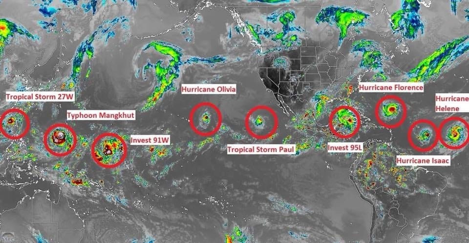
Tropical Storm Erin (2007) and Tropical Storm Arlene (1993) come to mind.TexasBreeze wrote:Unrelated, but the HPC map brought out the infamous ' pink ' color for Florence in the Carolinas. It is going to be a rough one over there!
Even if 95L goes to south TX, many times se TX sees northern feeder bands set up shop and they create funnels and training storms. Gotta be prepared for this system!
-
davidiowx
- Posts: 1197
- Joined: Thu Jan 23, 2014 2:39 pm
- Location: Richmond, TX
- Contact:
Is it me or is 95L not looking so good right now...
-
Cpv17
- Posts: 7095
- Joined: Fri Aug 31, 2018 1:58 pm
- Location: El Campo/Wharton
- Contact:
It’s lost a lot of deep convection over the past few hours. I know that much.davidiowx wrote:Is it me or is 95L not looking so good right now...
-
jasons2k

- Posts: 6196
- Joined: Thu Feb 04, 2010 12:54 pm
- Location: Imperial Oaks
- Contact:
DMIN. Very common in weak systems.Cpv17 wrote:It’s lost a lot of deep convection over the past few hours. I know that much.davidiowx wrote:Is it me or is 95L not looking so good right now...
-
Cpv17
- Posts: 7095
- Joined: Fri Aug 31, 2018 1:58 pm
- Location: El Campo/Wharton
- Contact:
Yeah. DMAX in the morning will fire it back up. I expect it to get its act together a bit tomorrow.jasons wrote:DMIN. Very common in weak systems.Cpv17 wrote:It’s lost a lot of deep convection over the past few hours. I know that much.davidiowx wrote:Is it me or is 95L not looking so good right now...
-
unome
- Posts: 3062
- Joined: Fri Feb 12, 2010 6:11 pm
-
Cpv17
- Posts: 7095
- Joined: Fri Aug 31, 2018 1:58 pm
- Location: El Campo/Wharton
- Contact:
The 0z CMC is bullish with Isaac and it undergoes RI in the Gulf and goes into the mid TX coast. Pure fantasy land though so wouldn’t put much stock into it at this time.

-
Scott747
- Posts: 1648
- Joined: Tue Feb 23, 2010 9:56 am
- Location: Freeport/Surfside Beach
- Contact:
Looks like the hurricane models are being run for the 0z suite. At least the hmon is....
-
Cpv17
- Posts: 7095
- Joined: Fri Aug 31, 2018 1:58 pm
- Location: El Campo/Wharton
- Contact:
The HWRF is much further north with 95L fwiw.
-
Scott747
- Posts: 1648
- Joined: Tue Feb 23, 2010 9:56 am
- Location: Freeport/Surfside Beach
- Contact:
Background of the 0z hwrf Flo run has a weak but strengthening system moving in around Port A to San Antonio bay.
-
Scott747
- Posts: 1648
- Joined: Tue Feb 23, 2010 9:56 am
- Location: Freeport/Surfside Beach
- Contact:
Correct.Cpv17 wrote:The HWRF is much further north with 95L fwiw.
I was looking at the HWRF-P
-
Cpv17
- Posts: 7095
- Joined: Fri Aug 31, 2018 1:58 pm
- Location: El Campo/Wharton
- Contact:
HWRF has landfall near Palacios as a 996mb storm and has plenty of rain with it.
-
Texaspirate11

- Posts: 1278
- Joined: Tue Dec 31, 2013 12:24 am
- Contact:
HGX DISCO
As for the tropical disturbance near the tip of the Yucatan. Dry
air and shear has done a job on it and deep convection has nearly
been wiped out. Convection may be trying to initiate closer to the
low level center and not displaced by so far. GFS/NAM still
showing a system struggling to form with the dry air impacts as it
moves toward the Texas coast Thursday night/Friday.
Just because you're disabled, you don't have to be a victim
Be Weather Aware & Prepared!
Barbara Jordan Winner in Media
Disability Integration Consultant
Be Weather Aware & Prepared!
Barbara Jordan Winner in Media
Disability Integration Consultant
-
Scott747
- Posts: 1648
- Joined: Tue Feb 23, 2010 9:56 am
- Location: Freeport/Surfside Beach
- Contact:
Well if the HWRF is right it does show literally nothing for the next 10 hrs before thunderstorm development starts firing up.