February Weather Discussion. Wild Winter Storms?
-
ThunderMan
- Posts: 29
- Joined: Wed Feb 03, 2010 2:57 pm
- Location: Northwest Austin
- Contact:
When was the last time that Houston had this many feasible winter weather events occur in one winter season?
- srainhoutx
- Site Admin

- Posts: 19700
- Joined: Tue Feb 02, 2010 2:32 pm
- Location: Maggie Valley, NC
- Contact:
Meh, no real complaints on the pattern from me. I saw sleet here twice in the last 8 days. Not too shabby for borderline temps and a couple of unexpected surprises from this pattern. All in all the AO, NAO, Blocking regime brought more than many folks thought we would see. And like I stated back on the old Forum. It's Rodeo time in Houston and history has shown that some crazy winter weather can happen during February and during the Trail Rides. 
Carla/Alicia/Jerry(In The Eye)/Michelle/Charley/Ivan/Dennis/Katrina/Rita/Wilma/Humberto/Ike/Harvey
Member: National Weather Association
Facebook.com/Weather Infinity
Twitter @WeatherInfinity
Member: National Weather Association
Facebook.com/Weather Infinity
Twitter @WeatherInfinity
- srainhoutx
- Site Admin

- Posts: 19700
- Joined: Tue Feb 02, 2010 2:32 pm
- Location: Maggie Valley, NC
- Contact:
1973 saw 3 accumulating snow events. One in January and 2 in February.ThunderMan wrote:When was the last time that Houston had this many feasible winter weather events occur in one winter season?
Carla/Alicia/Jerry(In The Eye)/Michelle/Charley/Ivan/Dennis/Katrina/Rita/Wilma/Humberto/Ike/Harvey
Member: National Weather Association
Facebook.com/Weather Infinity
Twitter @WeatherInfinity
Member: National Weather Association
Facebook.com/Weather Infinity
Twitter @WeatherInfinity
- tireman4
- Global Moderator

- Posts: 7028
- Joined: Wed Feb 03, 2010 9:24 pm
- Location: Humble, Texas
- Contact:
Yep and I was there for all three. They were magical for someone who was 7 years old. 
- polisciaggie
- Posts: 19
- Joined: Wed Feb 03, 2010 10:06 pm
- Location: Houston, TX
- Contact:
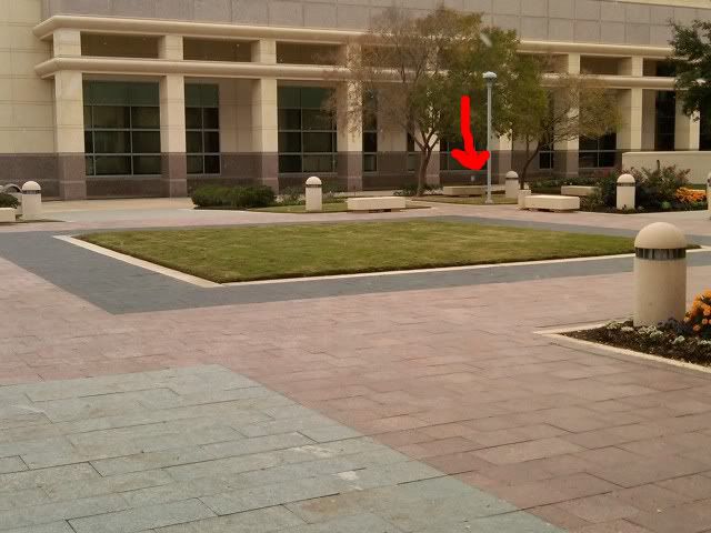
Since everyone is posting their pic of the snow they got in December, I figured I would post mine.  In College Station, I just got out of my World Politics final. I pointed out the snow flake!


- wxman57
- Global Moderator

- Posts: 2621
- Joined: Thu Feb 04, 2010 5:34 am
- Location: Southwest Houston (Westbury)
- Contact:
Wow! Did you make it back to your dorm OK?polisciaggie wrote:Since everyone is posting their pic of the snow they got in December, I figured I would post mine.In College Station, I just got out of my World Politics final. I pointed out the snow flake!

http://i91.photobucket.com/albums/k293/ ... 4-1244.jpg
- polisciaggie
- Posts: 19
- Joined: Wed Feb 03, 2010 10:06 pm
- Location: Houston, TX
- Contact:
Somehow I did, it was a treacherous route.wxman57 wrote:Wow! Did you make it back to your dorm OK?polisciaggie wrote:Since everyone is posting their pic of the snow they got in December, I figured I would post mine.In College Station, I just got out of my World Politics final. I pointed out the snow flake!

http://i91.photobucket.com/albums/k293/ ... 4-1244.jpg
- srainhoutx
- Site Admin

- Posts: 19700
- Joined: Tue Feb 02, 2010 2:32 pm
- Location: Maggie Valley, NC
- Contact:
Looks like it will be mighty close if the 12Z GFS verifies. Portastorm (Austin area) and those in College Station as well as NW Harris County and points E may just have a shot...
http://www.nco.ncep.noaa.gov/pmb/nwprod ... _072.shtml
http://www.nco.ncep.noaa.gov/pmb/nwprod ... _078.shtml
http://www.nco.ncep.noaa.gov/pmb/nwprod ... _084.shtml
http://www.nco.ncep.noaa.gov/pmb/nwprod ... _072.shtml
http://www.nco.ncep.noaa.gov/pmb/nwprod ... _078.shtml
http://www.nco.ncep.noaa.gov/pmb/nwprod ... _084.shtml
Carla/Alicia/Jerry(In The Eye)/Michelle/Charley/Ivan/Dennis/Katrina/Rita/Wilma/Humberto/Ike/Harvey
Member: National Weather Association
Facebook.com/Weather Infinity
Twitter @WeatherInfinity
Member: National Weather Association
Facebook.com/Weather Infinity
Twitter @WeatherInfinity
-
ThunderMan
- Posts: 29
- Joined: Wed Feb 03, 2010 2:57 pm
- Location: Northwest Austin
- Contact:
Are you sure it's not a speck of dust on your camera lens?polisciaggie wrote:Since everyone is posting their pic of the snow they got in December, I figured I would post mine.In College Station, I just got out of my World Politics final. I pointed out the snow flake!

- snowman65
- Posts: 1415
- Joined: Thu Feb 04, 2010 6:39 am
- Location: Orange, Tx
- Contact:
srainhoutx wrote:Looks like it will be mighty close if the 12Z GFS verifies. Portastorm (Austin area) and those in College Station as well as NW Harris County and points E may just have a shot...
http://www.nco.ncep.noaa.gov/pmb/nwprod ... _072.shtml
http://www.nco.ncep.noaa.gov/pmb/nwprod ... _078.shtml
http://www.nco.ncep.noaa.gov/pmb/nwprod ... _084.shtml
What (who) exactly are you reffering to by East??? What about golden triangle?
-
txsnowmaker
- Posts: 733
- Joined: Wed Feb 03, 2010 4:07 pm
- Location: SW Houston (Galleria area)
- Contact:
srainhoutx wrote:Looks like it will be mighty close if the 12Z GFS verifies. Portastorm (Austin area) and those in College Station as well as NW Harris County and points E may just have a shot...
http://www.nco.ncep.noaa.gov/pmb/nwprod ... _072.shtml
http://www.nco.ncep.noaa.gov/pmb/nwprod ... _078.shtml
http://www.nco.ncep.noaa.gov/pmb/nwprod ... _084.shtml
Sorry--not able to read the models at the moment. Did the 12z come in a little weaker in terms of snow chances in the city. It seems that the commentary on the 6z was a little more bullish on that.
- wxman57
- Global Moderator

- Posts: 2621
- Joined: Thu Feb 04, 2010 5:34 am
- Location: Southwest Houston (Westbury)
- Contact:
Waiting for the 12Z data to appear on the ARL website so I can make soundings. The ARL site is here:
http://ready.arl.noaa.gov/READYcmet.php
http://ready.arl.noaa.gov/READYcmet.php
- srainhoutx
- Site Admin

- Posts: 19700
- Joined: Tue Feb 02, 2010 2:32 pm
- Location: Maggie Valley, NC
- Contact:
Just a bit too soon to know for sure snowman65. You folks in far SE TX and SW LA look to have the same issues that Central Harris County and points S will have. Now if the colder air is a bit stronger and the column is a bit deeper with the cold air than what guidance is suggesting right now, perhaps you folks will see some big flakes as well. We shall see and we are far from knowing with any real certainty how this event on Tuesday will play out as of Saturday morning IMHO.
Carla/Alicia/Jerry(In The Eye)/Michelle/Charley/Ivan/Dennis/Katrina/Rita/Wilma/Humberto/Ike/Harvey
Member: National Weather Association
Facebook.com/Weather Infinity
Twitter @WeatherInfinity
Member: National Weather Association
Facebook.com/Weather Infinity
Twitter @WeatherInfinity
- Portastorm
- Posts: 800
- Joined: Wed Feb 03, 2010 3:04 pm
- Location: Southwest Austin/Oak Hill, TX
- Contact:
Would love to see some 12z GFS graphics for KATT or KAUS if you don't mind, Wxman57. I would be grateful. 
- don
- Posts: 3147
- Joined: Wed Feb 03, 2010 3:33 pm
- Location: Wichita Falls
- Contact:
Well if you believe the GFS the rain/snow line may settle as far south as the central counties (Harris county could be a transition zone or the 59/1-10 corridor with snow falling over the northern half of the county and rain/sleet falling over the southern half) Of course i know its too early just saying what the latest GFS is hinting at..
- wxman57
- Global Moderator

- Posts: 2621
- Joined: Thu Feb 04, 2010 5:34 am
- Location: Southwest Houston (Westbury)
- Contact:
Made some soundings for SE TX areas. First, Houston. No change from 6Z GFS. Cold rain changing to rain/sleet mid afternoon then maybe to sleet/snow as precip ends late afternoon/evening. If that tiny warm (above-freezing) area is not there, then we could see a few hours of snow here:

Now, Austin. Austin sounding is definitely colder than Houston, and the preicp lingers longer after temps aloft are cold enough. I'd say 1-2" of snow may be possible there.

Now, Beaumont. Same story as Houston, but a tad warmer aloft. Cold rain then rain mixed with sleet Tuesday PM. Maybe some flakes as it ends. Probably no accumulation.

College Station. Definitely colder than Houston. Maybe a few inches of snow Tuesday afternoon.


Now, Austin. Austin sounding is definitely colder than Houston, and the preicp lingers longer after temps aloft are cold enough. I'd say 1-2" of snow may be possible there.

Now, Beaumont. Same story as Houston, but a tad warmer aloft. Cold rain then rain mixed with sleet Tuesday PM. Maybe some flakes as it ends. Probably no accumulation.

College Station. Definitely colder than Houston. Maybe a few inches of snow Tuesday afternoon.

- wxman57
- Global Moderator

- Posts: 2621
- Joined: Thu Feb 04, 2010 5:34 am
- Location: Southwest Houston (Westbury)
- Contact:
By the way, if you want to keep tabs on what the GFS is forecasting as far as accumulated snow in our area, go to Earl's weather page and click on the blue square closest to your location. It will generate a plot of GFS-predicted accumulated snow out to 120 hrs:
http://wxcaster.com/gis-gfs-snow-overlays.htm
OK, heading out on our bikes shortly for a 4-hr ride to downtown Houston (Discovery Green Park) for lunch. Can't let this sunshine and semi-mild weather go to waste!
http://wxcaster.com/gis-gfs-snow-overlays.htm
OK, heading out on our bikes shortly for a 4-hr ride to downtown Houston (Discovery Green Park) for lunch. Can't let this sunshine and semi-mild weather go to waste!
- wxman57
- Global Moderator

- Posts: 2621
- Joined: Thu Feb 04, 2010 5:34 am
- Location: Southwest Houston (Westbury)
- Contact:
I think current NWS forecast for Houston of a high of 50 on Tuesday is a bit off. Should be in the upper 30s during the day with rain, then dropping more in the afternoon. Here's a 12Z GFS meteogram for Houston. Note temps during precip (30s):


Last edited by wxman57 on Sat Feb 20, 2010 11:39 am, edited 1 time in total.
- wxdata
- Site Admin

- Posts: 1059
- Joined: Wed Feb 03, 2010 3:04 pm
- Location: Houston, TX
- Contact:
2 meter data off of the 12z GFS shows near 50 shortly after midnight Tuesday with falling temps thereafter.wxman57 wrote:I think current NWS forecast for Houston of a high of 50 on Tuesday is a bit off. Should be in the upper 30s during the day with rain, then dropping more in the afternoon.
------
Further down the road, very 'interesting' weather possible for Monday week.
- wxman57
- Global Moderator

- Posts: 2621
- Joined: Thu Feb 04, 2010 5:34 am
- Location: Southwest Houston (Westbury)
- Contact:
I know that the high on Tuesday will occur shortly after midnight, but I don't think that's what the NWS is forecasting. They do forecast a low Tuesday night of 42. With increasing clouds and precip, temps will fall through the day.wxdata wrote:2 meter data off of the 12z GFS shows near 50 shortly after midnight Tuesday with falling temps thereafter.wxman57 wrote:I think current NWS forecast for Houston of a high of 50 on Tuesday is a bit off. Should be in the upper 30s during the day with rain, then dropping more in the afternoon.
Last edited by wxman57 on Sat Feb 20, 2010 11:47 am, edited 1 time in total.