

February Weather Discussion. Wild Winter Storms?
-
don

- Posts: 3148
- Joined: Wed Feb 03, 2010 3:33 pm
- Location: Wichita Falls
- Contact:
Yep if the 6z was correct we could get about an inch of snow FWIW
-
brazoria_county22
- Posts: 61
- Joined: Thu Feb 04, 2010 6:39 am
- Location: angleton,tx
- Contact:
is this snow going to reach the coast or is it to soon to know yet?
-
Mr. T

- Posts: 992
- Joined: Wed Feb 03, 2010 4:22 pm
- Location: Kingwood
- Contact:
If the GFS verified, the snow would reach the coast, however, we are still very far off from tuesday night, so it is too early to begin pinning down who will see what and how much... There is the possibility of the GFS overdoing the amount of cold air to work with, however, it was consistently the coldest and wettest model for the Dec 4th event, and the GFS turned out to be correct.brazoria_county22 wrote:is this snow going to reach the coast or is it to soon to know yet?
Also, the Euro and CMC differ on the timing and strength of the system, with both models showing a more sheared out and weaker system. I will note that all global models continue to trend slightly further south with the track of this system, which is why the GFS and Euro have trended slightly colder this morning.
-
sleetstorm
- Posts: 651
- Joined: Thu Feb 04, 2010 12:33 pm
- Contact:
I do not have to have snow accumulation to make me happy. Simply watching it fall through the air and seeing it land on various different surfaces is adequate fun, in my opinion. Accumulation is simply an extra bonus, in my opinion.
-
Mr. T
- Posts: 992
- Joined: Wed Feb 03, 2010 4:22 pm
- Location: Kingwood
- Contact:
I agree with this completely. It is a matter of understanding where you live. This is Houston, afterall.sleetstorm wrote:I do not have to have snow accumulation to make me happy. Simply watching it fall through the air and seeing it land on various different surfaces is adequate fun, in my opinion. Accumulation is simply an extra bonus, in my opinion.
If all we see is some snow flying through the air tuesday night, that'll be fine with me! I guess it helps that we've already seen an accumulating snow storm already this year...
I think chances of seeing some flurries tuesday evening or night are fairly good at this point. Accumulation is another story, entirely.
-
wxman57

- Global Moderator

- Posts: 2621
- Joined: Thu Feb 04, 2010 5:34 am
- Location: Southwest Houston (Westbury)
- Contact:
Forecast sounding has temps aloft cooling to below freezing enough to allow for snow Tuesday evening, but with very light precip. Precip ends a few hours after the temps get cold enough for snow. If this forecast was right, then we'd see cold rain with temps in the 37-39F range during the day Tuesday, mixed with sleet in the afternoon. Then rain/sleet would taper off after sunset and we could see a few flakes Tuesday night.
Last edited by wxman57 on Sat Feb 20, 2010 8:04 am, edited 1 time in total.
-
Portastorm

- Posts: 800
- Joined: Wed Feb 03, 2010 3:04 pm
- Location: Southwest Austin/Oak Hill, TX
- Contact:
Given that I've seen five minutes of goopy sleet and five minutes of one snow flurry this winter season, sleetstorm, I'm with you. I'll take anything at this point as long as it lasts more than 30 minutes!sleetstorm wrote:I do not have to have snow accumulation to make me happy. Simply watching it fall through the air and seeing it land on various different surfaces is adequate fun, in my opinion. Accumulation is simply an extra bonus, in my opinion.
BTW, I'm sorry I missed all the good dialogue last night with the "night crew." Looks like Kludge is trying to find me a corporate sponsor. Nice!
-
Mr. T
- Posts: 992
- Joined: Wed Feb 03, 2010 4:22 pm
- Location: Kingwood
- Contact:
The 6z GFS is forecasting more than a few flakes, with accumulating snow across the area.wxman57 wrote:Forecast sounding has temps aloft cooling to below freezing enough to allow for snow Tuesday evening, but with very light precip. Precip ends a few hours after the temps get cold enough for snow. If this forecast was right, then we'd see cold rain with temps in the 37-39F range during the day Tuesday, mixed with sleet in the afternoon. Then rain/sleet would taper off after sunset and we could see a few flakes Tuesday night.
I'm not saying it is right, but that is what it shows.
I think it is too early to start nailing down accumulations at this point, but this is a very dynamic system that will be moving across
-
srainhoutx

- Site Admin

- Posts: 19700
- Joined: Tue Feb 02, 2010 2:32 pm
- Location: Maggie Valley, NC
- Contact:
It is too soon to know with any certainty the who, what, and where just yet for anyone SE TX or other parts of the Lone Star State for that matter. That being said as time continues to move forward it does appear that some folks will see snow/sleet and perhaps enough to cover the ground. It appears that the night crew expressed a lot of thoughts last night and that is a good thing for our Weather Forum. The whole purpose of this board is to discuss Weather. That is my 2 cents worth about that. A wise person told me long time ago that if you have a passion for weather, learn as much as you can and prepare to be humbled if you make a prediction too soon. The patterns change as the wind will surely blow and the sun will rise and set each day. We have a great new place to discuss All things Weather and for that I am grateful. We encourage exchange of ideas and thoughts and hope as time goes by many more will chime in. We also have a great group of members that share a passion for weather and some that just read what some of us are willing to post. Keep up the good work and when the time come that lives and property are in jeopardy as we saw with Ike and other weather event, the Forum will become a again a great tool for the folks that are looking for the “facts”. Now enjoy your passion for weather and the new platform and here is hoping that we see another shot of Wintry Weather in this unusual Winter Weather Pattern that we have all been a part of and then on to severe weather…tropical season...brazoria_county22 wrote:is this snow going to reach the coast or is it to soon to know yet?
Carla/Alicia/Jerry(In The Eye)/Michelle/Charley/Ivan/Dennis/Katrina/Rita/Wilma/Humberto/Ike/Harvey
Member: National Weather Association
Facebook.com/Weather Infinity
Twitter @WeatherInfinity
Member: National Weather Association
Facebook.com/Weather Infinity
Twitter @WeatherInfinity
-
Portastorm
- Posts: 800
- Joined: Wed Feb 03, 2010 3:04 pm
- Location: Southwest Austin/Oak Hill, TX
- Contact:
Mr. T, where are you seeing this? I've looked at the 6z run and while I see the magical 850mb line dip far enough south for winter "fun" in the Houston area, it doesn't seem like surface temps will be low enough to support accumulating snow. Maybe I'm missing something.Mr. T wrote:The 6z GFS is forecasting more than a few flakes, with accumulating snow across the area.wxman57 wrote:Forecast sounding has temps aloft cooling to below freezing enough to allow for snow Tuesday evening, but with very light precip. Precip ends a few hours after the temps get cold enough for snow. If this forecast was right, then we'd see cold rain with temps in the 37-39F range during the day Tuesday, mixed with sleet in the afternoon. Then rain/sleet would taper off after sunset and we could see a few flakes Tuesday night.
I'm not saying it is right, but that is what it shows.
I think it is too early to start nailing down accumulations at this point, but this is a very dynamic system that will be moving across
Edit update: and based on what I see Jeff Lindner just saying, I guess I am missing something!
Last edited by Portastorm on Sat Feb 20, 2010 8:20 am, edited 1 time in total.
-
Portastorm
- Posts: 800
- Joined: Wed Feb 03, 2010 3:04 pm
- Location: Southwest Austin/Oak Hill, TX
- Contact:
Here is the latest from Jeff Lindner:
-----
Confidence growing in a winter weather event for early next week.
Strong cold front will arrive on Sunday...enjoy the mild temps. this weekend.
Discussion:
Weak return flow underway this morning with a mid level deck over much of the region and fog/mist is some areas. Surface dewpoints have been very slow to recover, and it appears the models are really overdoing the moisture return over the cold nearshore Gulf waters. So far dewpoints have remained below nearshore SST's keeping sea fog as a none issue...this may change during the day on Sunday. Otherwise, colder Gulf waters appear to be mitigating the return of an unstable air mass, and latest model trends support a lower chance for thunderstorms on Sunday as instability will be greatly lacking. Still expect showers late this afternoon through frontal passage, but all severe threat will be removed for Sunday with strong capping in the mid levels and meager amounts of instability.
Early Next Week:
Main forecast item of concern now lies in early next week as strong cold front surges off the coast Monday and then a strong storm system moves across TX in the cold air Tues/Wed. Poor model agreement of late has trended toward each other over the past 24 hours with the ECMWF trending toward the colder and wetter GFS. The GFS continues to lead the pack with the coldest and wettest solution and would indeed produce accumulating snows over parts of SE TX Tuesday afternoon and Tuesday night. The GFS is now supported by the ECMWF, CMC, and several of the ensemble members adding more confidence that some sort of winter weather event will happen early next week.
An extensive review of the 00Z forecast soundings for College Station, Conroe, IAH, and Sugar Land suggest the onset of rainfall around midday Tuesday with soundings all supporting rain. CLL is the coldest, but still above freezing, although the sounding looks like it would support some sleet (IP) or RA/IP mix. By Tuesday evening CLL is fairly close to a saturated and frozen profile with only the lowest levels above freezing. Would expect RA/SN mix changing to all SN Tuesday evening. The other 3 sites remain a touch too warm, but by early Wednesday morning Conroe and IAH show a favorable SN profile....but drying starts to take over by this point.
With all this said, would expect an onset of a winter mix over our N and W counties Tuesday midday with surface temperatures remaining above freezing with no accumulation. RA/SN line will progress southward Tuesday afternoon into the evening hours with all SN over the northern 1/3rd of the area by mid evening Tuesday. Surface temperatures fall closer to freezing in the SN area with some accumulation possible. North of US 59, rain will likely mix with snow late Tuesday evening as the event starts to come to an end.
Too early to lay out any accumulation amounts at this time as deviations in the models could still keep the majority of the frozen precip. north of our area. This event remains low confidence and significant forecast changes over the next 3 days are likely.
As for temperatures Sunday will be the warmest with highs in the 70-75 range and then all downhill from there for all of next week. Will undercut the already cold GFS guidance with highs only in the 40's on Tuesday...possibly 30's up north where clouds/precip. begin first. Could see freezing temps. over parts of the area Tuesday night/Wednesday AM and then possibly more widespread freeze Thursday AM.
-
Mr. T
- Posts: 992
- Joined: Wed Feb 03, 2010 4:22 pm
- Location: Kingwood
- Contact:
I think surface temperatures are overrated, ala Dec 4th. It doesn't have to be right at freezing for accumulation, but of course it is more favorable.Portastorm wrote:
Mr. T, where are you seeing this? I've looked at the 6z run and while I see the magical 850mb line dip far enough south for winter "fun" in the Houston area, it doesn't seem like surface temps will be low enough to support accumulating snow. Maybe I'm missing something.
Edit update: and based on what I see Jeff Lindner just saying, I guess I am missing something!
I'd be more worried about the air column over our heads rather than surface temperatures. If we can just get the snow to fall...
-
txsnowmaker
- Posts: 733
- Joined: Wed Feb 03, 2010 4:07 pm
- Location: SW Houston (Galleria area)
- Contact:
Keep pushing to the south! Keep pushing to the south! I like the trend that the GFS has been taking...
-
biggerbyte
- Posts: 1437
- Joined: Thu Feb 04, 2010 12:15 am
- Location: Porter, Texas. (Montgomery County)
- Contact:
Mr. T wrote:The 6z GFS is forecasting more than a few flakes, with accumulating snow across the area.wxman57 wrote:Forecast sounding has temps aloft cooling to below freezing enough to allow for snow Tuesday evening, but with very light precip. Precip ends a few hours after the temps get cold enough for snow. If this forecast was right, then we'd see cold rain with temps in the 37-39F range during the day Tuesday, mixed with sleet in the afternoon. Then rain/sleet would taper off after sunset and we could see a few flakes Tuesday night.
I'm not saying it is right, but that is what it shows.
I think it is too early to start nailing down accumulations at this point, but this is a very dynamic system that will be moving across
If we get the transition to snow at all, it will be more than a few flakes. Light accumulation at this point, but stay tuned for changes to the outlook that will surely come.
-
Portastorm
- Posts: 800
- Joined: Wed Feb 03, 2010 3:04 pm
- Location: Southwest Austin/Oak Hill, TX
- Contact:
Oh, I would expect some changes. The main player is still off the West Coast and is just now approaching California.
-
srainhoutx
- Site Admin
- Posts: 19700
- Joined: Tue Feb 02, 2010 2:32 pm
- Location: Maggie Valley, NC
- Contact:
The 12Z NAM appears to be a bit further S at the H5 level and that warm biased model is a bit cooler than what it has been showing. HPC thoughts this morning...
PRELIMINARY EXTENDED FORECAST DISCUSSION
NWS HYDROMETEOROLOGICAL PREDICTION CENTER CAMP SPRINGS MD
859 AM EST SAT FEB 20 2010
VALID 12Z WED FEB 24 2010 - 12Z SAT FEB 27 2010
AFTER CORRECTING TOWARDS THE HIGHER AMPLITUDE GFS FAMILY OF
SOLUTIONS IN THE 12Z RUN YESTERDAY...00Z/20 ENSEMBLE SPAGHETTI
PLOTS AGAIN SHOW MANY ECMWF ENSEMBLE MEMBERS LESS
AMPLIFIED/FARTHER E THAN CORRESPONDING GEFS MEMBERS WITH ERN CONUS
TROFFING BELOW 40 DEGREES LATITUDE THE LATTER PORTION OF NEXT
WEEK. SIGNIFICANTLY...THE 06Z/20 GFS HAS TRENDED S FROM ITS 00Z
RUN WITH THE STRONG SYS DIGGING SE INTO THE MIDWEST LATE
WED...THEN TURNING MORE EWD AS IT CLOSES OFF OVER THE OH VLY THU.
THE NEW 06Z/20 GEFS ENSEMBLE MEAN HAS ALSO TRENDED SLIGHTLY S FROM
ITS PREVIOUS MEAN WITH THE CLOSED LOW DRIFTING FROM THE SRN GRT
LAKES INTO SRN NEW ENG THU/FRI. GIVEN THAT 2010 SO FAR HAS BEEN A
YEAR OF EXTREMES AND STRONG BLOCKING IS PERSISTING OVER THE SRN
DAVIS STRAIT...WE PREFER THE MORE AMPLIFIED DETERMINISTIC GFS/GEFS
MEAN/ECMWF ENSEMBLE MEAN SCENARIO WITH THE TRACK OF THIS UPPER
LOW. AT THE TIME OF THIS ISSUANCE...WE STAYED WITH THE 50/50 BLEND
OF DETERMINISTIC GFS/ECMWF THAT WAS USED IN THE EARLY PRELIM. I
WOULD NOT BE SURPRISED IS 12Z MODEL GUIDANCE PERSUADES US TO TO
MAKE A SLIGHT SWD ADJUSTMENT TO THE CYCLONIC ACTIVITY ALONG THE
ATLANTIC SEABOARD LATER NEXT WEEK.
TELECONNECTIONS WITH A QUASI-STATIONARY POSITIVE ANOMALY OVER THE
DAVIS STRAIT AND A SLOWLY PROGRESSIVE NEGATIVE ANOMALY BETWEEN
HAWAII AND ALASKA FAVOR A SLOWLY PROGRESSIVE FLOW PATTERN OVER THE
LOWER 48...WHICH SHOULD LEAD TO MINIMAL RUN-TO-RUN AND DAY-TO-DAY
CHANGES IN THE GUIDANCE...INCREASING CONFIDENCE IN THE OVERALL
FORECAST. A MEAN SURFACE CYCLONE WILL MOVE FROM THE
MID-ATLANTIC/GREAT LAKES STATES INTO NEW ENGLAND...REINFORCED BY A
SECOND WAVE MID PERIOD WHICH HAS THE POTENTIAL TO SPREAD SNOWS
ACROSS THE MID-ATLANTIC STATES AND NEW ENGLAND. STRONG ATLANTIC
INFLOW TO THE NORTHEAST OF THIS SYSTEM WILL MAINTAIN A RELATIVELY
MILD (BUT STILL COLD ENOUGH FOR SNOW IN THE INTERIOR) MARITIME
POLAR AIR MASS ACROSS NEW ENGLAND AND EASTERN CANADA...WITH ARCTIC
AIR INTRUSIONS LIMITED TO THE GREAT LAKES...PLAINS...AND
SOUTHEASTERN STATES INCLUDING FLORIDA LATE NEXT WEEK. LAKE EFFECT
SNOWS ARE EXPECTED FROM WEDNESDAY ONWARD IN THE GUSTY COLD
CYCLONIC FLOW ON THE CYCLONES BACKSIDE.
FOR THE WEST COAST...A STORM SYSTEM IS EXPECTED TO MOVE INTO
CALIFORNIA AND THE GREAT BASIN BY LATE NEXT WEEK...WHICH SHOULD
SPREAD LOW ELEVATION RAINS/ELEVATED SNOWS THROUGH THE
REGION...FORCING A BREAK IN THE MILD TO WARM WEATHER ACROSS THE
REGION. THE MODELS ARE IN RATHER GOOD AGREEMENT WITH THE GENERAL
FLOW PATTERN...SO CHOSE TO COMPROMISE BETWEEN THE 00Z GFS AND 00Z
ECMWF FOR MUCH OF THE PERIOD...ADJUSTING THIS SOLUTION TOWARDS 12Z
MULTI-MODEL ENSEMBLE LOW CLUSTERING WHERE APPROPRIATE...SUCH AS
NEAR THE EAST COAST. THIS PREFERENCE KEPT GOOD CONTINUITY.
ROTH/FLOOD
Carla/Alicia/Jerry(In The Eye)/Michelle/Charley/Ivan/Dennis/Katrina/Rita/Wilma/Humberto/Ike/Harvey
Member: National Weather Association
Facebook.com/Weather Infinity
Twitter @WeatherInfinity
Member: National Weather Association
Facebook.com/Weather Infinity
Twitter @WeatherInfinity
-
Mr. T
- Posts: 992
- Joined: Wed Feb 03, 2010 4:22 pm
- Location: Kingwood
- Contact:
srainhoutx wrote:
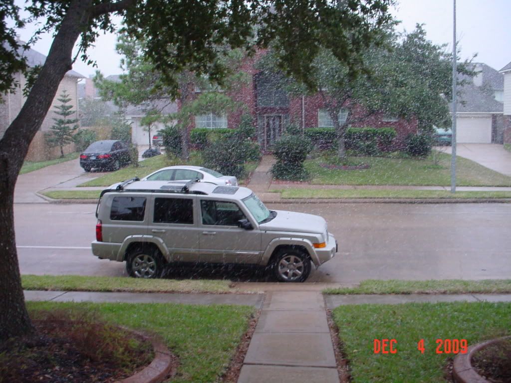
I counteract with this!
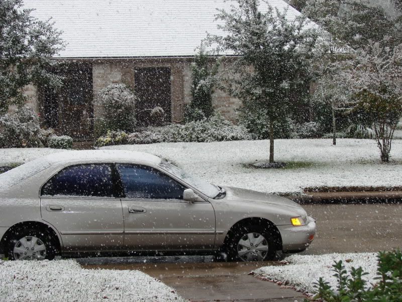
(also from Dec 4th)
-
srainhoutx
- Site Admin
- Posts: 19700
- Joined: Tue Feb 02, 2010 2:32 pm
- Location: Maggie Valley, NC
- Contact:
Mr. T wrote:srainhoutx wrote:
I counteract with this!

(also from Dec 4th)
Now you know how much I saw on Dec 4th!
Carla/Alicia/Jerry(In The Eye)/Michelle/Charley/Ivan/Dennis/Katrina/Rita/Wilma/Humberto/Ike/Harvey
Member: National Weather Association
Facebook.com/Weather Infinity
Twitter @WeatherInfinity
Member: National Weather Association
Facebook.com/Weather Infinity
Twitter @WeatherInfinity
-
Mr. T
- Posts: 992
- Joined: Wed Feb 03, 2010 4:22 pm
- Location: Kingwood
- Contact:
Yeah. I had some friends in NW Houston complaining that they didn't see much... As that snow band moved north that afternoon, I surely thought that it would sit over that area for a little bit and give you guys a few inches... I kept telling them, "hold on! Hold on! It is almost there! You guys are about to get several inches!" Of course, it ended up really shafting the NW side. I ended up being wrong, giving out a few "I'm sorry's"... Heh. At least it snowed period, you know?srainhoutx wrote: Now you know how much I saw on Dec 4th!
The snow total where I'm at in Kingwood during the Dec 08 and Dec 09 storms were pretty identical (1"-2"). I hate to be a spoiled brat, but I would love to see that 4 inches that you saw.
-
wxman57
- Global Moderator
- Posts: 2621
- Joined: Thu Feb 04, 2010 5:34 am
- Location: Southwest Houston (Westbury)
- Contact:
Here's the 06Z GFS. Has most precip ending with the temp at IAH of 35F. That would be warmer than the Dec. 4th event. Of course, this is assuming the 06Z GFS has a perfect temperature forecast for 72-84 hours out.

So it has most precip ending between 6pm and 9pm Tuesday. Now let's take a look at the projected vertical profile as per the 06Z GFS for Tuesday to trace the changeover from rain to sleet to snow. First, 3pm Tuesday. On this chart, I've marked the freezing line in blue. The red line is temperature, the green line is dew point. Clouds and precip occur when the red and green lines are close together (high relative humidity). The 3pm chart shows the red/green lines touching from just above 700mb (10,000ft) to about 550mb (14,000ft or so). In that area, snow would form and fall.
But as the snow reaches just above 800mb (6500ft) it encounters an area of above freezing temps. The thickness of this warm air layer will determine if the snow has time to melt before reaching colder air farther down. It looks like the warm air is thick enough here to melt the snow into rain. The rain falls a few thousand feet then encounters colder air, cold enough to re-freeze it into sleet. At the surface, a mixture of rain and sleet is seen, possibly mixed with a few surviving snowflakes. Surface temperature is in the 37F range, so no accumulation.
3pm Tuesday GFS forecast sounding:

Let's move on to the 6pm sounding. Major changes occur between 3pm and 6pm. Note that the red and green lines are touching from 500mb to the surface. That indicates a near-saturated column (clouds and precip likely). Also note that the red temperature line has slid left of the freezing line, meaning the whole column is below freezing EXCEPT for the surface, which is at around 34-35F.
This is a snow sounding for Houston at 6pm Tuesday. However, if surface temps are above freezing, then it won't hang around long. For it to stick around, we really need surface temps to be below 32F.
6pm Tuesday GFS forecast sounding:

On to 9pm Tuesday. Note that there is only a very small area at the surface which is above freezing. Also note that the red and green lines are separating. The separating lines means the air aloft is drying out - the precip is coming to an end.
9pm Tuesday GFS forecast sounding:

So, the 6Z GFS does show snow for Houston, but there is a BIG question mark as to if any will accumulate. My instincts say no accumulation. I don't think that the airmass will be quite cold enough early enough. But we could see some nice big flakes in the sky Tuesday late afternoon/evening.
So it has most precip ending between 6pm and 9pm Tuesday. Now let's take a look at the projected vertical profile as per the 06Z GFS for Tuesday to trace the changeover from rain to sleet to snow. First, 3pm Tuesday. On this chart, I've marked the freezing line in blue. The red line is temperature, the green line is dew point. Clouds and precip occur when the red and green lines are close together (high relative humidity). The 3pm chart shows the red/green lines touching from just above 700mb (10,000ft) to about 550mb (14,000ft or so). In that area, snow would form and fall.
But as the snow reaches just above 800mb (6500ft) it encounters an area of above freezing temps. The thickness of this warm air layer will determine if the snow has time to melt before reaching colder air farther down. It looks like the warm air is thick enough here to melt the snow into rain. The rain falls a few thousand feet then encounters colder air, cold enough to re-freeze it into sleet. At the surface, a mixture of rain and sleet is seen, possibly mixed with a few surviving snowflakes. Surface temperature is in the 37F range, so no accumulation.
3pm Tuesday GFS forecast sounding:
Let's move on to the 6pm sounding. Major changes occur between 3pm and 6pm. Note that the red and green lines are touching from 500mb to the surface. That indicates a near-saturated column (clouds and precip likely). Also note that the red temperature line has slid left of the freezing line, meaning the whole column is below freezing EXCEPT for the surface, which is at around 34-35F.
This is a snow sounding for Houston at 6pm Tuesday. However, if surface temps are above freezing, then it won't hang around long. For it to stick around, we really need surface temps to be below 32F.
6pm Tuesday GFS forecast sounding:
On to 9pm Tuesday. Note that there is only a very small area at the surface which is above freezing. Also note that the red and green lines are separating. The separating lines means the air aloft is drying out - the precip is coming to an end.
9pm Tuesday GFS forecast sounding:
So, the 6Z GFS does show snow for Houston, but there is a BIG question mark as to if any will accumulate. My instincts say no accumulation. I don't think that the airmass will be quite cold enough early enough. But we could see some nice big flakes in the sky Tuesday late afternoon/evening.
Last edited by wxman57 on Sat Feb 20, 2010 9:30 am, edited 1 time in total.