
November: Cool & Dry To End The Month
-
biggerbyte
- Posts: 1437
- Joined: Thu Feb 04, 2010 12:15 am
- Location: Porter, Texas. (Montgomery County)
- Contact:
Upper 30s, but depends on where you live. Could be slightly colder, or warmer for you.
-
srainhoutx

- Site Admin

- Posts: 19700
- Joined: Tue Feb 02, 2010 2:32 pm
- Location: Maggie Valley, NC
- Contact:
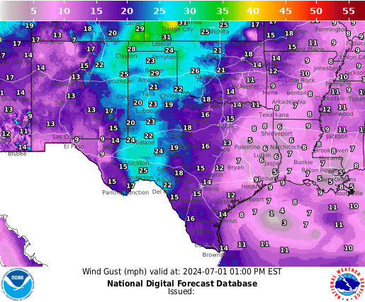
It looks like everyone across the area is seeing temps in the upper 40's this morning as the NW winds have blown all night. The 50's and breezy conditions should be the theme for the day with a Red Flag Warning hoisted across the area. With clear skies and calm winds and ideal radiational cooling, I would not be surprised to see a Freeze Watch/Warning issued later today as we already see from the NWS offices in Austin/San Antonio and Corpus. The grid forecast is for some upper 20's overnight for our northern areas. Folks along the Coastal Counties should be fine regarding any freeze potential. We should end November on a cool note and actually have done much better in the rainfall department than the previous 4-5 months. So as we end the long Thanksgiving Holiday period we can be thankful for that bit of news in the weather department.
Carla/Alicia/Jerry(In The Eye)/Michelle/Charley/Ivan/Dennis/Katrina/Rita/Wilma/Humberto/Ike/Harvey
Member: National Weather Association
Facebook.com/Weather Infinity
Twitter @WeatherInfinity
Member: National Weather Association
Facebook.com/Weather Infinity
Twitter @WeatherInfinity
-
biggerbyte
- Posts: 1437
- Joined: Thu Feb 04, 2010 12:15 am
- Location: Porter, Texas. (Montgomery County)
- Contact:
Could not hit the right conditions for 30s last night. Those numbers did seem a bit low considering everything. I wonder why the NWS was suggesting any. Oh well! Go with the gut next time. Folks, this is the same NWS calling for low thirties tonight. We're going to need to clear the skies and calm the wind first. That is the game plan across the board, and all indications are that will happen. I'd certainly prepare for it.
-
unome
- Posts: 3062
- Joined: Fri Feb 12, 2010 6:11 pm
Power outages increasing, updates every 15 minutes: http://gis.centerpointenergy.com/outage ... index.html
Wind forecasts in Google maps: http://www.windfinder.com/forecasts/win ... .98,-95.34
Texas burn ban map: http://tfsfrp.tamu.edu/wildfires/decban.png
be smart, stay safe everyone !
Wind forecasts in Google maps: http://www.windfinder.com/forecasts/win ... .98,-95.34
Texas burn ban map: http://tfsfrp.tamu.edu/wildfires/decban.png
be smart, stay safe everyone !
-
biggerbyte
- Posts: 1437
- Joined: Thu Feb 04, 2010 12:15 am
- Location: Porter, Texas. (Montgomery County)
- Contact:
Folks, we have clear skies and low humidity. The wind should die down as well. We are set up now for a very cold night. My area should see 30 to 32, but areas north and west could see upper 20s... Conroe and NW Harris... Lookout! Strange that the NWS is officially calling for freezing temps, but they have not issued a warning.
-
Katdaddy

- Global Moderator

- Posts: 2521
- Joined: Thu Feb 04, 2010 8:18 am
- Location: League City, Tx
- Contact:
URGENT - WEATHER MESSAGE
NATIONAL WEATHER SERVICE HOUSTON/GALVESTON TX
405 PM CST SUN NOV 27 2011
...FREEZING TEMPERATURES EXPECTED EARLY MONDAY MORNING...
...WIND ADVISORY TO EXPIRE LATE THIS AFTERNOON...
.STRONG NORTHWEST WILL REMAIN GUSTY THROUGH SUNSET AND DECREASE
QUICKLY AFTER SUNSET. LIGHT WINDS AND CLEAR SKIES WILL ALLOW
TEMPERATURES TO DROP SIGNIFICANTLY TONIGHT. A GOOD PORTION OF
SOUTHEAST TEXAS TO SEE TEMPERATURE AT OR BELOW FREEZING FOR A FEW
HOURS EARLY MONDAY MORNING. OVERNIGHT LOWS IN AND NEAR THE HOUSTON
METRO AREA SHOULD REMAIN ABOVE FREEZING.
TXZ176-195>198-210>214-226-227-235>238-280615-
/O.NEW.KHGX.FZ.W.0002.111128T0600Z-111128T1500Z/
/O.CON.KHGX.WI.Y.0030.000000T0000Z-111127T2300Z/
AUSTIN-BRAZORIA-BRAZOS-BURLESON-CHAMBERS-COLORADO-FORT BEND-
GALVESTON-GRIMES-HARRIS-JACKSON-MADISON-MATAGORDA-WALLER-
WASHINGTON-WHARTON-
INCLUDING THE CITIES OF...ALVIN...ANAHUAC...ANGLETON...BAY CITY...
BELLVILLE...BRENHAM...BROOKSHIRE...BRYAN...CALDWELL...
COLLEGE STATION...COLUMBUS...EAGLE LAKE...EDNA...EL CAMPO...
FREEPORT...FRIENDSWOOD...GALVESTON...HEMPSTEAD...HOUSTON...
HUMBLE...KATY...LAKE JACKSON...LAKE SOMERVILLE...LEAGUE CITY...
MADISONVILLE...MISSOURI CITY...MONT BELVIEU...NAVASOTA...
PALACIOS...PASADENA...PEARLAND...PIERCE...PRAIRIE VIEW...
RICHMOND...ROSENBERG...SEALY...SUGAR LAND...TEXAS CITY...
TOMBALL...WEIMAR...WHARTON...WINNIE
405 PM CST SUN NOV 27 2011
...WIND ADVISORY REMAINS IN EFFECT UNTIL 5 PM CST THIS
AFTERNOON...
...FREEZE WARNING IN EFFECT FROM MIDNIGHT TONIGHT TO 9 AM CST
MONDAY...
THE NATIONAL WEATHER SERVICE IN HOUSTON/GALVESTON HAS ISSUED A
FREEZE WARNING...WHICH IS IN EFFECT FROM MIDNIGHT TONIGHT TO 9 AM
CST MONDAY.
* EVENT...TEMPERATURES WILL DROP TO BETWEEN 29 AND 32 DEGREES
ACROSS THE WARNING AREA...ESPECIALLY IN RURAL AND LOW LYING
AREAS. MORE URBAN AREAS AND LOCATIONS ALONG THE IMMEDIATE COAST
SHOULD SEE ABOVE FREEZING TEMPERATURES.
* TIMING...4 AM AND 8 AM MONDAY MORNING.
* IMPACT...FREEZING TEMPERATURES WILL AFFECT TENDER PLANTS AND
VEGETATION. EXPOSED PIPES WILL NEED TO BE COVERED.
PRECAUTIONARY/PREPAREDNESS ACTIONS...
A FREEZE WARNING MEANS SUB-FREEZING TEMPERATURES ARE IMMINENT OR
HIGHLY LIKELY. THESE CONDITIONS WILL KILL CROPS AND OTHER
SENSITIVE VEGETATION.
THE WIND ADVISORY WILL REMAIN IN EFFECT UNTIL 5 PM CST THIS
AFTERNOON.
* EVENT...NORTHWEST WINDS 20 TO 30 MPH. GUSTS 35 TO 40 MPH
POSSIBLE ESPECIALLY NEAR THE COAST.
* TIMING...NOW THROUGH 5 PM TODAY.
* IMPACT...MAINLY FOR DRIVERS ON EAST-WEST ORIENTED ROADS.
PRECAUTIONARY/PREPAREDNESS ACTIONS...
DRIVERS OF VANS...CAMPERS...TRAILERS...AND OTHER HIGH-PROFILE
VEHICLES SHOULD BE ALERT TO THE DANGER OF THESE WINDS...
ESPECIALLY WHEN DRIVING ALONG EAST TO WEST ORIENTED ROADS.
-
unome
- Posts: 3062
- Joined: Fri Feb 12, 2010 6:11 pm
they had mentioned in their earlier discussion that they would be issuing freeze warningsbiggerbyte wrote: Strange that the NWS is officially calling for freezing temps, but they have not issued a warning.
http://forecast.weather.gov/product.php ... glossary=0
a snippet:
333 PM CST SUN NOV 27 2011
AS SUCH...A FREEZE WARNING WILL BE ISSUED FOR TONIGHT FOR ALL OF SE TX...BUT THE MORE URBAN AREAS WILL LIKELY REMAIN ABOVE FREEZING TEMPS. ATTM NOT SEE- ING A HARD FREEZE (I.E. BELOW 32 FOR AT LEAST 2 HRS) AS WINDS WILL LIKELY NOT BE CALM.
-
ticka1
- Posts: 1265
- Joined: Wed Feb 03, 2010 3:02 pm
- Location: Baytown/Mont Belvieu
- Contact:
Been outside several times tonight to walk the dog and the winds have died down. I have 43 here at the house at 8:18 p.m. - I think we will get close to freezing.....just have to wait and see.
-
biggerbyte
- Posts: 1437
- Joined: Thu Feb 04, 2010 12:15 am
- Location: Porter, Texas. (Montgomery County)
- Contact:
39 degrees at my house in Porter at 9:30 pm. I will easily hit 32 before sunrise.
Brrrrrrr
Brrrrrrr
-
ticka1
- Posts: 1265
- Joined: Wed Feb 03, 2010 3:02 pm
- Location: Baytown/Mont Belvieu
- Contact:
It is 11:00 p.m. and 39 degrees. Will be interesting to see how cold we do get tonight - I'll be up bright and early at 4:45 a.m.!

-
sleetstorm
- Posts: 651
- Joined: Thu Feb 04, 2010 12:33 pm
- Contact:
Currently, 45ºF here in Baytown, at 11:55 p.m. with the dew point at 28ºF.
-
srainhoutx
- Site Admin
- Posts: 19700
- Joined: Tue Feb 02, 2010 2:32 pm
- Location: Maggie Valley, NC
- Contact:
I'm waking up to 33F this morning, so far, while Conroe/Brenham/Hobby are reporting 32F and even colder in Victoria and points NE in the Upper 20's. We still have a couple of hours to cool further, so more areas could fall below that freezing mark. It appears we may see a repeat tonight, so I wouldn't be surprised to see the Freeze Warning extended again tonight. Of note are Winter Weather Advisories/Winter Storm Warnings for areas in E TN/N MS for tonight under that cold core Upper Low to our E. It's rather unusual to see such a potent system this far S in late November and I mention it as just a point of interest in a wacky La Nina Pattern. It appears that we will end the month of November with an 'official' 4.70 inches of rain at IAH as well. Not too shabby at all with the extended drought we've seen for many months, in my opinion.
- Attachments
-
Carla/Alicia/Jerry(In The Eye)/Michelle/Charley/Ivan/Dennis/Katrina/Rita/Wilma/Humberto/Ike/Harvey
Member: National Weather Association
Facebook.com/Weather Infinity
Twitter @WeatherInfinity
Member: National Weather Association
Facebook.com/Weather Infinity
Twitter @WeatherInfinity
-
unome
- Posts: 3062
- Joined: Fri Feb 12, 2010 6:11 pm
34 here in Cypress http://www.nws.noaa.gov/data/obhistory/KDWH.html (taken from Hooks airport)
what I like about this mesonet site is that it gives you the height of the measuring instruments & exact time when you mouse over it
http://www.wrh.noaa.gov/mesowest/gmap.p ... 1&precip=1
what I like about this mesonet site is that it gives you the height of the measuring instruments & exact time when you mouse over it
http://www.wrh.noaa.gov/mesowest/gmap.p ... 1&precip=1
-
srainhoutx
- Site Admin
- Posts: 19700
- Joined: Tue Feb 02, 2010 2:32 pm
- Location: Maggie Valley, NC
- Contact:
Very impressive cold core low to our E creating some wintry mischief...

Carla/Alicia/Jerry(In The Eye)/Michelle/Charley/Ivan/Dennis/Katrina/Rita/Wilma/Humberto/Ike/Harvey
Member: National Weather Association
Facebook.com/Weather Infinity
Twitter @WeatherInfinity
Member: National Weather Association
Facebook.com/Weather Infinity
Twitter @WeatherInfinity
-
unome
- Posts: 3062
- Joined: Fri Feb 12, 2010 6:11 pm
up to 5 inches of snow in TN https://nwschat.weather.gov/lsr/#MEG/20 ... 00559/0100
-
srainhoutx
- Site Admin
- Posts: 19700
- Joined: Tue Feb 02, 2010 2:32 pm
- Location: Maggie Valley, NC
- Contact:
Mid to upper 30's are the theme this morning across the area except for Coastal Counties. A re-inforcing cold front is making its way across the northern areas this morning heading S. Northerly winds will increase a bit lending to a cool day and another shot at some freezing temps for the northern areas tonight.
Carla/Alicia/Jerry(In The Eye)/Michelle/Charley/Ivan/Dennis/Katrina/Rita/Wilma/Humberto/Ike/Harvey
Member: National Weather Association
Facebook.com/Weather Infinity
Twitter @WeatherInfinity
Member: National Weather Association
Facebook.com/Weather Infinity
Twitter @WeatherInfinity