
It’s going to be a close call for those of us in the southern part of the viewing area this evening. This round could go north of us. If it starts popping south of San Antonio and towards Victoria then I would feel a lot more confident about it. Latest HRR gives me about 6-7” tonight so we’ll see.
May 2021:
-
Cpv17
- Posts: 7091
- Joined: Fri Aug 31, 2018 1:58 pm
- Location: El Campo/Wharton
- Contact:
-
jasons2k

- Posts: 6192
- Joined: Thu Feb 04, 2010 12:54 pm
- Location: Imperial Oaks
- Contact:
I emptied 2.05" from the rain gauge (last emptied Sunday).
Digital gauge had totaled 1.82"
Always good to have a backup. The wind/trees/rooftops mess with the totals....and it was windy when it was storming.
Digital gauge had totaled 1.82"
Always good to have a backup. The wind/trees/rooftops mess with the totals....and it was windy when it was storming.
-
unome
- Posts: 3062
- Joined: Fri Feb 12, 2010 6:11 pm
-
Texaspirate11

- Posts: 1278
- Joined: Tue Dec 31, 2013 12:24 am
- Contact:
GALVESTON would like to see some action.
Just because you're disabled, you don't have to be a victim
Be Weather Aware & Prepared!
Barbara Jordan Winner in Media
Disability Integration Consultant
Be Weather Aware & Prepared!
Barbara Jordan Winner in Media
Disability Integration Consultant
-
Stratton20
- Posts: 5815
- Joined: Tue Feb 09, 2021 11:35 pm
- Location: College Station, Texas
- Contact:
Do yall think the WPC might issue a high risk for flash fooding? This has the potential with another 2-4 days of heavy rain to be devastating for some areas.
-
Texaspirate11
- Posts: 1278
- Joined: Tue Dec 31, 2013 12:24 am
- Contact:
KTRK is suggesting that people dont park their cars in the street due to flooding....
Just because you're disabled, you don't have to be a victim
Be Weather Aware & Prepared!
Barbara Jordan Winner in Media
Disability Integration Consultant
Be Weather Aware & Prepared!
Barbara Jordan Winner in Media
Disability Integration Consultant
-
Cpv17
- Posts: 7091
- Joined: Fri Aug 31, 2018 1:58 pm
- Location: El Campo/Wharton
- Contact:
It’s definitely a possibility.Stratton20 wrote: ↑Tue May 18, 2021 5:14 pm Do yall think the WPC might issue a high risk for flash fooding? This has the potential with another 2-4 days of heavy rain to be devastating for some areas.
-
jasons2k
- Posts: 6192
- Joined: Thu Feb 04, 2010 12:54 pm
- Location: Imperial Oaks
- Contact:
***Dangerous flash flood event likely tonight-Wednesday night over SE TX.***
Short range models have become increasingly consistent today in suggesting the development of a corridor of slow moving excessive rainfall this evening into early Wednesday from roughly Conroe to Hempstead to Columbus that slowly moves east and south with time. Given the potential for an east-west or NE to SW line of training thunderstorms with strong low level inflow off the Gulf of Mexico is historically a dangerous flash flood setup for this area.
Where exactly the line anchors or trains for any extended period of time is questionable, but given moisture profiles, significant short duration rainfall totals of 2-4 inches per hour will be possible leading to rapid onset flash flooding.
There has been little change in the overall forecasted rainfall amounts today and would not be surprised if someone in SE TX sees 10-15 inches over the next 36 hours.
Expected rainfall rates and totals will likely push some creeks and bayous toward their banks and in some cases overbanks resulting in more significant widespread flooding. While this threat appears greatest north of I-10…the entire county and area is at risk.
Jeff Lindner
Director Hydrologic Operations Division/Meteorologist
Harris County Flood Control District
-
jasons2k
- Posts: 6192
- Joined: Thu Feb 04, 2010 12:54 pm
- Location: Imperial Oaks
- Contact:
For as long as I can remember, Tornado Watches are red and Severe Thunderstorm Watches are yellow.
You wake-up in 2021 and somebody thought it was a good idea to change it.
You wake-up in 2021 and somebody thought it was a good idea to change it.
-
unome
- Posts: 3062
- Joined: Fri Feb 12, 2010 6:11 pm
warnings are red, I've always remembered tornado watches as yellow
https://www.weather.gov/bro/mapcolors
https://www.weather.gov/help-map
Last edited by unome on Tue May 18, 2021 5:56 pm, edited 1 time in total.
-
jasons2k
- Posts: 6192
- Joined: Thu Feb 04, 2010 12:54 pm
- Location: Imperial Oaks
- Contact:
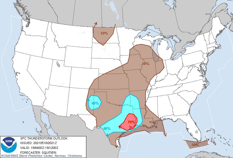
WPC Map
- Attachments
-
-
jasons2k
- Posts: 6192
- Joined: Thu Feb 04, 2010 12:54 pm
- Location: Imperial Oaks
- Contact:
unome wrote: ↑Tue May 18, 2021 5:50 pmwarnings are red, I've always remembered tornado watches as yellow
https://www.weather.gov/bro/mapcolors
https://www.weather.gov/help-map
It changed at some point. It was traditionally designated like this on the major media outlets:
- Attachments
-
-
weatherguy425
- Pro Met

- Posts: 830
- Joined: Wed Feb 03, 2010 7:45 pm
- Location: Atlanta, Georgia
- Contact:
National Weather Service contrasted against Media. NWS has been yellow for Tornado Watches and a purpleish for Severe Thunderstorm Watches; that’s the standard in my opinion.jasons2k wrote: ↑Tue May 18, 2021 5:59 pmunome wrote: ↑Tue May 18, 2021 5:50 pmwarnings are red, I've always remembered tornado watches as yellow
https://www.weather.gov/bro/mapcolors
https://www.weather.gov/help-map
It changed at some point. It was traditionally designated like this on the major media outlets:
-
Cpv17
- Posts: 7091
- Joined: Fri Aug 31, 2018 1:58 pm
- Location: El Campo/Wharton
- Contact:
I have no clue what y’all are talking about. Tornado watches have always been red and severe thunderstorm watches have always been yellow. That’s elementary.
-
weatherguy425
- Pro Met
- Posts: 830
- Joined: Wed Feb 03, 2010 7:45 pm
- Location: Atlanta, Georgia
- Contact:
By some companies, groups - yes. But, that is not the current scheme used by the NWS. But, this will probably be changing over the next decade.
- Attachments
-
-
Cpv17
- Posts: 7091
- Joined: Fri Aug 31, 2018 1:58 pm
- Location: El Campo/Wharton
- Contact:
I’ve never seen that in my life.weatherguy425 wrote: ↑Tue May 18, 2021 6:09 pmBy some companies, groups - yes. But, that is not the current scheme used by the NWS. But, this will probably be changing over the next decade.
-
Cpv17
- Posts: 7091
- Joined: Fri Aug 31, 2018 1:58 pm
- Location: El Campo/Wharton
- Contact:
That storm south of San Antonio looks nasty!
-
Katdaddy

- Global Moderator

- Posts: 2521
- Joined: Thu Feb 04, 2010 8:18 am
- Location: League City, Tx
- Contact:
Only 1.70" the last 3 day in League City but that will change. Storms looking impressive over Central and S Central TX.
- Attachments
-
-
unome
- Posts: 3062
- Joined: Fri Feb 12, 2010 6:11 pm
WPC is doing "Storm Summary" updates for this event.
You can find previous ones here https://www.wpc.ncep.noaa.gov/html/discuss.shtml
This is the link for "Latest" https://www.wpc.ncep.noaa.gov/discussions/nfdscc1.html
You can find previous ones here https://www.wpc.ncep.noaa.gov/html/discuss.shtml
This is the link for "Latest" https://www.wpc.ncep.noaa.gov/discussions/nfdscc1.html
-
txbear
- Posts: 249
- Joined: Wed Oct 31, 2018 12:54 pm
- Contact:
Tornado watch is verifying for sure. Could be a one-two punch with a serious flood and added severe threat.