
The. Sun. Set.Pas_Bon wrote: ↑Thu May 01, 2025 2:38 pmYes. Cap, stable air, etc. All of it....but WHY?Stratton20 wrote: ↑Thu May 01, 2025 2:29 pm Im blaming the cap and lack of instability in that department, herzog said last nights storms fell apart due to stable air over se texas and the upper level winds were pushing those storms into lousiana , im still optimistic about next week providing much better opportunities
Why is this happening so frequently - in just this relatively small geographic spot?
May 2025
-
DoctorMu

- Posts: 8030
- Joined: Sun Jun 28, 2015 11:58 am
- Location: College Station
- Contact:
-
DoctorMu
- Posts: 8030
- Joined: Sun Jun 28, 2015 11:58 am
- Location: College Station
- Contact:
-
DoctorMu
- Posts: 8030
- Joined: Sun Jun 28, 2015 11:58 am
- Location: College Station
- Contact:
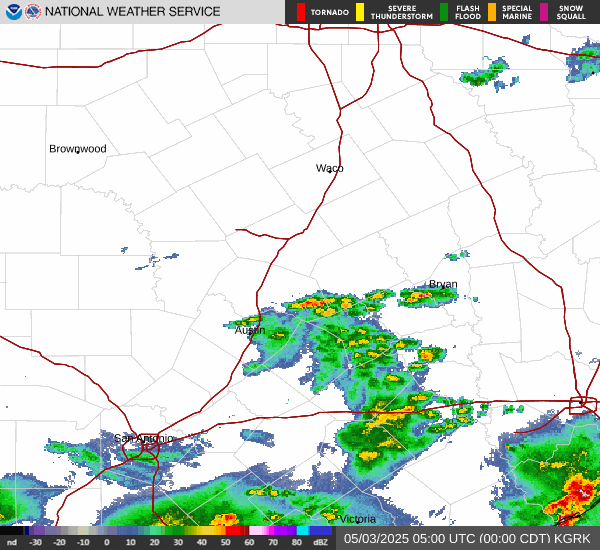
That's one dark cloud. It's starting to weaken about 5 miles from the casa. We got lucky yesterday - can we get a twofer?
-
jasons2k

- Posts: 6193
- Joined: Thu Feb 04, 2010 12:54 pm
- Location: Imperial Oaks
- Contact:
-
DoctorMu
- Posts: 8030
- Joined: Sun Jun 28, 2015 11:58 am
- Location: College Station
- Contact:
Severe Thunderstorm Warning issued May 1 at 6:16PM CDT until May 1 at 6:45PM CDT by NWS Houston/Galveston TX
SVRHGX
The National Weather Service in League City has issued a
* Severe Thunderstorm Warning for...
Northeastern Burleson County in southeastern Texas...
Northwestern Grimes County in southeastern Texas...
Central Brazos County in southeastern Texas...
* Until 645 PM CDT.
* At 615 PM CDT, a severe thunderstorm was located near Bryan
Utilities Lake, or near Bryan, moving southeast at 15 mph.
HAZARD...70 mph wind gusts and ping pong ball size hail.
SOURCE...Public.
IMPACT...People and animals outdoors will be injured. Expect hail
damage to roofs, siding, windows, and vehicles. Expect
considerable tree damage. Wind damage is also likely to
mobile homes, roofs, and outbuildings.
* Locations impacted include...
Northwestern College Station, Bryan, Kurten, Wixon Valley, Bryan
Utilities Lake, and Kyle Field.
Instructions
For your protection move to an interior room on the lowest floor of a
building.
Sender NWS Houston/Galveston TX
Sent 5/1/2025 18:16 CDT
Brazos, TX; Burleson, TX; Grimes, TX
-
DoctorMu
- Posts: 8030
- Joined: Sun Jun 28, 2015 11:58 am
- Location: College Station
- Contact:
-
don

- Posts: 3148
- Joined: Wed Feb 03, 2010 3:33 pm
- Location: Wichita Falls
- Contact:
Beautiful storms! 

- Attachments
-
- carrrnvas.png (528.63 KiB) Viewed 11021 times
-
DoctorMu
- Posts: 8030
- Joined: Sun Jun 28, 2015 11:58 am
- Location: College Station
- Contact:
-
jasons2k
- Posts: 6193
- Joined: Thu Feb 04, 2010 12:54 pm
- Location: Imperial Oaks
- Contact:
I see mammatus clouds to my north. It’s definitely May.
-
jasons2k
- Posts: 6193
- Joined: Thu Feb 04, 2010 12:54 pm
- Location: Imperial Oaks
- Contact:
Strong one.
- Attachments
-
- IMG_0552.png
- (4.42 MiB) Downloaded 1666 times
-
Cpv17
- Posts: 7091
- Joined: Fri Aug 31, 2018 1:58 pm
- Location: El Campo/Wharton
- Contact:
And it’ll go poof by the time it makes it S of I-10 lol
-
DoctorMu
- Posts: 8030
- Joined: Sun Jun 28, 2015 11:58 am
- Location: College Station
- Contact:
-
tireman4

- Global Moderator

- Posts: 7127
- Joined: Wed Feb 03, 2010 9:24 pm
- Location: Humble, Texas
- Contact:
Will it make it to Humble. .
- Attachments
-
- KHGX_loop.gif (612.99 KiB) Viewed 10988 times
-
Cromagnum
- Posts: 3065
- Joined: Thu Feb 03, 2011 10:42 pm
- Location: Georgetown
- Contact:
Day two of severe storms here and tomorrow is progged to be the worst yet. Got hail both times and was close to catching a tornado in today's storm.


Wall cloud before dropping the Briggs tornado.

This was the tornado on the ground between Georgetown and Briggs.


Wall cloud before dropping the Briggs tornado.
This was the tornado on the ground between Georgetown and Briggs.
Last edited by Cromagnum on Thu May 01, 2025 8:18 pm, edited 2 times in total.
-
Cromagnum
- Posts: 3065
- Joined: Thu Feb 03, 2011 10:42 pm
- Location: Georgetown
- Contact:
Looking northwest off my backyard patio before yesterday's storm.

-
tireman4
- Global Moderator
- Posts: 7127
- Joined: Wed Feb 03, 2010 9:24 pm
- Location: Humble, Texas
- Contact:
Looks like Humble might get something..
- Attachments
-
- KHGX_loop-1.gif (641.17 KiB) Viewed 10972 times
-
jasons2k
- Posts: 6193
- Joined: Thu Feb 04, 2010 12:54 pm
- Location: Imperial Oaks
- Contact:
-
Cromagnum
- Posts: 3065
- Joined: Thu Feb 03, 2011 10:42 pm
- Location: Georgetown
- Contact:
It's been BUSY between life, work, and yard work.
It's starting to pay off. I can enjoy looking at a nice yard. Still getting used to Austin area though. 1/4 the population but every bit as congested on the roads.
 [/url]
-
DoctorMu
- Posts: 8030
- Joined: Sun Jun 28, 2015 11:58 am
- Location: College Station
- Contact:
Right. The dry line that triggered storms for Don will be moving into the I-35 corridor.Cromagnum wrote: ↑Thu May 01, 2025 8:09 pm Day two of severe storms here and tomorrow is progged to be the worst yet. Got hail both times and was close to catching a tornado in today's storm.
Wall cloud before dropping the Briggs tornado.
This was the tornado on the ground between Georgetown and Briggs.
I didn't expect rain today when I got up this morning. We've had 0.72 inches.
- Attachments
-
- day2probotlk_1730_torn.gif (24.29 KiB) Viewed 10954 times
-
- day2probotlk_1730_hail.gif (26.74 KiB) Viewed 10954 times
-
DoctorMu
- Posts: 8030
- Joined: Sun Jun 28, 2015 11:58 am
- Location: College Station
- Contact:
Landscaping with limestone always looks great. The lollipop live oaks add that central Texas character. Monkey grass is a good touch. Plus the Georgetown and Austin areas have slopes and shifts in elevation that enhance the look of yard landscaping.