
BULLETIN - EAS ACTIVATION REQUESTED
FLASH FLOOD WARNING
NATIONAL WEATHER SERVICE HOUSTON/GALVESTON TX
133 AM CDT TUE MAY 13 2014
THE NATIONAL WEATHER SERVICE IN LEAGUE CITY HAS ISSUED A
* FLASH FLOOD WARNING FOR...
CENTRAL AUSTIN COUNTY IN SOUTHEAST TEXAS...
COLORADO COUNTY IN SOUTHEAST TEXAS...
* UNTIL 430 AM CDT
* AT 130 AM CDT...DOPPLER RADAR INDICATED SEVERAL THUNDERSTORM
PRODUCING HEAVY RAIN OVER COLUMBUS WITH 2 TO 4 INCHES OF RAIN
HAVING ALREADY FALLEN. FLASH FLOODING IS EXPECTED TO BEGIN SHORTLY.
* SOME LOCATIONS THAT WILL EXPERIENCE FLOODING INCLUDE...
SEALY...BELLVILLE...COLUMBUS...EAGLE LAKE...WEIMAR...SAN FELIPE...
INDUSTRY...ROCK ISLAND...NEW ULM...CAT SPRING...ALTAIR...SHERIDAN
AND FRELSBURG.
ADDITIONAL RAINFALL AMOUNTS OF 2 TO 4 INCHES ARE POSSIBLE IN THE
WARNED AREA.
PRECAUTIONARY/PREPAREDNESS ACTIONS...
BE ESPECIALLY CAUTIOUS AT NIGHT WHEN IT IS HARDER TO RECOGNIZE THE
DANGERS OF FLOODING.
May: IAH Does Not Reach 90 During May. 1970 Mark Achieved
-
djjordan

- Posts: 929
- Joined: Fri Feb 05, 2010 7:19 pm
- Location: Montgomery, Texas
- Contact:
~~~When Thunder Roars Go Indoors~~~
~~~Turn Around Don't Drown~~~
~~~Run From The Water, Hide From The Wind~~~
~~~Turn Around Don't Drown~~~
~~~Run From The Water, Hide From The Wind~~~
-
djjordan
- Posts: 929
- Joined: Fri Feb 05, 2010 7:19 pm
- Location: Montgomery, Texas
- Contact:
FF Watch until 10 AM and expanded Southwestward as well......
...FLASH FLOOD WATCH NOW IN EFFECT UNTIL 10 AM CDT THIS MORNING...
THE FLASH FLOOD WATCH IS NOW IN EFFECT FOR
* A PORTION OF SOUTHEAST TEXAS...INCLUDING THE FOLLOWING
COUNTIES...AUSTIN...COLORADO AND WALLER.
* UNTIL 10 AM CDT THIS MORNING
* HEAVY RAINFALL ASSOCIATED WITH A SLOW MOVING COLD FRONT WILL
PRODUCE A THREAT FOR OVERNIGHT FLASH FLOODING.
* THUNDERSTORMS MAY PERSIST ACROSS THE WATCH AREA FOR SEVERAL
HOURS. AVERAGE RAINFALL AMOUNTS OF 1 TO 2 INCHES ARE EXPECTED
...FLASH FLOOD WATCH IN EFFECT UNTIL 10 AM CDT THIS MORNING...
THE NATIONAL WEATHER SERVICE IN HOUSTON/GALVESTON HAS EXPANDED
THE
* FLASH FLOOD WATCH TO INCLUDE A PORTION OF SOUTHEAST TEXAS...
INCLUDING THE FOLLOWING COUNTIES...JACKSON...MATAGORDA AND
WHARTON.
* UNTIL 10 AM CDT THIS MORNING
* HEAVY RAINFALL ASSOCIATED WITH A SLOW MOVING COLD FRONT WILL
PRODUCE A THREAT FOR OVERNIGHT FLASH FLOODING.
* THUNDERSTORMS OCCURRING AHEAD OF A SLOW MOVING COLD FRONT WILL
DEVELOP EARLY THIS MORNING AND MAY PERSIST FOR SEVERAL HOURS.
AVERAGE RAINFALL AMOUNTS OF 1 TO 2 INCHES ARE EXPECTED WITH
ISOLATED AMOUNTS OF UP TO 4 INCHES POSSIBLE.
WITH ISOLATED AMOUNTS OF UP TO 4 INCHES POSSIBLE.
~~~When Thunder Roars Go Indoors~~~
~~~Turn Around Don't Drown~~~
~~~Run From The Water, Hide From The Wind~~~
~~~Turn Around Don't Drown~~~
~~~Run From The Water, Hide From The Wind~~~
-
djjordan
- Posts: 929
- Joined: Fri Feb 05, 2010 7:19 pm
- Location: Montgomery, Texas
- Contact:
Taking a step back to look at the bigger picture. This is just what the doctor ordered!!!! I like it!!!!
http://radar.weather.gov/ridge/Conus/so ... s_loop.php
http://radar.weather.gov/ridge/Conus/so ... s_loop.php
~~~When Thunder Roars Go Indoors~~~
~~~Turn Around Don't Drown~~~
~~~Run From The Water, Hide From The Wind~~~
~~~Turn Around Don't Drown~~~
~~~Run From The Water, Hide From The Wind~~~
-
djjordan
- Posts: 929
- Joined: Fri Feb 05, 2010 7:19 pm
- Location: Montgomery, Texas
- Contact:
...THE FLASH FLOOD WARNING REMAINS IN EFFECT UNTIL 430 AM CDT FOR
COLORADO COUNTY...
AT 216 AM CDT...DOPPLER RADAR INDICATED THUNDERSTORMS PRODUCING
HEAVY RAIN ACROSS THE WARNED AREA. 5 TO 7 INCHES OF RAIN HAVE FALLEN
MAINLY NEAR OR JUST WEST OF COLUMBUS. MOTORISTS ALONG INTERSTATE 10
SHOULD TAKE CAUTION FOR THE POSSIBILITY OF FLOODING OVER
INTERSTATE 10. FLASH FLOODING IS EXPECTED TO BEGIN SHORTLY.
SOME LOCATIONS THAT WILL EXPERIENCE FLOODING INCLUDE...
COLUMBUS...EAGLE LAKE...WEIMAR...ROCK ISLAND...FRELSBURG...SHERIDAN
AND ALTAIR.
ADDITIONAL RAINFALL AMOUNTS OF 1 TO 3 INCHES ARE POSSIBLE IN THE
WARNED AREA.
PRECAUTIONARY/PREPAREDNESS ACTIONS...
BE ESPECIALLY CAUTIOUS AT NIGHT WHEN IT IS HARDER TO RECOGNIZE THE
DANGERS OF FLOODING.
~~~When Thunder Roars Go Indoors~~~
~~~Turn Around Don't Drown~~~
~~~Run From The Water, Hide From The Wind~~~
~~~Turn Around Don't Drown~~~
~~~Run From The Water, Hide From The Wind~~~
-
djjordan
- Posts: 929
- Joined: Fri Feb 05, 2010 7:19 pm
- Location: Montgomery, Texas
- Contact:
Severe Thunderstorm Warning issued SW HGX CWA........
BULLETIN - IMMEDIATE BROADCAST REQUESTED
SEVERE THUNDERSTORM WARNING
NATIONAL WEATHER SERVICE HOUSTON/GALVESTON TX
243 AM CDT TUE MAY 13 2014
THE NATIONAL WEATHER SERVICE IN LEAGUE CITY HAS ISSUED A
* SEVERE THUNDERSTORM WARNING FOR...
NORTHWESTERN MATAGORDA COUNTY IN SOUTHEAST TEXAS...
JACKSON COUNTY IN SOUTH CENTRAL TEXAS...
SOUTH CENTRAL COLORADO COUNTY IN SOUTHEAST TEXAS...
SOUTHWESTERN WHARTON COUNTY IN SOUTHEAST TEXAS...
* UNTIL 330 AM CDT
* AT 242 AM CDT...DOPPLER RADAR INDICATED A SEVERE THUNDERSTORM
CAPABLE OF PRODUCING DAMAGING WINDS IN EXCESS OF 60 MPH. THIS STORM
WAS LOCATED OVER EDNA...AND MOVING EAST AT 55 MPH.
* LOCATIONS IMPACTED INCLUDE...
EL CAMPO...WHARTON...EDNA...GANADO...LA WARD...PIERCE...BLESSING...
LOLITA...MIDFIELD...MORALES...LAKE TEXANA DAM...DANEVANG...
VANDERBILT...CORDELE AND LOUISE.
PRECAUTIONARY/PREPAREDNESS ACTIONS...
SEVERE THUNDERSTORMS PRODUCE DAMAGING WINDS...DESTRUCTIVE HAIL...
DEADLY LIGHTNING AND VERY HEAVY RAIN. FOR YOUR PROTECTION...MOVE TO
AN INTERIOR ROOM ON THE LOWEST FLOOR OF YOUR HOME OR BUSINESS. HEAVY
RAINS FLOOD ROADS QUICKLY SO DO NOT DRIVE INTO AREAS WHERE WATER
COVERS THE ROAD.
TO REPORT SEVERE WEATHER...CONTACT YOUR NEAREST LAW ENFORCEMENT
AGENCY. THEY WILL RELAY YOUR REPORT TO THE NATIONAL WEATHER SERVICE
OFFICE IN LEAGUE CITY .
~~~When Thunder Roars Go Indoors~~~
~~~Turn Around Don't Drown~~~
~~~Run From The Water, Hide From The Wind~~~
~~~Turn Around Don't Drown~~~
~~~Run From The Water, Hide From The Wind~~~
-
djjordan
- Posts: 929
- Joined: Fri Feb 05, 2010 7:19 pm
- Location: Montgomery, Texas
- Contact:
THE NATIONAL WEATHER SERVICE IN LEAGUE CITY HAS ISSUED A
* FLOOD ADVISORY FOR...
SOUTHERN AUSTIN COUNTY IN SOUTHEAST TEXAS...
SOUTHWESTERN HARRIS COUNTY IN SOUTHEAST TEXAS...
SOUTHERN WALLER COUNTY IN SOUTHEAST TEXAS...
NORTHERN FORT BEND COUNTY IN SOUTHEAST TEXAS...
* UNTIL 545 AM CDT
* AT 246 AM CDT...DOPPLER RADAR INDICATED HEAVY RAIN DUE TO
THUNDERSTORMS. THIS WILL CAUSE MINOR FLOODING IN THE ADVISORY AREA.
* SOME LOCATIONS THAT WILL EXPERIENCE FLOODING INCLUDE...
SUGAR LAND...MISSOURI CITY...ROSENBERG...STAFFORD...BELLAIRE...
WEST UNIVERSITY PLACE...KATY...RICHMOND...JERSEY VILLAGE...
SEALY...BROOKSHIRE...HUNTERS CREEK VILLAGE...BELLVILLE...BUNKER
HILL VILLAGE...PINEY POINT VILLAGE...SPRING BRANCH NORTH...SPRING
BRANCH WEST...GREENWAY / UPPER KIRBY AREA...MISSION BEND...AND
PECAN GROVE.
PRECAUTIONARY/PREPAREDNESS ACTIONS...
MOST FLOOD DEATHS OCCUR IN AUTOMOBILES. NEVER DRIVE YOUR VEHICLE INTO
AREAS WHERE THE WATER COVERS THE ROADWAY. FLOOD WATERS ARE USUALLY
DEEPER THAN THEY APPEAR. JUST ONE FOOT OF FLOWING WATER IS POWERFUL
ENOUGH TO SWEEP VEHICLES OFF THE ROAD. WHEN ENCOUNTERING FLOODED
ROADS MAKE THE SMART CHOICE...TURN AROUND...DONT DROWN.
~~~When Thunder Roars Go Indoors~~~
~~~Turn Around Don't Drown~~~
~~~Run From The Water, Hide From The Wind~~~
~~~Turn Around Don't Drown~~~
~~~Run From The Water, Hide From The Wind~~~


-
unome
- Posts: 3062
- Joined: Fri Feb 12, 2010 6:11 pm
from the West Gulf River Forecast Center: http://www.srh.noaa.gov/wgrfc/
and Advanced Hydro-meteorological Prediction Center http://water.weather.gov/ahps/
Lake Conroe

Lake Houston

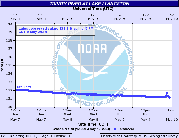
Lake Livingston
and Advanced Hydro-meteorological Prediction Center http://water.weather.gov/ahps/
Lake Conroe
Lake Houston
Lake Livingston
-
tireman4

- Global Moderator

- Posts: 7123
- Joined: Wed Feb 03, 2010 9:24 pm
- Location: Humble, Texas
- Contact:
Still coming down quite steadily in Humble at this time. I am sure there will be no soccer practice for my child this afternoon. LOL
-
BlueJay
- Posts: 938
- Joined: Tue Mar 04, 2014 10:47 am
- Location: Alden Bridge-The Woodlands, Texas
- Contact:
It's been raining all night here. Had lightening flashes and thunder that seemed to rumble for 30 seconds at a time. My rain gauge says we have received 5.29 (!) inches thus far. I guess it has been feast or famine around here. Glad to have the wet weather!
-
djmike

- Posts: 1875
- Joined: Fri Jan 07, 2011 12:19 pm
- Location: BEAUMONT, TX
- Contact:
Must be nice. Us in the BPT area dont seem to be getting squat out of this. And it now looks to be petering out. Figures. Glad to see much of Texas got the rains so desperatly needed...
Mike
Beaumont, TX
(IH-10 & College Street)
Beaumont, TX
(IH-10 & College Street)
-
srainhoutx

- Site Admin

- Posts: 19700
- Joined: Tue Feb 02, 2010 2:32 pm
- Location: Maggie Valley, NC
- Contact:
Judging by the reports I am seeing on NWSchat from across Central and SE Texas, most areas received between 2-4 inches of rain with isolated higher amounts near 7 inches of much needed rainfall across the Hill Country.
Carla/Alicia/Jerry(In The Eye)/Michelle/Charley/Ivan/Dennis/Katrina/Rita/Wilma/Humberto/Ike/Harvey
Member: National Weather Association
Facebook.com/Weather Infinity
Twitter @WeatherInfinity
Member: National Weather Association
Facebook.com/Weather Infinity
Twitter @WeatherInfinity
-
srainhoutx
- Site Admin
- Posts: 19700
- Joined: Tue Feb 02, 2010 2:32 pm
- Location: Maggie Valley, NC
- Contact:
Update from Jeff:
Quite the overnight rainfall cross the area with numerous locations getting between 4-7 inches of rainfall with up to 8 inches in Colorado County. Ongoing run-off and flooding is the main near term focus.
Widespread 3-5 inches of rainfall has fallen overnight along and NW of US 59 with almost no rainfall over Galveston or Chambers Counties…models actually did handle the sharp cut-off very well. Excessive short term rainfall rates area resulting in significant run-off into area rivers and stream even though grounds were dry going into the event.
Meso low has been generated along the upper TX coast in response to strong forcing from convection overnight. This feature has lost much of its identity in the last few hours and gusty wind associated with the small scale pressure gradient have ended. Outflow boundary and cold pool which helped force heavy rainfall deeper into SE TX overnight is starting to weaken as it crosses into the Gulf waters and has shown very little additional development in the last hour suggesting this convective complex is weakening. Additionally cloud tops are warming and large mass of convectively induced stratiform rain is weakening. Expect a fairly quick improvement in conditions over the next 2-3 hours as rainfall dissipates.
Main question then becomes how quickly does the thick anvil debris clouds dissipate and can the air mass recover this afternoon ahead of the main trough axis tonight. IR images show a fairly impressive convective complex plowing through S TX with significant high level cirrus clouds pouring northward along and east of I-35, but there is a clearing and thinning trend on the satellite images. Meso low induced meso high sitting directly over SE TX will also help to shut off rainfall and helping in clearing skies. Moisture is already quickly returning up the Rio Grande as noted by developing thunderstorms south and southeast of Del Rio. Think the air mass has time to recover especially since the current activity did not move very far offshore and a return of southerly winds by early afternoon should begin to replenish moisture. Do not expect as organized of activity as this current batch nor as high hourly rainfall rates. Confidence is not great on when nor where development may occur this evening/overnight.
Cold front will sweep across the region early Wednesday with a very cool air mass for mid May. Low temperatures Thursday-Saturday will be in the 50’s with highs in the 70’s and 80’s with low humidity.
- Attachments
-
-
Carla/Alicia/Jerry(In The Eye)/Michelle/Charley/Ivan/Dennis/Katrina/Rita/Wilma/Humberto/Ike/Harvey
Member: National Weather Association
Facebook.com/Weather Infinity
Twitter @WeatherInfinity
Member: National Weather Association
Facebook.com/Weather Infinity
Twitter @WeatherInfinity
-
kayci

- Posts: 358
- Joined: Thu Feb 04, 2010 10:30 am
- Location: Alvin
- Contact:
I'm diggin this!!!!! Wish we could get more of it though.
-
srainhoutx
- Site Admin
- Posts: 19700
- Joined: Tue Feb 02, 2010 2:32 pm
- Location: Maggie Valley, NC
- Contact:
FLOOD ADVISORY
NATIONAL WEATHER SERVICE HOUSTON/GALVESTON TX
751 AM CDT TUE MAY 13 2014
TXC157-201-131545-
/O.NEW.KHGX.FA.Y.0007.140513T1251Z-140513T1545Z/
/00000.N.ER.000000T0000Z.000000T0000Z.000000T0000Z.OO/
HARRIS TX-FORT BEND TX-
751 AM CDT TUE MAY 13 2014
THE NATIONAL WEATHER SERVICE IN LEAGUE CITY HAS ISSUED A
* FLOOD ADVISORY FOR...
HARRIS COUNTY IN SOUTHEAST TEXAS...
NORTHERN FORT BEND COUNTY IN SOUTHEAST TEXAS...
* UNTIL 1045 AM CDT
* AT 750 AM CDT...DOPPLER RADAR INDICATED HEAVY RAIN DUE TO
THUNDERSTORMS. THIS WILL CAUSE MINOR FLOODING IN THE ADVISORY AREA.
* SOME LOCATIONS THAT WILL EXPERIENCE FLOODING INCLUDE...
NORTHWESTERN PASADENA...SUGAR LAND...MISSOURI CITY...NORTHEASTERN
ROSENBERG...STAFFORD...BELLAIRE...HUMBLE...WEST UNIVERSITY PLACE...
RICHMOND...GALENA PARK...JACINTO CITY...HUNTERS CREEK VILLAGE...
BUNKER HILL VILLAGE...PINEY POINT VILLAGE...MIDTOWN HOUSTON...
FOURTH WARD...GREATER THIRD WARD...GREATER EASTWOOD...ALDINE AND
MISSION BEND.
- Attachments
-
Carla/Alicia/Jerry(In The Eye)/Michelle/Charley/Ivan/Dennis/Katrina/Rita/Wilma/Humberto/Ike/Harvey
Member: National Weather Association
Facebook.com/Weather Infinity
Twitter @WeatherInfinity
Member: National Weather Association
Facebook.com/Weather Infinity
Twitter @WeatherInfinity
-
kayci
- Posts: 358
- Joined: Thu Feb 04, 2010 10:30 am
- Location: Alvin
- Contact:
Ed Mahmoud wrote:kayci wrote:I'm diggin this!!!!! Wish we could get more of it though.
Car wash and demotion to a 'black tagger' was enough to break the Ed Rule.
The sprinkler may get the whole week off, and the bayou at I-10 and I-45 is way out of its banks, much higher I think it might get into neighborhoods. Totally covering the grassy areas either side of the concrete channel.
Boy, you really are upset about the 'black tag' think ain't ya?
-
ticka1
- Posts: 1265
- Joined: Wed Feb 03, 2010 3:02 pm
- Location: Baytown/Mont Belvieu
- Contact:
nice rainfall - received over one inch of rain at the house. Not too much to flood the garden but enough to give it a good soaking. It will do my garden good. 
-
Kludge

- Posts: 280
- Joined: Wed Feb 03, 2010 11:53 pm
- Location: Montgomery (Walden) TX
- Contact:
5.6" here overnight to go with the 2.55" last Thursday.
I see another disturbance heading this way from Austin. For the first time in over 4 years, I actually wouldn't mind if it misses me.
Don't get me wrong... I'm delighted. Maybe we've delayed the wildfires by a few more weeks.
I see another disturbance heading this way from Austin. For the first time in over 4 years, I actually wouldn't mind if it misses me.
Don't get me wrong... I'm delighted.
Last edited by Kludge on Tue May 13, 2014 10:21 am, edited 1 time in total.
-
jojotheidiotclown
- Posts: 46
- Joined: Wed Apr 25, 2012 4:01 pm
- Contact:
love the rain, but wheres the heat?