Page 7 of 70
Re: 93L Central Caribbean. RECON Scheduled!
Posted: Tue Jun 22, 2010 11:35 pm
by Paul
Mr. T wrote:The 0z GFS loses 93L over the Yucatan again... The model continues to be the lone sheep with the failure of trying to develop a well defined system
even the newer version buries it in the Yucatan....1am for the EURO....whos staying up for that?

Re: 93L Central Caribbean. RECON Scheduled!
Posted: Tue Jun 22, 2010 11:39 pm
by Ptarmigan
Paul wrote:
even the newer version buries it in the Yucatan....1am for the EURO....whos staying up for that?

Something tells me that 93L will be a tropical depression in at least 2 days.
Re: 93L Central Caribbean. RECON Scheduled!
Posted: Wed Jun 23, 2010 2:24 am
by Andrew
Well this would be catastrophic for the gulf. Oil would go everywhere, but like I have stated I still strongly believe until we actually get a surface low these runs are not exactly valid. What these runs do show is that a storm is predicted to form and a trough is expected to create a possible weakness in the ridge causing a turn to the north and eventually north-east. The timing and how strong this weakness will be is still very much in the air and much should change from now to next week...

The other thing that is noticeable about the run is it also shows the ridge coming back strong and really stalling the storm around the LA coast and then sending it west towards Texas. Again it emphasizes the aspect of timing and how important it is for where this invest/possible future storm goes.
Re: 93L Central Caribbean. RECON Scheduled!
Posted: Wed Jun 23, 2010 3:08 am
by Mr. T
Andrew wrote:
The other thing that is noticeable about the run is it also shows the ridge coming back strong and really stalling the storm around the LA coast and then sending it west towards Texas. Again it emphasizes the aspect of timing and how important it is for where this invest/possible future storm goes.
Very interesting...
A stronger storm will tend to move more poleward, which is why this particular run of the Euro shows 93L almost being taken away by the trough. But, just as 93L is trying to take a turn to the east, the trough passes off the East Coast and another ridge builds in to the north. Thus, the storm is kicked back to the west.
If this storm were to stay weak and move a bit slower, it could miss that bypassing trough to the NE and take a more westerly track. This is why it needs to be stressed that these long range model runs are in no way a "consensus forming" or have a high chance to be accurate that far away in time. Again, we have yet to see 93L make any kind of organizational stance. Without a defined storm or center, we're pretty much throwing darts a mile down the road to hit a grain of rice being carried by an ant.
And, who knows, this thing may never get its act together...
Re: 93L Central Caribbean. RECON Scheduled!
Posted: Wed Jun 23, 2010 3:52 am
by Paul
MR T I concur with your thoughts....exactly how I would put it....
and Andrew not to shabby bro. nice write up
one thing that needs to be pointed out it is almost July and its is rare to have a SV dig so deep this time of year....its happened I am sure but you dont see it very often. If its not as sharp or timing is off this could easily move more westward. We need to get a center and model consensus.
Re: 93L Central Caribbean. RECON Scheduled!
Posted: Wed Jun 23, 2010 5:56 am
by Hardcoreweather
Re: 93L Central Caribbean. RECON Scheduled!
Posted: Wed Jun 23, 2010 6:05 am
by srainhoutx
HPC thoughts this morning....
MEANWHILE MODELS/ENSEMBLES DEFINE A RATHER WIDE SOLN
ENVELOPE WITH A POSSIBLE TROPICAL SYSTEM EMERGING FROM THE
CARIBBEAN INTO THE GULF OF MEXICO... WITH THE 00Z ECMWF BY FAR THE
DEEPEST AS THE SYSTEM TRACKS OVER THE GULF. ASIDE FROM THE FAST
CANADIAN MOST GUIDANCE BECOMES SLOWER THAN YDAYS TPC/HPC
COORDINATED TRACK... SO CONTINUITY IS ADJUSTED A LITTLE SLOWER BY
THE LATTER HALF OF THE FCST.
Re: 93L Central Caribbean. RECON Scheduled!
Posted: Wed Jun 23, 2010 7:37 am
by Hardcoreweather
Re: 93L Central Caribbean. RECON Scheduled!
Posted: Wed Jun 23, 2010 7:42 am
by Hardcoreweather
RECON
I. ATLANTIC REQUIREMENTS
1. SUSPECT AREA (SOUTH OF JAMAICA)
FLIGHT ONE - TEAL 70
A. 23/1800Z
B. AFXXX 01AAA INVEST
C. 23/1330Z
D. 17.0N 77.5W
E. 23/1700Z TO 23/2100Z
F. SFC TO 10,000 FT
FLIGHT TWO - TEAL 71
A. 24/0600Z
B. AFXXX 0201A CYCLONE
C. 24/0100Z
D. 17.5N 79.5W
E. 24/0400Z TO 24/0830Z
F. SFC TO 10,000 FT
Re: 93L Central Caribbean. RECON Scheduled!
Posted: Wed Jun 23, 2010 7:49 am
by srainhoutx
Re: 93L Central Caribbean. RECON Scheduled!
Posted: Wed Jun 23, 2010 8:23 am
by Hardcoreweather
Re: 93L Central Caribbean. RECON Scheduled!
Posted: Wed Jun 23, 2010 8:29 am
by Portastorm
The blob watch continues ...

Re: 93L Central Caribbean. RECON Scheduled!
Posted: Wed Jun 23, 2010 8:32 am
by Katdaddy
Invest 93L looking more organized. From Joe Bastardi's morning post:
So strap in, here we go. The tropics are bubbling and the lid is about to pop off for our first impact threat of the season.
Re: 93L Central Caribbean. RECON Cancelled.
Posted: Wed Jun 23, 2010 8:51 am
by srainhoutx
000
NOUS42 KNHC 231345
WEATHER RECONNAISSANCE FLIGHTS
CARCAH, NATIONAL HURRICANE CENTER, MIAMI, FL.
0945 AM EDT WED 23 JUNE 2010
SUBJECT: TROPICAL CYCLONE PLAN OF THE DAY (TCPOD)
VALID 24/1100Z TO 25/1100Z JUNE 2010
TCPOD NUMBER.....10-023
I. ATLANTIC REQUIREMENTS
1. SUSPECT AREA (SOUTHWEST OF JAMAICA)
FLIGHT ONE - TEAL 70
A. 24/1800Z
B. AFXXX 01AAA INVEST
C. 24/1330Z
D. 16.5N 80.0W
E. 24/1700Z TO 24/2100Z
F. SFC TO 10,000 FT
FLIGHT TWO - TEAL 71
A. 25/0600Z
B. AFXXX 0201A CYCLONE
C. 25/0200Z
D. 17.0N 81.0W
E. 25/0400Z TO 25/0830Z
F. SFC TO 10,000 FT
2. SUCCEEDING DAY OUTLOOK: CONTINUE 12 HRLY
FIXES IF SYSTEM REMAINS A THREAT.
3. REMARKS: TASKING FOR 23/1800Z AND 24/0600Z
CANCELED BY NHC AT 23/0930Z.
Re: 93L Central Caribbean. RECON Cancelled.
Posted: Wed Jun 23, 2010 9:25 am
by Hardcoreweather
Re: 93L Central Caribbean. RECON Scheduled!
Posted: Wed Jun 23, 2010 11:09 am
by Andrew
Paul wrote:MR T I concur with your thoughts....exactly how I would put it....
and Andrew not to shabby bro. nice write up
one thing that needs to be pointed out it is almost July and its is rare to have a SV dig so deep this time of year....its happened I am sure but you dont see it very often. If its not as sharp or timing is off this could easily move more westward. We need to get a center and model consensus.
Thanks

Also I agree as I believe the models are overdoing this SV as they often do. It will be interesting to watch it play out but right now 93L looks pretty sad. As it moves west though it SHOULD have a better chance of development.
Also USA USA USA!!!! That was an amazing GOOOOOOOAAAAAALLLLLL!!!
Re: 93L Central Caribbean. RECON Cancelled.
Posted: Wed Jun 23, 2010 11:44 am
by ticka1
How can the models be forecasting a hurricane when we don't even have a LLC yet. From what I'm seeing today 93L is looking rather weak and dis-organized. Definitely not on the track for organization today. Maybe by this weekend but time is getting short.
Re: 93L Central Caribbean. RECON Cancelled.
Posted: Wed Jun 23, 2010 11:53 am
by Andrew
ticka1 wrote:How can the models be forecasting a hurricane when we don't even have a LLC yet. From what I'm seeing today 93L is looking rather weak and dis-organized. Definitely not on the track for organization today. Maybe by this weekend but time is getting short.
It is because the more it continues west the more favorable the conditions become for development. Yes we do not have a LLC yet but remember things can happen very fast and once a LLC is defined and developed anything can happen. Remember also that many times models predict storms before they even get off the African coast. I think the longer it is the gulf the stronger it will become.
Re: 93L Central Caribbean. RECON Cancelled.
Posted: Wed Jun 23, 2010 12:10 pm
by Portastorm
I'm beginning to think that the GFS' call of little or no development might not be so nutty after all. 93L may end up being the French soccer team of the tropical season!

Re: 93L Central Caribbean. RECON Cancelled.
Posted: Wed Jun 23, 2010 12:14 pm
by srainhoutx
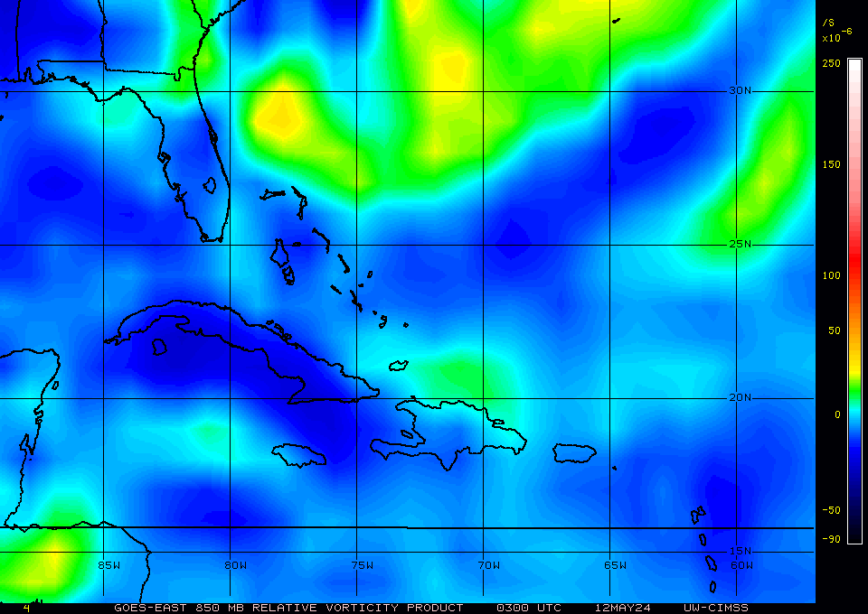
The best vorticity (albeit weak) seems to be S of Jamaica.

Suface map from NHC/TPC...


