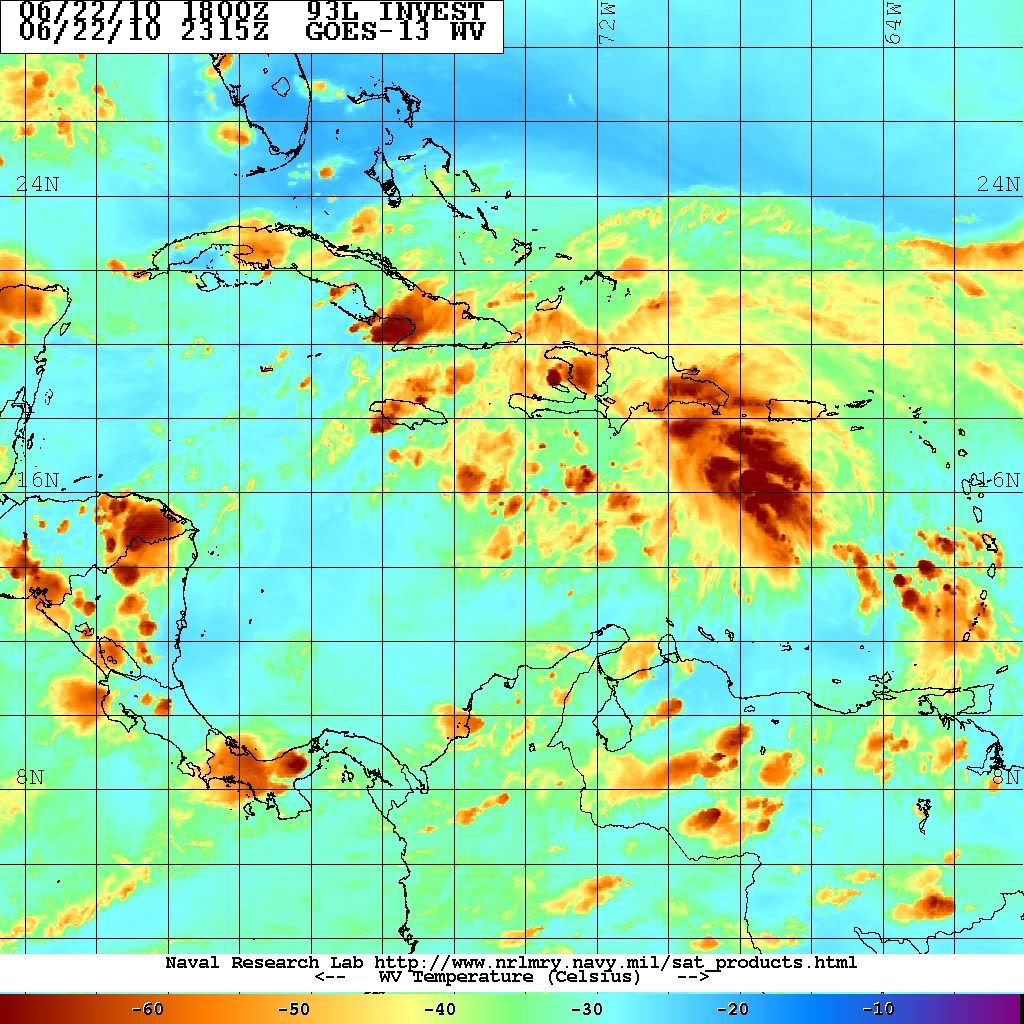
Re: 93L Central Caribbean. RECON Scheduled!
Posted: Tue Jun 22, 2010 3:18 pm
AFD's are coming in from the TX NWS offices this afternoon...
Corpus Christi...
FORECAST NEXT WEEK HIGHLY DEPENDENT ON TROPICAL SYSTEM CURRENTLY IN
THE CARIBBEAN SEA. IT DOES APPEAR NOW PER THE ECMWF/GFS/CANADIAN
THAT THE RIDGE ACROSS THE NORTHERN GULF AND SOUTHEAST U.S. WILL
WEAKEN AS A TROUGH DIGS THROUGH THE GREAT LAKES INTO THE EASTERN
CONUS. THIS WOULD ALLOW THE TROPICAL SYSTEM TO GAIN LATITUDE THROUGH
THE GULF. WILL FOLLOW CLOSE TO THE LEAD OF NHC/HPC MEDIUM RANGE
COORDINATION...WHICH CALLS FOR THE LOW CENTERED IN THE CENTRAL GULF
12Z MONDAY AND TOWARDS THE UPPER TEXAS COAST 12Z TUESDAY. INTRODUCED
LOW POPS INTO THE FORECAST FOR DAY 7 ON TUESDAY. IT SHOULD BE
STRESSED...IT IS STILL TOO EARLY TO SPECULATE ON EXACTLY WHERE AND
HOW THIS SYSTEM WILL IMPACT THE GULF OF MEXICO NEXT WEEK...AND THE
FORECAST FOR THE MIDDLE TEXAS COAST COULD CHANGE SIGNIFICANTLY.
THOSE WITH INTERESTS IN THE WESTERN GULF SHOULD CONTINUE TO MONITOR
THE PROGRESS AND DEVELOPMENT OF THIS WAVE THROUGH THE CARIBBEAN SEA
OVER THE COMING DAYS.
Austin/San Antonio
BEGINNING NEXT WEEK NUMERICAL MODEL GUIDANCE DEVELOP SEVERAL AREAS
OF LOW PRESSURE ACROSS THE WESTERN CARIBBEAN/GULF OF MEXICO. AT THIS
TIME...THEIR SOLUTIONS ARE A BIT DIFFERENCE...HOWEVER...FOR THE LAST
TWO DAYS...THE ECMWF MODEL HAS SHOWED SOME SORT OF TROPICAL
DEVELOPMENT OVER THE GULF OF MEXICO TOWARDS THE END OF THE FORECAST
CYCLE.
LOOKING A HISTORICAL TROPICAL CYCLONE DATA FOR THE LAST WEEK OF JUNE
(21-30)...MOST OF THE TROPICAL CYCLONES FORMED NEAR THE YUCATAN
PENINSULA AND OVER THE DEEP GULF. THE ONES FORMED NEAR OR OVER THE
YUCATAN TEND TO MOVE NNE AFFECTING AREAS FROM LOUISIANA EASTWARD TO
THE WESTERN FLORIDA COAST. THOSE THAT FORMED OVER THE DEEP GULF TEND
TO TRACK NORTH AND THEN WEST NORTHWEST AFFECTING THE SOUTH TEXAS
COASTLINE FROM WEST OF GALVESTON TO BROWNSVILLE.
WILL KEEP MONITORING AND ADJUSTING THE FORECAST AS NEW MODEL RUNS
COME IN. SO FAR...THIS TROPICAL MOISTURE IS EXPECTED TO
SIGNIFICANTLY INCREASE SHOWERS AND THUNDERSTORMS ACROSS THE SOUTH
COASTAL PLAINS AND SOUTH CENTRAL TEXAS NEXT TUESDAY AND WEDNESDAY
AND MAYBE INTO THURSDAY. FORTUNATELY...THE FORTH OF JULY WEEKEND
LOOKS GOOD AS STRONG HIGH BUILDS OVER THE CENTRAL PLAINS.


