
AFD's are coming in from the TX NWS offices this afternoon...
Corpus Christi...
FORECAST NEXT WEEK HIGHLY DEPENDENT ON TROPICAL SYSTEM CURRENTLY IN
THE CARIBBEAN SEA. IT DOES APPEAR NOW PER THE ECMWF/GFS/CANADIAN
THAT THE RIDGE ACROSS THE NORTHERN GULF AND SOUTHEAST U.S. WILL
WEAKEN AS A TROUGH DIGS THROUGH THE GREAT LAKES INTO THE EASTERN
CONUS. THIS WOULD ALLOW THE TROPICAL SYSTEM TO GAIN LATITUDE THROUGH
THE GULF. WILL FOLLOW CLOSE TO THE LEAD OF NHC/HPC MEDIUM RANGE
COORDINATION...WHICH CALLS FOR THE LOW CENTERED IN THE CENTRAL GULF
12Z MONDAY AND TOWARDS THE UPPER TEXAS COAST 12Z TUESDAY. INTRODUCED
LOW POPS INTO THE FORECAST FOR DAY 7 ON TUESDAY. IT SHOULD BE
STRESSED...IT IS STILL TOO EARLY TO SPECULATE ON EXACTLY WHERE AND
HOW THIS SYSTEM WILL IMPACT THE GULF OF MEXICO NEXT WEEK...AND THE
FORECAST FOR THE MIDDLE TEXAS COAST COULD CHANGE SIGNIFICANTLY.
THOSE WITH INTERESTS IN THE WESTERN GULF SHOULD CONTINUE TO MONITOR
THE PROGRESS AND DEVELOPMENT OF THIS WAVE THROUGH THE CARIBBEAN SEA
OVER THE COMING DAYS.
Austin/San Antonio
BEGINNING NEXT WEEK NUMERICAL MODEL GUIDANCE DEVELOP SEVERAL AREAS
OF LOW PRESSURE ACROSS THE WESTERN CARIBBEAN/GULF OF MEXICO. AT THIS
TIME...THEIR SOLUTIONS ARE A BIT DIFFERENCE...HOWEVER...FOR THE LAST
TWO DAYS...THE ECMWF MODEL HAS SHOWED SOME SORT OF TROPICAL
DEVELOPMENT OVER THE GULF OF MEXICO TOWARDS THE END OF THE FORECAST
CYCLE.
LOOKING A HISTORICAL TROPICAL CYCLONE DATA FOR THE LAST WEEK OF JUNE
(21-30)...MOST OF THE TROPICAL CYCLONES FORMED NEAR THE YUCATAN
PENINSULA AND OVER THE DEEP GULF. THE ONES FORMED NEAR OR OVER THE
YUCATAN TEND TO MOVE NNE AFFECTING AREAS FROM LOUISIANA EASTWARD TO
THE WESTERN FLORIDA COAST. THOSE THAT FORMED OVER THE DEEP GULF TEND
TO TRACK NORTH AND THEN WEST NORTHWEST AFFECTING THE SOUTH TEXAS
COASTLINE FROM WEST OF GALVESTON TO BROWNSVILLE.
WILL KEEP MONITORING AND ADJUSTING THE FORECAST AS NEW MODEL RUNS
COME IN. SO FAR...THIS TROPICAL MOISTURE IS EXPECTED TO
SIGNIFICANTLY INCREASE SHOWERS AND THUNDERSTORMS ACROSS THE SOUTH
COASTAL PLAINS AND SOUTH CENTRAL TEXAS NEXT TUESDAY AND WEDNESDAY
AND MAYBE INTO THURSDAY. FORTUNATELY...THE FORTH OF JULY WEEKEND
LOOKS GOOD AS STRONG HIGH BUILDS OVER THE CENTRAL PLAINS.
Hurricane Alex. 40 Miles NNE of La Pesca. 100 MPH/948MB
-
srainhoutx

- Site Admin

- Posts: 19700
- Joined: Tue Feb 02, 2010 2:32 pm
- Location: Maggie Valley, NC
- Contact:
Carla/Alicia/Jerry(In The Eye)/Michelle/Charley/Ivan/Dennis/Katrina/Rita/Wilma/Humberto/Ike/Harvey
Member: National Weather Association
Facebook.com/Weather Infinity
Twitter @WeatherInfinity
Member: National Weather Association
Facebook.com/Weather Infinity
Twitter @WeatherInfinity
-
wxdata

- Site Admin
- Posts: 1059
- Joined: Wed Feb 03, 2010 3:04 pm
- Location: Houston, TX
- Contact:
HPC's take:
COORDINATION WITH TPC ON THE LOW IN THE GULF THIS PERIOD RESULTED IN A SLIGHTLY FASTER FORECAST...WITH THE CIRCULATION APPROACHING THE UPPER TEXAS COAST DAY 7 (Tuesday)
-
Scott747
- Posts: 1648
- Joined: Tue Feb 23, 2010 9:56 am
- Location: Freeport/Surfside Beach
- Contact:
Might want to consider having a separate thread for models/discos. It's great that the local board finally has image ability but they quickly take up the pages and text only posts can easily be missed.
-
biggerbyte
- Posts: 1437
- Joined: Thu Feb 04, 2010 12:15 am
- Location: Porter, Texas. (Montgomery County)
- Contact:
I know it is too early to start buying water and such, but the way things look at the moment, it sure gives all of the Texas coast something to think about. I don't know about you guys, but I am so not ready for another Katrina/Rita/Ike.

-
unome
- Posts: 3062
- Joined: Fri Feb 12, 2010 6:11 pm
It's not too early, you should stock up before season & replace things as used/needed. Sure beats standing in line at the grocery store with someone beside you having a meltdown because they can't get bottled water for their Ag class chickens... I swear, that happened before Rita... poor girl finally sobbed that she would have to resort to letting them drink out of the pond... the nuts come out a fews days before a hurricane hitsbiggerbyte wrote:I know it is too early to start buying water and such, but the way things look at the moment, it sure gives all of the Texas coast something to think about. I don't know about you guys, but I am so not ready for another Katrina/Rita/Ike.
-
Portastorm

- Posts: 800
- Joined: Wed Feb 03, 2010 3:04 pm
- Location: Southwest Austin/Oak Hill, TX
- Contact:
Been mostly in "lurk mode" but wanted to post and say it sure looks to these tired old eyes that 93L today is slowly appearing to get its act together. Will be interesting to see how tonight's diurnal max affects it.
Wxman57's suggestion that will have some development by Friday looks like a smart bet to me.
Wxman57's suggestion that will have some development by Friday looks like a smart bet to me.

-
Rip76

- Posts: 2126
- Joined: Mon Feb 15, 2010 12:38 am
- Location: The Woodlands
- Contact:


-
srainhoutx
- Site Admin
- Posts: 19700
- Joined: Tue Feb 02, 2010 2:32 pm
- Location: Maggie Valley, NC
- Contact:
Moisture is not a problem for this disturbance. Tonight could be interesting development wise. We shall see.
Carla/Alicia/Jerry(In The Eye)/Michelle/Charley/Ivan/Dennis/Katrina/Rita/Wilma/Humberto/Ike/Harvey
Member: National Weather Association
Facebook.com/Weather Infinity
Twitter @WeatherInfinity
Member: National Weather Association
Facebook.com/Weather Infinity
Twitter @WeatherInfinity
-
sambucol

- Posts: 1244
- Joined: Wed Feb 03, 2010 5:43 pm
- Location: Mont Belvieu
- Contact:
It's not too early to buy water and such. The way this hurricane season is forecast to be very active, I think it's wise to get supplies now before a storm is in the Gulf. I'm working on finishing up my supplies this week. If it seems 93L remotely has a chance of becoming a hurricane by this weekend, I think we will see a lot of people getting their supplies together. I would rather watch that happen from the house instead of firsthand!biggerbyte wrote:I know it is too early to start buying water and such, but the way things look at the moment, it sure gives all of the Texas coast something to think about. I don't know about you guys, but I am so not ready for another Katrina/Rita/Ike.
-
Paul

- Posts: 535
- Joined: Wed Feb 03, 2010 11:46 pm
- Location: Pearland
- Contact:
the 18z GFDL was interesting...lets see if the EURO bites tonight.....for a SV to dig far enough to weaken a ridge in June is pretty rare...but with nothing of any type of center to track I am sure the models will tweaking their tracks until we get a clear LLC.....


-
Paul
- Posts: 535
- Joined: Wed Feb 03, 2010 11:46 pm
- Location: Pearland
- Contact:
nice model runs HC...now we need a true center to nail down a true model run
-
srainhoutx
- Site Admin
- Posts: 19700
- Joined: Tue Feb 02, 2010 2:32 pm
- Location: Maggie Valley, NC
- Contact:
D-max could be interesting. I suspect in light of todays developments, the night crew should be busy. 
Carla/Alicia/Jerry(In The Eye)/Michelle/Charley/Ivan/Dennis/Katrina/Rita/Wilma/Humberto/Ike/Harvey
Member: National Weather Association
Facebook.com/Weather Infinity
Twitter @WeatherInfinity
Member: National Weather Association
Facebook.com/Weather Infinity
Twitter @WeatherInfinity
-
Mr. T

- Posts: 992
- Joined: Wed Feb 03, 2010 4:22 pm
- Location: Kingwood
- Contact:
That 18z GFS run in the upper levels is ridiculous. We aren't going to see a deep trough like that across the eastern 2/3rds of the CONUS in late June/near the start of July.

-
sleetstorm
- Posts: 651
- Joined: Thu Feb 04, 2010 12:33 pm
- Contact:
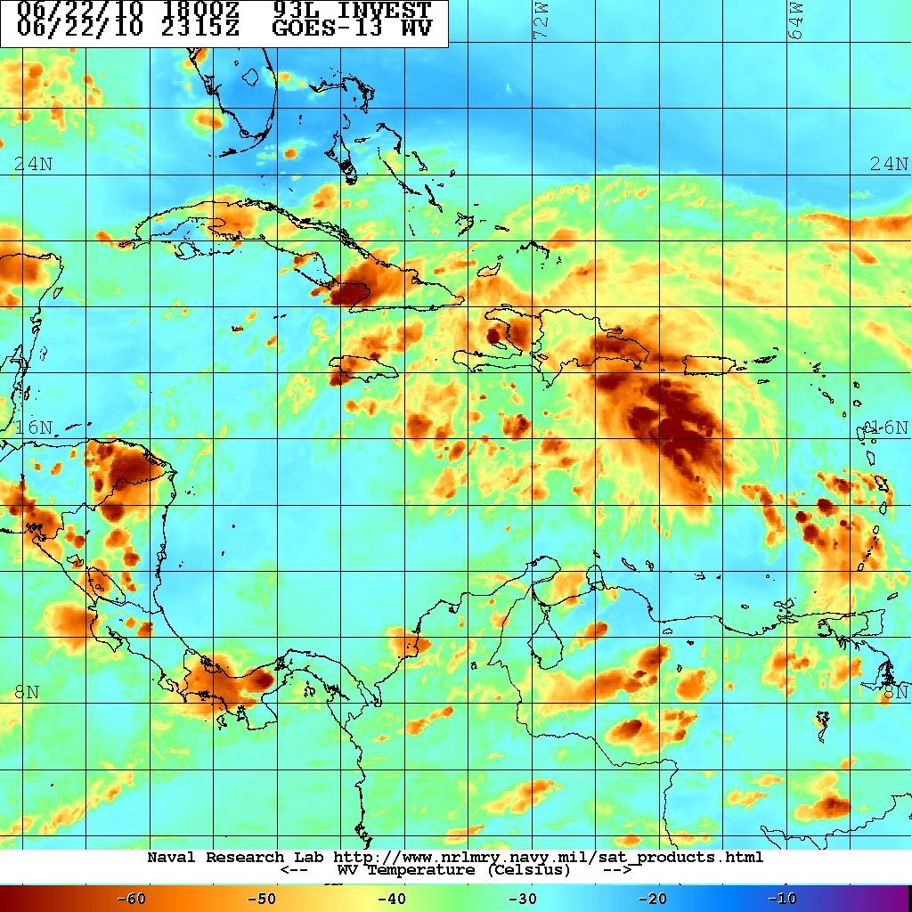
When you would watch the RGB Infrared Color Loop or Rainbow Infrared Color Loop in motion you will see that 93L's center of circulation is not that far from Haiti's coast. It has good rotation with it and tropical showers & thunderstorms have increased wonderfully when I saw it.
-
Mr. T
- Posts: 992
- Joined: Wed Feb 03, 2010 4:22 pm
- Location: Kingwood
- Contact:
The 0z GFS loses 93L over the Yucatan again... The model continues to be the lone sheep with the failure of trying to develop a well defined system