National Weather Service Houston/Galveston TX
858 PM CDT WED JUN 1 2016
.UPDATE...
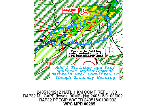
5 to 7 inches of rain has fallen along the Spring and Cypress Creek watersheds tonight and this has renewed flooding along these channels. have not had much time to do analysis tonight but thought the TT WRF and RAP initialized well and will lean in their direction overnight into Thursday. Regrettably, this will portend very high rain chances later tonight into Thursday. Showers and thunderstorms expected to redevelop between 08-10z and expand in coverage and intensity by 12z. PW values progged to be near 2.00 inches and 300 mb winds split with a well defined speed max rotating into the area between 12-18z. Models show a strong signal for heavy rain. Will maintain the Flash Flood Watch and high PoPs. With area creeks and rivers near record levels and flash flood guidance around 2.00-2.50 inches per hour, it just won`t take much rain to create flooding issues. A very dangerous 24-30 hours shaping up for SE TX. Please be careful and avoid high water and flood prone areas. 43
http://www.ssd.noaa.gov/goes/east/sc.html