
Tropical Depression Bonnie forms 5:15 PM 7/22/2010
alright so this storm's movement will depend on the strength of the ridge of high pressure over the southeast. are there any other factors? and any opinions on the strength of the ridge?
Unfortunately like many of us thought the track of TD3 has become a big issue for the oil spill and its operations.
Work on the relief well has been suspended and may take up to two weeks before being able to restart. As noted earlier in the thread the 2nd relief well was already suspended until the 1st one intercepted the original well.
Good news is that the well remains capped but now they are faced with a difficult decision on whether to open it back up or allow it to stay capped while they evacuate. The pressure was still slowly rising which may allow them enough reasoning to feel safe about keeping it closed. Otherwise it's risky to not be fully in control and able to relieve pressure if needed and having the risk of a blowout.
Thad Allen should update later today now that the storm has been designated with more in depth details. Hoping that they feel secure enough to keep it closed.
There was some talk about that. Most everyone has dismissed it as being spurious.singlemom wrote:I know it's the Canadian model, but did anyone catch this 12z run? Another system following 97L like a one, two punch:
http://moe.met.fsu.edu/cgi-bin/cmctc2.c ... =Animation
Ridge looks strong and based on the first disco the NHC feels it's going to strengthen.Snowman wrote:alright so this storm's movement will depend on the strength of the ridge of high pressure over the southeast. are there any other factors? and any opinions on the strength of the ridge?
ULL could have some impact but as usual it's hard to forecast where and how these ULL's will interact with a developing system.
-
srainhoutx

- Site Admin

- Posts: 19616
- Joined: Tue Feb 02, 2010 2:32 pm
- Location: Maggie Valley, NC
- Contact:
The 12Z para GFS (850 vort) does show another system crossing the Bay of Campeche and heading NW toward the Lower/Middle TX coast several days behind TD3. We shall see and that would likely be a topic for discussion in the General Tropical thread for now.Scott747 wrote:There was some talk about that. Most everyone has dismissed it as being spurious.singlemom wrote:I know it's the Canadian model, but did anyone catch this 12z run? Another system following 97L like a one, two punch:
http://moe.met.fsu.edu/cgi-bin/cmctc2.c ... =Animation
Carla/Alicia/Jerry(In The Eye)/Michelle/Charley/Ivan/Dennis/Katrina/Rita/Wilma/Humberto/Ike/Harvey
Member: National Weather Association
Facebook.com/Weather Infinity
Twitter @WeatherInfinity
Member: National Weather Association
Facebook.com/Weather Infinity
Twitter @WeatherInfinity
Yeah I mentioned last night in the Eastern thread on 98l that the parallel was showing low after low in the BOC for the next week.srainhoutx wrote:The 12Z para GFS (850 vort) does show another system crossing the Bay of Campeche and heading NW toward the Lower/Middle TX coast several days behind TD3. We shall see and that would likely be a topic for discussion in the General Tropical thread for now.Scott747 wrote:There was some talk about that. Most everyone has dismissed it as being spurious.singlemom wrote:I know it's the Canadian model, but did anyone catch this 12z run? Another system following 97L like a one, two punch:
http://moe.met.fsu.edu/cgi-bin/cmctc2.c ... =Animation
Plenty on the plate.

How can or will that affect the track?Scott747 wrote:Ridge looks strong and based on the first disco the NHC feels it's going to strengthen.
ULL could have some impact but as usual it's hard to forecast where and how these ULL's will interact with a developing system.
sambucol wrote:How can or will that affect the track?Scott747 wrote:Ridge looks strong and based on the first disco the NHC feels it's going to strengthen.
ULL could have some impact but as usual it's hard to forecast where and how these ULL's will interact with a developing system.
stronger ridge sends the storm more westerly and a weaker ridge sends the storm more easterly
Ok. Thanks.
Stronger ridge and how long it stays intact will lead to a more westerly heading. The continuing NOAA flights will help the modeling better, or some of the better pros (AFM, Wxman57) will be able to interpret the current upper level data to have a better feel on the strength and extent of the ridge.sambucol wrote:How can or will that affect the track?Scott747 wrote:Ridge looks strong and based on the first disco the NHC feels it's going to strengthen.
ULL could have some impact but as usual it's hard to forecast where and how these ULL's will interact with a developing system.
The ULL and its interaction is always a crap shoot.
12z HWRF looks to initialize it correctly but then appears to reform the center slightly to the N.
Final landfall is around Venice La.
Final landfall is around Venice La.
Need to look at models, JB, satellite, CIMSS, what pro-mets at EasternUS Weather say, and then I'll give the most interesting amateur opinion on the board about TD #3.
LMAO, I look forward to reading it....It has to be way better then mine....
LMAO, I look forward to reading it....It has to be way better then mine....
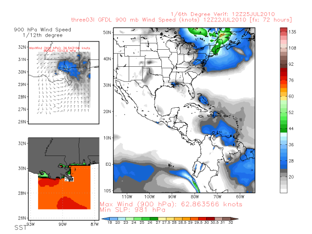
12z GFDL -
Decent system into the Grand Isle area. Not quite a big westward shift in the hurricane models but seems there might be a hint at one.
Decent system into the Grand Isle area. Not quite a big westward shift in the hurricane models but seems there might be a hint at one.
-
srainhoutx
- Site Admin
- Posts: 19616
- Joined: Tue Feb 02, 2010 2:32 pm
- Location: Maggie Valley, NC
- Contact:
From the 100 PM Advisory...
DISCUSSION AND 48-HOUR OUTLOOK
------------------------------
RECENT VISIBLE SATELLITE IMAGES SHOW THAT THE CENTER IS A LITTLE TO
THE NORTHEAST OF THE LOCATION PREVIOUSLY INDICATED. AT 200 PM
EDT...1800 UTC...THE CENTER OF TROPICAL DEPRESSION THREE WAS
ESTIMATED NEAR LATITUDE 22.3 NORTH...LONGITUDE 74.9 WEST. THE
DEPRESSION HAS MOVED LITTLE DURING THE PAST FEW HOURS. HOWEVER...IT
SHOULD BEGIN TO MOVE TOWARD THE WEST-NORTHWEST NEAR 15 MPH...24
KM/HR SOON...WITH A GRADUAL INCREASE IN FORWARD SPEED.
Carla/Alicia/Jerry(In The Eye)/Michelle/Charley/Ivan/Dennis/Katrina/Rita/Wilma/Humberto/Ike/Harvey
Member: National Weather Association
Facebook.com/Weather Infinity
Twitter @WeatherInfinity
Member: National Weather Association
Facebook.com/Weather Infinity
Twitter @WeatherInfinity
i think its time for people of southeast texas to start making preparations for a possible cat1 or 2 hurricane...just my opinion
-
tireman4

- Global Moderator

- Posts: 4495
- Joined: Wed Feb 03, 2010 9:24 pm
- Location: Humble, Texas
- Contact:
i think its time for people of southeast texas to start making preparations for a possible cat1 or 2 hurricane...just my opinion
I agree, but I would still take a watch and see attitude. I think ( to quote Dan and Wxman57) we should just go over our hurricane preparedness lists and make sure everything is ready.
I agree, but I would still take a watch and see attitude. I think ( to quote Dan and Wxman57) we should just go over our hurricane preparedness lists and make sure everything is ready.
-
Andrew
- Site Admin
- Posts: 3440
- Joined: Wed Feb 03, 2010 9:46 pm
- Location: North-West Houston
- Contact:
tireman4 wrote:i think its time for people of southeast texas to start making preparations for a possible cat1 or 2 hurricane...just my opinion
I agree, but I would still take a watch and see attitude. I think ( to quote Dan and Wxman57) we should just go over our hurricane preparedness lists and make sure everything is ready.
Yes I read wxman's post and was a little shocked on the bluntness of it.
For Your Infinite Source For All Things Weather Visit Our Facebook
-
weatherguy425
- Pro Met

- Posts: 830
- Joined: Wed Feb 03, 2010 7:45 pm
- Location: Atlanta, Georgia
- Contact:
What post?Yes I read wxman's post and was a little shocked on the bluntness of it.
-
Andrew
- Site Admin
- Posts: 3440
- Joined: Wed Feb 03, 2010 9:46 pm
- Location: North-West Houston
- Contact:
Not much time to post. Based on the strength of the ridge to its north, I think I'll go fill up a few 5-gal gas cans for my generators when I get home today.weatherguy425 wrote:What post?Yes I read wxman's post and was a little shocked on the bluntness of it.
For Your Infinite Source For All Things Weather Visit Our Facebook

Okie doke. Thankssrainhoutx wrote:The 12Z para GFS (850 vort) does show another system crossing the Bay of Campeche and heading NW toward the Lower/Middle TX coast several days behind TD3. We shall see and that would likely be a topic for discussion in the General Tropical thread for now.Scott747 wrote:There was some talk about that. Most everyone has dismissed it as being spurious.singlemom wrote:I know it's the Canadian model, but did anyone catch this 12z run? Another system following 97L like a one, two punch:
http://moe.met.fsu.edu/cgi-bin/cmctc2.c ... =Animation
*and my apologies for posting this question in the wrong forum. I'll pay better attention next time. Long night....