
September 2019 - Warm End of September
-
Cromagnum
- Posts: 3077
- Joined: Thu Feb 03, 2011 10:42 pm
- Location: Georgetown
- Contact:
Way too early to make a call on recurve back to sea potential. The GFS is underdoing the ridging to expose an early weakness while other models like the EURO and ICON see a stronger ridge. Still gonna be a battle for a couple more days sadly.
-
brooksgarner

- Global Moderator

- Posts: 226
- Joined: Tue Jun 04, 2013 3:06 pm
- Location: Houston, TX
- Contact:
This hurricane reminds me of the 2004 season over on the east coast of FL. Vero got slammed by Frances and Jeanne! Watching from Denver ...
Broadcast Met
http://BrooksGarner.com
http://twitter.com/BrooksWeather
http://BrooksGarner.com
http://twitter.com/BrooksWeather
- '17 Harvey
- '12 Sandy (P3 Orion)
- '91 Bob
- '85 Gloria
-
Scott747
- Posts: 1659
- Joined: Tue Feb 23, 2010 9:56 am
- Location: Freeport/Surfside Beach
- Contact:
Overall the model runs have started zeroing in on a lessening threat to the ngom the last 24 hrs.
There were a few hints though to not fully take the ngom out of play. Operational 12z Ukie takes Dorian across fla and to the ne gulf along with the HWRF and a small cluster of the Euro ensembles.
Otherwise most all the globals and ensembles show the main threat away from the gulf.
There were a few hints though to not fully take the ngom out of play. Operational 12z Ukie takes Dorian across fla and to the ne gulf along with the HWRF and a small cluster of the Euro ensembles.
Otherwise most all the globals and ensembles show the main threat away from the gulf.
-
cperk
- Posts: 858
- Joined: Sun Aug 19, 2012 12:09 pm
- Location: Richmond
- Contact:
A just saw a OCM on MSNBC and he indicated that they really don't know where Dorian will make landfall yet or if it will at all.The models are giving them fits 3 days out and that's a little scary.No watches or warnings have been issued yet nor have any evacuations.
-
srainhoutx

- Site Admin

- Posts: 19700
- Joined: Tue Feb 02, 2010 2:32 pm
- Location: Maggie Valley, NC
- Contact:
I really couldn't care less what media and WxTwitter/social media has to say about Dorian. These days there is always an agenda to push it seems. The older I get, the more I rely on my own intuition regarding sensible weather forecasts.
Carla/Alicia/Jerry(In The Eye)/Michelle/Charley/Ivan/Dennis/Katrina/Rita/Wilma/Humberto/Ike/Harvey
Member: National Weather Association
Facebook.com/Weather Infinity
Twitter @WeatherInfinity
Member: National Weather Association
Facebook.com/Weather Infinity
Twitter @WeatherInfinity
-
Scott747
- Posts: 1659
- Joined: Tue Feb 23, 2010 9:56 am
- Location: Freeport/Surfside Beach
- Contact:
Small trend to the w with the early suite of 18z runs.
-
Scott747
- Posts: 1659
- Joined: Tue Feb 23, 2010 9:56 am
- Location: Freeport/Surfside Beach
- Contact:
I hear ya about the media. Especially the national networks. I threw it on CNN yesterday curious how they were covering it and they had a panel with talking points which were focused on the impending impact on Puerto Rico by a major hurricane.
Problem was Dorian was already pulling away from the island after missing it to the e.
Problem was Dorian was already pulling away from the island after missing it to the e.
-
srainhoutx
- Site Admin
- Posts: 19700
- Joined: Tue Feb 02, 2010 2:32 pm
- Location: Maggie Valley, NC
- Contact:
One guy I do follow always provides important historical facts.
Philip Klotzbach
@philklotzbach
September continental US #hurricane landfall locations since 1851. 39 out of the 121 September continental US hurricane landfalls have been in Florida. #HurricaneDorian
Philip Klotzbach
@philklotzbach
September continental US #hurricane landfall locations since 1851. 39 out of the 121 September continental US hurricane landfalls have been in Florida. #HurricaneDorian
- Attachments
-
Carla/Alicia/Jerry(In The Eye)/Michelle/Charley/Ivan/Dennis/Katrina/Rita/Wilma/Humberto/Ike/Harvey
Member: National Weather Association
Facebook.com/Weather Infinity
Twitter @WeatherInfinity
Member: National Weather Association
Facebook.com/Weather Infinity
Twitter @WeatherInfinity
-
Texaspirate11

- Posts: 1278
- Joined: Tue Dec 31, 2013 12:24 am
- Contact:
All I gotta hear is "not texas" and I'm good. Although I love the tracking part.
Just because you're disabled, you don't have to be a victim
Be Weather Aware & Prepared!
Barbara Jordan Winner in Media
Disability Integration Consultant
Be Weather Aware & Prepared!
Barbara Jordan Winner in Media
Disability Integration Consultant
-
Cpv17
- Posts: 7110
- Joined: Fri Aug 31, 2018 1:58 pm
- Location: El Campo/Wharton
- Contact:
They are really fun track even though I lose out on sleep staying up late for the 0z runs lol it’s worth it.Texaspirate11 wrote: ↑Thu Aug 29, 2019 6:15 pm All I gotta hear is "not texas" and I'm good. Although I love the tracking part.
-
Scott747
- Posts: 1659
- Joined: Tue Feb 23, 2010 9:56 am
- Location: Freeport/Surfside Beach
- Contact:
Still further shifts on the 18z runs.
The hurricane model HMON which is often referred to in the discos is taking Dorian across the Florida straits.
The hurricane model HMON which is often referred to in the discos is taking Dorian across the Florida straits.
-
Cpv17
- Posts: 7110
- Joined: Fri Aug 31, 2018 1:58 pm
- Location: El Campo/Wharton
- Contact:
-
Andrew
- Site Admin
- Posts: 3511
- Joined: Wed Feb 03, 2010 9:46 pm
- Location: North-West Houston
- Contact:
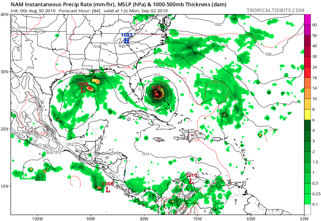
I think the current track looks pretty reasonable based on model data and the projected evolution of the ridge over the Western Atlantic. The far Northeast Gulf could be under threat but anything west of that I have trouble seeing right now. Also, keep an eye on the mid-level vorticity that will cross the southern half of the Gulf. More models are indicating some minor development could occur.
For Your Infinite Source For All Things Weather Visit Our Facebook
-
Rip76

- Posts: 2152
- Joined: Mon Feb 15, 2010 12:38 am
- Location: The Woodlands
- Contact:
-
Kingwood36
- Posts: 1592
- Joined: Sat Dec 29, 2018 10:29 am
- Location: Freeport
- Contact:
-
Rip76
- Posts: 2152
- Joined: Mon Feb 15, 2010 12:38 am
- Location: The Woodlands
- Contact:
-
Kingwood36
- Posts: 1592
- Joined: Sat Dec 29, 2018 10:29 am
- Location: Freeport
- Contact:
Looks to go in to lousiana whatever it is
-
DoctorMu

- Posts: 8097
- Joined: Sun Jun 28, 2015 11:58 am
- Location: College Station
- Contact:
GFS. Euro, CMC have Dorian blowing through Mar-a-Lago:

[Write your own paper towel joke here]
[Write your own paper towel joke here]
-
Cpv17
- Posts: 7110
- Joined: Fri Aug 31, 2018 1:58 pm
- Location: El Campo/Wharton
- Contact:
The Euro takes this into Mexico. I don’t think we’ll see much of anything in SETX from it.Andrew wrote: ↑Thu Aug 29, 2019 8:46 pm I think the current track looks pretty reasonable based on model data and the projected evolution of the ridge over the Western Atlantic. The far Northeast Gulf could be under threat but anything west of that I have trouble seeing right now. Also, keep an eye on the mid-level vorticity that will cross the southern half of the Gulf. More models are indicating some minor development could occur.
-
Scott747
- Posts: 1659
- Joined: Tue Feb 23, 2010 9:56 am
- Location: Freeport/Surfside Beach
- Contact:
Whoa. The ridging on the 0z GFS...