
January 2017 -Warming Trend To End The Month
-
srainhoutx

- Site Admin

- Posts: 19700
- Joined: Tue Feb 02, 2010 2:32 pm
- Location: Maggie Valley, NC
- Contact:
The afternoon guidance suggests a split flow with a very active pattern with a parade of storm systems impacting the West Coast advancing East with an impressive Pacific Jet bringing heavy rainfall at the lower elevations and additional heavy snowfall for higher elevations for the Sierra and Southern/Central Rockies as well as unsettled weather across the Lone Star State.
- Attachments
-
Carla/Alicia/Jerry(In The Eye)/Michelle/Charley/Ivan/Dennis/Katrina/Rita/Wilma/Humberto/Ike/Harvey
Member: National Weather Association
Facebook.com/Weather Infinity
Twitter @WeatherInfinity
Member: National Weather Association
Facebook.com/Weather Infinity
Twitter @WeatherInfinity
-
Katdaddy

- Global Moderator

- Posts: 2521
- Joined: Thu Feb 04, 2010 8:18 am
- Location: League City, Tx
- Contact:
The weather roller-coaster continues across the Southern Plains. Significant icing ongoing across the NE TX Panhandle, NW OK, and Central KS, SE NB, SW IA, and extreme NW MO with Ice Storm Warnings in effect. I have seen many photos of damaging ice this afternoon from TX and OK. The SPC has a large slight risk area across TX in the warm sector. A Severe Thunderstorm Watch has been issued for portions of West Central TX until 10:00PM
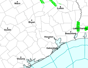
An active weather week is on the way across TX with the potential for flooding, severe weather, and Winter weather. For SE TX it will be multiple rain events and some severe weather concerns. The afternoon's Houston-Galveston NWS AFD (Area Forecast Discussion) state it very well: the theme of virtually the entire week will be unsettled weather
An active weather week is on the way across TX with the potential for flooding, severe weather, and Winter weather. For SE TX it will be multiple rain events and some severe weather concerns. The afternoon's Houston-Galveston NWS AFD (Area Forecast Discussion) state it very well: the theme of virtually the entire week will be unsettled weather
- Attachments
-
- Screen Shot 2017-01-15 at 3.57.39 PM.png (194.09 KiB) Viewed 6273 times

-
DoctorMu

- Posts: 7955
- Joined: Sun Jun 28, 2015 11:58 am
- Location: College Station
- Contact:
Tornado warning near Gatesville, NW of Temple. Severe weather could overperform in rapid moving cells. Those in the NW quadrant of the HGX forecast area should be watchful.
Nasty looking squall line forming around San Angelo and moving east.
Nasty looking squall line forming around San Angelo and moving east.
-
DoctorMu
- Posts: 7955
- Joined: Sun Jun 28, 2015 11:58 am
- Location: College Station
- Contact:
Tornado Warning
Alert:
The National Weather Service in Fort Worth has issued a
* Tornado Warning for...
Central Bosque County in central Texas...
* Until 645 PM CST
* At 609 PM CST, a severe thunderstorm capable of producing a tornado
was located near Clifton, moving north at 30 mph.
HAZARD...Tornado.
SOURCE...Radar indicated rotation.
IMPACT...Flying debris will be dangerous to those caught without
shelter. Mobile homes will be damaged or destroyed.
Damage to roofs, windows, and vehicles will occur. Tree
damage is likely.
* This dangerous storm will be near...
Clifton around 625 PM CST.
Meridian around 640 PM CST.
Other locations impacted by this tornadic thunderstorm include
Morgan.
TORNADO...RADAR INDICATED
HAIL...<.75IN
Instructions: TAKE COVER NOW! Move to a basement or an interior room on the lowest floor of a sturdy building. Avoid windows. If you are outdoors, in a mobile home, or in a vehicle, move to the closest substantial shelter and protect yourself from flying debris.
-
srainhoutx
- Site Admin
- Posts: 19700
- Joined: Tue Feb 02, 2010 2:32 pm
- Location: Maggie Valley, NC
- Contact:
Tornado Watch issued until Midnight including the Cities of Austin, Waco and Dallas.
- Attachments
-
Carla/Alicia/Jerry(In The Eye)/Michelle/Charley/Ivan/Dennis/Katrina/Rita/Wilma/Humberto/Ike/Harvey
Member: National Weather Association
Facebook.com/Weather Infinity
Twitter @WeatherInfinity
Member: National Weather Association
Facebook.com/Weather Infinity
Twitter @WeatherInfinity
-
srainhoutx
- Site Admin
- Posts: 19700
- Joined: Tue Feb 02, 2010 2:32 pm
- Location: Maggie Valley, NC
- Contact:
NWS WEATHER PREDICTION CENTER COLLEGE PARK MD
712 PM EST SUN JAN 15 2017
AREAS AFFECTED...CENTRAL TX...NORTH TX
CONCERNING...HEAVY RAINFALL...FLASH FLOODING POSSIBLE
VALID 160011Z - 160526Z
SUMMARY...TWO ROUNDS OF CONVECTION IN RAPID SUCCESSION WITHIN AN
INCREASINGLY EFFICIENT HEAVY RAIN ENVIRONMENT MAY CAUSE FLASH
FLOODING IN URBAN OR OTHER PARTICULARLY SENSITIVE AREAS.
DISCUSSION...THE ENVIRONMENT WAS PERHAPS FOREMOST A SEVERE WEATHER
ENVIRONMENT...BUT THE FLASH FLOOD POTENTIAL SHOULD NOT BE
UNDERESTIMATED AS SOUTH TO NORTH TRAINING BANDS OF CONVECTION WILL
BE QUICKLY FOLLOWED BY A QUASI-LINEAR SYSTEM. LATE AFTERNOON HRRR
RUNS HAD BEEN CONSISTENT AT PRODUCING ISOLATED TOTALS BETWEEN 2
AND 3 INCHES STRADDLING THE WARM FRONT / INTERSTATE 35 CORRIDOR
THROUGH 05Z. AT 00Z...THE INITIAL STORMS WERE TRAINING FROM ABOUT
190 DEGREES...FOLLOWING THE MEAN LOWER TO MID LEVEL WINDS...AS
BROAD SCALE LIFT INCREASED AHEAD OF THE EJECTING NEGATIVELY TILTED
MID LEVEL WAVE. THERE WAS A CORRESPONDING SUBTLE BACKING OF LOW
LEVEL FLOW OBSERVED PER RAP SOUNDINGS AND VAD WIND PROFILES FROM
FWS/GRK CONTRIBUTING TO THE TRAINING CELL MOTIONS.
OF PARTICULAR CONCERN...ONE-HOUR RAINFALL ESTIMATES FROM KFWS HAD
INCREASED ABOVE 2 INCHES WEST OF WACO AND HILLSBORO. THIS WAS
FAIRLY CLOSE TO THE RADAR AND AWAY FROM MELTING LAYER
ISSUES...SUCH THAT THERE IS LITTLE REASON TO DOUBT THE ESTIMATES.
PW VALUES WERE INCREASING TOWARD 1.4 INCHES IN THIS REGION AND
OTHER FACTORS SUCH AS INCREASING DEEP LAYER ASCENT AND LOW LEVEL
MOISTURE FLUX WILL FAVOR EFFICIENT RAINFALL PRODUCTION DESPITE
SOME SMALL HAIL.
FLASH FLOOD GUIDANCE VALUES ARE SOMEWHAT HIGH...BUT GIVEN THE
RECENT RADAR QPE TRENDS THE 3-HOUR FFG VALUES MAY BE EXCEEDED
WHEREVER THE S-N BANDS SET UP IN ADVANCE OF THE SQUALL LINE. WITH
THE WARM FRONT ALSO BISECTING THE DALLAS / FORT WORTH
METROPLEX...URBAN RUNOFF ISSUES MAY BECOME A FACTOR AS WELL.
BURKE
ATTN...WFO...EWX...FWD...SHV...
Carla/Alicia/Jerry(In The Eye)/Michelle/Charley/Ivan/Dennis/Katrina/Rita/Wilma/Humberto/Ike/Harvey
Member: National Weather Association
Facebook.com/Weather Infinity
Twitter @WeatherInfinity
Member: National Weather Association
Facebook.com/Weather Infinity
Twitter @WeatherInfinity
-
DoctorMu
- Posts: 7955
- Joined: Sun Jun 28, 2015 11:58 am
- Location: College Station
- Contact:
Bad looking cell near Rocksprings, leaning right. Should be near Kerrvile and Boerne in an hour. Very spring-like severe pattern. Bad stuff marching east.

-
Ptarmigan

- Statistical Specialist

- Posts: 4513
- Joined: Wed Feb 03, 2010 7:20 pm
- Contact:

Quite a storm in Central Texas for January.
Code: Select all
000
FXUS64 KHGX 160511
AFDHGX

Area Forecast Discussion
National Weather Service Houston/Galveston TX
1111 PM CST Sun Jan 15 2017

.AVIATION...
MVFR cigs will persist for the next several hours...possible
transitioning down to higher end IFR for a bit if winds relax
enough. Shortwave moving across n Tx will drag tail end of precip
into northern parts of se Tx after 7z and likely bring periods of rain
with iso tstms for CLL/UTS into the mid morning hours. Isolated
popcorn type activity possible in the metro area, but should be as
widespread. May see a break and lifting cigs from mvfr to vfr in
the mid morning-early afternoon hours...esp Houston areas. Daytime
heating and the lingering boundary will probably focus some
additional afternoon precip (mainly north of a Columbus-Livingston
line). Frontal boundary will slowly sag into the region Monday
night with increased chances of precip well inland...and a return
of possibly dense sea fog closer to the coast.  47

&&

.PREV DISCUSSION... /ISSUED 830 PM CST Sun Jan 15 2017/
Fog not an issue this evening with better lower level mixing
(30-35 knot just-off-the-deck winds)...shallow shelf water
temperatures having warmed into the lower 60s may be tonight`s
dense maritime fog inhibitor. The focus shifts from fog to
precipitation as there have been a few thunderstorm cells that
have exhibited weak rotation as they have moved northward over the
northwestern-northern CWA tonight. Vicious looking QLCS moving
into EWX`s western forecast area...with a right moving supercell
rotating through Bandera County west of San Anton. Per the higher
resolution modeling...this squall line is forecast to break apart
as it moves east of I-35. The northeast ejection of the western
Texas upper low into OK-KS tomorrow morning suggests that the bulk
of the highest shear/energy should stay well to the north...with
the stretching flow becoming more parallel to the boundary slowing
the associated mid-surface boundary as it approaches SE TX
tomorrow night. With a slightly higher surge of Gulf moisture
moving inland and warmer mid layers providing interior skinny CAPE
values (600-800 J/kg)...scattered thunderstorms mixed in with
southern-moving-northerly rain clusters through Monday are not out
of the question. There is enough turning of the lower few thousand
layer winds to promote a weak tornado threat (early day 150-200
SRH northern values). Mainly overcast and precipitation should
regulate Monday`s diurnal temperatures to a near 5 to 10 degree
minimum-maximum temperature differential. 31

&&

.PRELIMINARY POINT TEMPS/POPS...
College Station (CLL)      65  73  56  61  53 /  70  80  60  50  50
Houston (IAH)              66  77  63  69  58 /  40  50  60  50  50
Galveston (GLS)            65  70  63  69  61 /  20  30  60  50  50

&&

.HGX WATCHES/WARNINGS/ADVISORIES...
TX...NONE.
GM...SMALL CRAFT SHOULD EXERCISE CAUTION until 6 AM CST Monday for
     the following zones: Coastal waters from Freeport to the
     Matagorda Ship Channel out 20 NM...Coastal waters from High
     Island to Freeport out 20 NM.

     Small Craft Advisory until 8 AM CST Monday for the following
     zones: Waters from Freeport to the Matagorda Ship Channel
     from 20 to 60 NM...Waters from High Island to Freeport from
     20 to 60 NM.

&&

$$
-
Cromagnum
- Posts: 3065
- Joined: Thu Feb 03, 2011 10:42 pm
- Location: Georgetown
- Contact:
Any of that central texas voodoo weather expected to hit us in the morning here in Houston?
-
unome
- Posts: 3062
- Joined: Fri Feb 12, 2010 6:11 pm
https://twitter.com/iembot_hgx

Mesoscale Discussion 0059
NWS Storm Prediction Center Norman OK
0501 AM CST Mon Jan 16 2017
Areas affected...portions of southeast TX and the upper TX coastal plain
Concerning...Severe potential...Watch unlikely
Valid 161101Z - 161130Z
Probability of Watch Issuance...5 percent
SUMMARY...A small spatiotemporal window for isolated strong to locally severe thunderstorms will likely be confined from areas west through northwest of the greater Houston metro as storms move eastward through a moist axis.
DISCUSSION...Radar imagery during the past 2-3 hours has shown transient circulations with the more intense updrafts as a discontinuous convective band moves eastward across east and southeast TX. Strong wind fields are in place ---reference the KHGX VAD--- and 200-300 m2/s2 effective SRH is analyzed by objective analysis. Despite the weak instability, the strong shear and ample forcing for ascent are at least promoting some weak storm-scale organization. Nonetheless, the storms are moving through a narrowing wedge of richer low-level moisture and significant poleward moisture return into the lower Sabine Valley will likely not occur before the convective band moves through this region. As a result, the strong-storm threat will likely decrease substantially once storms' move through the moist sector. While a brief/weaktornado or pocket of wind damage cannot be ruled out, it seems the coverage of any severe risk will likely remain low and preclude the need for a watch given the limiting factors discussed above.
..Smith/Grams.. 01/16/2017
ATTN...WFO...HGX...
loop: http://weather.cod.edu/satrad/nexrad/in ... X-N0K-1-96
Last edited by unome on Mon Jan 16, 2017 5:33 am, edited 1 time in total.
-
unome
- Posts: 3062
- Joined: Fri Feb 12, 2010 6:11 pm
https://twitter.com/iembot_hgx
BULLETIN - EAS ACTIVATION REQUESTED
Tornado Warning
National Weather Service Houston/Galveston TX
516 AM CST MON JAN 16 2017
The National Weather Service in League City has issued a
* Tornado Warning for...
North central Wharton County in southeastern Texas...
East central Colorado County in southeastern Texas...
Southeastern Austin County in southeastern Texas...
West central Fort Bend County in southeastern Texas...
* Until 545 AM CST.
* At 516 AM CST, a severe thunderstorm capable of producing a tornado was located near East Bernard, or 10 miles southeast of Eagle Lake, moving northeast at 25 mph.
HAZARD...Tornado.
SOURCE...Radar indicated rotation.
IMPACT...Flying debris will be dangerous to those caught without shelter. Mobile homes will be damaged or destroyed. Damage to roofs, windows, and vehicles will occur. Tree damage is likely.
* Locations impacted include...
Northwestern Rosenberg, Sealy, East Bernard, Wallis, Simonton, San Felipe, Orchard and southeastern Weston Lakes.
PRECAUTIONARY/PREPAREDNESS ACTIONS...
TAKE COVER NOW! Move to a basement or an interior room on the lowest floor of a sturdy building. Avoid windows. If you are outdoors, in a mobile home, or in a vehicle, move to the closest substantial shelter and protect yourself from flying debris.
&&
LAT...LON 2940 9615 2952 9630 2978 9612 2957 9583
TIME...MOT...LOC 1116Z 228DEG 21KT 2952 9617
TORNADO...RADAR INDICATED
HAIL...<.75IN
-
DoctorMu
- Posts: 7955
- Joined: Sun Jun 28, 2015 11:58 am
- Location: College Station
- Contact:
essage: NOAA-NWS-ALERTS-TX1258389B1CF0.TornadoWarning.1258389B2844TX.HGXTORHGX.3866eb074cf667b9cbce76664ff1ed5f from w-nws.webmaster@noaa.gov
Sent: 05:16 CST on 01-16-2017
Effective: 05:16 CST on 01-16-2017
Expires: 05:45 CST on 01-16-2017
Event: Tornado Warning
Alert:
The National Weather Service in League City has issued a
* Tornado Warning for...
North central Wharton County in southeastern Texas...
East central Colorado County in southeastern Texas...
Southeastern Austin County in southeastern Texas...
West central Fort Bend County in southeastern Texas...
* Until 545 AM CST.
* At 516 AM CST, a severe thunderstorm capable of producing a tornado
was located near East Bernard, or 10 miles southeast of Eagle Lake,
moving northeast at 25 mph.
HAZARD...Tornado.
SOURCE...Radar indicated rotation.
IMPACT...Flying debris will be dangerous to those caught without
shelter. Mobile homes will be damaged or destroyed.
Damage to roofs, windows, and vehicles will occur. Tree
damage is likely.
* Locations impacted include...
Northwestern Rosenberg, Sealy, East Bernard, Wallis, Simonton, San
Felipe, Orchard and southeastern Weston Lakes.
TORNADO...RADAR INDICATED
HAIL...<.75IN
Instructions: TAKE COVER NOW! Move to a basement or an interior room on the lowest floor of a sturdy building. Avoid windows. If you are outdoors, in a mobile home, or in a vehicle, move to the closest substantial shelter and protect yourself from flying debris.
Target Area:
Austin
Colorado
Fort Bend
Wharton
-
DoctorMu
- Posts: 7955
- Joined: Sun Jun 28, 2015 11:58 am
- Location: College Station
- Contact:
Area Forecast Discussion
National Weather Service Houston/Galveston TX
521 AM CST Mon Jan 16 2017
.AVIATION...
An area of showers and thunderstorms will affect most of the
Houston metro and points northward through mid morning. There is a
potential for isolated stronger storms. The strongest were west of
KSGR at 1115Z and could affect KSGR, KIAH, and the temporary
forecast site at KDWH between 14Z and 17Z (give or take an hour).
Not confident that the area of showers and storms will work its
way much further to the south. Models still showed a break from
the MVFR/IFR conditions this afternoon before ceilings and/or
visibility lowers again after 00Z. Sea fog may become a threat
again for KGLS, KLBX, and KHOU after 06Z tonight.
40
&&
.PREV DISCUSSION... /ISSUED 402 AM CST Mon Jan 16 2017/
DISCUSSION...
At 3 AM, an area of weak of low pressure was located over central
Oklahoma with a weak warm front extending SE from the low
across southern Arkansas. A cold front extended SSW of the
surface low and lies across central Texas. A line of showers and
thunderstorms extends N-S across SE Texas and this will persist
for much of the morning. There is sufficient shear to support some
marginal wind gusts or isolated tornadoes this morning, especially
over the NW zones. The line will progress slowly east today while
individual storms within the line move NNE. This will allow storms
to train today especially over the western zones and could produce
some locally heavy rain. Upper level winds are diffluent with PW
values near 1.40 inches. There are enough parameters in place to
spark some interest in hoisting a flash flood watch but it`s been
dry and most areas should be able to handle 1 to 2 inches of rain
(isolated 3 inch totals) so will forego a flash flood watch today.
A deep upper level trough over Baja CA will remain nearly
stationary through Wednesday night. The upper low will slowly fill
as it meanders to the east toward the central plains through
Thursday. PW values remain between 1.30 and 1.50 inches through
Tuesday with a series of weak upper level disturbances embedded in
the SW flow aloft. Most of SE TX will experience intermittent
showers and thunderstorms. A cold weak front will cross or try to
cross SE TX Mon night through Wed night. Initially thought the
best chance for precip would be along the boundary but it`s
looking more likely to focus behind the front with isentropic
upglide. Have gone with likely PoPs everywhere but have tapered
higher PoPs to the NW and lower at the coast.
Rain chances will continue Tuesday night into Wednesday as a
weak disturbance approaches and fcst soundings show a nearly
saturated profile. Showers and thunderstorms are expected to
increase Wednesday night into Thursday as the upper low shifts
east and jet dynamics becoming increasingly favorable. Fcst
soundings over the SE half of the region look super saturated with
PW values peaking at 1.60 inches. Could get more heavy rain late
Wed night into early Thursday. Some drying is expected Thursday
afternoon with drier conditions expected Friday. Another fast
moving short wave will cross the southern plains on Saturday. Not
sure how much moisture will make it back into SE TX but will
maintain 20/30 PoPs late Fri night into Saturday. A dry northwest
flow aloft will develop Sun/Mon with conditions turning drier and
cooler. 43
-
DoctorMu
- Posts: 7955
- Joined: Sun Jun 28, 2015 11:58 am
- Location: College Station
- Contact:

-
unome
- Posts: 3062
- Joined: Fri Feb 12, 2010 6:11 pm
https://twitter.com/iembot_hgx/status/8 ... 2935646208
HGX updates Tornado Warning (cancels 1 area, continues 3 areas) till 6:15 AM CST
BULLETIN - EAS ACTIVATION REQUESTED
Tornado Warning
National Weather Service Houston/Galveston TX
547 AM CST MON JAN 16 2017
The National Weather Service in League City has issued a
* Tornado Warning for...
North central Wharton County in southeastern Texas...
Southeastern Waller County in southeastern Texas...
Southeastern Austin County in southeastern Texas...
Northwestern Fort Bend County in southeastern Texas...
* Until 615 AM CST.
* At 546 AM CST, a severe thunderstorm capable of producing a tornado
was located over Wallis, or 11 miles southwest of Brookshire,
moving northeast at 25 mph.
HAZARD...Tornado.
SOURCE...Radar indicated rotation.
IMPACT...Flying debris will be dangerous to those caught without
shelter. Mobile homes will be damaged or destroyed.
Damage to roofs, windows, and vehicles will occur. Tree
damage is likely.
* Locations impacted include...
Northwestern Rosenberg, Katy, Brookshire, Pecan Grove, East
Bernard, Wallis, Fulshear, Simonton, Pattison, Orchard, Weston
Lakes and Cinco Ranch.
Another possible tornado was near East Bernard, moving northeast at
25 mph.
PRECAUTIONARY/PREPAREDNESS ACTIONS...
TAKE COVER NOW! Move to a basement or an interior room on the lowest
floor of a sturdy building. Avoid windows. If you are outdoors, in a
mobile home, or in a vehicle, move to the closest substantial shelter
and protect yourself from flying debris.
&&
LAT...LON 2991 9593 2981 9583 2979 9582 2977 9579
2967 9569 2947 9607 2966 9619
TIME...MOT...LOC 1146Z 227DEG 20KT 2963 9603
TORNADO...RADAR INDICATED
HAIL...<.75IN
$$
-
DoctorMu
- Posts: 7955
- Joined: Sun Jun 28, 2015 11:58 am
- Location: College Station
- Contact:
This cell is heading through Katy into NW Harris Co.
NOAA-NWS-ALERTS-TX1258389B2DBC.TornadoWarning.1258389B439CTX.HGXSVSHGX.3abeaec0d9137271f667fc18afc46c17 from w-nws.webmaster@noaa.gov
Sent: 05:59 CST on 01-16-2017
Effective: 05:59 CST on 01-16-2017
Expires: 06:15 CST on 01-16-2017
Event: Tornado Warning
Alert:
...A TORNADO WARNING REMAINS IN EFFECT UNTIL 615 AM CST FOR
SOUTHEASTERN WALLER...SOUTHEASTERN AUSTIN AND NORTHWESTERN FORT BEND
COUNTIES...
At 558 AM CST, a severe thunderstorm capable of producing a tornado
was located over Simonton, or 8 miles south of Brookshire, moving
northeast at 20 mph. A second storm capable of producing a tornado
was located near Orchard, moving northeast at 20 mph.
HAZARD...Tornado.
SOURCE...Radar indicated rotation.
IMPACT...Flying debris will be dangerous to those caught without
shelter. Mobile homes will be damaged or destroyed. Damage
to roofs, windows, and vehicles will occur. Tree damage is
likely.
Locations impacted include...
Northwestern Rosenberg, Katy, Brookshire, Pecan Grove, Wallis,
Fulshear, Simonton, Pattison, Orchard, Weston Lakes and Cinco Ranch.
TORNADO...RADAR INDICATED
HAIL...<.75IN
Instructions: TAKE COVER NOW! Move to a basement or an interior room on the lowest floor of a sturdy building. Avoid windows. If you are outdoors, in a mobile home, or in a vehicle, move to the closest substantial shelter and protect yourself from flying debris. Tornadoes are extremely difficult to see and confirm at night. Do not wait to see or hear the tornado. TAKE COVER NOW!
Target Area:
Austin
Fort Bend
Waller
-
DoctorMu
- Posts: 7955
- Joined: Sun Jun 28, 2015 11:58 am
- Location: College Station
- Contact:
Cypress --> Tomball --> Woodlands in the path of this dangerous cell within the next 60 minutes.
Stay tuned to NOAA and weather-related media.
Stay tuned to NOAA and weather-related media.
-
DoctorMu
- Posts: 7955
- Joined: Sun Jun 28, 2015 11:58 am
- Location: College Station
- Contact:
Message: NOAA-NWS-ALERTS-TX1258389B4270.TornadoWarning.1258389B4F54TX.HGXTORHGX.0ef0816a2ec62ecfe416a53d46f0d10b from w-nws.webmaster@noaa.gov
Sent: 06:12 CST on 01-16-2017
Effective: 06:12 CST on 01-16-2017
Expires: 06:45 CST on 01-16-2017
Event: Tornado Warning
Alert:
The National Weather Service in League City has issued a
* Tornado Warning for...
Southeastern Waller County in southeastern Texas...
West central Harris County in southeastern Texas...
Eastern Austin County in southeastern Texas...
Northwestern Fort Bend County in southeastern Texas...
* Until 645 AM CST.
* At 612 AM CST, a severe thunderstorm capable of producing a tornado
was located over Fulshear, or near Brookshire, moving northeast at
20 mph.
HAZARD...Tornado.
SOURCE...Radar indicated rotation.
IMPACT...Flying debris will be dangerous to those caught without
shelter. Mobile homes will be damaged or destroyed.
Damage to roofs, windows, and vehicles will occur. Tree
damage is likely.
* Locations impacted include...
Northwestern Rosenberg, Katy, Brookshire, Eldridge / West Oaks,
Mission Bend, southwestern Addicks Park Ten, Fulshear, Simonton,
Weston Lakes, Cinco Ranch, Briar Forest, Addicks and Memorial.
TORNADO...RADAR INDICATED
HAIL...0.00IN
Instructions: TAKE COVER NOW! Move to an interior room on the lowest floor of a sturdy building. Avoid windows. If you are outdoors, in a mobile home, or in a vehicle, move to the closest substantial shelter and protect yourself from flying debris. Motorists should not take shelter under highway overpasses. If you cannot safely drive away from the tornado, as a last resort, either park your vehicle and stay put, or abandon your vehicle and lie down in a low lying area and protect yourself from flying debris.
Target Area:
Austin
Fort Bend
Harris
Waller
-
DoctorMu
- Posts: 7955
- Joined: Sun Jun 28, 2015 11:58 am
- Location: College Station
- Contact:
Tornado confirmed by radar. In Fulshear and headed to Katy and Cinco Ranch. Take Cover!