
Tracking the Tropics:
-
srainhoutx

- Site Admin

- Posts: 19616
- Joined: Tue Feb 02, 2010 2:32 pm
- Location: Maggie Valley, NC
- Contact:
92L has a very vigorous low level circulation SE of Marathon in the Middle Keys. The 18Z track guidance suggests a Westward motion will continue across the Gulf and intensity guidance has increased a bit. Once the mid/upper shear relaxes to the North of this disturbance, expect conditions to become a bit more favorable for tropical development Sunday into Monday.
- Attachments
-
Carla/Alicia/Jerry(In The Eye)/Michelle/Charley/Ivan/Dennis/Katrina/Rita/Wilma/Humberto/Ike/Harvey
Member: National Weather Association
Facebook.com/Weather Infinity
Twitter @WeatherInfinity
Member: National Weather Association
Facebook.com/Weather Infinity
Twitter @WeatherInfinity
-
stormlover
- Posts: 439
- Joined: Wed Dec 04, 2013 10:21 am
- Location: Lumberton TX
- Contact:
srain would this go to mexico, I thought anything that develop with this disturbance would be sw/la or tx?
-
srainhoutx
- Site Admin
- Posts: 19616
- Joined: Tue Feb 02, 2010 2:32 pm
- Location: Maggie Valley, NC
- Contact:
That's the $64,000 question this afternoon. A couple of things I am watching is exactly when the upper low to the North of 92L slows down and eventually stalls over Northern Florida and wind shear decreases and an upper ridge develops over 92L as it passes the Florida Keys and nears the Yucatan Channel. Waters are very warm to the West of Key West and if this disturbance can maintain a vigorous low level circulation, things could wrap up quickly. Anywhere from Mexico to Louisiana need to monitor developments over the next several days, in my opinion.stormlover wrote:srain would this go to mexico, I thought anything that develop with this disturbance would be sw/la or tx?

Carla/Alicia/Jerry(In The Eye)/Michelle/Charley/Ivan/Dennis/Katrina/Rita/Wilma/Humberto/Ike/Harvey
Member: National Weather Association
Facebook.com/Weather Infinity
Twitter @WeatherInfinity
Member: National Weather Association
Facebook.com/Weather Infinity
Twitter @WeatherInfinity
-
houstonia
- Posts: 138
- Joined: Sun Jun 14, 2015 6:51 pm
- Location: Houston, Texas (Southwest side; Sharpstown)
- Contact:
Isn't the general consensus with storms that if they strengthen/organize, they are more likely to turn poleward? If that's the case, it's really dependent on when/if strengthening/organization begins, yes? Or maybe that's exactly what you just said. LOL. I've got the Fridays in my head and I can't think well. 
srainhoutx wrote:That's the $64,000 question this afternoon. A couple of things I am watching is exactly when the upper low to the North of 92L slows down and eventually stalls over Northern Florida and wind shear decreases and an upper ridge develops over 92L as it passes the Florida Keys and nears the Yucatan Channel. Waters are very warm to the West of Key West and if this disturbance can maintain a vigorous low level circulation, things could wrap up quickly. Anywhere from Mexico to Louisiana need to monitor developments over the next several days, in my opinion.stormlover wrote:srain would this go to mexico, I thought anything that develop with this disturbance would be sw/la or tx?
-
rselby0654
- Posts: 31
- Joined: Sun Aug 26, 2012 8:53 pm
- Contact:
We definitely need to keep an eye on this lil guy which could end up being "Ian". Anything in the gulf this time of year is dangerous. 
-
houstonia
- Posts: 138
- Joined: Sun Jun 14, 2015 6:51 pm
- Location: Houston, Texas (Southwest side; Sharpstown)
- Contact:
Latest from Jeff (no graphics):
Heavy rainfall possible this weekend.
92L (FL Straits) is looking better organized and has some development potential in the Gulf
An upper level low pressure system over the NW Gulf of Mexico along with a westward moving tropical wave and a cold front approaching from N TX will combine over SE TX this weekend to generate periods of rainfall. Think the greatest chances will be Saturday afternoon into Sunday as the front moves southward and stalls along a College Station to Crockett line and outflow boundaries collide with the northward moving seabreeze front. Scattered to numerous showers and thunderstorms will be possible and with high moisture levels heavy to excessive rainfall rates of 2-4 inches per hour would be likely under the stronger cells. We have seen such rainfall rates the last few afternoons with slow moving thunderstorms.
While grounds are not overly saturated….they certainly are not dry…with region wide KBDI values running in the 0-300 range indicating a fairly wet profile for early September. Street flooding will be the main concern, but any prolonged heavy rainfall over the same area could result in more significant rises on area watersheds.
92L:
Westward moving tropical wave now approaching the FL Keys and the FL Straits has become better organized this morning with both visible satellite images and Key West radar showing the formation of a broad surface circulation on the western side of deep convection. Upper level winds are currently not favorable for additional development…with that said…it will not take much more organization for a tropical depression to form. This feature will continue to move westward and enter the SE Gulf of Mexico late this weekend where upper level winds may begin to become slightly more conducive for development. There is currently very little model support for this feature developing and the limited track guidance available shows a general westward track toward the western Gulf of Mexico over the next 5 days.
The National Hurricane Center currently gives the system a 40% chance of development and this system should be monitored closely over the next several days as it moves into the Gulf of Mexico.
-
Skyguy
Here's a graphic, srainhoutex:houstonia wrote:Latest from Jeff (no graphics):
Heavy rainfall possible this weekend.
92L (FL Straits) is looking better organized and has some development potential in the Gulf
An upper level low pressure system over the NW Gulf of Mexico along with a westward moving tropical wave and a cold front approaching from N TX will combine over SE TX this weekend to generate periods of rainfall. Think the greatest chances will be Saturday afternoon into Sunday as the front moves southward and stalls along a College Station to Crockett line and outflow boundaries collide with the northward moving seabreeze front. Scattered to numerous showers and thunderstorms will be possible and with high moisture levels heavy to excessive rainfall rates of 2-4 inches per hour would be likely under the stronger cells. We have seen such rainfall rates the last few afternoons with slow moving thunderstorms.
While grounds are not overly saturated….they certainly are not dry…with region wide KBDI values running in the 0-300 range indicating a fairly wet profile for early September. Street flooding will be the main concern, but any prolonged heavy rainfall over the same area could result in more significant rises on area watersheds.
92L:
Westward moving tropical wave now approaching the FL Keys and the FL Straits has become better organized this morning with both visible satellite images and Key West radar showing the formation of a broad surface circulation on the western side of deep convection. Upper level winds are currently not favorable for additional development…with that said…it will not take much more organization for a tropical depression to form. This feature will continue to move westward and enter the SE Gulf of Mexico late this weekend where upper level winds may begin to become slightly more conducive for development. There is currently very little model support for this feature developing and the limited track guidance available shows a general westward track toward the western Gulf of Mexico over the next 5 days.
The National Hurricane Center currently gives the system a 40% chance of development and this system should be monitored closely over the next several days as it moves into the Gulf of Mexico.
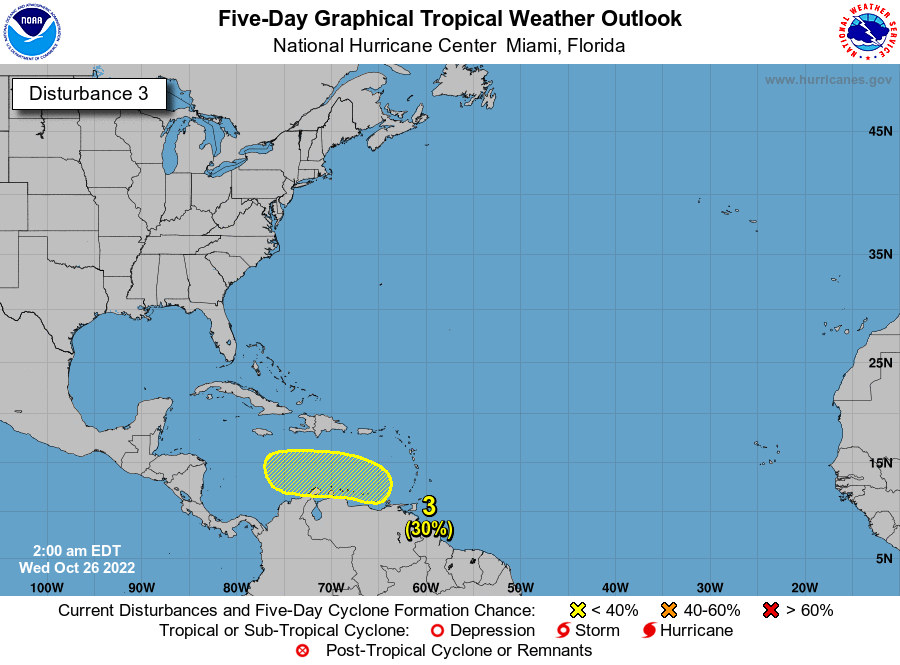
P.S. I notice worrybug posted a question for you regarding 92L. He'd like to know if we're looking at a potential reincarnation of 2005's Hurricane Rita. That's what I'd like to know myself. For research purposes, of course.3. Due to strong upper-level winds, shower and thunderstorm activity
has become less organized and is now located farther southeast of an
area of low pressure located just south of the lower Florida Keys.
Upper-level winds are expected to remain unfavorable for significant
development while this system moves westward at 5 to 10 mph into the
southeastern Gulf of Mexico during the next couple of days.
However, squalls and gusty winds are possible in portions of the
Florida Keys tonight and Saturday. For additional information on
this system, see High Seas Forecasts issued by the National Weather
Service.
* Formation chance through 48 hours...low...30 percent
* Formation chance through 5 days...low...30 percent
Anyway, get back with me as soon as you can, 'kay?
-
Andrew
- Site Admin
- Posts: 3440
- Joined: Wed Feb 03, 2010 9:46 pm
- Location: North-West Houston
- Contact:
Shear should decrease over the next 2 days and a slight chance of development is possible but turbulence then increases dramatically during the beginning/middle of next week. Little chance of any sustained development. May increase rain chances some though during the middle/late part of the week.
For Your Infinite Source For All Things Weather Visit Our Facebook
-
srainhoutx
- Site Admin
- Posts: 19616
- Joined: Tue Feb 02, 2010 2:32 pm
- Location: Maggie Valley, NC
- Contact:
92L is hanging on by a thread this morning in the SE Gulf of Mexico. Northerly shear continues to plague the weak surface low exposing the center of circulation.
TROPICAL WEATHER OUTLOOK
NWS NATIONAL HURRICANE CENTER MIAMI FL
800 AM EDT SAT SEP 10 2016
For the North Atlantic...Caribbean Sea and the Gulf of Mexico:
1. A broad area of low pressure is located a little more than 1000
miles east of the Lesser Antilles. Although the shower activity
associated with the system has not become any better organized
since yesterday, conditions are favorable for a tropical depression
to form by early next week while this disturbance moves toward the
west-northwest and then toward the northwest over the central
Atlantic during the next several days.
* Formation chance through 48 hours...high...70 percent
* Formation chance through 5 days...high...90 percent
2. An area of cloudiness and thunderstorms located north of Puerto Rico
and Hispaniola remains disorganized. Environmental conditions are
not expected to be conducive for significant development of this
system while it moves generally west-northwestward at around 15 mph.
* Formation chance through 48 hours...low...10 percent
* Formation chance through 5 days...low...10 percent
3. Satellite and radar data indicate that the weak area of low pressure
located over the extreme southeastern Gulf of Mexico is producing
limited shower activity. Upper-level winds are not favorable for
development, and the low is forecast to weaken while it moves
westward at 5 to 10 mph.
* Formation chance through 48 hours...low...10 percent
* Formation chance through 5 days...low...10 percent
Forecaster Avila
- Attachments
-
-
-
Carla/Alicia/Jerry(In The Eye)/Michelle/Charley/Ivan/Dennis/Katrina/Rita/Wilma/Humberto/Ike/Harvey
Member: National Weather Association
Facebook.com/Weather Infinity
Twitter @WeatherInfinity
Member: National Weather Association
Facebook.com/Weather Infinity
Twitter @WeatherInfinity


-
worrybug
Katdaddy wrote:Watching Invest 92L this evening.
Uh-oh. You must think it's going to be a problem for the Houston/Galveston area despite what NHC says.
TROPICAL WEATHER OUTLOOK
NWS NATIONAL HURRICANE CENTER MIAMI FL
800 AM EDT SUN SEP 11 2016
For the North Atlantic...Caribbean Sea and the Gulf of Mexico:
1. A low pressure system located about 1000 miles east of the Leeward Islands is producing a large area of cloudiness and showers, but it currently has limited thunderstorm activity near the center of circulation. However, a tropical depression is still likely to form later today or on Monday before upper-level winds become less conducive for development. The low is expected to move northwestward or north-northwestward at 10 to 15 mph over the central Atlantic Ocean during the next few days.
* Formation chance through 48 hours...high...70 percent
* Formation chance through 5 days...high...80 percent
2. Showers and thunderstorms have increased with a disturbance located near the southeastern Bahamas. However, there are still no signs of a surface circulation, and conditions do not appear conducive for significant development of this disturbance while it moves west-northwestward at 10 to 15 mph. Heavy rainfall is possible over portions of the Bahamas today and on Monday.
* Formation chance through 48 hours...low...near 0 percent
* Formation chance through 5 days...low...near 0 percent
3. A few showers and thunderstorms have re-formed near a weak area of low pressure located over southeastern Gulf of Mexico. However, upper-level winds will not be conducive for development of this system while it moves generally westward across the Gulf of Mexico during the next few days at 5 to 10 mph.
* Formation chance through 48 hours...low...near 0 percent
* Formation chance through 5 days...low...near 0 percent
Forecaster Berg
-
Texaspirate11

- Posts: 1278
- Joined: Tue Dec 31, 2013 12:24 am
- Contact:
3. A few showers and thunderstorms have re-formed near a weak area of low pressure located over southeastern Gulf of Mexico. However, upper-level winds will not be conducive for development of this system while it moves generally westward across the Gulf of Mexico during the next few days at 5 to 10 mph.
* Formation chance through 48 hours...low...near 0 percent
* Formation chance through 5 days...low...near 0 percent
92L !!!!!!!!!!!!! You and Tequila drive me crazy.
End of weather rant.
* Formation chance through 48 hours...low...near 0 percent
* Formation chance through 5 days...low...near 0 percent
92L !!!!!!!!!!!!! You and Tequila drive me crazy.
End of weather rant.
Just because you're disabled, you don't have to be a victim
Be Weather Aware & Prepared!
Barbara Jordan Winner in Media
Disability Integration Consultant
Be Weather Aware & Prepared!
Barbara Jordan Winner in Media
Disability Integration Consultant
-
Skyguy
Welcome to the world, Invest 95L.

Just a heads up, right now, everybody. Don't worry too much.
Oh, one more thing: Notice the Herbert box in the graphic. I wonder what 95L'll do when it gets to that.
Just a heads up, right now, everybody. Don't worry too much.
Oh, one more thing: Notice the Herbert box in the graphic. I wonder what 95L'll do when it gets to that.

Things are winding down for Western Gulf hurricane season. A mid-Atlantic high seems to be dragging invests and other tropical systems north on the backside before reaching the Caribbean. Nothing of interest for us on the long-term models of this moment.
Never say never, but would not be surprised if we're done. East coast and eastern Gulf could pick up a system...
When's that first decent cold front?
Never say never, but would not be surprised if we're done. East coast and eastern Gulf could pick up a system...
When's that first decent cold front?
-
srainhoutx
- Site Admin
- Posts: 19616
- Joined: Tue Feb 02, 2010 2:32 pm
- Location: Maggie Valley, NC
- Contact:
Oh look. INVEST 92L is back from the dead for the umpteenth time...
TROPICAL WEATHER OUTLOOK
NWS NATIONAL HURRICANE CENTER MIAMI FL
200 PM EDT WED SEP 14 2016
For the North Atlantic...Caribbean Sea and the Gulf of Mexico:
The National Hurricane Center is issuing advisories on Tropical
Storm Ian, located well to the east of Bermuda, on Tropical Storm
Julia, near southeastern Georgia, and on newly formed Tropical
Depression Twelve, located near the Cabo Verde Islands.
1. A weak area of low pressure over the central Gulf of Mexico is
producing disorganized showers and thunderstorms. Environmental
conditions are not expected to be conducive for significant
development of this low while it moves westward toward the Texas
coast.
* Formation chance through 48 hours...low...10 percent
* Formation chance through 5 days...low...10 percent
2. A tropical wave is expected to move off of the west coast of Africa
by late Friday, and then move generally west-northwestward over the
far eastern Atlantic. Conditions are expected to be conducive for
development of this system after it moves offshore but could become
less favorable by early next week.
* Formation chance through 48 hours...low...near 0 percent
* Formation chance through 5 days...medium...50 percent
Public Advisories on Tropical Storm Julia are issued under WMO
header WTNT31 KNHC and under AWIPS header MIATCPAT1.
Forecast/Advisories on Tropical Storm Julia are issued under WMO
header WTNT21 KNHC and under AWIPS header MIATCMAT1.
Public Advisories on Tropical Depression Twelve are issued under WMO
header WTNT32 KNHC and under AWIPS header MIATCPAT2.
Forecast/Advisories on Tropical Depression Twelve are issued under
WMO header WTNT22 KNHC and under AWIPS header MIATCMAT2.
Forecaster Blake
Carla/Alicia/Jerry(In The Eye)/Michelle/Charley/Ivan/Dennis/Katrina/Rita/Wilma/Humberto/Ike/Harvey
Member: National Weather Association
Facebook.com/Weather Infinity
Twitter @WeatherInfinity
Member: National Weather Association
Facebook.com/Weather Infinity
Twitter @WeatherInfinity

I've been watching it.

Yeah, I have been too. The swirl that just won't die. I'm not expecting it do do anything but the mere fact it made the TWO raises an eyebrow. One thing about the weather is nothing is ever for certain, until it happens (or doesn't).
-
srainhoutx
- Site Admin
- Posts: 19616
- Joined: Tue Feb 02, 2010 2:32 pm
- Location: Maggie Valley, NC
- Contact:
Latest surface analysis suggests a 1013mb surface low S of Vermilion Bay/Lake Charles. Visible imagery does indicate some spin at the surface. Looks like a rainy weekend ahead, particularly along the Coastal tier of Counties.
- Attachments
-
Carla/Alicia/Jerry(In The Eye)/Michelle/Charley/Ivan/Dennis/Katrina/Rita/Wilma/Humberto/Ike/Harvey
Member: National Weather Association
Facebook.com/Weather Infinity
Twitter @WeatherInfinity
Member: National Weather Association
Facebook.com/Weather Infinity
Twitter @WeatherInfinity
SRain.
Weekend, or before that?
Just curious, I'll be traveling back from Irving on Friday.
Weekend, or before that?
Just curious, I'll be traveling back from Irving on Friday.