
April 2016 Recap: Regional Flood/Severe Weather

Some of the gusts offshore TX are in excess of tropical storm force.
-
Andrew
- Site Admin

- Posts: 3440
- Joined: Wed Feb 03, 2010 9:46 pm
- Location: North-West Houston
- Contact:
18z GFS shows how isolated the higher QPF totals will be. 17 inches over Western SE Texas with a 6 inch gradient over Harris county. So overall expect a large gradient.
- Attachments
-
For Your Infinite Source For All Things Weather Visit Our Facebook
-
srainhoutx

- Site Admin
- Posts: 19616
- Joined: Tue Feb 02, 2010 2:32 pm
- Location: Maggie Valley, NC
- Contact:
Getting a bit concerned about the tidal levels that are increasing along Kemah and the mouth of the San Jacinto River in Upper Galveston Bay. Long fetch winds off the Gulf have increased this evening and tides along Galveston Bay are running about 3.5 feet above normal. The Upper Low/Trough continues to sit an spin over New Mexico. wxman57 and I were looking at the latest Euro and GFS solutions and are becoming increasingly concerned with the QPF output we are seeing. Depending on where the frontal boundary eventually stalls, it appears some folks across SE and Central Texas could face a significant flood event. He and I will depart S Padre Island tomorrow and should beat the storms and heavy rainfall before they get going. Stay safe and informed and pay attention to the Updates that will follow overnight into tomorrow and early next week. #Turn Around Don't Drown

Carla/Alicia/Jerry(In The Eye)/Michelle/Charley/Ivan/Dennis/Katrina/Rita/Wilma/Humberto/Ike/Harvey
Member: National Weather Association
Facebook.com/Weather Infinity
Twitter @WeatherInfinity
Member: National Weather Association
Facebook.com/Weather Infinity
Twitter @WeatherInfinity

The 0z GFS nearly shows 16 inches of rain for Harris County... 

-
houstonia
- Posts: 138
- Joined: Sun Jun 14, 2015 6:51 pm
- Location: Houston, Texas (Southwest side; Sharpstown)
- Contact:
Coastal Flood Warning
COASTAL HAZARD MESSAGE
NATIONAL WEATHER SERVICE HOUSTON/GALVESTON TX
253 AM CDT SUN APR 17 2016
...STRONG EAST TO SOUTHEAST WINDS WILL ALLOW TIDE LEVELS TO
CONTINUE TO INCREASE TODAY...
.TIDE LEVELS ARE 2 TO 3 FEET ABOVE ASTRONOMICALLY PREDICTED
LEVELS. MODERATE COASTAL FLOODING IS OCCURRING ALONG THE
BEACHES AND BAY SHORELINES IN THE WARNING AREA....ESPECIALLY
AT HIGH TIDE TIMES.
TXZ213-236-172100-
/O.EXB.KHGX.CF.W.0002.000000T0000Z-160418T1800Z/
HARRIS-MATAGORDA-
253 AM CDT SUN APR 17 2016
...COASTAL FLOOD WARNING IN EFFECT UNTIL 1 PM CDT MONDAY...
THE NATIONAL WEATHER SERVICE IN HOUSTON/GALVESTON HAS ISSUED A
COASTAL FLOOD WARNING...WHICH IS IN EFFECT UNTIL 1 PM CDT MONDAY.
* COASTAL FLOODING...MODERATE COASTAL FLOODING IS OCCURRING ALONG
GULF FACING BEACHES AND BAY SHORELINES DUE TO PERSISTENT STRONG
EASTERLY WINDS.
* TIMING...NOW THROUGH MONDAY MORNING.
* IMPACTS...LOCALIZED FLOODING ALONG AREA BEACHES ESPECIALLY
ALONG HIGHWAY 87 ON THE BOLIVAR PENINSULA AND POSSIBLY
BLUE WATER HIGHWAY NEAR SURFSIDE. THE KEMAH WATERFRONT HAS
REPORTED FLOODING. TODDVILLE ROAD IN SEABROOK WILL HAVE WATER
OVER THE ROAD NEAR AND AT TIMES OF HIGH TIDE.
NOTE...THE FOLLOWING HIGH TIDE LEVELS ARE REFERENCED FROM MEAN
LOWER LOW WATER.
LOCATION HIGH TIDES EXPECTED
TIMES WATER LEVEL
MORGANS POINT...
SUN 6:04 AM 3.7 FEET
SUN 7:45 PM 3.9 FEET
MON 7:24 AM 3.7 FEET
EAGLE POINT...
SUN 3:19 AM 3.6 FEET
SUN 6:45 PM 3.9 FEET
MON 5:29 AM 3.7 FEET
GALVESTON CHANNEL (PIER 21)...
SUN 3:05 PM 3.7 FEET
MON 2:49 AM 3.6 FEET
GALVESTON BAY ENTRANCE...
SUN 2:08 PM 3.9 FEET
MON 2:09 AM 3.7 FEET
FREEPORT USCG...
SUN 2:04 PM 3.8 FEET
MON 1:59 AM 3.7 FEET
PORT OCONNOR...
SUN 5:42 PM 2.8 FEET
MON 5:01 AM 2.6 FEET
PRECAUTIONARY/PREPAREDNESS ACTIONS...
MOTORISTS SHOULD STAY OFF OF WATER COVERED COASTAL ROADWAYS.
A COASTAL FLOOD WARNING MEANS THAT FLOODING IS OCCURRING OR
IMMINENT. COASTAL RESIDENTS IN THE WARNED AREA SHOULD BE ALERT
FOR RISING WATER...AND TAKE APPROPRIATE ACTION TO PROTECT LIFE
AND PROPERTY.
&&
$$
when your city is mentioned by name in the QPF discussion, it's can't be a good thing...
http://www.wpc.ncep.noaa.gov/discussion ... isc=qpfpfd
given the qpf amounts forecast... and the proximity to the houston metro area... there is the potential for a significant flash flood event.
up to 6" of the total shown here comes in day 2 - it actually looks less ominous when you view it in the 6-hr loop, here: http://www.wpc.ncep.noaa.gov/qpf/qpfloop.html
Last edited by unome on Fri Apr 22, 2016 7:12 am, edited 2 times in total.
and a much anticipated morning discussion from HGX: http://forecast.weather.gov/product.php ... glossary=0
...growing potential for flooding beginning tonight through tuesday for southeast texas...
.discussion...
as expected east to southeast winds have increased across the area bringing deep moisture into the area with surface dewpoints in the low 70s. impacts of the strong east winds have already been felt with coastal flooding along bolivar peninsula... galveston island and kemah/seabrook areas of galveston bay. tide levels are as high as 2 to 3 feet above astronomical in these areas. coastal flood warnings have been extended for all coastal areas of the upper texas coast.
surface analysis shows weak low pressure over west texas with a frontal boundary stretching through the plains down through the texas panhandle and west texas. segmented squall line stretches from the red river south through west central texas which has been well supported by moist inflow. upper level analysis still has broad upper low over the central rockies with a decent jet core moving from the davis mountains up across the panhandle into western kansas. rather diffluent flow exists over texas which will also support the broad area of convection. outflow boundaries from the convection should push east and possibly be the focus for additional thunderstorm development today which could impact central texas and northwest parts of southeast texas.
synoptic models continue some consistency with a strong heavy rainfall signal starting tonight and going through tuesday. gfs/ecmwf/nam/canadian all have a very similar upper level pattern and evolution that provides broad southwest flow aloft which remains quite diffluent through tuesday. precip water values increase today and tonight reaching 1.8 to 2.0 inches monday morning over a broad area of southeast texas. expect this much moisture to persist through tuesday morning before decreasing tuesday night. again these values fall in the 99th percentile and close to climatological max according to naefs data. this kind of moisture along with mesoscale lift will be very efficient in producing high rain rates. models also continue to show strong 20 to 40 knot flow at 925mb to 850mb which may become oriented normal to convective bands depending upon how outflow boundaries orient themselves from previous convection. this will only add to precipitation efficiency in convection.
there is still a small risk for severe weather tonight with spc putting areas west of i-45 in a slight risk. primary time for this will be after 21z today and into the overnight hours. damaging winds and hail will be possible but look for storms to transition into more of a flooding threat. wpc has northwest portions of southeast texas in a moderate risk for excessive rainfall meaning a 10 to 15 percent chance of exceeding flash flood guidance. ffg for a 6 hour period is running about 4.5 to 5.5 inches across this area. given precip trends in the synoptic models this makes sense but there is also good support now from some of the mesoscale models namely the wrf-nmm. given the environment and timing of convection by models decided to go ahead with a flash flood watch for a portion of southeast texas. the watch will be expanded to include all of southeast texas for the heavy rainfall threat monday night into tuesday but think it better to hold off on that part of the watch to monitor precip trends from convection and trends in the model data.
right now it looks like there could be two periods of heavy rainfall potential mainly tonight into monday with a lull late monday morning going into the afternoon. convection could increase again monday evening and overnight into tuesday morning for the second time period. this appears to be when the bulk of the heavy rainfall may occur. given the latest trends in precip placement by the models think areas near college station will have the highest threat starting tonight into monday. threat may expand to include houston and the gulf coast for monday night into tuesday which is why the flash flood watch may need to be expanded. since there will be some mesoscale forcing to the convection... exact locations of heavy precip will be difficult to pinpoint but looks like an area south and west of a houston to college station line will have the highest potential for flooding.
one of the more challenging forecast questions will be just how much rain will fall over the area. overall for a three day rainfall forecast... think there will be wide range in precipitation amounts mainly due to the convective nature of the event. gfs ensemble members support anywhere from 2 to 10 inches of rainfall with even a member or two exceeding 10 inches. that said there are about 2 camps of ensemble members. one camp has precip totals around 2 to 5 inches with another camp of equal number of members showing 5 to 10 inches of rainfall. for now will go with a higher range of like 4 to 8 inches like yesterday but leary that there very well could be rainfall amounts that exceed 10 inches over the course of the next 3 days. confidence in this kind of forecast is growing but understand that forecasting extreme rainfall amounts such as these is quite challenging when considering mesoscale influences that could radically change the outcome.
-
Andrew
- Site Admin
- Posts: 3440
- Joined: Wed Feb 03, 2010 9:46 pm
- Location: North-West Houston
- Contact:
I think what the GFS, and a lot of the models are indicating are correct in mentioning that this will be a highly localized event for the heavier QPF values. Keep that in mind everyone that some places very well could see the 10+ inches of rain, but most places should see more in the 3-6in range. Unfortunately, pinpointing where that will happen is next to impossible until it actually starts.
For Your Infinite Source For All Things Weather Visit Our Facebook
Last edited by unome on Fri Apr 22, 2016 7:11 am, edited 1 time in total.
-
srainhoutx
- Site Admin
- Posts: 19616
- Joined: Tue Feb 02, 2010 2:32 pm
- Location: Maggie Valley, NC
- Contact:
Sunday morning briefing from Jeff:
***High impact storm system moving into TX***
***Significant flash flood threat Monday and Tuesday***
***Major river flood threat all week***
***Flash Flood Watch issued for the NW 1/3rd of SE TX***
***Coastal Flood Warning for Harris, Galveston, Chambers, Brazoria, and Matagorda Counties***
Discussion:
Large scale upper level low over the SW US will edge into NM and W TX today while large conveyor belt of moisture becomes focused over the eastern 50% of the state of TX. A large line of slow moving heavy rainfall has already developed from Del Rio to west of Fort Worth with numerous flash flood warning ongoing. Moisture only increases as this line creeps eastward and expect rainfall rates to continue to increase. All ingredients are in place to produce a significant rainfall event over SE TX:
o Near record moisture levels (PWS 1.8-2.0 inches)
o Strong upper level storm system to the west with highly diffluent upper level flow
o Slow moving outflow boundaries parallel to the upper level winds
o Strong (20-40mph) low level moisture inflow
o High threat for boundaries to become perpendicular to the low level inflow
o Saturated air column
o Upper air disturbances aloft to enhance lift
Flash flood decision tree is suggesting 85-95% probability of a flash flood event over SE TX given the factors in play across the region.
Timing:
Should see W TX line of heavy rainfall reach the I-35 corridor later this morning/early this afternoon. Meso models show a significant enhancement of this activity this evening just east of I-35 which then approaches our NW counties late this evening. NW of a line from Columbus to Hempstead to Huntsville will be under the gun overnight with this slow moving line progressing into that area. Will bring this line into the US 59 corridor Monday morning (800-1000am) period…could be slower with the line trying to stall out over the area…but thunderstorm outflows can sometimes push things a little more southward than the models expect. TX TECH 3km WRF blows this line through the region fairly quickly and well out into the Gulf of Mexico, but after coordination with HGX this seems unlikely and does not have much support from the other models. Clearly this is showing the meso scale influences that are at play.
Rainfall Amounts:
After coordinating with HGX and WGRFC we are comfortable going with widespread 4-8 inches over much of the region…and this is on the lower end especially the 4.0 inches range. Highest threat is along and NW of US 59 where totals could be significant over a large area. Will leave the upper end isolated maximum loosely defined in the 8-14 inch range. Certainly 10-15 inches in isolated areas is possible, but there is just no skill at determining where that will occur. Think those isolated maximums will be in the region bounded by Houston to Columbus to College Station. High intensity short duration rainfall totals will be likely with the strongest storms and would not be surprises to see 2-3 inch per hour rates.
Hydro:
The widespread nature of the high totals is screaming a major river flood event for SE TX. Highest QPF is across nearly the entire middle and lower Brazos basin/Navasota basin into the San Jacinto and Colorado basins and the NW ½ of Harris Counties creeks and bayous. If these QPF numbers verify as expected a very significant flood of the Brazos River is likely. WGRFC running of the QPF values last evening results in:
Brazos: major to record (Near Bryan)
Navasota: major to record
San Jacinto: major (west fork), minor (east fork)
San Bernard: moderate to major
Colorado: moderate to major
Trinity: minor to moderate
Cypress Creek: moderate to major
Spring Creek: minor to moderate
The QPF spread out over 72 hours across Harris County keeps most watersheds below flood stage, but it is more likely that much of the rainfall will occur in the 24 hours period from Monday AM to Tuesday AM which will put much more water much faster onto the Harris County system.
Overall it looks like a potentially very significant event for the Brazos River basin
Tides:
ESE winds of 25-35mph yesterday have really elevated the tides along the upper TX coast and W side of Galveston Bay. Water levels rose to 3.5-3.7ft last evening resulting in several impacts around Kemah, Seabrook, and Clear Lake. Would not have expected such impacts at those levels and think wave run-up was a big factor in some of the overtopping seen at Kemah yesterday. Tides have shown almost no fall overnight and remain highly elevated with flooding ongoing on Bolivar and parts of the west end of GLS Is as well as the SE part of Harris County. Not likely to see much recovery today with water levels 3.5-4.0 ft all day and expect impacts to continue. Winds turn more SE and S on Monday and that should help lower water levels at least a foot or so.
Severe Threat:
Think this threat is slight. Can’t rule out an isolated wind damage report or even hail if the storms really get going, but looking at the saturated profile in place usually is not a big severe weather event for this area. This threat is certainly secondary to the flash flood threat over the region.
Decision Support:
Rainfall Amounts: widespread 4-8 inches; isolated: 8-14 (moderate confidence)
Onset Timing: midnight to 800am (NW counties); 800am to 1000am US 59 corridor (moderate confidence)
Rainfall amounts location: moderate
River Flood Threat: very high
Creek/Bayou Flood Threat: moderate to high
Street Flooding Threat: high
Tides: 3.5-4.0ft through today with minor coastal flooding impacts
Severe: low (mainly gusty winds).
5-Day QPF: Note the large area of 7-10 inches covering nearly all of SE TX W of I-45
Carla/Alicia/Jerry(In The Eye)/Michelle/Charley/Ivan/Dennis/Katrina/Rita/Wilma/Humberto/Ike/Harvey
Member: National Weather Association
Facebook.com/Weather Infinity
Twitter @WeatherInfinity
Member: National Weather Association
Facebook.com/Weather Infinity
Twitter @WeatherInfinity
-
txflagwaver

- Posts: 411
- Joined: Wed Feb 03, 2010 2:37 pm
- Location: Seabrook/Kemah
- Contact:
Is this one of those systems that delivers a glancing blow to our coastline? Seems most of the energy is tracking north.

Latest Euro and GFS not nearly as widespread with the heavy rains over Houston, and shifted the heavy stuff mostly to the SW towards Jackson/Wharton/Matagorda counties.
It was quite cloudy and windy this morning in Stafford. The sun is peaking out now. When will the rain hit this area? Are we looking at a late night/early Monday morning timeframe? I know it's difficult to pinpoint the exact times, just curious. At least the hubby is able to play in his golf tourney this morning. He was doubtful looking at the skies early this morning.
-
Texaspirate11

- Posts: 1278
- Joined: Tue Dec 31, 2013 12:24 am
- Contact:
Here is the latest disco from HGX
AREA FORECAST DISCUSSION
NATIONAL WEATHER SERVICE HOUSTON/GALVESTON TX
1035 AM CDT SUN APR 17 2016
.UPDATE...
ALL OF THE METEOROLOGICAL ELEMENTS ARE COMING TOGETHER IN
ANTICIPATION FOR A HIGH RAINFALL EVENT THAT WILL TARGET EASTERN
TEXAS FROM TONIGHT THROUGH EARLY TUESDAY MORNING. TODAY`S HIGH
RAINFALL APPEARS TO BE FOCUSED WEST OF THE THE CWA...THROUGH
CENTRAL TEXAS...WHERE THE BEST INFLOW OF HIGHLY MOIST AIR (GREATER
THAN 1.8 INCH PWS/SEASONAL 99TH PERCENTILE) GETS BROUGHT INTO A
SLOW MOVING PRE-FRONTAL TROUGH (30 KT 925-7H LAYER FLOW). THE
LARGE SCALE OMEGA BLOCKING PATTERN WILL BE IN PLAY THROUGH TUESDAY
WITH THE SLOW EASTERN MOVEMENT OF A ROCKY MOUNTAIN BROAD UPPER
LOW MAINTAINING A REGIONAL DIFFULENT UPPER LEVEL STRUCTURE. MODEL
SOLUTIONS ARE SCATTERED ON THE PLACEMENT OF WHERE THE HIGHEST
LOCALIZED RAINFALL WILL OCCUR...BUT THE MORE AGGRESSIVE MODELS DO
DEVELOP A MCS FEATURE THAT WILL TRACK INTO THE WESTERN REACHES OF
OUR AREA LATE MONDAY INTO EARLY TUESDAY MORNING. SLOW STORM
MOVEMENT WITHIN WHAT WILL BE A STRICTLY MESOSCALE-DRIVEN EVENT
FROM TONIGHT THROUGH TUESDAY HAS AREAWIDE 3 DAY QPF (THROUGH
WEDNESDAY) IN THE AVERAGE 3 TO 5 INCH RANGE...LOCALLY 8 INCHES OR
SLIGHTLY GREATER. 31
Just because you're disabled, you don't have to be a victim
Be Weather Aware & Prepared!
Barbara Jordan Winner in Media
Disability Integration Consultant
Be Weather Aware & Prepared!
Barbara Jordan Winner in Media
Disability Integration Consultant
-
Andrew
- Site Admin
- Posts: 3440
- Joined: Wed Feb 03, 2010 9:46 pm
- Location: North-West Houston
- Contact:
And now the heaviest stuff is to the North and Northwest. Going to probably bounce around until Monday nightjasons wrote:Latest Euro and GFS not nearly as widespread with the heavy rains over Houston, and shifted the heavy stuff mostly to the SW towards Jackson/Wharton/Matagorda counties.
For Your Infinite Source For All Things Weather Visit Our Facebook
-
srainhoutx
- Site Admin
- Posts: 19616
- Joined: Tue Feb 02, 2010 2:32 pm
- Location: Maggie Valley, NC
- Contact:
Sunday afternoon briefing from Jeff:
Numerous thunderstorms have rapidly developed in a low level convergence zone from Bastrop into Lee Counties and then NNW toward Waco and southward to near I-10 north of Lulling. Doppler radar out of New Braunfels shows high hourly rainfall rates of 2-3 inches over these counties with extensive upstream cell growth taking place. Expect rapid onset excessive rainfall event to unfold from Waco to Austin to west of College Station this afternoon with storm totals between now and dark 3-6 inches with isolated amounts of 8 inches or greater.
Flash flooding is already in progress from south of Dallas to north and Waco and expect this to build southward across the middle Brazos, Little, and San Gabriel River basins this afternoon and the Colorado basin below Austin.
Cell training is extensive with this line and thus far there is no low level boundary, but expect cold outflow to likely generate some sort of outflow boundary over the next couple and hours and will have to closely watch to see if this feature attempts to enter SE TX or remains anchored in the corridor from Lulling to Waco. A secondary boundary is clearly noted on radar drifting southward north of Austin and this will also interact with the developing storms to its southeast.
Doppler radar 1-hr storm totals of 2-3 inches over Bastrop County clearly indicate the ability of this air mass to produce some really large totals in a short period of time.
Carla/Alicia/Jerry(In The Eye)/Michelle/Charley/Ivan/Dennis/Katrina/Rita/Wilma/Humberto/Ike/Harvey
Member: National Weather Association
Facebook.com/Weather Infinity
Twitter @WeatherInfinity
Member: National Weather Association
Facebook.com/Weather Infinity
Twitter @WeatherInfinity
-
Andrew
- Site Admin
- Posts: 3440
- Joined: Wed Feb 03, 2010 9:46 pm
- Location: North-West Houston
- Contact:
Outflow boundary progressing southward along the I35 corridor currently. Expect areas just East of Austin could get hit rather hard with training and eventual outflow boundary moving through. Could be one of those isolated higher spots talked about earlier.
For Your Infinite Source For All Things Weather Visit Our Facebook
from http://www.wpc.ncep.noaa.gov/metwatch/metwatch_mpd.php
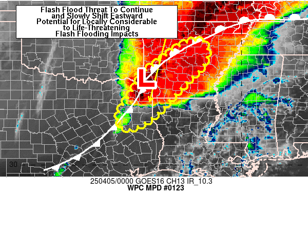
summary...slow-moving heavy showers and thunderstorms are expected to continue this afternoon with repeating cells and cell-mergers likely. concerns for flash flooding will increase through the afternoon.
discussion... moist and relatively unstable low level flow continues to converge north across central and southeast tx and toward what has been a persistent axis of heavy showers and thunderstorms. the colder convective tops over the last hour have been generally south of dallas down toward the waco and gatesville area. additional cells are also developing just southeast of austin which is indicative of added boundary layer destabilization within the broad and deeper layer south to southeast flow across southeast tx.
over the next few hours there will be strong concerns for some very heavy rainfall totals as increased diabatic heating/solar insolation ahead of the convection helps destabilize the boundary layer further. this is suggested in the latest vis satellite imagery which shows and expansive cu/tcu field surging north to northwest across south texas along with a number of cloud streets.this will allow convection to continue to focus along a convectively enhanced outflow boundary... and also in a somewhat elevated fashion over a well-defined cold pool over central tx.
the hires guidance has been terrible in accurately depicting the convective evolution today across the region... but recent runs of the hrrr/hrrx are suggesting some impressive convective rains developing near the current outflow boundary through the afternoon hours. the 15z hrrr-tle indicates high probabilities of over 6 inches in 6 hours generally within a line from waco to austin to llano.
pwats are generally close to 1.5 inches now across this region... and with rather strong sbcape values setting up south of austin... convection should tend to intensify with heavier rainfall rates through the afternoon. current radar trends indicate a likelihood of cell-mergers... and this will enhance the rates further.
expect rainfall amounts over the next 6 hours to be as much as 3 to 6 inches with locally heavier amounts perhaps approaching 8 inches where cell-mergers and repeating cells occur. the mean flow is not very keen on a strong southeast push this afternoon... so expect numerous repeating cells to foster heavy rainfall totals with an enhanced flash flood threat.
loop http://www.ssd.noaa.gov/goes/east/sc/h5-loop-rgb.html
Last edited by unome on Fri Apr 22, 2016 7:10 am, edited 2 times in total.