January 2016: Mardi Gras WX Outlook
Aha. I'll gladly take my crow raw and juicy then. I thought they had missed it, again.
- Katdaddy
- Global Moderator

- Posts: 2502
- Joined: Thu Feb 04, 2010 8:18 am
- Location: League City, Tx
- Contact:
The fast moving SW flow continues across SE TX and the Upper TX Coast. A sunny day followed by increasing clouds from quick moving shortwave trough on Thursday which will bring rain chances to the coastal areas. More sun Friday followed by another fast moving shortwave trough Saturday afternoon and evening with rain chances mainly along the coast. Clearing skies Sunday morning for the Chevron Houston Marathon followed by yet another disturbance on Monday.
- srainhoutx
- Site Admin

- Posts: 19616
- Joined: Tue Feb 02, 2010 2:32 pm
- Location: Maggie Valley, NC
- Contact:
Heavy frost this morning in NW Harris County.
Carla/Alicia/Jerry(In The Eye)/Michelle/Charley/Ivan/Dennis/Katrina/Rita/Wilma/Humberto/Ike/Harvey
Member: National Weather Association
Facebook.com/Weather Infinity
Twitter @WeatherInfinity
Member: National Weather Association
Facebook.com/Weather Infinity
Twitter @WeatherInfinity
-
BigThicket
- Posts: 53
- Joined: Sun Dec 27, 2015 10:14 pm
- Contact:
Frost all the way to the growing this morning...32 at weather station this morning in central Hardin County.
- srainhoutx
- Site Admin

- Posts: 19616
- Joined: Tue Feb 02, 2010 2:32 pm
- Location: Maggie Valley, NC
- Contact:
Active storm pattern across the Pacific crashing into the Western Ridge with some shortwaves undercutting the Ridge while others bring anomalous moisture to the Pacific NW and Northern California appears to be the theme in the fast moving split flow pattern. The Arctic Oscillation continues to drop in the -4 range and could reach -5 early next week. The Pacific North American (PNA) is slowing increasing to a +1.3 and may increase to near +2 next week. The North Atlantic Oscillation (NAO) continues to hover near -1 while the East Pacific Oscillation (EPO) oscillates near a neutral state. The MJO continues in Phase 8 with Tropical Cyclone Pali showing a weakening trend SW of Hawaii suggesting the weakening early next week of the MJO in the Eastern Pacific as it shifts more toward Mexico/Western Caribbean Sea. The morning updated Quantitative Precipitation Forecast for Sunday into Monday night has increased for our area. This is during the timeframe that garnered all the chatter regarding wintry mischief, although the overnight guidance backed off that idea as the phasing of the Northern and Southern jet stream shortwaves are still unresolved at this range. A strong Vortex of very cold Arctic air is expected to settle into the Great Lakes/Mid West Region late week which tends to bring a lot of volatility regarding our sensible weather. Hopefully those running in the Marathon will have a good weather day and we will continue to update as the week progresses.


Carla/Alicia/Jerry(In The Eye)/Michelle/Charley/Ivan/Dennis/Katrina/Rita/Wilma/Humberto/Ike/Harvey
Member: National Weather Association
Facebook.com/Weather Infinity
Twitter @WeatherInfinity
Member: National Weather Association
Facebook.com/Weather Infinity
Twitter @WeatherInfinity
TC Pali sure is getting sheared apart!srainhoutx wrote:Tropical Cyclone Pali showing a weakening trend SW of Hawaii suggesting the weakening early next week of the MJO in the Eastern Pacific as it shifts more toward Mexico/Western Caribbean Sea. The morning updated Quantitative Precipitation Forecast for Sunday into Monday night has increased for our area.
This is during the timeframe that garnered all the chatter regard wintry mischief, although the overnight guidance backed off that idea as the phasing of the Northern and Southern jet stream shortwaves are still unresolved at this range. A strong Vortex of very cold Arctic air is expected to settle into the Great Lakes/Mid West Region late week which tends to bring a lot of volatility regarding our sensible weather. Hopefully those running in the Marathon will have a good weather day and we will continue to update as the week progresses.
Regarding Sunday morning, I'll appreciate the Southern jet stream providing a blanket of clouds and the rain can start after 2 p.m. Thanks for thinking about us, Srain.
- srainhoutx
- Site Admin

- Posts: 19616
- Joined: Tue Feb 02, 2010 2:32 pm
- Location: Maggie Valley, NC
- Contact:
Afternoon Updated Climate Prediction Center Day 8+ Analogs and Day 6 through 10 Outlook and Discussion:
PROGNOSTIC DISCUSSION FOR 6 TO 10 AND 8 TO 14 DAY OUTLOOKS
NWS CLIMATE PREDICTION CENTER COLLEGE PARK, MD
300 PM EST TUE JANUARY 12 2016
6-10 DAY OUTLOOK FOR JAN 18 - 22 2016
TODAY'S DYNAMICAL MODELS ARE IN GOOD AGREEMENT ON THE PREDICTED 500-HPA
CIRCULATION PATTERN ACROSS MOST OF THE FORECAST DOMAIN. TROUGHS ARE PREDICTED
OVER THE ALEUTIANS AND MUCH OF EASTERN NORTH AMERICA WHILE A RIDGE IS FORECAST
OVER THE WESTERN CONUS EXTENDING NORTH TO EASTERN ALASKA. ABOVE NORMAL HEIGHTS
ARE FORECAST OVER MUCH OF THE HIGH LATITUDES WHILE BELOW NORMAL HEIGHTS ARE
FORECAST FARTHER TO THE SOUTH OVER MUCH OF THE EASTERN SEABOARD CONSISTENT WITH
A NEGATIVE AO. BELOW NORMAL HEIGHTS ARE PREDICTED OVER WESTERN ALASKA AND PART
OF THE NORTHWEST CONUS IN ASSOCIATION WITH A TROUGH PREDICTED OVER THE
NORTHEASTERN PACIFIC OCEAN. CONVERSELY, ABOVE NORMAL HEIGHTS ARE FORECAST OVER
PARTS OF THE SOUTHWEST CONUS IN ASSOCIATION WITH A PREDICTED RIDGE. TODAY'S
OFFICIAL 500-HPA MANUAL BLEND IS BASED PRIMARILY ON THE GFS, ECMWF, AND
CANADIAN ENSEMBLE MEAN SOLUTIONS.
ABOVE-NORMAL TEMPERATURES ARE FAVORED FOR MUCH OF THE WESTERN CONUS DUE TO A
PREDICTED RIDGE. ABOVE NORMAL TEMPERATURES ARE ALSO FAVORED FOR MUCH OF
SOUTHERN ALASKA AHEAD OF A TROUGH PREDICTED OVER THE ALEUTIANS. THERE ARE
ENHANCED PROBABILITIES FOR BELOW NORMAL TEMPERATURES FOR MUCH OF THE EASTERN
CONUS IN ASSOCIATION WITH A MEAN LONGWAVE TROUGH FORECAST OVER EASTERN NORTH
AMERICA.
ABOVE-MEDIAN PRECIPITATION IS FAVORED FOR THE WEST COAST AHEAD OF A TROUGH
PREDICTED OVER THE NORTHEASTERN PACIFIC OCEAN. ENHANCED PROBABILITIES FOR ABOVE
MEDIAN PRECIPITATION ARE ALSO INDICATED FOR MUCH OF THE INTERMOUNTAIN WEST
EXTENDING TO THE CENTRAL GREAT PLAINS CONSISTENT WITH PRECIPITATION ESTIMATES
FROM THE GFS AND ECMWF ENSEMBLE MEMBERS. THERE ARE ENHANCED PROBABILITIES OF
BELOW MEDIAN PRECIPITATION FOR PARTS OF THE SOUTHERN HIGH PLAINS AND SOUTHWEST
TO THE SOUTH THE PREDICTED MEAN STORM TRACK. BELOW MEDIAN PRECIPITATION IS ALSO
FAVORED FOR MUCH OF THE NORTHEAST CONUS UNDERNEATH PREDICTED MEAN NORTHERLY LOW
LEVEL FLOW. ENHANCED PROBABILITIES FOR BELOW MEDIAN PRECIPITATION ARE ALSO
INDICATED FOR PARTS OF CENTRAL ALASKA CONSISTENT WITH GEFS REFORECAST GUIDANCE.
TODAY'S OFFICIAL 500-HPA BLEND CONSISTS OF 20% OF TODAY'S 0Z GFS ENSEMBLE MEAN
CENTERED ON DAY 8, 20% OF TODAY'S 6Z GFS ENSEMBLE MEAN CENTERED ON DAY 8, 5% OF
TODAY'S OPERATIONAL 0Z GFS CENTERED ON DAY 8, 5% OF TODAY'S OPERATIONAL 6Z GFS
CENTERED ON DAY 8, 20% OF TODAY'S 0Z EUROPEAN ENSEMBLE MEAN CENTERED ON DAY 8,
5% OF YESTERDAY'S 12Z EUROPEAN ENSEMBLE MEAN CENTERED ON DAY 7, 5% OF TODAY'S
OPERATIONAL 0Z ECMWF CENTERED ON DAY 8, AND 20% OF TODAY'S 0Z CANADIAN ENSEMBLE
MEAN CENTERED ON DAY 8
FORECAST CONFIDENCE FOR THE 6-10 DAY PERIOD: ABOVE-AVERAGE, 4 OUT OF 5, DUE TO
FAIRLY GOOD MODEL AGREEMENT.
Carla/Alicia/Jerry(In The Eye)/Michelle/Charley/Ivan/Dennis/Katrina/Rita/Wilma/Humberto/Ike/Harvey
Member: National Weather Association
Facebook.com/Weather Infinity
Twitter @WeatherInfinity
Member: National Weather Association
Facebook.com/Weather Infinity
Twitter @WeatherInfinity
Wait a second! I'm sending my crow back! Upon further review...the NWS busted that forecast back in November. We didn't get the anticipated freeze that sparked that warning. Clock reset. They should have issued a fresh freeze warning Sunday night, since it ended-up being the first freeze of the season after all.jasons wrote:Aha. I'll gladly take my crow raw and juicy then. I thought they had missed it, again.
With that, I'll let this go...until next season. In the meantime, I'm ready for spring!
I posted this earlier, but here goes again https://twitter.com/NWSHouston/status/6 ... 4637605888
note that Willis hit 31, Conroe 32, just to name a couple - both of which qualify as freezing in Montgomery County
note that Willis hit 31, Conroe 32, just to name a couple - both of which qualify as freezing in Montgomery County
Yeah, the usual cold places, mostly along and north of 105. Not the US-59 corridor like predicted, and not at IAH, the official reporting station for the vast majority of viewers and the city of Houston. They should have issued a freeze warning for Monday AM for Harris County and they didn't. I think this horse is dead now. 
- srainhoutx
- Site Admin

- Posts: 19616
- Joined: Tue Feb 02, 2010 2:32 pm
- Location: Maggie Valley, NC
- Contact:
Another light frost in NW Harris County this morning. A couple of fast moving shortwaves will be the weather makers across our Region the next couple of days. One is rotating SE embedded in the longwave trough across the Central/Eastern half of the Nation with a second near the Baja Peninsula heading East across Mexico and will induce a surface low over the Western Gulf tonight into tomorrow. Clouds look to increase as modest moisture moves inland mainly along the Coastal tier of Counties. There may be some rumbles of thunder offshore and near the Coast and possibly across East Texas into Louisiana, but these storms will be elevated and we will probably not see much if any rainfall across most areas.


Carla/Alicia/Jerry(In The Eye)/Michelle/Charley/Ivan/Dennis/Katrina/Rita/Wilma/Humberto/Ike/Harvey
Member: National Weather Association
Facebook.com/Weather Infinity
Twitter @WeatherInfinity
Member: National Weather Association
Facebook.com/Weather Infinity
Twitter @WeatherInfinity
- BiggieSmalls
- Posts: 92
- Joined: Thu Feb 04, 2010 10:05 am
- Location: Dallas, Texas
- Contact:
Looks like the chances of anything other than normal "cold" in the next 10 days is gone..no more chances of wintery precip in North Texas as was being predicted even a few days ago....quite the dud of a winter so far
- srainhoutx
- Site Admin

- Posts: 19616
- Joined: Tue Feb 02, 2010 2:32 pm
- Location: Maggie Valley, NC
- Contact:
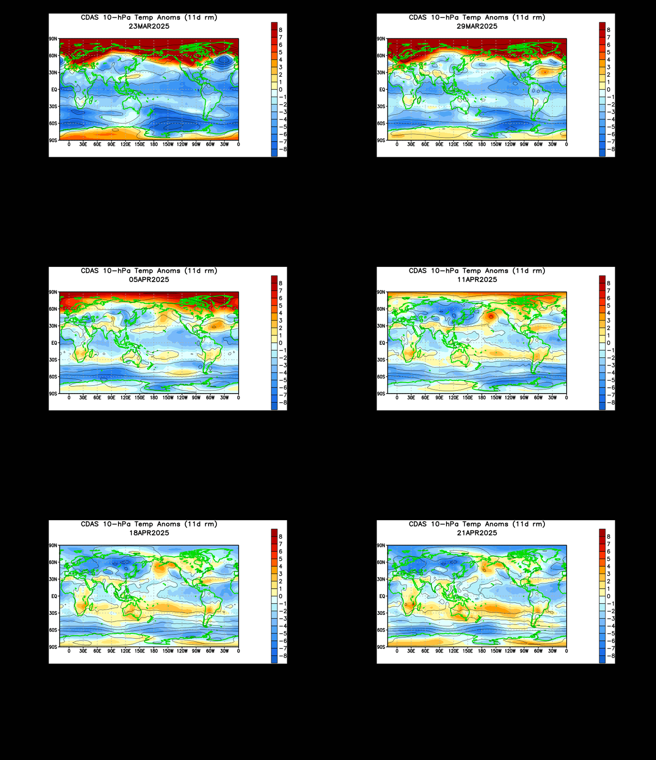
Interesting to note the CPC Day 11+ Super Ensembles are suggesting an upper air (500mb) pattern that continues an unsettled and chilly regime from California across the Desert SW into the Southern half of Texas and along the Gulf Coast. The Arctic Oscillation (AO) is showing signs of crashing nearing a severely negative -6 next week while the Pacific North American (PNA) may well go strongly positive to +4, perhaps even higher. The North Atlantic Oscillation (NAO) is predicted to trend toward a neutral or positive phase while the East Pacific Oscillation (EPO) hovers near neutral. Also of note we are seeing some very significant warming occurring at the Stratospheric levels suggesting the potential of a strong Sudden Stratospheric Warming event may be developing. The combination of all the Hemispheric indicators suggest to me that a chaotic weather pattern may be developing that could lead to a lot of volatility via the computer guidance. The very fast flow off the Pacific just adds to the uncertainty in our sensible weather forecast.


Carla/Alicia/Jerry(In The Eye)/Michelle/Charley/Ivan/Dennis/Katrina/Rita/Wilma/Humberto/Ike/Harvey
Member: National Weather Association
Facebook.com/Weather Infinity
Twitter @WeatherInfinity
Member: National Weather Association
Facebook.com/Weather Infinity
Twitter @WeatherInfinity
This is the case almost all of the time. Rarely does it pan out the way the models show from that far out. Even my trip to N. Alabama tomorrow through the weekend will not be anything like what was shown days ago....but that's OKBiggieSmalls wrote:Looks like the chances of anything other than normal "cold" in the next 10 days is gone..no more chances of wintery precip in North Texas as was being predicted even a few days ago....quite the dud of a winter so far
- BiggieSmalls
- Posts: 92
- Joined: Thu Feb 04, 2010 10:05 am
- Location: Dallas, Texas
- Contact:
Haha I know, its just fun when they DO verify....We still have February, at least. Last March 1 Dallas had 3-4 inches of snow on the ground, after all
I forgot to thank you for posting the NWS for this Sunday, Kat. Thanks. This is a beautiful forecast with the clouds slowing the temp because today on the Weatherbug site on Memorial and Chimney Rock (mile 18) the temperature under blue skies went from 37 to 58 degrees at 10 a.m. That sun really saps me as I have enough trouble just finishing under cloudy skies.Katdaddy wrote:The fast moving SW flow continues across SE TX and the Upper TX Coast. A sunny day followed by increasing clouds from quick moving shortwave trough on Thursday which will bring rain chances to the coastal areas. More sun Friday followed by another fast moving shortwave trough Saturday afternoon and evening with rain chances mainly along the coast. Clearing skies Sunday morning for the Chevron Houston Marathon followed by yet another disturbance on Monday.
- srainhoutx
- Site Admin

- Posts: 19616
- Joined: Tue Feb 02, 2010 2:32 pm
- Location: Maggie Valley, NC
- Contact:
The afternoon updated Climate Prediction Center Day 8+ Analogs are hinting some fairly big snow event years for Houston particularly during the late January/February timeframe. Rolling it forward to the Day11+ Analogs, the trends continue to look positive for the potential for wintry mischief based on Analog years. We will see.
Carla/Alicia/Jerry(In The Eye)/Michelle/Charley/Ivan/Dennis/Katrina/Rita/Wilma/Humberto/Ike/Harvey
Member: National Weather Association
Facebook.com/Weather Infinity
Twitter @WeatherInfinity
Member: National Weather Association
Facebook.com/Weather Infinity
Twitter @WeatherInfinity
Yeah, the snow lost its MoJOsnowman65 wrote:This is the case almost all of the time. Rarely does it pan out the way the models show from that far out. Even my trip to N. Alabama tomorrow through the weekend will not be anything like what was shown days ago....but that's OKBiggieSmalls wrote:Looks like the chances of anything other than normal "cold" in the next 10 days is gone..no more chances of wintery precip in North Texas as was being predicted even a few days ago....quite the dud of a winter so far
i think this winter is going to be alot like last winter. january 14th and my lowest temp has been 32 degrees
Last edited by ticka1 on Thu Jan 14, 2016 7:48 am, edited 1 time in total.
- Katdaddy
- Global Moderator

- Posts: 2502
- Joined: Thu Feb 04, 2010 8:18 am
- Location: League City, Tx
- Contact:
Showers will be possible for areas mainly S of I-10 toward the coast as a broad low moves along the coastal waters today. Sun returns Friday ahead of another quick moving shortwave trough. Clearing skies and windy Saturday evening and night. Sunday morning weather still looking nice but cold with temps in the upper 30s and low 40s for the start of the Chevron Houston Marathon. Out in the far E Atlantic Subtropical Storm Alex is up to 70MPH and will move over the Azores Islands tomorrow.
- Attachments
-
- Screen Shot 2016-01-14 at 5.34.21 AM.png (117.01 KiB) Viewed 3943 times