
December 2015 -Year Ends As One Of Wettest On Record
It appears that wxman57 and his evil heat machine come Sunday will have to bow down and kiss the ring of Old Man Winter. 
-
srainhoutx

- Site Admin

- Posts: 19616
- Joined: Tue Feb 02, 2010 2:32 pm
- Location: Maggie Valley, NC
- Contact:
I understand he is leading in the annual office pool regarding temperatures for Houston. Now we ALL know that he wouldn't have any sort of "warm bias" until the Calendar turns to January.cperk wrote:It appears that wxman57 and his evil heat machine come Sunday will have to bow down and kiss the ring of Old Man Winter.
Carla/Alicia/Jerry(In The Eye)/Michelle/Charley/Ivan/Dennis/Katrina/Rita/Wilma/Humberto/Ike/Harvey
Member: National Weather Association
Facebook.com/Weather Infinity
Twitter @WeatherInfinity
Member: National Weather Association
Facebook.com/Weather Infinity
Twitter @WeatherInfinity


Severe weather on Christmas Eve and Christmas is rare.
Severe Weather On Christmas Eve
1975
2009
Severe Weather On Christmas
2012
This is since 1950. I am sure there have been severe weather on Christmas Eve and Christmas before 1950. It is possible severe weather occurred in those wettest Christmas before 1950.
http://www.srh.noaa.gov/hgx/?n=climate_holidays_xmas
I notice severe weather happens more in an El Nino Winter than in La Nina and Neutral Winter.
-
srainhoutx
- Site Admin
- Posts: 19616
- Joined: Tue Feb 02, 2010 2:32 pm
- Location: Maggie Valley, NC
- Contact:
Morning briefing from Jeff:
***Powerful…high impact…storm system to affect TX this weekend.***
Impacts across the state likely to include:
· Severe weather including tornadoes
· Heavy rainfall and flooding
· Winter Weather with blizzard conditions
Today-Christmas Day:
Sea fog has made its return to the nearshore waters and inland bays this morning and progressed inland over portions of SE TX. Strong low level inversion around 900mb will result in only slow improvement in visibilities this morning and locations along the coast may stay fogged in much of the day as high dewpoint air mass begins to advect over the cooler shelf waters. Warm front begins to take shape overnight along the coast while a short wave approaches in the SW flow aloft out of MX. Will likely see an increase in shower and thunderstorm activity after midnight-the morning hours of Christmas Day over the region as the warm front returns northward, moisture increases and broad divergence of upper level wind field develops. There could be a few strong or even isolated severe thunderstorms Friday morning especially along and E of I-45, but this threat looks marginal at the moment.
Temperatures will continue to run extremely warm for this time of year with near record values today-Saturday. Actual high temperatures will depend greatly on how much sun can penetrate the cloud cover and fog resulting in warming. As was the case yesterday…sunshine… warmed many sites to record highs for 12-23.
Weekend:
A compact and potent upper level system currently approaching the NW US coast will dive SE into the SW US Friday and into N MX on Saturday. Broad warm sector air mass will develop over eastern TX with surface dewpoints rising into the upper 60’s to near 70 as current western Caribbean air mass is brought into the area. Large scale height falls will begin to spread into SW TX late Saturday helping to spawn a rapidly intensifying surface low pressure system ahead of the deep upper level storm system. Lead short wave will eject across CO unlocking a cold Canadian air mass southward down the plains on Saturday and into TX. Major models are coming into good agreement on the track of the strong upper level system along with heavy rainfall, severe, and winter weather parameters.
Severe:
Warm sector air mass will be moist and unstable by Saturday afternoon across all of central and east TX. Expect ripples of energy in the SW flow aloft to help foster thunderstorm development over the warm sector during the day on Saturday. Increasing wind field may support a marginal severe weather threat across SE TX.
Main period of concern will be Saturday night into Sunday as deepening surface low pressure tracks from SW TX toward Waco and DFW area. Wind field greatly increases Saturday night with strong upper level jet cutting across low level jet maximum. Strong cold front approaching from the NW with strong linear forcing will result in squall line formation. Latest high resolution guidance is showing some potential for discrete cell development east of the surface low over SW TX after dark on Saturday…this would certainly support a tornado threat with backing low level winds east of the surface low track. All severe modes will be possible from Saturday afternoon through Sunday over central and eastern TX. SPC has added a slight risk (cat 2) outline for a large portion of central TX for Saturday and expect a large slight risk to be added for Sunday later today.
Heavy Rainfall/Flooding:
This will certainly be a wet system with near record high moisture values expected to surge inland off the still warm Gulf of Mexico and the connection to tropical moisture in the upper levels from the central Pacific. Strong dynamics will work on all this moisture to produce bands of heavy to excessive rainfall. QPF is maximized over N TX where widespread 5-8 inches will be possible with isolated totals of 10 inches. Rainfall of this magnitude on wet grounds, flooding rivers, and full lakes is going to cause problems. Across SE TX widespread amounts of 1-2 inches appear likely with isolated totals of 3-5 inches especially north of I-10. Most areas will be able to handle this rainfall…but significant run-off will result in rises on area watersheds.
Hydro:
River flooding is already ongoing on the Sabine, Neches, and Trinity Basins and this upcoming rainfall event is only going to add a lot more water on to already troubled watersheds. Upstream flood control/water supply lakes are either into their flood pools or well above their conservation pools levels and flood gate operations are ongoing at many locations. Upcoming weekend situation will not bode well for mainstem rivers with so much water already involved. River flooding is very likely on the Trinity, Neches, and Sabine basins and rises to flood levels on the Navasota and Brazos basins are possible.
Winter Storm:
Strongly dynamic and intensifying cold core upper level storm system will move from SW TX to near/over DFW Sunday/early Monday. Dynamic cooling of the air column under this feature along with moisture wrapping NW around the upper level system will result in a large area of heavy snow and strong winds across much of W TX including the panhandle, Big Country, and Caprock regions. Heavy snow rates under meso scale bands of 1-3 inches per hour will be possible along with surface winds of 50-60mph which will lead to significant blowing and drifting of snow. Portions of NW TX will see crippling blizzard conditions with impossible travel Sunday into Sunday night including Amarillo, Lubbock, Midland and Abilene. Track of the center of the upper level low will determine how far east the rain/snow line migrates. Could see a changeover as far east as DFW by Monday morning back SW into the NW Hill Country. Track of upper low will be far enough to our west to keep the air column above freezing over SE TX. Additionally, SE TX may get dry slotted from the SW on the underside of the upper level low late Sunday night shutting off precipitation fairly quickly.
Cold Air:
Strong Canadian front will cross TX Saturday and Sunday with temperatures rapidly falling behind this boundary. Warm sector air mass will be firmly in the 70’s with post frontal temperatures crashing through the 40’s. Cold air mass will remain in place all of next week with lows in the 30’s and highs in the 50’s.
Day 3 (Saturday) Severe Weather Outlook:
Carla/Alicia/Jerry(In The Eye)/Michelle/Charley/Ivan/Dennis/Katrina/Rita/Wilma/Humberto/Ike/Harvey
Member: National Weather Association
Facebook.com/Weather Infinity
Twitter @WeatherInfinity
Member: National Weather Association
Facebook.com/Weather Infinity
Twitter @WeatherInfinity
-
srainhoutx
- Site Admin
- Posts: 19616
- Joined: Tue Feb 02, 2010 2:32 pm
- Location: Maggie Valley, NC
- Contact:
The 12Z GFS and Canadian are suggesting a further South track of both the cold core 500mb Upper Low as well as the surface low. The Upper low tracks well South of New Mexico and South of the Big Bend to near or just South of Midland and on East toward Killeen/Waco and then ENE toward Texarkana. The surface low drops SW of Brownsville and then moves NE over Houston and on NE to Shreveport via the GFS and CMC.
Carla/Alicia/Jerry(In The Eye)/Michelle/Charley/Ivan/Dennis/Katrina/Rita/Wilma/Humberto/Ike/Harvey
Member: National Weather Association
Facebook.com/Weather Infinity
Twitter @WeatherInfinity
Member: National Weather Association
Facebook.com/Weather Infinity
Twitter @WeatherInfinity
-
srainhoutx
- Site Admin
- Posts: 19616
- Joined: Tue Feb 02, 2010 2:32 pm
- Location: Maggie Valley, NC
- Contact:
The 12Z Euro is similar to the GFS/CMC scheme with a slightly South and East shift of the Big Storm. The potent cold core shortwave is nearing the Oregon Pacific Coast at this hour and should be inland over Northern California late this afternoon.

- Attachments
-
-
Carla/Alicia/Jerry(In The Eye)/Michelle/Charley/Ivan/Dennis/Katrina/Rita/Wilma/Humberto/Ike/Harvey
Member: National Weather Association
Facebook.com/Weather Infinity
Twitter @WeatherInfinity
Member: National Weather Association
Facebook.com/Weather Infinity
Twitter @WeatherInfinity
what does that mean for us if anything it moving slightlt south and east?
-
MontgomeryCoWx

- Posts: 2356
- Joined: Wed Dec 14, 2011 4:31 pm
- Location: Weimar, TX
- Contact:
Colder temps bc snow pack moves south and east as well.
Team #NeverSummer
88 in Weslaco / 38 in Dumas...
http://mesowest.utah.edu/cgi-bin/droman ... rawsflag=3
any cold will feel colder after this unseasonably warm weather
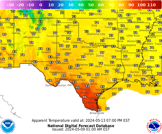
apparent temp forecasts
http://graphical.weather.gov/images/sou ... plains.png
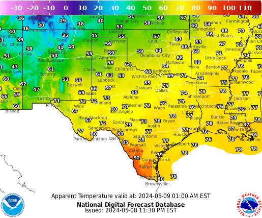
http://graphical.weather.gov/images/sou ... plains.png
http://mesowest.utah.edu/cgi-bin/droman ... rawsflag=3
any cold will feel colder after this unseasonably warm weather
apparent temp forecasts
http://graphical.weather.gov/images/sou ... plains.png
http://graphical.weather.gov/images/sou ... plains.png
To all the KHOU forum members and their families.Have a merry,safe,and blessed Christmas.I look foward to the interesting weather we will be discussing going into the New Year.
-
srainhoutx
- Site Admin
- Posts: 19616
- Joined: Tue Feb 02, 2010 2:32 pm
- Location: Maggie Valley, NC
- Contact:
Short Range Forecast Discussion
NWS Weather Prediction Center College Park MD
341 AM EST Fri Dec 25 2015
Valid 12Z Fri Dec 25 2015 - 12Z Sun Dec 27 2015
...Flash flooding possible across portions of the Southeast, Tennessee and
Ohio Valleys, Appalachians and Southern Plains...
...Heavy snow possible from portions of the Rockies into the Central and
Northern plains Christmas Day and into the weekend...
...Snow expected to develop on Saturday from portions of the Southern
Rockies to the southern High Plains...
The overall pattern for the CONUS will be active through the weekend, with
a vast majority of the country expecting precipitation. Light
accumulations are expected over the next couple of days for the West Coast
and southern Florida.
A nearly stationary front, spanning from the Mid-Atlantic to the lower
Mississippi Valley, will keep scattered to numerous showers and
thunderstorms through the weekend for these regions. Periods of heavy
rainfall is anticipated along the axis of this boundary, especially along
the Appalachians, which may result in flash flooding. Temperatures are
forecast to remain well above average on Christmas Day across much of the
eastern half of the nation. The warmest temperatures will be along the
Eastern Seaboard, where high temperatures more than 20 degrees above
average are forecast. Above average temperatures will persist into the
weekend from the lower/middle Mississippi valley eastward.
Widespread snow is expected for portions of the Central Rockies,
Central/Northern Plains and the Upper Midwest as a cold front surges
southward from the southern Canada. Numerous Winter Storm Advisories and
Warnings are effect with this system. Snow accumulations of 2 to 6 inches
will be common over the next couple of days. Some areas, particularly in
higher terrain, amounts may exceed 1 foot. Locations along and south of
the advancing boundary may observe sleet or freezing rain.
A robust low pressure system is forecast to develop and strengthen over
the Southwest on Saturday. With an Arctic cold front trekking southward
through the plains this could potentially become a significant winter
storm. A vast area from New Mexico to Oklahoma is under a Winter Storm
Watch and Blizzard Watch. Please refer to products issued by local NWS
Forecast Offices for details specific to your area. Areas of accumulating
sleet and freezing rain will be possible by Saturday evening across
portions of the Southern/Central Plains. Snow accumulations 6 to 12 inches
will be common across norther New Mexico to western Oklahoma; 1 to 2 feet
possible for southern New Mexico and northern Texas.
Campbell
Carla/Alicia/Jerry(In The Eye)/Michelle/Charley/Ivan/Dennis/Katrina/Rita/Wilma/Humberto/Ike/Harvey
Member: National Weather Association
Facebook.com/Weather Infinity
Twitter @WeatherInfinity
Member: National Weather Association
Facebook.com/Weather Infinity
Twitter @WeatherInfinity


Now that is one spectacular sunrise this morning Katdaddy!!!! Merry Christmas to all on our weather forum!!!
~~~When Thunder Roars Go Indoors~~~
~~~Turn Around Don't Drown~~~
~~~Run From The Water, Hide From The Wind~~~
~~~Turn Around Don't Drown~~~
~~~Run From The Water, Hide From The Wind~~~
-
srainhoutx
- Site Admin
- Posts: 19616
- Joined: Tue Feb 02, 2010 2:32 pm
- Location: Maggie Valley, NC
- Contact:
Merry Christmas to all the KHOU Weather Forum family as well as those that follow our online Weather Community.
Carla/Alicia/Jerry(In The Eye)/Michelle/Charley/Ivan/Dennis/Katrina/Rita/Wilma/Humberto/Ike/Harvey
Member: National Weather Association
Facebook.com/Weather Infinity
Twitter @WeatherInfinity
Member: National Weather Association
Facebook.com/Weather Infinity
Twitter @WeatherInfinity
-
GBinGrimes

- Posts: 108
- Joined: Mon Jan 27, 2014 1:50 pm
- Location: Anderson, TX
- Contact:
Merry Christmas everyone! Looks like we have a very interesting week ahead with the weather.
Does anyone have a driving route suggestion from Montana back to the Houston area that could perhaps bypass the blizzard conditions that are forecast for the Rockies into North Texas? I am leaving tomorrow morning to return home and this looks bleak for road travel. Every weather site's travel forecast has me a wee bit queezy.
Have a great Christmas day everybody!!!
-
srainhoutx
- Site Admin
- Posts: 19616
- Joined: Tue Feb 02, 2010 2:32 pm
- Location: Maggie Valley, NC
- Contact:
GBinGrimes wrote:Merry Christmas everyone! Looks like we have a very interesting week ahead with the weather.
Does anyone have a driving route suggestion from Montana back to the Houston area that could perhaps bypass the blizzard conditions that are forecast for the Rockies into North Texas? I am leaving tomorrow morning to return home and this looks bleak for road travel. Every weather site's travel forecast has me a wee bit queezy.
Have a great Christmas day everybody!!!
Looks like a tough drive ahead GBinGrimes. Perhaps make a beeline down I-25 to Denver and then East on I-70 to Salina, KS and hunker down til the storm passes. The Interstates would likely be the best option in this situation since those will be cleared first versus the shorter/faster US Highways, distance wise. I know I would not head south of Colorado Springs on I-25 toward Raton Pass and on SE into Texas until sometime later Monday or preferably Tuesday.
Carla/Alicia/Jerry(In The Eye)/Michelle/Charley/Ivan/Dennis/Katrina/Rita/Wilma/Humberto/Ike/Harvey
Member: National Weather Association
Facebook.com/Weather Infinity
Twitter @WeatherInfinity
Member: National Weather Association
Facebook.com/Weather Infinity
Twitter @WeatherInfinity
-
GBinGrimes
- Posts: 108
- Joined: Mon Jan 27, 2014 1:50 pm
- Location: Anderson, TX
- Contact:
Thanks srainhoutx. Pretty much what I feared. Rats. May have to head SW from here and find a more southerly route home. Hunkering down til Mon or Tues does not fit schedule but...safety first always.
Merry Christmas to everyone!srainhoutx wrote:Merry Christmas to all the KHOU Weather Forum family as well as those that follow our online Weather Community.
-
John Rogers
- Posts: 2
- Joined: Thu Dec 24, 2015 8:52 pm
Merry Christmas, y'all.
For those of you wondering if our fair community is going to be washed and blown right off the map on Sunday/Monday, I got a message for you:
relax.
I don't think NWS is looking for a massive windstorm to blow through Houston. More likely just some rain 'round here. I'm a part time storm chaser and some friends of mine at the HBU weather station feel this system will have more of an impact, as far as severe storms go, north of our location.
Not bad for a first timer, huh?