
August - Warm and Dry Weather Returns To End The Month
-
Katdaddy

- Global Moderator

- Posts: 2502
- Joined: Thu Feb 04, 2010 8:18 am
- Location: League City, Tx
- Contact:
Take your umbrella today. A continued chance of tropical thunderstorms will continue the rest of the week with morning funnels and waterspouts possible each day with the tropical airmass. Minor flooding will develop with the heavier cells. Tropics remain very quiet.

And the overnight crew swings wet again. Hmm.

Not looking too good.
-
robertscottlazar
- Posts: 38
- Joined: Thu Jun 06, 2013 10:56 am
- Contact:
wheres all the rain? yesterday david paul was saying today would be wetter than yesterday. he was showing alot more showers right now than what the radar is currently showing. this is a big joke.
-
robertscottlazar
- Posts: 38
- Joined: Thu Jun 06, 2013 10:56 am
- Contact:
yesterday david pauls future cast was showing widespread wetting rainfall for this time of the day today. future cast was wrong. this is becoming sickening. models,blah blah blah.perhaps its time for meteorologists to go back to old fashioned methods. these stupid computer models dont get it right. and todays lack of rainfall is proof.
-
srainhoutx

- Site Admin

- Posts: 19616
- Joined: Tue Feb 02, 2010 2:32 pm
- Location: Maggie Valley, NC
- Contact:
Seabreeze/Baybreeze getting active now. AZ bust... 

Carla/Alicia/Jerry(In The Eye)/Michelle/Charley/Ivan/Dennis/Katrina/Rita/Wilma/Humberto/Ike/Harvey
Member: National Weather Association
Facebook.com/Weather Infinity
Twitter @WeatherInfinity
Member: National Weather Association
Facebook.com/Weather Infinity
Twitter @WeatherInfinity
So far nothing up here, not even close by...I guess the day shifters have the edge.
-
srainhoutx
- Site Admin
- Posts: 19616
- Joined: Tue Feb 02, 2010 2:32 pm
- Location: Maggie Valley, NC
- Contact:
With the upper ridge firmly anchored to our N, the inland push of sea breeze showers and storms has had a difficult time making much headway inland this week. Further E, an inverted trough is progressing W bound and should arrive by the weekend increasing daily chances of showers and storms along our Coastal tier of Counties where tropical funnels again may be possible. Higher PW's and perhaps a bit more wide spread rain activity will develop by Saturday with a bit better chance of isolated to scattered storms reaching the second tier of Counties into Sunday. That pattern appears to be somewhat locked in as earstly waves move beneath the underbelly of the upper ridge across the Gulf Coast heading W into next week. There are still indications that an unsettled pattern will remain in place as a robust MJO pulse moves E and enters the Gulf of Mexico and Caribbean Sea as we end August and begin September. We will need to monitor the Tropics for any home grown tropical development during that timeframe as conditions may become a bit more conducive for tropical mischief to form as pressures lower and rising air creates more favorable conditions for convective development across the Western Atlantic Basin. We will see.
New publically released Eurosip Seasonal Guidance suggests lowering pressures across the MDR, Caribbean Sea and across Texas:
Euro 51 Member Ensembles for MJO:
New publically released Eurosip Seasonal Guidance suggests lowering pressures across the MDR, Caribbean Sea and across Texas:
Carla/Alicia/Jerry(In The Eye)/Michelle/Charley/Ivan/Dennis/Katrina/Rita/Wilma/Humberto/Ike/Harvey
Member: National Weather Association
Facebook.com/Weather Infinity
Twitter @WeatherInfinity
Member: National Weather Association
Facebook.com/Weather Infinity
Twitter @WeatherInfinity
-
srainhoutx
- Site Admin
- Posts: 19616
- Joined: Tue Feb 02, 2010 2:32 pm
- Location: Maggie Valley, NC
- Contact:
Morning e-mail from Jeff:
Favorable pattern continues in place to support daily rain chances.
Upper level high pressure cells located west and east of TX this morning with a break in the high pressure ridges over TX. This has allowed overall weakened height fields and less sinking air. The high over the SE US continues to pump a stream of tropical air from FL across the Gulf to the TX coast and this is confirmed by moist soundings from both CRP and LCH with PWS at or above 1.8 inches across the region. Higher moisture levels are found from the Sabine River eastward and will gradually work westward over the next few days. Tropical wave is noted extending from south of Cuba to off the western coast of FL and moving west.
With the Gulf of Mexico wide open allowing both moisture and tropical waves to arrive on the TX coast…rain chances will continue through the weekend. Showers and thunderstorms will develop in the 300-700am time period offshore and along the coast and begin to advance inland during the morning hours. Daytime heating in the very moist air mass will support scattered development during the afternoon hours inland from the coast once surface temperatures achieve the mid to upper 80’s. Tropical wave axis moving inland periodically over the next few days will support higher rain chances on their eastern flanks or once the waves have passed west of our location. Could argue for higher rain chances on Saturday and Sunday when the current eastern Gulf wave should arrive.
While this pattern does support decent rainfall chances (30-50%) it is still scattered in nature and not everyone will see rainfall each day. Generally rainfall amounts will average 1-2 inches over the next 5 days south of I-10 and less than an inch north of I-10, but some locations will see no rainfall and other locations will see several inches of rainfall. This tropical air mass is very capable of producing some hefty rainfall totals in a short period of time (3-5 inches over NE Grimes and NW Walker Counties late yesterday evening). Boundary collisions will help to determine where the greatest rainfall on a daily basis will reside.
Overall pattern is favorable for any tropical entity to head in the general direction of the NW/W Gulf, but at this time there is nothing in the Caribbean or western Atlantic that looks on the verge of developing.
Carla/Alicia/Jerry(In The Eye)/Michelle/Charley/Ivan/Dennis/Katrina/Rita/Wilma/Humberto/Ike/Harvey
Member: National Weather Association
Facebook.com/Weather Infinity
Twitter @WeatherInfinity
Member: National Weather Association
Facebook.com/Weather Infinity
Twitter @WeatherInfinity
-
robertscottlazar
- Posts: 38
- Joined: Thu Jun 06, 2013 10:56 am
- Contact:
im calling today another bust. i am not seeing the 40% coverage as forecasted by david paul last night. wheres all the showers? wheres all the showers that were supposed to move into our area from louisiana? this is ridiculous. come on guys.
i think its time to stop forecasting based soley on the what the models say. i think meterologists like david paul should use old fashioned observations and analyization of data to make forecasts. the models arent getting it right.
i dont like khou's futurecast,or whatever they call it. it hasnt been doing a good job predicting the daily rain chances.
-
TexasBreeze
- Posts: 942
- Joined: Sun Sep 26, 2010 4:46 pm
- Location: NW Houston, TX
- Contact:
I'd almost hate to agree, but he does have a point. I couldn't begin to tell if we are even in a 'wet pattern'. Isolated showers all week mainly along coast.
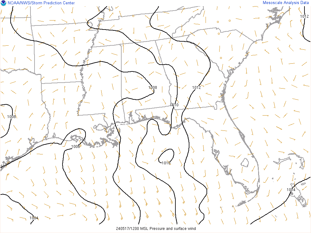
Ed Mahmoud wrote:Long shot optimism for local SETX excitement, or at least enhancement to rain...
No model support, but 500 mb low in Eastern Gulf has developed an 850 mb vorticity reflection, and SPC surface mesoanalysis shows a hint of lowering pressure.
I almost feel embarrassed to post this, but things are so boring as far as tropics go, plus this can't hurt our rain chances weekend/earl week, I give you the Gulf of Mexico satellite showing storms associated with a 500 mb low and very weak surface reflection.

They're surely discussing it on another one of my favorite forums.

Mr. lAZar...robertscottlazar wrote:im calling today another bust. i am not seeing the 40% coverage as forecasted by david paul last night. wheres all the showers? wheres all the showers that were supposed to move into our area from louisiana? this is ridiculous. come on guys.
i think its time to stop forecasting based soley on the what the models say. i think meterologists like david paul should use old fashioned observations and analyization of data to make forecasts. the models arent getting it right.
i dont like khou's futurecast,or whatever they call it. it hasnt been doing a good job predicting the daily rain chances.
If you don't feel your post is getting the response you desire, you might try putting your text in all caps.
-
srainhoutx
- Site Admin
- Posts: 19616
- Joined: Tue Feb 02, 2010 2:32 pm
- Location: Maggie Valley, NC
- Contact:
Kludge wrote:Mr. lAZar...robertscottlazar wrote:im calling today another bust. i am not seeing the 40% coverage as forecasted by david paul last night. wheres all the showers? wheres all the showers that were supposed to move into our area from louisiana? this is ridiculous. come on guys.
i think its time to stop forecasting based soley on the what the models say. i think meterologists like david paul should use old fashioned observations and analyization of data to make forecasts. the models arent getting it right.
i dont like khou's futurecast,or whatever they call it. it hasnt been doing a good job predicting the daily rain chances.
If you don't feel your post is getting the response you desire, you might try putting your text in all caps.
How was that 4-5 inch rainfall last night, Kludge?
Carla/Alicia/Jerry(In The Eye)/Michelle/Charley/Ivan/Dennis/Katrina/Rita/Wilma/Humberto/Ike/Harvey
Member: National Weather Association
Facebook.com/Weather Infinity
Twitter @WeatherInfinity
Member: National Weather Association
Facebook.com/Weather Infinity
Twitter @WeatherInfinity
Thanks for asking, Steve...srainhoutx wrote: How was that 4-5 inch rainfall last night, Kludge?
Like so many of you, we've been staring at the radar and sky a lot this summer, and frequently seeing someone else in SE Texas (maybe even just across our fence) get dumped on... and wondering if we'll EVER get our turn. The NWS teases us (as does the NHC at times) with hope that a widespread event is just a couple of days away... but the event never materializes.
My dear Wife tries to cheer me up by saying, "hang in there...we'll win the rainfall "lottery" some day soon.
Yesterday appeared like it would be more of the same. Then around 19:00 a cloud darkened to our SW, continued to grow, and actually appeared to be moving in our direction. We were still skeptical when the first drops begin to fall. But then they just kept on falling. 1"... then 2"... then 3", finally ending up with 3.55", all in 2.5 hours.
I have to admit that it's painful to log on here the day after many of you got a nice shower and we didn't. When I see your rainfall totals it hurts all the more... so I am hesitant to report mine. But I do so only in order to remind you all to "hang in there, yours is coming soon".
BTW, if you go here http://sslmaps.tamu.edu/website/nexrad/viewer.htm you can see how amazingly fortunate we were (map will update later)
I've been watching the clouds toward Corpus Christi roll northward, to just die out south of Galveston.
-
srainhoutx
- Site Admin
- Posts: 19616
- Joined: Tue Feb 02, 2010 2:32 pm
- Location: Maggie Valley, NC
- Contact:
I feel your pain, Kludge as well as our neighbors Portastorm, Texoz and others in Central Texas. While I've had just under 21 inches for the year here in NW Harris County, I've resorted to watering along with running our irrigation system just to keep the grass from burning up. Fingers crossed once we get beyond the subsidence that is overhead today with the departure of that TUTT/upper low moving W across Mexico and ahead of the Eastern Gulf inverted trough disturbance moving W bound, something more than very isolated activity will become a bit more widespread. That said, as our old friend Dan used to tell us..."Be careful what you wish for"...particularly during tropical season. If we see Doc make an appearance on KHOU, we'll know that we need to start paying attention.Kludge wrote:Thanks for asking, Steve...srainhoutx wrote: How was that 4-5 inch rainfall last night, Kludge?
Like so many of you, we've been staring at the radar and sky a lot this summer, and frequently seeing someone else in SE Texas (maybe even just across our fence) get dumped on... and wondering if we'll EVER get our turn. The NWS teases us (as does the NHC at times) with hope that a widespread event is just a couple of days away... but the event never materializes.
My dear Wife tries to cheer me up by saying, "hang in there...we'll win the rainfall "lottery" some day soon.
Yesterday appeared like it would be more of the same. Then around 19:00 a cloud darkened to our SW, continued to grow, and actually appeared to be moving in our direction. We were still skeptical when the first drops begin to fall. But then they just kept on falling. 1"... then 2"... then 3", finally ending up with 3.55", all in 2.5 hours.
I have to admit that it's painful to log on here the day after many of you got a nice shower and we didn't. When I see your rainfall totals it hurts all the more... so I am hesitant to report mine. But I do so only in order to remind you all to "hang in there, yours is coming soon".
BTW, if you go here http://sslmaps.tamu.edu/website/nexrad/viewer.htm you can see how amazingly fortunate we were (map will update later)
Carla/Alicia/Jerry(In The Eye)/Michelle/Charley/Ivan/Dennis/Katrina/Rita/Wilma/Humberto/Ike/Harvey
Member: National Weather Association
Facebook.com/Weather Infinity
Twitter @WeatherInfinity
Member: National Weather Association
Facebook.com/Weather Infinity
Twitter @WeatherInfinity
I just got a quick .23" from a tiny little spec on radar, so these tropical showers can quickly lay down the rain.

Still nothing in my area....Frustrating but typical this summer
EGOM - starting to get that "look."