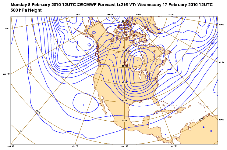
More cold air on the way next week!?

General Weather Discussions and Analysis
biggerbyte
Posts: 1142
Joined: Thu Feb 04, 2010 12:15 am
Location: Porter, Texas. (Montgomery County)
Contact:

wxman57 wrote:
biggerbyte wrote:The only way, in this case, to get an accurate forecast for the upcoming event, is to wait until Wednesday evening. There are too many variables to make a call. Having said that, I will say that I don't see how we in s.e Texas could have anything like the potentials for DFW, but it is still to early to say that we will not see some sleet of more than just the scattered variety. Everything everyone is saying at this point can be nothing more than mere speculation.

Wednesday night... Let's make the call.
It's easy for a meteorologist to make a perfect forecast if he's allowed to wait until the event is happening to issue our forecast. However, we don't have that luxury. We must make a 3-5 day forecast for our clients, regardless of our confidence in the potential event. A forecast is always what the meteorologist thinks is most likely to happen. For now, that "most likely" event would be cold rain with a little sleet mixed in at firs.
Hey, I like your bike. :)

Anyway, my statements mainly apply to the folks in this forum.
I would add one thing to your statement though.. Most forecasters I've known let it be known that anything they forecast beyond three days is speculative. Even Doc would always mention that we need to wait and see. The late Harold Taft would not even give a forecast more than three days out. It is just not accurate.

Having said that.... I just don't see the point of giving someone a forecast that can not be relied on. The extended portion will change. Would it not make more sense to pay for accuracy, vs. speculation? We've even had short range forecast bust big time when folks relied too heavily on the models.

With all due respect my friend, and I don't mean to be rude, but I have to say that even though I agree that there is a service to be provided for folks willing to pay for it, that does not mean they are getting their monies worth. But hey, if the client does not mind paying for an inaacurate long range forecast, that is up to them.. Right? At any rate... I'm just trying to make a point, and I know some of you don't agree with me. However, I can tell you that many big names in the industry do. I've already mentioned two of them.
User avatar
wxman57
Global Moderator
Global Moderator
Posts: 2621
Joined: Thu Feb 04, 2010 5:34 am
Location: Southwest Houston (Westbury)
Contact:

biggerbyte wrote:
Hey, I like your bike. :)

Anyway, my statements mainly apply to the folks in this forum.
I would add one thing to your statement though.. Most forecasters I've known let it be known that anything they forecast beyond three days is speculative. Even Doc would always mention that we need to wait and see. The late Harold Taft would not even give a forecast more than three days out. It is just not accurate.

Having said that.... I just don't see the point of giving someone a forecast that can not be relied on. The extended portion will change. Would it not make more sense to pay for accuracy, vs. speculation? We've even had short range forecast bust big time when folks relied too heavily on the models.

With all due respect my friend, and I don't mean to be rude, but I have to say that even though I agree that there is a service to be provided for folks willing to pay for it, that does not mean they are getting their monies worth. But hey, if the client does not mind paying for an inaccurate long range forecast, that is up to them.. Right? At any rate... I'm just trying to make a point, and I know some of you don't agree with me. However, I can tell you that many big names in the industry do. I've already mentioned two of them.
The bike in the 1989 photo is an old cheap Trek 400. My current bike is a custom-built one by Dave Tesch out of San Marcos, CA. But that's for another forum.

Yeah, I understand your point about your statements pertaining to non-mets making predictions on the forum. It's often hard to distinguish between a wishcast of snow and a well thought-out prediction.

Whenever we approach a potential client about providing a weather service, we try to determine how bad weather causes them problems (costs them money) if they're not properly prepared. Most of our business deals with the hurricane threat, where we can provide quite valuable guidance for a refinery trying to determine if millions of dollars should be spent to shut down or not. For winter weather, it's the utilities that have to schedule repair crews 3-5 days in advance. Or it may be a major retailer planning future supply routes for its trucks. Adding value that does save substantial money for our clients is not an easy task, but it's certainly possible with a thorough knowledge of the client's weather issues and a good long-range heads-up.
User avatar
srainhoutx
Site Admin
Site Admin
Posts: 19616
Joined: Tue Feb 02, 2010 2:32 pm
Location: Maggie Valley, NC
Contact:

Candy Cane wrote:The low, according to HPC, wants to track right over head. It should also be mentioned that the HPC has no hatched areas across Texas for significant snowfall. Grant it, they only go out to day 3, but that will be something to watch for...

It will be interesting to see the Updated Storm Tracks from the HPC around 19Z.
Carla/Alicia/Jerry(In The Eye)/Michelle/Charley/Ivan/Dennis/Katrina/Rita/Wilma/Humberto/Ike/Harvey

Member: National Weather Association
Facebook.com/Weather Infinity
Twitter @WeatherInfinity
User avatar
wxdata
Site Admin
Site Admin
Posts: 1059
Joined: Wed Feb 03, 2010 3:04 pm
Location: Houston, TX
Contact:

San Antonio/Austin NWS:

Either small hail or sleet falling in Round Rock.
User avatar
Portastorm
Posts: 800
Joined: Wed Feb 03, 2010 3:04 pm
Location: Southwest Austin/Oak Hill, TX
Contact:

It is hail. Our air temps were in the mid 60s up until about 10 minutes ago.

I think the front is arriving here in AUS. Rain coming down sideways downtown and gusty winds. Here's hoping the next time it precipitates here, it's frozen and not liquid!
User avatar
wxdata
Site Admin
Site Admin
Posts: 1059
Joined: Wed Feb 03, 2010 3:04 pm
Location: Houston, TX
Contact:

Portastorm wrote:It is hail. Our air temps were in the mid 60s up until about 10 minutes ago.

I think the front is arriving here in AUS. Rain coming down sideways downtown and gusty winds. Here's hoping the next time it precipitates here, it's frozen and not liquid!

The thinking it is sleet comes from the NWS.
User avatar
Portastorm
Posts: 800
Joined: Wed Feb 03, 2010 3:04 pm
Location: Southwest Austin/Oak Hill, TX
Contact:

Uh, scratch that ... hail is coming down now!!
User avatar
srainhoutx
Site Admin
Site Admin
Posts: 19616
Joined: Tue Feb 02, 2010 2:32 pm
Location: Maggie Valley, NC
Contact:

RE: Longer Range. The ECMWF continues to advertise we will be stuck in this pattern for a while...

Image

Image
Carla/Alicia/Jerry(In The Eye)/Michelle/Charley/Ivan/Dennis/Katrina/Rita/Wilma/Humberto/Ike/Harvey

Member: National Weather Association
Facebook.com/Weather Infinity
Twitter @WeatherInfinity
User avatar
wxdata
Site Admin
Site Admin
Posts: 1059
Joined: Wed Feb 03, 2010 3:04 pm
Location: Houston, TX
Contact:

Interesting area of high winds just north of Giddings. BV suggest 60+ kts.
User avatar
wxdata
Site Admin
Site Admin
Posts: 1059
Joined: Wed Feb 03, 2010 3:04 pm
Location: Houston, TX
Contact:

This area is sliding eastward:


SPECIAL WEATHER STATEMENT
NATIONAL WEATHER SERVICE AUSTIN/SAN ANTONIO TX
200 PM CST MON FEB 8 2010

TXZ173-192>194-209-082100-
BASTROP-FAYETTE-LEE-TRAVIS-WILLIAMSON-
200 PM CST MON FEB 8 2010

...STRONG THUNDERSTORMS WERE AFFECTING BASTROP...FAYETTE...LEE...
TRAVIS AND WILLIAMSON COUNTIES...

AT 155 PM CST...NWS METEOROLOGISTS ARE TRACKING STRONG THUNDERSTORMS
7 MILES SOUTHWEST OF BASTROP...NEAR LINCOLN...AND NEAR TAYLOR MOVING
NORTHEAST AT 25 MPH. PEA SIZE HAIL HAS ALREADY REPORTED NEAR BASTROP
COUNTY FROM ONE OF THESE STORMS.
User avatar
Portastorm
Posts: 800
Joined: Wed Feb 03, 2010 3:04 pm
Location: Southwest Austin/Oak Hill, TX
Contact:

Okee-doke. Not sure if it was hail or sleet but whatever it was, it fell for about 5 minutes here in downtown Austin. Done now. Temperature has dropped 12 degrees in the last 30 minutes!
User avatar
wxdata
Site Admin
Site Admin
Posts: 1059
Joined: Wed Feb 03, 2010 3:04 pm
Location: Houston, TX
Contact:

SPECIAL WEATHER STATEMENT
NATIONAL WEATHER SERVICE HOUSTON/GALVESTON TX
220 PM CST MON FEB 8 2010

TXZ195>197-082115-
BRAZOS-BURLESON-WASHINGTON-
220 PM CST MON FEB 8 2010

...SIGNIFICANT WEATHER ADVISORY...

AT 215 PM CST...NATIONAL WEATHER SERVICE DOPPLER RADAR INDICATED A
STRONG THUNDERSTORM 12 MILES SOUTH OF CALDWELL...MOVING EAST AT 25
MPH.

PEA SIZE HAIL...WINDS GREATER THAN 40 MPH...FREQUENT CLOUD TO GROUND
LIGHTNING...BRIEF HEAVY DOWNPOURS...ARE POSSIBLE WITH THIS STORM.

LOCATIONS IN THE PATH OF THIS STORM INCLUDE...WELLBORN...
WASHINGTON...MILLICAN...INDEPENDENCE...WIXON VALLEY...SNOOK...COLLEGE
STATION...CALDWELL AND BRYAN.
gregco31
Posts: 20
Joined: Mon Feb 08, 2010 2:21 pm
Contact:

Same system different city.
I am flying to Philly on Wednesday morning early and I wanted to check the weather. This trip needs to happen for me so awful weather is awful news.
User avatar
wxman57
Global Moderator
Global Moderator
Posts: 2621
Joined: Thu Feb 04, 2010 5:34 am
Location: Southwest Houston (Westbury)
Contact:

Portastorm wrote:Uh, scratch that ... hail is coming down now!!
There! You can pretend it's sleeting!
User avatar
wxdata
Site Admin
Site Admin
Posts: 1059
Joined: Wed Feb 03, 2010 3:04 pm
Location: Houston, TX
Contact:

Houston NWS:

pea to dime size hail in storm in Burleson County reported by EM.
User avatar
wxman57
Global Moderator
Global Moderator
Posts: 2621
Joined: Thu Feb 04, 2010 5:34 am
Location: Southwest Houston (Westbury)
Contact:

gregco31 wrote:Same system different city.
I am flying to Philly on Wednesday morning early and I wanted to check the weather. This trip needs to happen for me so awful weather is awful news.
I'm sorry, but it's looking like there is a high probability of a major snow storm raging in Philadelphia Wednesday morning. It's very likely that the airport will be closed from tomorrow night until Thursday morning.
User avatar
Portastorm
Posts: 800
Joined: Wed Feb 03, 2010 3:04 pm
Location: Southwest Austin/Oak Hill, TX
Contact:

wxman57 wrote:
Portastorm wrote:Uh, scratch that ... hail is coming down now!!
There! You can pretend it's sleeting!
Gee, thanks! :roll:

Listen, the way my luck has gone this winter, that indeed may be all I get to see in the frozen precip department!
User avatar
wxdata
Site Admin
Site Admin
Posts: 1059
Joined: Wed Feb 03, 2010 3:04 pm
Location: Houston, TX
Contact:

Pea sized hail reported just north of San Antonio. That's part of the line heading our way.
HannahMontana
Posts: 9
Joined: Thu Feb 04, 2010 4:49 pm
Contact:

I'm in San Marcos, good chance I'll see some hail in a few minutes. The sky is really dark and lots of booming thunder, which means lots of instability, and temps aloft are pretty cold compared to a late-spring or summertime thunderstorm..
User avatar
wxdata
Site Admin
Site Admin
Posts: 1059
Joined: Wed Feb 03, 2010 3:04 pm
Location: Houston, TX
Contact:

HannahMontana wrote:I'm in San Marcos, good chance I'll see some hail in a few minutes. The sky is really dark and lots of booming thunder, which means lots of instability, and temps aloft are pretty cold compared to a late-spring or summertime thunderstorm..
A few strong cells in you vicinity right now.
Post Reply
  • Information