
To be fair the the 06Z GFS is showing 2 meter temps of highs in the upper 60's and lows in the mid to upper 40's.biggerbyte wrote:LOL
Yet another lesson in long range forecasting. NWS has moved from a good chance of rain and highs in the 60s, to little rain with highs in the 70s with this front. Harold Taft's two to three day window philosophy will never die.We'll see about post frontal rainfall in another day or two.
October- Cool Mornings & Mild Days To End The Month
-
srainhoutx

- Site Admin

- Posts: 19616
- Joined: Tue Feb 02, 2010 2:32 pm
- Location: Maggie Valley, NC
- Contact:
Carla/Alicia/Jerry(In The Eye)/Michelle/Charley/Ivan/Dennis/Katrina/Rita/Wilma/Humberto/Ike/Harvey
Member: National Weather Association
Facebook.com/Weather Infinity
Twitter @WeatherInfinity
Member: National Weather Association
Facebook.com/Weather Infinity
Twitter @WeatherInfinity
-
wxman57

- Global Moderator

- Posts: 2621
- Joined: Thu Feb 04, 2010 5:34 am
- Location: Southwest Houston (Westbury)
- Contact:
I got to visit with Harold Taft at KXAS in the summer of 1979 while storm chasing with a friend of mine who's father worked at the station. Saw him prepare the weather maps for the afternoon broadcast. Giant U.S. maps maybe 4ft high and 6ft long, all colored by hand in chalk. No green screen wizardry back then. Wish I'd have asked for one as a souvenir.biggerbyte wrote:LOL
Yet another lesson in long range forecasting. NWS has moved from a good chance of rain and highs in the 60s, to little rain with highs in the 70s with this front. Harold Taft's two to three day window philosophy will never die.
-
biggerbyte
- Posts: 1142
- Joined: Thu Feb 04, 2010 12:15 am
- Location: Porter, Texas. (Montgomery County)
- Contact:
I miss Mr. Taft greatly. Greatest weatherman was an understatement for him. He, like Doc, was so old fashioned, and very accurate. Hardly ever wrong. His stubbornness about sticking with what we can know, vs. what we think we know has stuck with me all these years. God rest his soul.
Srain, we'll see about the 60s. This front could end up a mere duplicate of last. Post frontal rainfall with this front is still in question though, IMHO.
Srain, we'll see about the 60s. This front could end up a mere duplicate of last. Post frontal rainfall with this front is still in question though, IMHO.
-
srainhoutx
- Site Admin
- Posts: 19616
- Joined: Tue Feb 02, 2010 2:32 pm
- Location: Maggie Valley, NC
- Contact:
The front is making some headway this morning in the Texas Panhandle. I even see some snow flying in the Southern Rockies at this hour heading S into N New Mexico. Frontal timing looks to be tomorrow afternoon with light rain showers, post frontal. There make be a few storms along the frontal trough to our N and E tomorrow afternoon with some peak heating. We will see.

Carla/Alicia/Jerry(In The Eye)/Michelle/Charley/Ivan/Dennis/Katrina/Rita/Wilma/Humberto/Ike/Harvey
Member: National Weather Association
Facebook.com/Weather Infinity
Twitter @WeatherInfinity
Member: National Weather Association
Facebook.com/Weather Infinity
Twitter @WeatherInfinity
-
srainhoutx
- Site Admin
- Posts: 19616
- Joined: Tue Feb 02, 2010 2:32 pm
- Location: Maggie Valley, NC
- Contact:
Morning e-mail from Jeff:
Strong cold front heading for Texas
Chance for rainfall increasing Thursday
Significant weather change from warm and dry to cold and somewhat wet over the next 24-36 hours as a strong Canadian front moves across TX. Cold front is currently located over the TX panhandle this morning and is moving southward and should reach into central TX overnight and SE TX on Thursday. Ahead of the front a warm and moist air mass is in place and deeper moisture will be transported into the region starting later today into early Thursday. Even with the deeper moisture the mid levels remain fairly dry and the coverage of rainfall along and behind the front will be widespread but with fairly meager amounts.
Strong front should slowly move across the area Thursday as the shallow air mass undercuts the warmer air mass. A few showers and maybe a thunderstorms will be possible along the leading edge of the front. Better chances for rainfall come behind the boundary as the warm moist air mass is forced up and over the cooler surface dome by a lagging upper level trough to the west Thursday night into early Friday. General light to at times moderate rainfall will be possible post front. Total accumulations of .25-.50 of an inch is likely with a few isolated locations possibility seeing 1 inch of rainfall.
Decent cold air advection will onset post front with gusty NW winds of 20-25mph and a rapid temperature fall during the afternoon on Thursday. Temperatures ahead of the front will be in the 80’s and fall quickly into the 60’s behind the front and even into the upper 50’s around College Station by late Thursday afternoon. Cold air will continue to advect into the area Thursday night with light rainfall and gusty winds making it feel chilly.
Starting to look like it may be hard to break out the frontal inversion on Friday with moisture trapped in the lowest levels so this may linger clouds much longer than currently expected which will result in significantly lower temperatures on Friday. Current highs near 70 could be a good 10 degrees too warm if clouds linger much of the day.
Clear skies will be in place by Friday evening and with a cold and dry air mass in place lows will fall into the low to mid 40’s for most areas. A cool October weekend is in store for the region with lows in the 40’s and highs in the lower 70’s.
Forecast models diverge once again early next week with the ECMWF showing a potent upper level low trough driving across TX and OK while the GFS shows a much flatten pattern. ECMWF is a lonely outlier with its strong solution which could bring a bout a severe weather to TX, but will side with the weaker and more progressive GFS solution and keep a generally dry and slow warming trend from the late weekend into early next week.
Carla/Alicia/Jerry(In The Eye)/Michelle/Charley/Ivan/Dennis/Katrina/Rita/Wilma/Humberto/Ike/Harvey
Member: National Weather Association
Facebook.com/Weather Infinity
Twitter @WeatherInfinity
Member: National Weather Association
Facebook.com/Weather Infinity
Twitter @WeatherInfinity
-
srainhoutx
- Site Admin
- Posts: 19616
- Joined: Tue Feb 02, 2010 2:32 pm
- Location: Maggie Valley, NC
- Contact:
The 12Z NAM has come in a touch wetter and keeps cloud cover around throughout the day on Friday. Looks like a nice fall weekend ahead as well. It's almost November. Perhaps someone would like to start a new thread to carry us into a new month...and hopefully bring some rain with it as well... 
Carla/Alicia/Jerry(In The Eye)/Michelle/Charley/Ivan/Dennis/Katrina/Rita/Wilma/Humberto/Ike/Harvey
Member: National Weather Association
Facebook.com/Weather Infinity
Twitter @WeatherInfinity
Member: National Weather Association
Facebook.com/Weather Infinity
Twitter @WeatherInfinity
Srainhoutx - do you have the live link to that map? I would like to save it in my favs here at work.srainhoutx wrote:The front is making some headway this morning in the Texas Panhandle. I even see some snow flying in the Southern Rockies at this hour heading S into N New Mexico. Frontal timing looks to be tomorrow afternoon with light rain showers, post frontal. There make be a few storms along the frontal trough to our N and E tomorrow afternoon with some peak heating. We will see.
http://weather.rap.ucar.edu/surface/201 ... rs_abi.gif
Thank you.
-
srainhoutx
- Site Admin
- Posts: 19616
- Joined: Tue Feb 02, 2010 2:32 pm
- Location: Maggie Valley, NC
- Contact:
http://weather.rap.ucar.edu/surface/dis ... duration=0ticka1 wrote:
Srainhoutx - do you have the live link to that map? I would like to save it in my favs here at work.
Thank you.
Carla/Alicia/Jerry(In The Eye)/Michelle/Charley/Ivan/Dennis/Katrina/Rita/Wilma/Humberto/Ike/Harvey
Member: National Weather Association
Facebook.com/Weather Infinity
Twitter @WeatherInfinity
Member: National Weather Association
Facebook.com/Weather Infinity
Twitter @WeatherInfinity
-
biggerbyte
- Posts: 1142
- Joined: Thu Feb 04, 2010 12:15 am
- Location: Porter, Texas. (Montgomery County)
- Contact:
Thanks guys for those updates. It looks like Fridays cloud cover may indeed hold our temps in the 60s. Low 70s if we get a break from the clouds. I'm sure wxman will tell you cold is cold, whether it is from a front, or lack of sunshine. LOL We'll see how much of the wet stuff we can squeeze out of this event.
-
srainhoutx
- Site Admin
- Posts: 19616
- Joined: Tue Feb 02, 2010 2:32 pm
- Location: Maggie Valley, NC
- Contact:
Things are looking a bit more promising in the post frontal rain department this afternoon... 
AREA FORECAST DISCUSSION
NATIONAL WEATHER SERVICE HOUSTON/GALVESTON TX
226 PM CDT WED OCT 26 2011
.DISCUSSION...
UNSEASONABLY WARM AND HUMID CONDITIONS PERSIST OVER SE TX TODAY
WITH ONSHORE FLOW IN PLACE. A FEW STREAMER SHOWERS WILL CONTINUE
TO DEVELOP OVER THE COASTAL WATERS WITH THE POSSIBILITY OF A FEW
OF THESE PUSHING ONSHORE. LOW STRATUS WILL DEVELOP LATE
TONIGHT/EARLY THURSDAY ESPECIALLY OVER NRN/WRN ZONES. PATCHY FOG
WILL DEVELOP AS WELL MAINLY OVER RURAL AREAS. 12Z MODEL RUNS HAVE
TRENDED SLOWER WITH THE MOVEMENT OF THE FRONT ON THURSDAY.
FOLLOWED THE 12Z NAM CLOSELY FOR THE FORECAST THURSDAY/THURSDAY
EVENING. THE FRONT WILL REACH OUR NRN ZONES AROUND 15Z THEN PUSH
VERY SLOWLY THROUGH THE CWA...MOVING THROUGH THE HOUSTON AREA
21-23Z AND OFF THE COAST 01-04Z FRIDAY. HAVE RAISED TEMPS OVER
MOST OF THE AREA THURSDAY GIVEN THE SLOWER MOVEMENT. MOISTURE WILL
DEEPEN OVER THE AREA WITH PWS INCREASING TO 1.4-1.6 INCHES ALONG
THE FRONT. EXPECT SCATTERED CONVECTION TO DEVELOP ALONG THE FRONT.
HOWEVER...THE BEST CHANCE OF PRECIP WILL BE LATE THU AFTN/THURSDAY
EVENING IN THE WAKE OF THE FRONT AS ISENTROPIC LIFT DEVELOPS ABOVE
THE SHALLOW COOL LAYER AT THE SFC. HAVE KEPT HIGH CHANCE POPS MOST
AREAS BUT DID RAISE NRN ZONES TO LIKELY THURSDAY EVENING. PRECIP
WILL BE MOSTLY STRATIFORM RAIN WITH EMBEDDED THUNDER. AMOUNTS WILL
AVERAGE ON THE LIGHT SIDE (0.25-0.50 INCH) WITH LOCALLY HIGHER
TOTALS POSSIBLE. STRATUS DECK WILL PERSIST IN THE WAKE OF THE
FRONT THURSDAY NIGHT WHICH WILL KEEP TEMPS UP SOMEWHAT. MODELS
SHOW THE LOW CLOUDS LINGERING MUCH OF THE DAY FRIDAY WHICH WILL
KEEP MAX TEMPS IN THE 60S. SKIES SHOULD CLEAR FROM WEST TO EAST BY
FRIDAY EVENING.
SURFACE HIGH WILL BUILD ACROSS SE TX THIS WEEKEND RESULTING IN
FANTASTIC WEATHER: CLEAR SKIES...LOW HUMIDITIES...AND COOL
TEMPERATURES. ALL OF THE MODELS SHOW AT LEAST A WEAK REINFORCING
FRONT PUSHING THROUGH THE AREA SUNDAY NIGHT OR EARLY MONDAY. THE
ECMWF REMAINS MUCH STRONGER WITH THIS FRONT (AND UPPER TROUGH)
THAN THE OTHER MODELS...HOWEVER THE 12Z ECMWF IS WEAKER THAN ITS
PREVIOUS RUNS. HAVE STAYED WITH THE GFS SOLUTION THIS
WEEKEND/EARLY NEXT WEEK. OVERALL...THE WEATHER NEXT WEEK LOOKS
GREAT WITH SKIES REMAINING MOSTLY CLEAR AND HUMIDITIES STAYING LOW.
A SLOW WARMING TREND CAN BE EXPECTED BEGINNING MONDAY...BUT
OVERALL TEMPERATURES WILL REMAIN VERY PLEASANT NEXT WEEK.
Carla/Alicia/Jerry(In The Eye)/Michelle/Charley/Ivan/Dennis/Katrina/Rita/Wilma/Humberto/Ike/Harvey
Member: National Weather Association
Facebook.com/Weather Infinity
Twitter @WeatherInfinity
Member: National Weather Association
Facebook.com/Weather Infinity
Twitter @WeatherInfinity
-
srainhoutx
- Site Admin
- Posts: 19616
- Joined: Tue Feb 02, 2010 2:32 pm
- Location: Maggie Valley, NC
- Contact:
Morning e-mail from Jeff:
Much advertised cold front moving across TX this morning with significantly colder conditions moving southward.
At 600am the cold front extended from SE OK to just north of Austin to NW of Del Rio and slowly moving southward. South of this boundary temperatures are in the upper 60’s to near 70 while north of the boundary temperatures fall into the 40’s and 50’s including 44 at Wichita Falls and 32 with 1 mile visibility in light snow at Amarillo. Across SE TX increasing Gulf moisture is resulting in a few streamer showers over Matagorda and Wharton counties and across the Bolivar Peninsula this morning. High resolution meso models show additional activity developing late this morning and early afternoon streaming inland off the western Gulf as moisture slowly deepens. Rainfall amounts today will be spotty and generally less than .25 of an inch.
Front will reach our NW set of counties around CLL around noon and pass off the coast near midnight…a slow mover. Surface cold dome will build southward behind the surface front with temperatures falling into the 60’s and then the 50’s after dark. Lagging upper level trough and associated 850mb front will result in warm moist Gulf air mass being pulled northward over the top of the cooler surface air allowing for a period of favorable lifting and more widespread rains behind the surface front and ahead of the 850mb front. While coverage is expected to be widespread (60-80%), the amounts will be on the lower side as main rain form will be light with moderate embedded showers. Totals amounts today through early Friday will average .25 to .50 of an inch with a few isolated amounts of .75 to 1 inch possible mainly east of I-45.
Clouds will be hard to break on Friday as a thick low level stratus deck encompasses the area and becomes trapped under the frontal inversion. Temperatures will warm little with the clouds and highs in the low to mid 60’s appear likely. Areas where the clouds clear earliest could see highs into the lower 70’s. However looking at upstream temperatures this morning this air mass may be slightly colder than models are showing and with cold air advection continuing on Friday it will feel cool to cold.
Skies will clear Friday night and winds go calm as surface high pressure builds overhead allowing for excellent cooling conditions. Temperatures will fall toward the dewpoints in the lower 40’s and expect widespread lows in the low to mid 40’s with the colder locations possibly into the upper 30’s. Highs over the weekend will be in the 70’s under sunny skies.
Slow warming trend will continue into next week with models now in very good agreement on no frontal passage on Monday as the ECMWF has abandoned its idea of a strong upper level low/trough over TX on Halloween. Instead as suspected yesterday the ECMWF has fallen in line with the drier and warmer models. After today there will be little chance of rain through much of next week and the drought will continue to worsen.
Note: Tomball is now running a rainfall deficit of -38.43 inches for the period from October 1, 2010 to October 24, 2011
Although October 2011 has seen more rainfall than we have become use to over the past several months, it is typically one of our wetter months of the year and even with the rains we have seen this month most locations are running deficits of 1 to 2 inches for this October. On average after October we move toward our drier time of year (Nov-Mar) and given the formation of La Nina currently rainfall amounts for the next 3-4 months will likely run 40-50% below normal only worsening an already extremely severe drought situation. It is becoming increasingly likely that we will enter into next spring and summer with lake levels even lower than they currently are at this time! I will get out an updated drought statement next week.
Snow in Amarillo:
Carla/Alicia/Jerry(In The Eye)/Michelle/Charley/Ivan/Dennis/Katrina/Rita/Wilma/Humberto/Ike/Harvey
Member: National Weather Association
Facebook.com/Weather Infinity
Twitter @WeatherInfinity
Member: National Weather Association
Facebook.com/Weather Infinity
Twitter @WeatherInfinity

-
srainhoutx
- Site Admin
- Posts: 19616
- Joined: Tue Feb 02, 2010 2:32 pm
- Location: Maggie Valley, NC
- Contact:
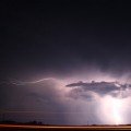
The 12Z WRF is coming in just a bit wetter for our area this afternoon/evening...
- Attachments
-
Carla/Alicia/Jerry(In The Eye)/Michelle/Charley/Ivan/Dennis/Katrina/Rita/Wilma/Humberto/Ike/Harvey
Member: National Weather Association
Facebook.com/Weather Infinity
Twitter @WeatherInfinity
Member: National Weather Association
Facebook.com/Weather Infinity
Twitter @WeatherInfinity
-
tireman4

- Global Moderator
- Posts: 4496
- Joined: Wed Feb 03, 2010 9:24 pm
- Location: Humble, Texas
- Contact:
The front is coming....
http://www.wunderground.com/wundermap/
Around Crockett, I believe at this hour.....11:38 am
http://www.wunderground.com/wundermap/
Around Crockett, I believe at this hour.....11:38 am
-
srainhoutx
- Site Admin
- Posts: 19616
- Joined: Tue Feb 02, 2010 2:32 pm
- Location: Maggie Valley, NC
- Contact:
Pre frontal trough/wind shift (NNW) through Brenham now. Cooler air is lagging about an hour or so behind with the actual Cold front.
Carla/Alicia/Jerry(In The Eye)/Michelle/Charley/Ivan/Dennis/Katrina/Rita/Wilma/Humberto/Ike/Harvey
Member: National Weather Association
Facebook.com/Weather Infinity
Twitter @WeatherInfinity
Member: National Weather Association
Facebook.com/Weather Infinity
Twitter @WeatherInfinity
Where is the cold front? I am sitting here waiting for it. If we can't get rain, I want cold! 
-
srainhoutx
- Site Admin
- Posts: 19616
- Joined: Tue Feb 02, 2010 2:32 pm
- Location: Maggie Valley, NC
- Contact:
The front is between DT and Hobby sloooowy creeping S and E. The 'cooler air' is beginning to spill S across the Hill Country and the Piney Woods where temps have dropped into the upper 40's and low 50's.mckinne63 wrote:Where is the cold front? I am sitting here waiting for it. If we can't get rain, I want cold!
Carla/Alicia/Jerry(In The Eye)/Michelle/Charley/Ivan/Dennis/Katrina/Rita/Wilma/Humberto/Ike/Harvey
Member: National Weather Association
Facebook.com/Weather Infinity
Twitter @WeatherInfinity
Member: National Weather Association
Facebook.com/Weather Infinity
Twitter @WeatherInfinity
-
redneckweather
- Posts: 1023
- Joined: Mon Feb 08, 2010 7:29 pm
- Location: Montgomery, Texas
- Contact:
Secong gully washer since 5 this evening here at my house right now. I wasn't expecting this much rain and looks like more on the way. Nice!
It's the perfect night, rain and coldredneckweather wrote:Secong gully washer since 5 this evening here at my house right now. I wasn't expecting this much rain and looks like more on the way. Nice!

Just wanted to carry that wonderful image (thanks Ed!!) onto this new page. History repeats. Bucket's back where it belongs... probably for good.Ed Mahmoud wrote:With a chance of post-frontal showers, its a good thing the Thursday night game time kept us from purchasing tickets to the 2011 Battle of the Bayou Bucket. It'll be on FSN instead.

Only 0.1" up here overnight.
-
- Information
-
Who is online
Users browsing this forum: Ahrefs [Bot], don, kelleyne, Semrush [Bot] and 29 guests