

August 2026
-
Cromagnum
- Posts: 3092
- Joined: Thu Feb 03, 2011 10:42 pm
- Location: Georgetown
- Contact:
Local mets calling for a chance of rain Wednesday. I know better though.
-
Ptarmigan
- Statistical Specialist

- Posts: 4548
- Joined: Wed Feb 03, 2010 7:20 pm
- Contact:
I suspect the instruments at KSGR needs to be calibrated.davidiowx wrote: ↑Sun Aug 23, 2026 11:33 amNothing is broken, if you aren’t familiar with the area, KSGR is literally surrounded by marsh/swamp. It’s going to have a “wetter” surface climate. I’m in the Pecan Grove area it far away and I hit 105.6 with a dew point 77+ all day. Heat index was well into the 120s
-
Ptarmigan
- Statistical Specialist
- Posts: 4548
- Joined: Wed Feb 03, 2010 7:20 pm
- Contact:
I take long range forecast with a grain of salt.

-
Stratton20
- Posts: 5892
- Joined: Tue Feb 09, 2021 11:35 pm
- Location: College Station, Texas
- Contact:
ABC13 has 20-40 % faily rain chances starting this weekend through the remainder of there 10 day outlook
-
DoctorMu

- Posts: 8138
- Joined: Sun Jun 28, 2015 11:58 am
- Location: College Station
- Contact:
Just a little tease. Maybe on Thursday?
https://radar.weather.gov/ridge/standar ... 7694136963
In the meantime...
https://radar.weather.gov/ridge/standar ... 7694136963
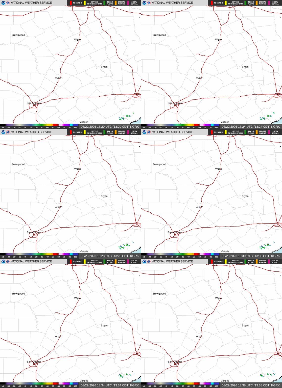
In the meantime...
- Attachments
-
- 777515965_10166574925337069_4546356226459395533_n.jpg
- (129.95 KiB) Not downloaded yet
-
captainbarbossa19

- Pro Met

- Posts: 464
- Joined: Mon Jun 28, 2021 2:50 pm
- Location: Conroe, TX
- Contact:
I think we are finished with triple digit temps after tomorrow in the Houston metro. Ridge starts breaking down and rain chances come up. It's also getting more difficult to heat up as much due to the changing sun angle.
-
Stratton20
- Posts: 5892
- Joined: Tue Feb 09, 2021 11:35 pm
- Location: College Station, Texas
- Contact:
I was just about to say, models are really going bye bye with the ridge, upper air pattern on the GFS would really draw in a lot of moisture into texas with a strong trough setting up over the western/ central US , ridge gets completely crushed
-
DoctorMu
- Posts: 8138
- Joined: Sun Jun 28, 2015 11:58 am
- Location: College Station
- Contact:
Ridging wanes near the beginning of September, but some models/Ensemble show a comeback around September 8-10.
100s in early and mid September in College Station are possible can even common. 17 100°F days in 2023. Tied for our all-time high of 112.5°F with multiple days in 2023 is September 4, 2000.
Having said that I see mid to upper 90s after tomorrow as well. 20-40% change of rain from tomorrow-Saturday. Αt least this afternoon was cloudy.
100s in early and mid September in College Station are possible can even common. 17 100°F days in 2023. Tied for our all-time high of 112.5°F with multiple days in 2023 is September 4, 2000.
Having said that I see mid to upper 90s after tomorrow as well. 20-40% change of rain from tomorrow-Saturday. Αt least this afternoon was cloudy.
-
Stratton20
- Posts: 5892
- Joined: Tue Feb 09, 2021 11:35 pm
- Location: College Station, Texas
- Contact:
I can say this, whatever ridging enswmbles show in september, it looks very weak, ensemble mean is around 591 DM, our current heat ridge is progged at 597 DM. Im pretty optimistic we will start to see the demise of the heat ridge over the next couple of weeks, that and as captainbarbossa mentioned, sun angle is naturally decreasing as we head towards september , stoll 90’s ahead. But i dont see ridging of this magnitude returning after these next few days
-
Cromagnum
- Posts: 3092
- Joined: Thu Feb 03, 2011 10:42 pm
- Location: Georgetown
- Contact:
Absolute garbage forecasting coming out of Austin. Nearest cell was in Fort Worth and lasted maybe 15 minutes.

-
DoctorMu
- Posts: 8138
- Joined: Sun Jun 28, 2015 11:58 am
- Location: College Station
- Contact:
Yeah, an alleged FROPA is sinking south and could generate a few showers east of I-45 and N of I-10. But, naturally, it's arriving in the dead of night...so I hardly expect but a drop of two. There's a wind shift to the north around noon, but there's return flow by 6 pm.
104°F IMFY; 102°F at the airport.
Maybe isolated showers early next week.
Surely by the winter solstice Texas summer will end.
.DISCUSSION...
Issued at 1156 AM CDT Wed Aug 26 2026
Summer heat continues today as abundant sunshine will lead to
afternoon temperatures reaching into the 100-103 degree range for
most areas along and north of I-10 with areas closer to the coast
remaining in the mid to upper 90s. High dew points will bring heat
indices into the 107-110 degree range for most of the region today,
thus the Heat Advisory remains in place today across the area.
For the first time in awhile, we are looking at the potential for
some late evening/overnight showers and thunderstorms to move into
the area from the north. The dominate high pressure that has been
over the region the past several days is beginning to shift a little
further westward to the Four Corner region. This will bring
northwesterly flow aloft over Texas with embedded disturbances
moving through the flow. The first of these weak disturbances will
push through tonight into Thursday bringing that chance showers
and thunderstorms. As of right now, coverage looks to be fairly
isolated tonight, and remaining mostly north of the I-10 Corridor
- but, I wouldn`t be shocked to see a more scattered coverage of
storms after the past several days of heating and abundant
moisture (PWATs nearing 2-2.2"). Expecting to see an increase in
shower and thunderstorm coverage during the day on Thursday as
daytime heating and passing vort maxes aid in storm development.
Lingering shower and thunderstorm activity will be possible into
Thursday night, especially along and south of I-10, but the bulk
of the activity should push off the coast for Friday. While severe
thunderstorms are not likely the next few days, any thunderstorm
that develops could become strong, producing gusty winds and
locally heavy rainfall. Additional isolated to scattered showers
and thunderstorms will be possible over the weekend as a weak
disturbance moves westward across the northern Gulf.
Turning the focus back onto heat - tomorrow will be a tricky
forecast for the need of a Heat Advisory as it will depend largely
on amount of cloud cover and rainfall coverage. Less activity = more
likely to need a Heat Advisory, more activity = less likely to need
a Heat Advisory. Have opted to not put out a Heat Advisory for
tomorrow at this time, but if forecast trends are for less
shower/thunderstorm activity, then an Advisory may be issued during
later shifts. Regardless, summer-time heat with temperatures in the
90s (and approaching 100 degrees in spots) means to continue to take
precautions against heat-related illnesses: stay hydrated and take
breaks if working outside. Temperatures will continue to slowly cool
(though still hot) through the weekend with high temperatures
generally in the mid 90s.
Fowler
104°F IMFY; 102°F at the airport.
Maybe isolated showers early next week.
Surely by the winter solstice Texas summer will end.
.DISCUSSION...
Issued at 1156 AM CDT Wed Aug 26 2026
Summer heat continues today as abundant sunshine will lead to
afternoon temperatures reaching into the 100-103 degree range for
most areas along and north of I-10 with areas closer to the coast
remaining in the mid to upper 90s. High dew points will bring heat
indices into the 107-110 degree range for most of the region today,
thus the Heat Advisory remains in place today across the area.
For the first time in awhile, we are looking at the potential for
some late evening/overnight showers and thunderstorms to move into
the area from the north. The dominate high pressure that has been
over the region the past several days is beginning to shift a little
further westward to the Four Corner region. This will bring
northwesterly flow aloft over Texas with embedded disturbances
moving through the flow. The first of these weak disturbances will
push through tonight into Thursday bringing that chance showers
and thunderstorms. As of right now, coverage looks to be fairly
isolated tonight, and remaining mostly north of the I-10 Corridor
- but, I wouldn`t be shocked to see a more scattered coverage of
storms after the past several days of heating and abundant
moisture (PWATs nearing 2-2.2"). Expecting to see an increase in
shower and thunderstorm coverage during the day on Thursday as
daytime heating and passing vort maxes aid in storm development.
Lingering shower and thunderstorm activity will be possible into
Thursday night, especially along and south of I-10, but the bulk
of the activity should push off the coast for Friday. While severe
thunderstorms are not likely the next few days, any thunderstorm
that develops could become strong, producing gusty winds and
locally heavy rainfall. Additional isolated to scattered showers
and thunderstorms will be possible over the weekend as a weak
disturbance moves westward across the northern Gulf.
Turning the focus back onto heat - tomorrow will be a tricky
forecast for the need of a Heat Advisory as it will depend largely
on amount of cloud cover and rainfall coverage. Less activity = more
likely to need a Heat Advisory, more activity = less likely to need
a Heat Advisory. Have opted to not put out a Heat Advisory for
tomorrow at this time, but if forecast trends are for less
shower/thunderstorm activity, then an Advisory may be issued during
later shifts. Regardless, summer-time heat with temperatures in the
90s (and approaching 100 degrees in spots) means to continue to take
precautions against heat-related illnesses: stay hydrated and take
breaks if working outside. Temperatures will continue to slowly cool
(though still hot) through the weekend with high temperatures
generally in the mid 90s.
Fowler
-
jasons2k

- Posts: 6212
- Joined: Thu Feb 04, 2010 12:54 pm
- Location: Imperial Oaks
- Contact:
Come on Charlie Brown! You can do it!
-
oleander
- Posts: 43
- Joined: Mon Feb 08, 2010 7:13 pm
- Location: Colorado County
- Contact:
Sunset 8/26/2026
Colorado County Texas
Colorado County Texas
- Attachments
-
- IMG_3810.jpeg
- (2.32 MiB) Not downloaded yet
-
DoctorMu
- Posts: 8138
- Joined: Sun Jun 28, 2015 11:58 am
- Location: College Station
- Contact:
Another bust, Lucy style.
Continued heat near 100°F for the next week.
Same as it ever was...
https://youtu.be/5IsSpAOD6K8?si=B9zyjWohJWALHnw6
-
DoctorMu
- Posts: 8138
- Joined: Sun Jun 28, 2015 11:58 am
- Location: College Station
- Contact:
-
Stratton20
- Posts: 5892
- Joined: Tue Feb 09, 2021 11:35 pm
- Location: College Station, Texas
- Contact:
GFS/ AI GFS, CMC all keep the ridge displaced well east of Texas in september, CMC looks to have a nice trough developing over the central US, things look good for daily rain chances to continue for the foreseeable future, starting later tonight of course
-
cperk
- Posts: 860
- Joined: Sun Aug 19, 2012 12:09 pm
- Location: Richmond
- Contact:
Stratton20 thanks we need some good news (goodbye August)Stratton20 wrote: ↑Thu Aug 27, 2026 11:51 am GFS/ AI GFS, CMC all keep the ridge displaced well east of Texas in september, CMC looks to have a nice trough developing over the central US, things look good for daily rain chances to continue for the foreseeable future, starting later tonight of course

-
JDsGN
- Posts: 175
- Joined: Tue May 23, 2017 10:25 pm
- Location: Cypress TX
- Contact:
I know it an evening event and really was only 30-40% change but this is looking like a big nothing most likely. Hope im wrong.
-
Cpv17
- Posts: 7128
- Joined: Fri Aug 31, 2018 1:58 pm
- Location: El Campo/Wharton
- Contact: