
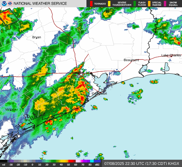
403
FXUS64 KHGX 081807
AFDHGX
Area Forecast Discussion
National Weather Service Houston/Galveston TX
107 PM CDT Tue Jul 8 2025
...New DISCUSSION, AVIATION, MARINE...
.KEY MESSAGES...
Issued at 107 PM CDT Tue Jul 8 2025
- Scattered to widespread showers and thunderstorms are expected
each day through the weekend, and even into early next week
though we should see a downward trend in storm coverage by that
point.
- Isolated strong thunderstorms will lead to gusty winds and localized
downpours. If more than one of these storms moves over the same
area, or happens to fall over an area of poor drainage, then
minor street flooding/ponding will be possible.
- Near seasonal temperatures will persist, but seasonal this time
of year is still hot. Make sure to take breaks if working
outside and stay hydrated.
&&
.DISCUSSION...
Issued at 107 PM CDT Tue Jul 8 2025
Numerous showers and storms are already strewn across Southeast
Texas early this afternoon, and for the next several
days...probably through at least this weekend...today makes a
pretty good template for the forecast. Look for convection to
follow the typical diurnal pattern - offshore pre-dawn, making
its way to the immediate coast in the morning, and spreading
inland through the afternoon, generally increasing in intensity
until the sun goes down enough that everything fades away for a
quiet end to the evening. Temperatures will start from a high
floor thanks to typically humid conditions in the 70s and lower
80s, rising to highs in the low to mid 90s. Just how high you get
depends on if, when, and how strong any storms you see during the
day end up being.
Today`s activity is very clearly getting a boost from an upper
trough making its way in from across the Gulf. Though that trough
will fade out, it`s made a clear weakness in the subtropical ridge
over us, and a parade of troughs in the northern stream will take
advantage. Expect them to dig a little deeper into this weakness
in the subtropical ridge, helping it persist into and likely
through the weekend, with the scattered to numerous storms to show
for it.
This high confidence scenario leads me right into my primary break
from the deterministic NBM output, which presents a (rather
unrealistic) scenario in which we have high rain chances daily,
but also hotter than typical temperatures; even high enough that
taken verbatim, might have me worrying about the heat advisory
threshold. But obviously, cloud cover and convective activity are
going to be a downward pressure on temperatures, so I find it very
unlikely that we see both. For instance, at 1 pm, temperatures
range from the upper 80s all the way down into the upper 70s! This
is definitely not a "Porque no los dos?" situation. And since the
current presence of the upper trough and high confidence in the
stream of northern stream troughs is here, I`m opting to stick
with the higher PoPs.
I`ve largely replaced NBM highs with the 50th percentile/median
NBM numbers, which puts me much closer to seasonal averages and
pulls us back from being unrealistically close to a heat advisory.
Of course, seasonable in SE Texas is still potentially dangerous
for folks sensitive to heat, and for those who are required to
exert themselves strenuously outdoors away from shade. Highs in
the lower 90s and a humid environment will still push the heat
index above 100, and wet bulb globe temperatures into the high
risk range. Fortunately, we should at least have plenty of winners
in the "afternoon rain lottery", and a passing shower will help
make things more comfortable...at least until the sun comes back.
And while we`re on notes of caution, those afternoon storms need
one as well. Storms, by definition, carry lightning and means you
want to be inside of well-constructed shelter to avoid that
threat. But also, "seasonable" storms can also cause localized
issues with gusty winds and heavy rain. Overall, each day`s
activity will be manageable, but the strongest storms of the day
could cause isolated problems if they occur in the wrong spot.
&&
.AVIATION...
(18Z TAF Issuance)
Issued at 107 PM CDT Tue Jul 8 2025
Main focus of this cycle is to handle timing and impacts of
scattered to numerous afternoon storms. Primary change so far is
to slide things up to accommodate slightly earlier start to
activity, and will continue to keep TAFs in line with actual
storms as the afternoon drags on. Also introduced PROB30s for
tomorrow`s development in the IAH extended.
&&
.MARINE...
Issued at 107 PM CDT Tue Jul 8 2025
Daily shower and thunderstorm chances continue through the end of
the week. Though more numerous than usual for the next few days,
they should follow the typical daily pattern of beginning over the
Gulf waters in the pre-dawn hours, then gradually shifting towards
the immediate coast later in the morning and farther inland
through the afternoon. Light to moderate winds and low seas are
expected through Wednesday. Occasionally higher gusts up to 15 to
20 knots are possible. Winds and seas may increase towards the end
of the week. Locally higher winds and seas possible in the
vicinity of any thunderstorm that develops over the bays and Gulf
waters this week.
At the shore, the persistent light to moderate onshore flow will
modestly boost tidal levels and risk of rip currents for the next
couple of days. Beyond that, the expectation for somewhat higher
winds may boost concern about rip current - but, for now,
Galveston Beach Patrol reports they are flying yellow flags.
&&
.PRELIMINARY POINT TEMPS/POPS...
College Station (CLL) 74 91 75 93 / 30 30 10 20
Houston (IAH) 76 92 77 94 / 20 60 10 50
Galveston (GLS) 82 90 81 90 / 20 40 20 40
&&
.HGX WATCHES/WARNINGS/ADVISORIES...
TX...None.
GM...None.
&&
$$
DISCUSSION...Luchs
AVIATION...Luchs
MARINE...Luchs
July 2025
-
tireman4

- Global Moderator

- Posts: 7161
- Joined: Wed Feb 03, 2010 9:24 pm
- Location: Humble, Texas
- Contact:
-
DoctorMu

- Posts: 8091
- Joined: Sun Jun 28, 2015 11:58 am
- Location: College Station
- Contact:
No Death Ridge on the models/Ensembles for the next 14 day. GFS leans to a DR after that...but GFS and 14 day forecast = lol. the Euro and Euro AI are leaning rainier than the rest of the models.
Your Zen Moment: EURO-AI has a FROPA easing into SETX on July 18.
Your Zen Moment: EURO-AI has a FROPA easing into SETX on July 18.
- Attachments
-
- ec-aifs_T2ma_us_42.png
- (130.91 KiB) Downloaded 1356 times
-
DoctorMu
- Posts: 8091
- Joined: Sun Jun 28, 2015 11:58 am
- Location: College Station
- Contact:
I'll allow this.
- Attachments
-
- 814prcp.new.gif
- (939.29 KiB) Downloaded 1351 times
-
jasons2k

- Posts: 6201
- Joined: Thu Feb 04, 2010 12:54 pm
- Location: Imperial Oaks
- Contact:
In the dome today.
- Attachments
-
- IMG_3224.png
- (3.35 MiB) Downloaded 1346 times
-
Stratton20
- Posts: 5870
- Joined: Tue Feb 09, 2021 11:35 pm
- Location: College Station, Texas
- Contact:
DoctorMu one thing ive noticed in the models this summer, is that they have consistently been over doing ridging over texas, especially the GFS with its bog “ death ridge” idea lol, dont wanna jinx it, but definitely hope that trend of over doing ridging continues for the rest of summer lol
-
DoctorMu
- Posts: 8091
- Joined: Sun Jun 28, 2015 11:58 am
- Location: College Station
- Contact:
Not enough weather balloon launches are cutting the legs under the already iffy GFS. Mets and NWS appear to just ignore it more now, especially after the tragedy in Kerr Co.Stratton20 wrote: ↑Tue Jul 08, 2025 2:02 pm DoctorMu one thing ive noticed in the models this summer, is that they have consistently been over doing ridging over texas, especially the GFS with its bog “ death ridge” idea lol, dont wanna jinx it, but definitely hope that trend of over doing ridging continues for the rest of summer lol
-
DoctorMu
- Posts: 8091
- Joined: Sun Jun 28, 2015 11:58 am
- Location: College Station
- Contact:
Even my phone weather app has gone full Euro with low 90s for highs and a chance of rain over a portion of the next 14 days.
-
TxLady

- Posts: 111
- Joined: Thu Feb 04, 2010 8:39 am
- Location: New Waverly, Walker Co., TX
- Contact:
These daily Thunderstorms remind me so much of the early 1970's, growing up in South Houston. Our local swimming pool opened every day at 1:00 pm. It was staffed by our High School Football coach and lifeguards were the Football players. Every dang day, there would come a storm at around 2:00-3:00 pm. Of course, if there's even a hint of lightning or a dark suggestive cloud anywhere near the neighborhood...the pool opening would be delayed or cancelled. My sister and I were in Junior High/Early High School. Any day without swimming pool = no interaction with cute Football players! 
-
Cpv17
- Posts: 7109
- Joined: Fri Aug 31, 2018 1:58 pm
- Location: El Campo/Wharton
- Contact:
-
Ptarmigan

- Statistical Specialist

- Posts: 4536
- Joined: Wed Feb 03, 2010 7:20 pm
- Contact:
Exactly. Core rains are notoriously difficult to forecast. Core rains are not just a Texas problem. I have seen with Hurricane Camille in Virginia and Super Typhoon Nina in China.DoctorMu wrote: ↑Tue Jul 08, 2025 1:35 pm Never, never underestimate warm core storms, especially at night. That's why old salt Mets are an incredibly invaluable resource. They've seen these systems, whether Atlantic or EPAC or Gulf, thwart the models and young buck Mets.
OK, we have the Louisiana wave in SETX and drying radar in the Hill Country at last.
I'm glad to see the NWS forecast leaning heavily with the Euro. College Station has a reasonable shot of rain every day heading into mid July - a rare commodity. And I'm here for that.
-
Ptarmigan
- Statistical Specialist
- Posts: 4536
- Joined: Wed Feb 03, 2010 7:20 pm
- Contact:
Kerr County tragedy already one of the deadliest floods in Texas history
https://www.ksat.com/weather/2025/07/08 ... s-history/
It is now the 4th deadliest flood in Texas history.
https://www.ksat.com/weather/2025/07/08 ... s-history/
It is now the 4th deadliest flood in Texas history.
-
Cromagnum
- Posts: 3076
- Joined: Thu Feb 03, 2011 10:42 pm
- Location: Georgetown
- Contact:
This summer definitely reminds me of Houston summers when I was a kid in the 80s, and I'm in Georgetown and its still acting that way.
-
tireman4
- Global Moderator
- Posts: 7161
- Joined: Wed Feb 03, 2010 9:24 pm
- Location: Humble, Texas
- Contact:
925
FXUS64 KHGX 091059
AFDHGX
Area Forecast Discussion
National Weather Service Houston/Galveston TX
559 AM CDT Wed Jul 9 2025
...New AVIATION...
.KEY MESSAGES...
Issued at 1111 PM CDT Tue Jul 8 2025
- Scattered to widespread showers and thunderstorms are expected
each day through the upcoming weekend.
- Isolated strong thunderstorms will result in gusty winds and
periods of heavy rainfall and could lead to ponding of water
along roadways, as well as minor flooding over poor drainage
and low lying areas.
- Daily high temperatures will continue to be at or just below
seasonal temperatures through the weekend. Regardless, it is
summer in Southeast TX and technically still hot. Make sure to
take breaks if spending time or working outside and stay
hydrated.
&&
.DISCUSSION...
Issued at 1111 PM CDT Tue Jul 8 2025
We will likely continue to see a rather active weather pattern
for the next several days as Southeast TX remains wedged between
two high pressure systems, one situated over SW CONUS and another
one situated over the eastern Gulf, allowing for weaknesses to
pass overhead and a mid-upper level trough to scoot into
northeast TX at times. During the next few days, it will generally
be a "rinse and repeat" scenario with passing showers possible
over the waters and coastal locations during the early to mid
morning hours, followed by stronger and more extensive development
of showers and thunderstorms further inland during the mid
morning to late afternoon hours as diurnal heating and instability
increases. There might be slightly less rain chances on Friday as
drier air moves into the region, but will be short lived as
chances rise again on Saturday.
Over the past couple of days, our heavy showers have been
efficient rain makers with rainfall rate between 2 to 3 inches per
hour at times. Given how PWs will stay mostly between 1.8 to 2.1
inches through the upcoming weekend, expect periods of heavy
rainfall with similar rainfall rates to continue. This could lead
to ponding of water along roadways and minor flooding in low lying
and poor drainage areas. Heavy downpours may occur during the
afternoon commute, thus, make sure to check the radar and traffic
conditions before you depart to your destination. Remember, never
cross flooded roads. In addition, if you plan to spend time or
work outdoors or visit our local beaches, be mindful of lightning
given that it can strike many miles away from the storm. When
thunder roars, head indoors.
In response to the rains and cloud coverage, our high
temperatures for the next several days will remain fairly
seasonable. Expect highs to be mainly in the lower 90s for much of
Southeast TX, along with heat indices in the lower 100s. Slightly
higher heat indices could occur for those who are not in or
around any of the rainfall, and although the heat indices are
expected to stay below the Heat Advisory criteria, it may still
result in elevated heat conditions for some. As for our low
temperatures, expect them to be between the mid to upper 70s
inland and the upper 70s to lower 80s for the coastal locations.
Cotto
&&
.AVIATION...
(12Z TAF Issuance)
Issued at 545 AM CDT Wed Jul 9 2025
Very sparse MVFR CIGs but otherwise VFR conditions broadly
prevail across the area this morning. Scattered showers/isolated
storms are already developing over the Gulf waters this morning.
Storms should move inland and increase in coverage during the
afternoon, later tapering off into the evening as S/SW winds
become light and variable again. Early Thursday morning could see
a few sparse MVFR CIGs, mainly to the north/northwest near KCLL,
though VFR conditions will dominate throughout the period.
03
&&
.MARINE...
Issued at 1111 PM CDT Tue Jul 8 2025
Light to occasionally moderate onshore winds and 2 to 4 foot seas
will prevail for much of the forecast period. Periods of showers
and thunderstorms are expected daily, with the strongest activity
occuring generally during the morning to early afternoon hours,
although a strong storm or two cannot be discarded later during
the day. Stronger storms could lead to periods of strong gusty
winds and outflow boundaries as well as elevated seas.
Persistent onshore flow will result in a moderate risk of rip
currents along the Gulf facing beaches, although strong rip
currents could still develop at times.
Cotto
&&
.PRELIMINARY POINT TEMPS/POPS...
College Station (CLL) 90 73 92 74 / 50 20 20 0
Houston (IAH) 90 75 93 76 / 60 20 40 0
Galveston (GLS) 91 82 91 83 / 50 20 40 10
&&
.HGX WATCHES/WARNINGS/ADVISORIES...
TX...None.
GM...None.
&&
$$
DISCUSSION...Cotto
AVIATION...03
MARINE...Cotto
-
tireman4
- Global Moderator
- Posts: 7161
- Joined: Wed Feb 03, 2010 9:24 pm
- Location: Humble, Texas
- Contact:
In brief: Deadly flooding hit parts of New Mexico yesterday, while significant street flooding occurred in Chicago. Flooding risks should cover the Carolinas through New Jersey today, with a focus on Virginia perhaps. The tropics remain calm.
More flooding, more places
If you live in Ruidoso, New Mexico, you have been under a flash flooding warning over 25 times in the past year and nearly 10 times this year. Last June, the South Fork Fire devastated parts of that region, destroying nearly 1,500 structures. As is often the case after a wildfire, debris flows are serious issues. Basically, all that now loose ground becomes mud and debris and rushes down hills and mountains into rivers and imperils communities. In other words, it's a looming disaster after a disaster. After the Thomas Fire in 2017-18 near Santa Barabra, CA, a debris flow in January in Montecito killed 23 people.
Ruidoso is situated in a location that tends to get summertime thunderstorms during the monsoon and just generally sits in a place where rising air and terrain effects can enhance precipitation. Ruidoso averages nearly 22 inches of precipitation annually, whereas Albuquerque averages less than 10 inches. Yesterday, rainfall of about 2 inches in an hour fell within Ruidoso, with radar estimating higher amounts just west of town.
Radar estimates of rainfall yesterday near Ruidoso, NM. (NOAA NSSL)
All that water pushed through the community. You can see just how quickly this happened. The water rapidly rose around 2-4 PM and by 8 PM, the river was basically back to normal. It happened essentially in a "flash."
The river gauge at Hollywood, just downstream from the town of Ruidoso is what you're looking at above. The river gauge observations are shown below.
River gauge on the Rio Ruidoso at Hollywood showing a rapid rise of 20 feet yesterday as flash flooding commenced downstream from the town. (NOAA)
That's a 20-foot rise in minutes. I'm not going to embed any other video here out of respect for many of our Texas readers still grappling with our own disaster. But you can search Google News, Twitter, or BlueSky for "Ruidoso" and find numerous pictures and videos. The flooding killed three, including two children and caused widespread damage. It also appears that this is the new flood of record for this area.
This Substack is reader-supported. To receive new posts and support our work, consider becoming a free or paid subscriber.
Upgrade to paid
Chicago flooding
A slow-moving thunderstorm with torrential rain sat over the urban core of Chicago last night dumping 2 to 5 inches in short order. Rates of nearly 2 inches per hour were recorded right near the West Loop, and some other gauges had even higher rates. Most impressively, over 5 inches of rain fell in 90 minutes near Garfield Park.
Radar rainfall estimates near Chicago yesterday. Rates of 5 inches in 90 minutes were reported near the West Loop and just east of Garfield Park. (NOAA NSSL)
Damage was mainly due to cars in flooded roads it appears, though water did come close to getting into some homes. No deaths have been reported as of this morning.
Both southeast New Mexico and Chicagoland were in marginal risks (1/4) of excessive rain and flooding yesterday.
More flooding to come?
Yes, more flooding is likely. Today's focus will be in Virginia. Much of the southeast half of Virginia has seen 1 to 3 inches of rain in the last 3 days, with the places just east of the Danville area hit by 4 to 7 inches of rain due to Chantal's remnants the other night.
A moderate risk (3/4) is posted for much of interior Virginia and extreme northern North Carolina for Wednesday. (NOAA WPC)
Much of Virginia, including Danville, Richmond, and Lynchburg are encased in a moderate risk (3/4) of excessive rainfall today. High-resolution weather modeling, such as that from the Storm Prediction Center's HREF model do show the potential for 2 to 5 inches of rain today in pockets across Virginia, as well as perhaps into New Jersey, Delaware, Maryland, or North Carolina.
The SPC's HREF model and its probability matched mean product show the risk of as much as 4 or 5 inches of rain in isolated spots today from the Carolinas into Virginia and Maryland, Delaware, and New Jersey. (NOAA SPC)
Since it seems the footprint definitely goes outside the moderate risk, folks in the slight risk areas will want to be on guard for some rapid onset street flooding today, from the Carolinas north to New Jersey. That HREF model has a thing for Baltimore today, so that may be an area to watch too. But the moderate risk area seems to have the highest probability and highest risks of seeing more widespread activity.
The risk of flooding continues into tomorrow, though the focus may shift into the Plains or Upper Midwest.
Tropics
Model support for something loosely organized continues next week in the northeast Gulf. But if we're really being honest, there's not a whole heck of a lot to zero in on at this point. It's currently just a small signal among some white noise. No news is good news.
- Attachments
-
- Screenshot 2025-07-09 084520.jpg (81.99 KiB) Viewed 2526 times
-
- Screenshot 2025-07-09 084547.jpg (121.63 KiB) Viewed 2526 times
-
- Screenshot 2025-07-09 084634.jpg (110.46 KiB) Viewed 2526 times
-
- Screenshot 2025-07-09 084655.jpg (103.53 KiB) Viewed 2526 times
-
- Screenshot 2025-07-09 084715.jpg (115.99 KiB) Viewed 2526 times
-
- Screenshot 2025-07-09 084731.jpg (217.75 KiB) Viewed 2526 times
-
DoctorMu
- Posts: 8091
- Joined: Sun Jun 28, 2015 11:58 am
- Location: College Station
- Contact:
Yes - Helene and a litany of Atlantic Coast hurricanes when moving north into the Appalachian Mountains.Ptarmigan wrote: ↑Tue Jul 08, 2025 9:09 pmExactly. Core rains are notoriously difficult to forecast. Core rains are not just a Texas problem. I have seen with Hurricane Camille in Virginia and Super Typhoon Nina in China.DoctorMu wrote: ↑Tue Jul 08, 2025 1:35 pm Never, never underestimate warm core storms, especially at night. That's why old salt Mets are an incredibly invaluable resource. They've seen these systems, whether Atlantic or EPAC or Gulf, thwart the models and young buck Mets.
OK, we have the Louisiana wave in SETX and drying radar in the Hill Country at last.
I'm glad to see the NWS forecast leaning heavily with the Euro. College Station has a reasonable shot of rain every day heading into mid July - a rare commodity. And I'm here for that.
-
DoctorMu
- Posts: 8091
- Joined: Sun Jun 28, 2015 11:58 am
- Location: College Station
- Contact:
Hills, mountains, rocky terrain, swampy, or concrete (e.g., Chicago) are all susceptible to flash flooding. With hurricanes and most storms, water and floods are the #1 killer.
-
DoctorMu
- Posts: 8091
- Joined: Sun Jun 28, 2015 11:58 am
- Location: College Station
- Contact:
Yesterday afternoon after the rain felt a lot more like a Florida or North Carolina summer. The current 7 day forecast continues to look more Euro with a chance of rain every day. There are toadstools in our front yard this morning! It's amazing how nature can stay dormant until opportunity knocks.
-
tireman4
- Global Moderator
- Posts: 7161
- Joined: Wed Feb 03, 2010 9:24 pm
- Location: Humble, Texas
- Contact:
424
FXUS64 KHGX 091819
AFDHGX
Area Forecast Discussion
National Weather Service Houston/Galveston TX
119 PM CDT Wed Jul 9 2025
...New KEY MESSAGES, DISCUSSION, MARINE...
.KEY MESSAGES...
Issued at 117 PM CDT Wed Jul 9 2025
- Scattered to widespread showers and thunderstorms continue across
Southeast TX this afternoon through early evening with a few strong
storms possible.
- Gusty winds, brief heavy downpours (potentially resulting in minor
street flooding), and frequent lightning can be expected with any
storms this afternoon.
- A daily risk of showers and storms continues in the next 7 days,
though coverage is expected to be less as we head into the weekend.
- Daily high temperatures will continue to be at or just below
seasonal temperatures through the weekend. Regardless, it is
summer in Southeast TX and technically still hot. Make sure to
take breaks if spending time or working outside and stay
hydrated.
&&
.DISCUSSION...
Issued at 117 PM CDT Wed Jul 9 2025
An active afternoon with scattered to widespread showers and
thunderstorms across Southeast TX and the Upper TX coast. The
region continues to be situated between high-pressure systems
aloft, bringing some "troughiness" over the us thanks to a mid-
level trough over the Ohio Valley. This weakness aloft, combined
with steep low- level lapse rates (~ 7 C/km), and deep low-level
convergence are producing this scattered to widespread activity
across the region. We should also make a note of the precipitable
water values remaining over our region. Early this afternoon,
latest readings show values in the 2.0 to 2.2 inch range. To
provide perspective, this is around the Max percentile of
climatology for today. In simple terms, rain and storms are likely
across most of the region this afternoon/early evening. A
Marginal Risk of Excessive Rain continues for all of SE TX today.
Rainfall rates of 0.5 to 1.5 inches/hr are expected, with
localized 2-3 inches/hr possible with some of the strongest
storms. Speaking of strong storms, we are already seeing storms
capable of producing gusty winds up to 40-45 mph, along with
frequent lightning. Rain/storms should diminish this evening as
the sun goes down. Albeit, some lingering rain could persist until
late night as some upper lvl forcing meanders over the region.
Stay weather alert; exercise caution during your commute.
The pattern aloft does not change much for Thursday. A few
shortwaves associated with the mid-level trough over the Ohio
Valley will be moving over us throughout the day. Again, the
ingredients for scattered showers and storms are there: enough
moisture, instability and forcing. Therefore, expect another warm
day with rain and storm chances, becoming likely in the afternoon
with the peak of daytime heating. This time, the best focus will
be for areas north of I-10 with a light activity as early as
7-8am. However, we cannot also rule out some activity over the
coastal waters in the morning.
Beyond Friday...ridging aloft remains strong over the southwest
CONUS, while different shortwaves embedded within the flow move
over the region. This pattern will continue to bring a daily risk
of showers and thunderstorms. Coverage of these storms, on the
other hand should be less than we have seen over the past couple
of days. However, strong storms and locally heavy downpours will
be possible each day. Most of this activity will be confined for
areas roughly south of I-10.
Regarding temperatures...it will continue to be warm and humid,
but it won`t feel as hot as we typically see for early July. NBM
guidance continues to suggest well-above average temperatures;
therefore, have leaned towards a blend between NBM and NBM50 for
temperatures. This is mostly due to cloud cover and daily
precipitation chances. Overall, expect highs from the upper 80s to
low 90s...becoming hotter towards the middle of next week.
Temperatures remain near seasonal, but don`t forget to keep
practicing heat safety whenever you are as peak heat indices in
the triple digits are expected each day.
JM
&&
.AVIATION...
(12Z TAF Issuance)
Issued at 545 AM CDT Wed Jul 9 2025
Very sparse MVFR CIGs but otherwise VFR conditions broadly
prevail across the area this morning. Scattered showers/isolated
storms are already developing over the Gulf waters this morning.
Storms should move inland and increase in coverage during the
afternoon, later tapering off into the evening as S/SW winds
become light and variable again. Early Thursday morning could see
a few sparse MVFR CIGs, mainly to the north/northwest near KCLL,
though VFR conditions will dominate throughout the period.
03
&&
.MARINE...
Issued at 117 PM CDT Wed Jul 9 2025
Surface high pressure centered across the eastern Gulf will continue
to bring light to moderate south to southeast winds across the Upper
TX coast. Gusts from 15 to 20 knots are expected at times. Seas
remain into the 2 to 4 ft range the rest of the week and into the
weekend. The main marine concern will be gusty winds and elevated
seas near any strong storms. Scattered showers and thunderstorms are
expected along the coast and further inland this afternoon and
evening. Expect a similar pattern through the weekend with showers
and storms offshore in the mornings, spreading inland by midday.
Onshore winds, low seas and rain/storm chances will continue through
at least next Wednesday.
Beach conditions: A moderate risk of rip currents continues across
all Gulf-facing beaches through the end of the week. The high risk
will be possible during the weekend. Stay weather alert, follow
beach flag systems, and always swim near a lifeguard.
JM
&&
.PRELIMINARY POINT TEMPS/POPS...
College Station (CLL) 90 73 92 74 / 60 10 20 0
Houston (IAH) 90 75 93 76 / 70 20 40 0
Galveston (GLS) 91 82 90 82 / 80 20 40 10
&&
.HGX WATCHES/WARNINGS/ADVISORIES...
TX...None.
GM...None.
&&
$$
DISCUSSION...JM
AVIATION...03
MARINE...JM
-
jasons2k
- Posts: 6201
- Joined: Thu Feb 04, 2010 12:54 pm
- Location: Imperial Oaks
- Contact:
No dome today…it is pouring!
-
Cpv17
- Posts: 7109
- Joined: Fri Aug 31, 2018 1:58 pm
- Location: El Campo/Wharton
- Contact: