
May 2025
-
Stratton20
- Posts: 5818
- Joined: Tue Feb 09, 2021 11:35 pm
- Location: College Station, Texas
- Contact:
Weather apps are generally unreliable outside of looking at the radar
-
DoctorMu

- Posts: 8030
- Joined: Sun Jun 28, 2015 11:58 am
- Location: College Station
- Contact:
NWS is hanging in there for B/CS with a 60% chance of rain on Memorial Day with a 50% chance on Tuesday. Not a slam dunk but better than today and tomorrow. Heat indexes in the 100s through Sunday.
18z Euro, GFS, CMC park the front over us. The Mesos will be in view soon.
18z Euro, GFS, CMC park the front over us. The Mesos will be in view soon.
-
tireman4

- Global Moderator

- Posts: 7127
- Joined: Wed Feb 03, 2010 9:24 pm
- Location: Humble, Texas
- Contact:
Hummm
- Attachments
-
- GrlZsfRWsAAmtBy.jpeg (79.9 KiB) Viewed 3507 times
-
JuneEl
- Posts: 14
- Joined: Tue May 24, 2022 8:27 pm
- Contact:
Still getting the red bars and are unable to see many of the posts.
- Attachments
-
- IMG_2519.jpeg
- (203.16 KiB) Downloaded 2091 times
-
cperk
- Posts: 857
- Joined: Sun Aug 19, 2012 12:09 pm
- Location: Richmond
- Contact:
-
tireman4
- Global Moderator
- Posts: 7127
- Joined: Wed Feb 03, 2010 9:24 pm
- Location: Humble, Texas
- Contact:
DM Andrew.
-
tireman4
- Global Moderator
- Posts: 7127
- Joined: Wed Feb 03, 2010 9:24 pm
- Location: Humble, Texas
- Contact:
185
FXUS64 KHGX 231125
AFDHGX
Area Forecast Discussion
National Weather Service Houston/Galveston TX
625 AM CDT Fri May 23 2025
...New AVIATION...
.SHORT TERM...
(Today through Saturday Night)
Issued at 213 AM CDT Fri May 23 2025
The heat and humidity continues today and tomorrow: high
temperatures in the low to mid 90s (cooler at the coast), low
temperatures in the mid to upper 70s (warmer at the coast). Heat
indices will be rising into the 100-105 degree range both
afternoons as well.
Ridging builds aloft today into tomorrow likely limiting any
precipitation, but wouldn`t be totally surprised if an isolated
shower develops during peak heating hours near the coast.
Fowler
&&
.LONG TERM...
(Sunday through Thursday)
Issued at 1200 AM CDT Fri May 23 2025
Rain chances will return late Sunday as the ridge axis begins to
slide eastward and an upper level trough moves in from the Four
Corners. Multiple rounds of embedded shortwaves are expected to move
through Southeast Texas over the course of the week, providing
multiple opportunities for showers and thunderstorms, including on
Memorial Day. A weak frontal boundary will move through
Monday/Tuesday, creating a medium chance of showers and
thunderstorms. Chances decrease slightly during the rest of the
week, with the afternoon hours being the more probable for showers
and thunderstorms (likely in association with diurnal
heating/seabreeze).
Temperature wise, Sunday into early next week will feature
widespread heat indices in the 100=105F range. With this being a
holiday weekend, please keep heat safety in mind when planning any
outdoor activities. Make sure to stay hydrated, be aware of the
signs of heat-related illnesses, and LOOK BEFORE YOU LOCK!
Daily chances of rain and cloud cover will help to keep temperatures
pretty seasonable through the rest of the week. By midweek,
temperatures will be in the upper 80s to low 90s.
Adams
&&
.AVIATION...
(12Z TAF Issuance)
Issued at 608 AM CDT Fri May 23 2025
Some lingering MVFR conditions with CIGs around 1200ft will
continue through sunrise, but then VFR conditions will prevail
through today with SSE winds around 7-10kt. However, MVFR
conditions return later tonight, between 6-8z, across the area
with CIGs back down to around 1500ft and possible patchy fog.
Fowler
&&
.MARINE...
Issued at 1200 AM CDT Fri May 23 2025
Light to moderate onshore winds will continue through Saturday.
Seas will remain around 2 to 4 feet during that time. Winds and
seas may increase slightly Sunday into Monday which may make
caution flags necessary. There will be an increasing risk of
strong rip currents along the Gulf-facing beaches as well as
higher water levels during high-tide early next week.
Adams
&&
.PRELIMINARY POINT TEMPS/POPS...
College Station (CLL) 95 76 96 77 / 10 0 0 0
Houston (IAH) 92 77 93 78 / 10 0 10 0
Galveston (GLS) 88 80 87 81 / 10 0 0 0
&&
.HGX WATCHES/WARNINGS/ADVISORIES...
TX...None.
GM...None.
&&
$$
SHORT TERM...Fowler
LONG TERM....Adams
AVIATION...Fowler
MARINE...Adams
-
jasons2k

- Posts: 6193
- Joined: Thu Feb 04, 2010 12:54 pm
- Location: Imperial Oaks
- Contact:
-
JuneEl
- Posts: 14
- Joined: Tue May 24, 2022 8:27 pm
- Contact:
Thanks, Jason 2K! That worked!
-
DoctorMu
- Posts: 8030
- Joined: Sun Jun 28, 2015 11:58 am
- Location: College Station
- Contact:
-
Andrew
- Site Admin

- Posts: 3508
- Joined: Wed Feb 03, 2010 9:46 pm
- Location: North-West Houston
- Contact:
I have allowed guests to view attachments again. If it looks like we the site is slowing down again i will likely have to revert it back. Additionally, i have extended the "remember me" to 30 days vs 5 days which it is currently.
For Your Infinite Source For All Things Weather Visit Our Facebook
-
DoctorMu
- Posts: 8030
- Joined: Sun Jun 28, 2015 11:58 am
- Location: College Station
- Contact:
A cell is blowing up near The Woodlands.
-
tireman4
- Global Moderator
- Posts: 7127
- Joined: Wed Feb 03, 2010 9:24 pm
- Location: Humble, Texas
- Contact:
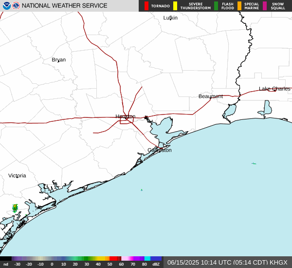
Radar
- Attachments
-
- KHGX_loop.gif (313.84 KiB) Viewed 3365 times
-
tireman4
- Global Moderator
- Posts: 7127
- Joined: Wed Feb 03, 2010 9:24 pm
- Location: Humble, Texas
- Contact:
Precipitation Outlook
- Attachments
-
- bsAed.png (478.26 KiB) Viewed 3309 times
-
tireman4
- Global Moderator
- Posts: 7127
- Joined: Wed Feb 03, 2010 9:24 pm
- Location: Humble, Texas
- Contact:
Today, Tonight and the Outlook
- Attachments
-
- bsAed.png (478.26 KiB) Viewed 3221 times
-
- small3.png (381.14 KiB) Viewed 3221 times
-
- small4.png (307.18 KiB) Viewed 3221 times
-
- small5.jpeg (76.66 KiB) Viewed 3221 times
-
DoctorMu
- Posts: 8030
- Joined: Sun Jun 28, 2015 11:58 am
- Location: College Station
- Contact:
-
DoctorMu
- Posts: 8030
- Joined: Sun Jun 28, 2015 11:58 am
- Location: College Station
- Contact:
NWS has been pushing back rain chances to later in the week.
-
DoctorMu
- Posts: 8030
- Joined: Sun Jun 28, 2015 11:58 am
- Location: College Station
- Contact:
Mesos are in disagreement about advancement of the FROPA and rain. RGEM is the most progressive.
-
Stratton20
- Posts: 5818
- Joined: Tue Feb 09, 2021 11:35 pm
- Location: College Station, Texas
- Contact:
Widespread rain chsnces are coming to se texas, looks like next weeks front will probably stall out somewhere in the vicinity of se texas , disturbances over riding the front would lead to good chances for rain every day next week, heavy at times, also could be looking at a pacific tropical system getting pulled into texas by a cut off upper low, that could throw even more moisture our way