
The summer doldrums are here. Here is a song that makes you think fall. It is a unidentified song.
https://www.youtube.com/watch?v=dJs6WFvtx0s
Here is Like The Wind.
https://www.youtube.com/watch?v=zPGf4liO-KQ
June 2024
-
Ptarmigan

- Statistical Specialist

- Posts: 4536
- Joined: Wed Feb 03, 2010 7:20 pm
- Contact:
-
DoctorMu

- Posts: 8089
- Joined: Sun Jun 28, 2015 11:58 am
- Location: College Station
- Contact:
Some parts of Bryan received 3 inches of rain in less than 40 minutes.
I wish we had at least and inch of rain yesterday, but beggarrs...
Hanging on until...
https://youtu.be/DB51XKdRQw4?si=BEAOWZK_dUavaavG
I wish we had at least and inch of rain yesterday, but beggarrs...
Hanging on until...
https://youtu.be/DB51XKdRQw4?si=BEAOWZK_dUavaavG
-
user:null
- Posts: 465
- Joined: Fri Jul 01, 2022 7:04 pm
- Location: The Land of Sugar
- Contact:
Oh no, the dewpoints have absolutely been up there the past few weeks area-wide.
But what I was saying is that, even factoring all that in, I often notice on NWS that certain sites like Sugar Land (where I'm at), Navasota, etc are often running notably ticks higher on the dewpoints than the "main order" sites like IAH, Hobby, etc.
In fairness, last year already had a number of upper 90s and 100°F+ days logged by June. Rain frequencies were also notably lower.
The upcoming stretch of heat is bad, but relatively transient (as of now).
-
user:null
- Posts: 465
- Joined: Fri Jul 01, 2022 7:04 pm
- Location: The Land of Sugar
- Contact:
However, I really don't understand what it is that causes "gaps" in storm formation?
Like, in the screenshot below, solid storms from Lake Charles to Golden Triangle area, while another axis (albeit, more sparse) is around Victoria/Matagorda areas. Meanwhile, the Houston area looks pretty blank (for now).
Like, in the screenshot below, solid storms from Lake Charles to Golden Triangle area, while another axis (albeit, more sparse) is around Victoria/Matagorda areas. Meanwhile, the Houston area looks pretty blank (for now).
- Attachments
-
- Screenshot (88).png (99.51 KiB) Viewed 46950 times
-
user:null
- Posts: 465
- Joined: Fri Jul 01, 2022 7:04 pm
- Location: The Land of Sugar
- Contact:
From 2:30-2:35PM, HOU airport went from 97°F down to 91°F.
Something strange is happening with the weather...
Something strange is happening with the weather...
-
Pas_Bon
- Posts: 968
- Joined: Tue Sep 11, 2018 7:58 am
- Location: League City, TX
- Contact:
Drove from League City to Lake Charles today and right back. Orange area/Lake Charles had some street flooding, it was raining so hard. Booooo!
I tried to catch a bunch in ziplocs and bring it back here, but alas, no dice.
I tried to catch a bunch in ziplocs and bring it back here, but alas, no dice.
-
DoctorMu
- Posts: 8089
- Joined: Sun Jun 28, 2015 11:58 am
- Location: College Station
- Contact:
GFS, CMC, Euro bring a front into the area about July 5-6. We'll see.
-
Pas_Bon
- Posts: 968
- Joined: Tue Sep 11, 2018 7:58 am
- Location: League City, TX
- Contact:
-
jasons2k

- Posts: 6201
- Joined: Thu Feb 04, 2010 12:54 pm
- Location: Imperial Oaks
- Contact:
Insane…
- Attachments
-
- IMG_2900.jpeg
- (1.14 MiB) Downloaded 36172 times
-
Cpv17
- Posts: 7109
- Joined: Fri Aug 31, 2018 1:58 pm
- Location: El Campo/Wharton
- Contact:
-
DoctorMu
- Posts: 8089
- Joined: Sun Jun 28, 2015 11:58 am
- Location: College Station
- Contact:
-
tireman4

- Global Moderator

- Posts: 7161
- Joined: Wed Feb 03, 2010 9:24 pm
- Location: Humble, Texas
- Contact:
Be careful out there today
- Attachments
-
- image4.png (334.07 KiB) Viewed 46365 times
-
DoctorMu
- Posts: 8089
- Joined: Sun Jun 28, 2015 11:58 am
- Location: College Station
- Contact:
Interesting. The latest GFS has a weakened Beryl delivering a truck full of lemonade to Texas and opening the Gulf as the Death Ridge withers on the vine...

-
DoctorMu
- Posts: 8089
- Joined: Sun Jun 28, 2015 11:58 am
- Location: College Station
- Contact:
Hello, CMC - Beryl washes ashore weak and wet.


-
Cromagnum
- Posts: 3076
- Joined: Thu Feb 03, 2011 10:42 pm
- Location: Georgetown
- Contact:
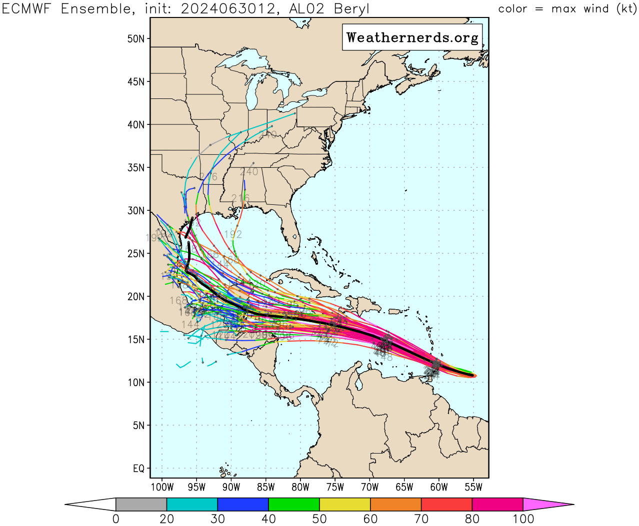
Beryl up to 130 mph and not showing any signs of slowing down. We better hope the Caribbean can shred it up some.
-
Cromagnum
- Posts: 3076
- Joined: Thu Feb 03, 2011 10:42 pm
- Location: Georgetown
- Contact:
Don't look at HWRF...
https://x.com/iCyclone/status/1807484559849648469
And most of the models are showing a north turn eventually.

https://x.com/iCyclone/status/1807484559849648469
And most of the models are showing a north turn eventually.