
Well if you don’t want it anymore then send it to my place.Stratton20 wrote: ↑Mon Jan 22, 2024 3:35 pm Got about 3 inches of rain today, time to shut the faucet off now
January 2024
Picked up 3.22” here so far.

1.86” here today.

2.85” here with more on the way. It was 2.84” until a random 2 min downpour a few min ago. It reminded me to look at my weather monitor lol


is it possible to have a flood and still be in a drought?? hmmm
Is the system down? I'm not getting anything.
-
tireman4

- Global Moderator

- Posts: 4488
- Joined: Wed Feb 03, 2010 9:24 pm
- Location: Humble, Texas
- Contact:
000
FXUS64 KHGX 231150
AFDHGX
Area Forecast Discussion
National Weather Service Houston/Galveston TX
550 AM CST Tue Jan 23 2024
...New AVIATION...
.SHORT TERM...
(Today through Wednesday Night)
Issued at 357 AM CST Tue Jan 23 2024
Scattered showers have continued to develop across the area
overnight, though additional rainfall totals have thus far been
relatively low. A drop in wind speeds as well as elevated near-
surface moisture levels has allowed for areas of dense fog to
develop across portions of the area over the past few hours. With
the potential for fog to become dense at times through just after
sunrise, a Dense Fog advisory has been issued for all of SE TX until
8 AM, though this may be extended by a few hours depending on how
quickly conditions improve with daytime heating.
Our main concern in the short term period continues to surround the
potential for heavy rainfall, a threat that will come in two rounds.
Another shortwave trough embedded within the midlevel flow will
traverse the area today, initiating widespread showers and
thunderstorms that should pick up in coverage after 7AM. Short-term
guidance continues to favor higher rainfall totals to the north of
the I-10 corridor given the expected positioning of the
aforementioned shortwave, with some impacted locations having picked
up 2-3 inches of rain already in the past 24 hours. Continued deep
moisture availability (PWs of 1.5-1.75 inches) will support the
potential for additional periods of heavy rainfall today, with
portions of the Brazos Valley/Piney Woods expected to receive
another 2-4 inches of rainfall with locally higher amounts possible
this afternoon. Rainfall totals for locations further south will
likely remain at 1 inch or less Considering the threat of heavy
downpours as well as the antecedent rainfall in these locations, a
Flood Watch has been issued through midnight tonight for the
northern zones. Street flooding, impacts to low-lying and poor
drainage areas, and isolated minor to moderate river flooding will
be possible. As such, those with travel plans or living in flood
prone locations should keep up to date with the latest forecast
information and have a way to receive warnings.
A lull in rainfall is expected after midnight tonight. However, this
decrease in activity is expected to be short-lived as yet another
shortwave trough pushes into the area in the overnight hours. This,
combined with steady onshore moisture transport and SE TX`s
positioning within the right front quadrant of a 110+kt upper jet
streak. will trigger widespread showers and isolated thunderstorms
along and south of the I-10 corridor beginning overnight tomorrow
and persisting well into the afternoon. This could potentially bring
widespread rainfall totals of 2-4 inches to locations along and
south of I-10 and 1-3 inches further to the north. Locally higher
totals will again be possible, and additional Flood Watches very
well may be required as the situation develops today.
In terms of the temperature forecast, steady WAA will allow for
highs to reach the upper 60s to low 70s both today and tomorrow,
while widespread cloud cover will inhibit radiative cooling and
thereby keep lows in the upper 50s to lower 60s.
Cady
&&
.LONG TERM...
(Thursday through Monday)
Issued at 357 AM CST Tue Jan 23 2024
The slow moving upper level trough to our west that stalled a
frontal boundary over our area on Wednesday finally pushes eastward
on Thursday leading to a lull in the rain...well a brief one at
least because we won`t be done with rain for the week just yet. Rain
chances taper off going into Thursday afternoon/night, but that
front will stall just offshore so the moisture remains nearby.
Another upper level trough swings through the Four Corners region on
late Thursday night and generates surface low pressure near the
TX/NM border. WAA and moisture advection in the warm sector of this
surface low pulls that moisture back inland leading to PW values
climbing back into the 1.0-1.4" range (75th percentile: ~1.08").
Going further into Friday, an embedded upper level low is expected
to develop within that trough as it amplifies and pushes eastward
through TX. As a result, we can expect the surface low to follow a
similar trend and deepen as well as it pushes northeastward and
drags a cold front through on late Friday. Showers and thunderstorms
will be possible both ahead of and along the frontal boundary and
some of the rain may be locally heavy at times.
Cooler and drier air filters in behind the front leading to quite
the pleasant weekend! We definitely deserve it after the multi-day
barrage of periods of rainfall throughout the work week. Surface
high pressure moves in and remains overhead into early next week, so
we`ll have a decent stretch of pleasant weather! Temperatures ahead
of the front on Thursday/Friday will be in the upper 60s/low 70s for
highs and 50s for lows. Behind the front, we see daytime
temperatures down into the low to mid 60s (maybe even upper 50s) and
nighttime temperatures making a return into the 30s/40s.
Batiste
&&
.AVIATION...
(12Z TAF Issuance)
Issued at 543 AM CST Tue Jan 23 2024
IFR to LIFR conditions will continue to dominate the current TAF
period as another period of widespread rainfall develops across
the area today resulting in persistent cigs below 1000 ft.
Additionally, widespread fog has developed across all terminals
this morning which, along with the impacts of the aforementioned
rainfall, will result in reduced visibilities throughout the
period. Steady showers, with some isolated thunderstorms, will
become more widespread over the next several hours and will pesis
into the evening. This will include the potential for some locally
heavy rain for the northern terminals before a brief reprieve is
expected around midnight. This will be short-lived, however, as
another round of widespread rainfall moves into the area early
tomorrow morning, mainly impacting the metro and coastal
terminals. This period of rainfall will also be locally heavy at
times and will result in continued IFR cigs/visibilities.
Cady
&&
.MARINE...
Issued at 357 AM CST Tue Jan 23 2024
Elevated seas and moderate onshore flow will persist throughout the
day. Seas in the farshore Gulf waters remain around 7-8 feet and
will take a while to come down, so a Small Craft Advisory remains in
effect for this region through later this morning. Increased low
level moisture has led to areas of dense sea fog in the bays and
Gulf waters, and this will likely linger through the mid morning
hours. However, the fog threat doesn`t completely end until the
second cold front of the week pushes offshore late Friday. Between
now and then, there will be multiple periods of showers and
thunderstorms due to various upper level disturbances moving
through. The first cold front arrives on early Thursday morning
followed by another one on Friday night. Winds are more elevated
following the late Friday front and will likely prompt caution
flags.
Batiste
&&
.HYDROLOGY...
Issued at 357 AM CST Tue Jan 23 2024
As expected, widespread heavy rainfall on Monday has led to numerous
river gauges reaching or forecast to reach into action stage. As of
early Tuesday morning, only two sites are forecast to go into minor
flood stage: San Bernard River near Boling (BOLT2) later this
morning and San Jacinto River near New Caney (NCET2) at the end of
the work week. There is a Flood Warning out for BOLT2 currently and
it is forecast to remain in minor flood stage through this afternoon
before dropping back into action stage. The majority of the rainfall
on Monday fell to the west of the I-45 corridor with 3-4" being
common. East of I-45 was more in the range of 1-2". An additional
round of heavy rain is expected later today for the Brazos
Valley/Piney Woods area with rainfall totals of 2-4" with isolated
higher amounts...and given the antecedent rainfall, it was decided
to issue a Flood Watch for our northern counties through midnight.
There will be even more additional rounds of rain throughout the
work week, so we will continue to monitor the response from
river/stream gauges around Southeast TX. Further expansion and
extension of the Flood Watch may be warranted for Wednesday with the
potential for a prolonged rain band setting up around the I-10
corridor. Stay tuned for more updates.
Batiste
&&
.CLIMATE...
Issued at 307 AM CST Mon Jan 22 2024
Here are some rainfall records (and year set) for today (22nd),
Tuesday (23rd) and Wednesday (24th)...
Today (22nd) Tuesday (23rd) Wednesday (24th)
CLL: 2.90 (2015) 2.72 (1938) 2.29 (2004)
IAH: 2.52 (2019) 2.62 (1920) 4.05 (2023)
HOU: 2.35 (2015) 1.42 (1984) 2.30 (2011)
GLS: 5.38 (1923) 2.17 (1924) 2.60 (1882)
PSX: 2.66 (2015) 1.88 (1958) 2.44 (2007)
42
&&
.PRELIMINARY POINT TEMPS/POPS...
College Station (CLL) 67 58 64 52 / 90 80 90 30
Houston (IAH) 70 63 68 57 / 80 90 90 60
Galveston (GLS) 64 59 64 57 / 40 90 100 80
&&
.HGX WATCHES/WARNINGS/ADVISORIES...
TX...Dense Fog Advisory until 8 AM CST this morning for TXZ163-164-
176>179-195>200-210>214-226-227-235>238-300-313-335>338-436-
438.
Flood Watch through this evening for TXZ163-164-176>179-195>199.
High Rip Current Risk until 9 AM CST this morning for TXZ436>439.
GM...Dense Fog Advisory until 9 AM CST this morning for GMZ330-335-
350-355.
Small Craft Advisory until 9 AM CST this morning for GMZ370-375.
&&
$$
SHORT TERM...Cady
LONG TERM....Batiste
AVIATION...Cady
MARINE...Batiste
Things picking up again.

Yep, it's raining pretty heavy over here.
Just went over 1.00” for the day with more coming.
Briefly had rainfall rates of 6.70”/hr.
Up to 2.97” for the storm total. For once it looks like I may get the rain totals that were on the models and HPC maps.
Briefly had rainfall rates of 6.70”/hr.
Up to 2.97” for the storm total. For once it looks like I may get the rain totals that were on the models and HPC maps.

2.66 inches as of yesterday evening. Probably another 0.3 in last night. More rounds are on their way. We're pretty soggy.
I'd like to reserve the remainder of the systems for this summer in BCS!
I'd like to reserve the remainder of the systems for this summer in BCS!
Kinda surprised there’s not any flash flood watches out.
-
Stratton20
- Posts: 4248
- Joined: Tue Feb 09, 2021 11:35 pm
- Location: College Station, Texas
- Contact:
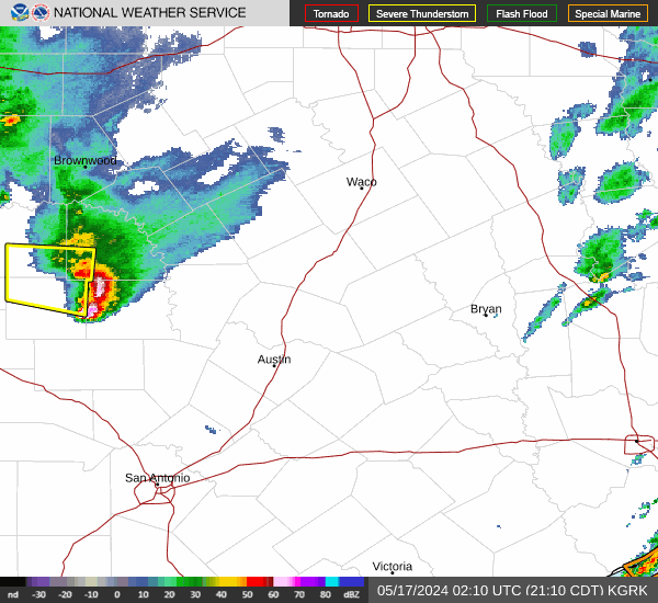
looks like the mesoscale models favor the coastal communities for the next couple batches of heavy rain
- hgx.png (11.16 KiB) Viewed 503 times
Flood Watch
National Weather Service Houston/Galveston TX
223 PM CST Tue Jan 23 2024
Houston-Trinity-Madison-Walker-San Jacinto-Polk-Burleson-Brazos-
Washington-Grimes-Montgomery-Northern Liberty-Austin-Waller-
Inland Harris-Chambers-Fort Bend-Inland Brazoria-Inland Galveston-
Southern Liberty-Coastal Harris-Coastal Brazoria-Coastal
Galveston-Brazoria Islands-Galveston Island-Bolivar Peninsula-
Including the cities of Groveton, Hempstead, Prairie View,
Rosenberg, Stowell, Freeport, Somerville, Houston, La Marque,
Livingston, Bellville, Conroe, The Woodlands, Lake Jackson,
Waller, Shepherd, Anahuac, Pearland, Crockett, Corrigan,
Caldwell, Trinity, Texas City, Mont Belvieu, Angleton, Brenham,
Navasota, Cleveland, Missouri City, Huntsville, College Station,
First Colony, Mission Bend, Galveston, Dickinson, Baytown,
Coldspring, Sugar Land, Friendswood, Bryan, Sealy, Devers,
Madisonville, Brookshire, League City, Alvin, Pecan Grove,
Dayton, Old River-Winfree, Winnie, Pasadena, Surfside Beach,
Clute, and Liberty
223 PM CST Tue Jan 23 2024
...FLOOD WATCH REMAINS IN EFFECT THROUGH WEDNESDAY MORNING...
* WHAT...Flooding caused by excessive rainfall continues to be
possible.
* WHERE...A portion of southeast Texas, including the following
areas, Austin, Bolivar Peninsula, Brazoria Islands, Brazos,
Burleson, Chambers, Coastal Brazoria, Coastal Galveston, Coastal
Harris, Fort Bend, Galveston Island, Grimes, Houston, Inland
Brazoria, Inland Galveston, Inland Harris, Madison, Montgomery,
Northern Liberty, Polk, San Jacinto, Southern Liberty, Trinity,
Walker, Waller and Washington.
* WHEN...Through Wednesday morning.
* IMPACTS...Excessive runoff may result in flooding of rivers,
creeks, streams, and other low-lying and flood-prone locations.
Flooding may occur in poor drainage and urban areas. Low-water
crossings may be flooded.
* ADDITIONAL DETAILS...
- Periods of moderate to heavy rainfall expected through
Wednesday morning. Widespread totals of 2-4 inches with
locally up to 5 inches expected in areas of training showers
and thunderstorms.
- http://www.weather.gov/safety/flood
PRECAUTIONARY/PREPAREDNESS ACTIONS...
You should monitor later forecasts and be alert for possible Flood
Warnings. Those living in areas prone to flooding should be prepared
to take action should flooding develop.