
000
FXUS64 KHGX 111134
AFDHGX
Area Forecast Discussion
National Weather Service Houston/Galveston TX
534 AM CST Thu Jan 11 2024
...New AVIATION...
.SHORT TERM...
(Today through Friday Night)
Issued at 458 AM CST Thu Jan 11 2024
Thursday will be our last day of warm weather for the foreseeable
future, as multiple cold fronts are expected to push across the
region through next week (more on this in the long term). For today,
it should be partly cloudy and breezy with highs largely in the 70s.
Overall very pleasant weather, so be sure to enjoy it while it
lasts, as we won`t have the wait long for it to come to an end.
Another mid/upper level trough will sweep across the
Central/Southern Plains Tonight. The associated surface low near the
TX/OK Panhandle should track NE overnight, draping a strong cold
front across SE Texas during the early morning hours of Friday.
Dynamics with this FROPA still look fairly strong, with a 40-50 knot
LLJ progged to slide in overhead ahead of the FROPA. 6KM Bulk Shear
looks to be in excess of 70 knots region-wide, capping out at 95
knots further N/NW as the front pushes through. Instability remains
rather low as noted in previous forecasts, with MU CAPE ranging from
200-800 J/KG. A robust capping inversion still looks to be in place
around 850mb-700mb during the overnight hours. Cooling aloft may
help erode this cap to some degree prior to the front`s arrival, but
it should greatly limit shower/storm development ahead of the cold
front. HREF members show a thin line of storms developing with the
FROPA, with simulated reflectivity & line cohesion greatest in areas
north of the I-10 corridor. The front will also be moving very
quickly, passing Collage Station around 1-3 AM, the Houston area
around 3-5 AM and offshore by 6 AM. SPC still has portions of the
Piney Woods/Lake Livingston area under a Slight Risk (level 2/5) of
severe weather during this period, with the rest of SE Texas under a
marginal (level 1/5) Risk. The primary threats from these storms
still look to be damaging winds and hail.
Friday will feature cold, dry and windy conditions behind the cold
front. Winds behind the front will be around 20-25 MPH with gusts up
to 40 MPH possible. Therefore, a Wind Advisory will be in effect
from early Friday morning through late Friday afternoon. Even with
clear skies, highs will top out in the 50s during the day. Lows
temperatures heading into Saturday morning will be in the mid
20s/mid 30s inland and upper 30s/lower 40s near the coast.
03
&&
.LONG TERM...
(Saturday through Wednesday)
Issued at 458 AM CST Thu Jan 11 2024
Saturday will be a dry transition day with slightly warmer
conditions as high pressure moves off to the east and we see a
brief return flow from the Gulf. Attention then turns to the
Arctic frontal passage.
We are starting to see the front coming into range on the latest
NAM12 runs. While not perfect, this typically does fairly well
with the cold, dense Arctic airmasses compared to some of the other
available guidance at this point in time. The 00z run has the
leading edge of the front approaching northern parts of the CWA
during the overnight hours Saturday. The 6z run was similar, and
with the extra added time period, has the boundary at or off the
coast by sunrise Sunday. If so, this has significant implications
for planned outdoor events...and also overall winterization
preparation times. Given its past track record, we are going to
give this guidance particularly more weight than some of the
others in regards to timing and temps and have made some
considerable downward adjustments for the daytime hours Sunday.
Disclaimer:
given that we have only had 2 runs to view...there is a much
higher than normal temp bust potential for this forecast package
than others you`ll probably see going forward. In addition to the
NAM12, we`ll begin seeing some other hires models begin coming
into view as well.
Other than daytime adjustments on Sunday...the rest of the fcst
remains very similar to what you`ve already seen advertised into
the middle of next week (hard freezes, some locations seeing the
potential for longer duration time period of readings <32, bitter
wind chills, etc). Residents are encouraged to complete outdoor
home/business preparations by Saturday evening.
In regards to winter precip: chances still appear on the low end
that we see much of significance - but not zero. Keeping an eye
across northern areas Sunday night where the tail end of precip
might try to clip it. Also, further south by early Monday where a
disturbance, possibly rooted in the H7 flow, might try to move in
from the southwest as a few models (0z GFS & UKMET) have been intermittently
hinting at. Forecast soundings indicate light freezing rain or
freezing drizzle would be what we`d be looking at where surface
readings are below freezing. Overall low chances of about 20% look
reasonable for now.
A subtle warm-up is anticipated Wed & Thurs...but might see
another fairly significant cold front next Fri or so. 47
&&
.AVIATION...
(12Z TAF Issuance)
Issued at 519 AM CST Thu Jan 11 2024
Expect MVFR to LIFR conditions early today from a mix of
patchy/areas of fog and CIGS near 1500-2500 ft. VFR conditions
return during the late morning/early afternoon as gusty southerly
winds develop region-wide. A strong LLJ ahead of a cold front
Thursday evening may produce wind shear tonight. MVFR CIGS may
develop overnight ahead of the front. The cold front itself
should quickly move across SE Texas during the early morning hours
of Friday, approaching KCLL just before midnight, then pushing
offshore before sunrise. Gusty W/NW winds and clear skies
developing in it`s wake.
03
&&
.MARINE...
Issued at 458 AM CST Thu Jan 11 2024
Onshore winds will increase later today and tonight ahead of the
next cold front that will be pushing off the coast between 3 am
and 6 am Friday. Small Craft Advisories will probably be required
by this evening for onshore winds and building seas.
Sustained northwest winds in the 25 to 35 knot range are expected
behind the front, with gusts well above gale force. Ongoing Gale
Watch will likely need to be upgraded to a Warning later today.
Strong WNW-NW winds will also bring significant low water levels
in the bays on Friday (PETSS guidance showing -2 to -3 MLLW). A
Low Water Advisory will likely be needed.
Onshore winds resume Saturday followed by the passage of a
strong Arctic cold front on Sunday. Timing is uncertain, but it
could be as early as sunrise Sunday. Much colder and breezy
conditions will prevail behind this front well into next week. 47
&&
.PRELIMINARY POINT TEMPS/POPS...
College Station (CLL) 73 40 52 31 / 10 60 0 0
Houston (IAH) 74 50 56 34 / 20 60 0 0
Galveston (GLS) 68 55 60 43 / 20 50 0 0
&&
.HGX WATCHES/WARNINGS/ADVISORIES...
TX...Wind Advisory from 3 AM to 4 PM CST Friday for TXZ163-164-
176>179-195>200-210>214-226-227-235>238-300-313-335>338-
436>439.
Dense Fog Advisory until 9 AM CST this morning for TXZ176-177-
195>199-210>213-226-227-235>237.
GM...Small Craft Advisory from midnight tonight to 3 AM CST Friday
for GMZ330-335-350-355-370-375.
Gale Watch from late tonight through Friday afternoon for GMZ330-
335-350-355-370-375.
Small Craft Should Exercise Caution through this afternoon for
GMZ370-375.
&&
$$
SHORT TERM...03
LONG TERM....47
AVIATION...03
MARINE...47
January 2024
-
tireman4

- Global Moderator

- Posts: 4488
- Joined: Wed Feb 03, 2010 9:24 pm
- Location: Humble, Texas
- Contact:
In regards to winter precip: chances still appear on the low end
that we see much of significance - but not zero. Keeping an eye
across northern areas Sunday night where the tail end of precip
might try to clip it. Also, further south by early Monday where a
disturbance, possibly rooted in the H7 flow, might try to move in
from the southwest as a few models (0z GFS & UKMET) have been intermittently
hinting at. Forecast soundings indicate light freezing rain or
freezing drizzle would be what we`d be looking at where surface
readings are below freezing. Overall low chances of about 20% look
reasonable for now.
-
brazoriatx
- Posts: 329
- Joined: Tue Nov 08, 2011 12:09 pm
- Contact:
So nws says 20% tv mets say 40% and 60%? What's the difference between the 2?tireman4 wrote: ↑Thu Jan 11, 2024 8:17 am In regards to winter precip: chances still appear on the low end
that we see much of significance - but not zero. Keeping an eye
across northern areas Sunday night where the tail end of precip
might try to clip it. Also, further south by early Monday where a
disturbance, possibly rooted in the H7 flow, might try to move in
from the southwest as a few models (0z GFS & UKMET) have been intermittently
hinting at. Forecast soundings indicate light freezing rain or
freezing drizzle would be what we`d be looking at where surface
readings are below freezing. Overall low chances of about 20% look
reasonable for now.
-
tireman4
- Global Moderator
- Posts: 4488
- Joined: Wed Feb 03, 2010 9:24 pm
- Location: Humble, Texas
- Contact:
NWS is being conservative, as well as they should be. They are leaving themselves enough wiggle room as the models continue to get a clearer picture.brazoriatx wrote: ↑Thu Jan 11, 2024 8:19 amSo nws says 20% tv mets say 40% and 60%? What's the difference between the 2?tireman4 wrote: ↑Thu Jan 11, 2024 8:17 am In regards to winter precip: chances still appear on the low end
that we see much of significance - but not zero. Keeping an eye
across northern areas Sunday night where the tail end of precip
might try to clip it. Also, further south by early Monday where a
disturbance, possibly rooted in the H7 flow, might try to move in
from the southwest as a few models (0z GFS & UKMET) have been intermittently
hinting at. Forecast soundings indicate light freezing rain or
freezing drizzle would be what we`d be looking at where surface
readings are below freezing. Overall low chances of about 20% look
reasonable for now.
-
MontgomeryCoWx

- Posts: 2356
- Joined: Wed Dec 14, 2011 4:31 pm
- Location: Weimar, TX
- Contact:
I’m off to Glacier Park and Cut Bank. Going to enjoy this.
Team #NeverSummer
-
MontgomeryCoWx
- Posts: 2356
- Joined: Wed Dec 14, 2011 4:31 pm
- Location: Weimar, TX
- Contact:
Yep, it’s always been this way with winter weather. Hell I’m not bullish until I’m inside 12 hours down heretireman4 wrote: ↑Thu Jan 11, 2024 8:26 amNWS is being conservative, as well as they should be. They are leaving themselves enough wiggle room as the models continue to get a clearer picture.brazoriatx wrote: ↑Thu Jan 11, 2024 8:19 amSo nws says 20% tv mets say 40% and 60%? What's the difference between the 2?tireman4 wrote: ↑Thu Jan 11, 2024 8:17 am In regards to winter precip: chances still appear on the low end
that we see much of significance - but not zero. Keeping an eye
across northern areas Sunday night where the tail end of precip
might try to clip it. Also, further south by early Monday where a
disturbance, possibly rooted in the H7 flow, might try to move in
from the southwest as a few models (0z GFS & UKMET) have been intermittently
hinting at. Forecast soundings indicate light freezing rain or
freezing drizzle would be what we`d be looking at where surface
readings are below freezing. Overall low chances of about 20% look
reasonable for now.
Team #NeverSummer
-
txsnowmaker
- Posts: 632
- Joined: Wed Feb 03, 2010 4:07 pm
- Location: SW Houston (Galleria area)
- Contact:
KHOU still calling for sleet, and 60% chance of it for Monday (7-day forecast at bottom of story linked below)tireman4 wrote: ↑Thu Jan 11, 2024 8:17 am In regards to winter precip: chances still appear on the low end
that we see much of significance - but not zero. Keeping an eye
across northern areas Sunday night where the tail end of precip
might try to clip it. Also, further south by early Monday where a
disturbance, possibly rooted in the H7 flow, might try to move in
from the southwest as a few models (0z GFS & UKMET) have been intermittently
hinting at. Forecast soundings indicate light freezing rain or
freezing drizzle would be what we`d be looking at where surface
readings are below freezing. Overall low chances of about 20% look
reasonable for now.
https://www.khou.com/article/weather/fo ... 68a39ff412
-
tireman4
- Global Moderator
- Posts: 4488
- Joined: Wed Feb 03, 2010 9:24 pm
- Location: Humble, Texas
- Contact:
With all due respect to Chita Craft, I am thinking ( right now) the NWS has the front progged right ( I have friends running the marathon on Sunday), off the coast by sunrise Sunday..
"The 6z run was similar, and
with the extra added time period, has the boundary at or off the
coast by sunrise Sunday. "
I see what she is doing. She is basing her forecast off the GFS and the NWS the NAM. I would still stick with the NWS, for now.
"The 6z run was similar, and
with the extra added time period, has the boundary at or off the
coast by sunrise Sunday. "
I see what she is doing. She is basing her forecast off the GFS and the NWS the NAM. I would still stick with the NWS, for now.
Two interesting things:
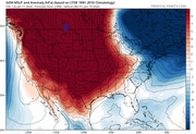
1. As mentioned before (and confirmed via weather.us), the EURO is actually the highest resolution (~9KM) of the globals, beating out ICON (~13km), and even two nests of NAM (~12 and 32km). Even the EPS ensembles run at ~14km, on par with 12km NAM nest and ICON. So, if resolution is what it takes to handle "shallow airmasses" more effectively, then EURO should actually be among the best models for that, rivalling some of our mesoscales.
2. It's also interesting to see the differences in ICON (and CMC) and NAM despite both being "great at handling shallow airmasses". For instance, from what we see so far, Sunday is coming in a lot colder as per overall daily temps with no warmup via NAM12km ... but temps aren't "bottomed out" as much. Meanwhile, temps behind the front are more intensely cold on the ICON (and CMC), but the Sunday warmup is actually stronger (up to 60s in areas). What factors could be in play behind that?
Last edited by user:null on Thu Jan 11, 2024 10:56 am, edited 1 time in total.
-
Stormlover2020
- Posts: 457
- Joined: Mon Jun 01, 2020 6:04 pm
- Contact:
It’s going to be interesting

20 - 40%brazoriatx wrote: ↑Thu Jan 11, 2024 8:19 amSo nws says 20% tv mets say 40% and 60%? What's the difference between the 2?tireman4 wrote: ↑Thu Jan 11, 2024 8:17 am In regards to winter precip: chances still appear on the low end
that we see much of significance - but not zero. Keeping an eye
across northern areas Sunday night where the tail end of precip
might try to clip it. Also, further south by early Monday where a
disturbance, possibly rooted in the H7 flow, might try to move in
from the southwest as a few models (0z GFS & UKMET) have been intermittently
hinting at. Forecast soundings indicate light freezing rain or
freezing drizzle would be what we`d be looking at where surface
readings are below freezing. Overall low chances of about 20% look
reasonable for now.
NWS now has 3 days of potentially freezing to subfreezing weather for CLL with a 20-30% chance of freezing rain. Two nights in the teens.txsnowmaker wrote: ↑Thu Jan 11, 2024 9:05 amKHOU still calling for sleet, and 60% chance of it for Monday (7-day forecast at bottom of story linked below)tireman4 wrote: ↑Thu Jan 11, 2024 8:17 am In regards to winter precip: chances still appear on the low end
that we see much of significance - but not zero. Keeping an eye
across northern areas Sunday night where the tail end of precip
might try to clip it. Also, further south by early Monday where a
disturbance, possibly rooted in the H7 flow, might try to move in
from the southwest as a few models (0z GFS & UKMET) have been intermittently
hinting at. Forecast soundings indicate light freezing rain or
freezing drizzle would be what we`d be looking at where surface
readings are below freezing. Overall low chances of about 20% look
reasonable for now.
https://www.khou.com/article/weather/fo ... 68a39ff412
-
Stormlover2020
- Posts: 457
- Joined: Mon Jun 01, 2020 6:04 pm
- Contact:
And still 4 days away
Longer range it really looks like there is potential for another Arctic blast a week or so after Monday's that might be even crazier.
CMC isn't budging. The snow may make it down to Hearne. The Canadian, fwiw, was the only model that really nailed Feb. 2021.


GFS is close to an agreement.

KHOU has it right IMO.
GFS has sleet/snow from a coastal low on Friday the 19th.
KHOU has it right IMO.
GFS has sleet/snow from a coastal low on Friday the 19th.

The GFS is trending towards a full fledge storm.If the NAM is right about the faster frontal passage most of the rain the GFS shows would be frozen precip instead. Like HGX mentioned the NAM often is ahead of the global models when dealing with shallow arctic air.
12Z Canadian model


12Z GFS

12Z Canadian model
12Z GFS
Last edited by don on Thu Jan 11, 2024 11:23 am, edited 1 time in total.
-
brazoriatx
- Posts: 329
- Joined: Tue Nov 08, 2011 12:09 pm
- Contact:
Even tho it's showing rain wouldn't that all be frozen? Nevernind you already answered that lol sorrydon wrote: ↑Thu Jan 11, 2024 11:20 am The GFS is trending towards a full fledge storm.If the NAM is right about the faster frontal passage most of the rain the GFS shows would be frozen precip instaedd. Like HGX mentioned the NAM often is ahead of the global models when dealing with shallow arctic air.
12Z Canadian model
-
Stratton20
- Posts: 4248
- Joined: Tue Feb 09, 2021 11:35 pm
- Location: College Station, Texas
- Contact:
The GFS definitely has me concerned, another system behind this that produces snow and ice, but look at the arctic air that just relentlessly floods the US through the end of its run, insane run
-
- Information
-
Who is online
Users browsing this forum: Ahrefs [Bot], Bing [Bot], Semrush [Bot] and 55 guests