October 2023
It has arrived. Images posted on S2K.
Just a sprinkle south of I10. Not gonna get much of anything.
I'm currently out of state, but radar looks like it's all missing Cypress. Forcefield seems to be working again. Haha!
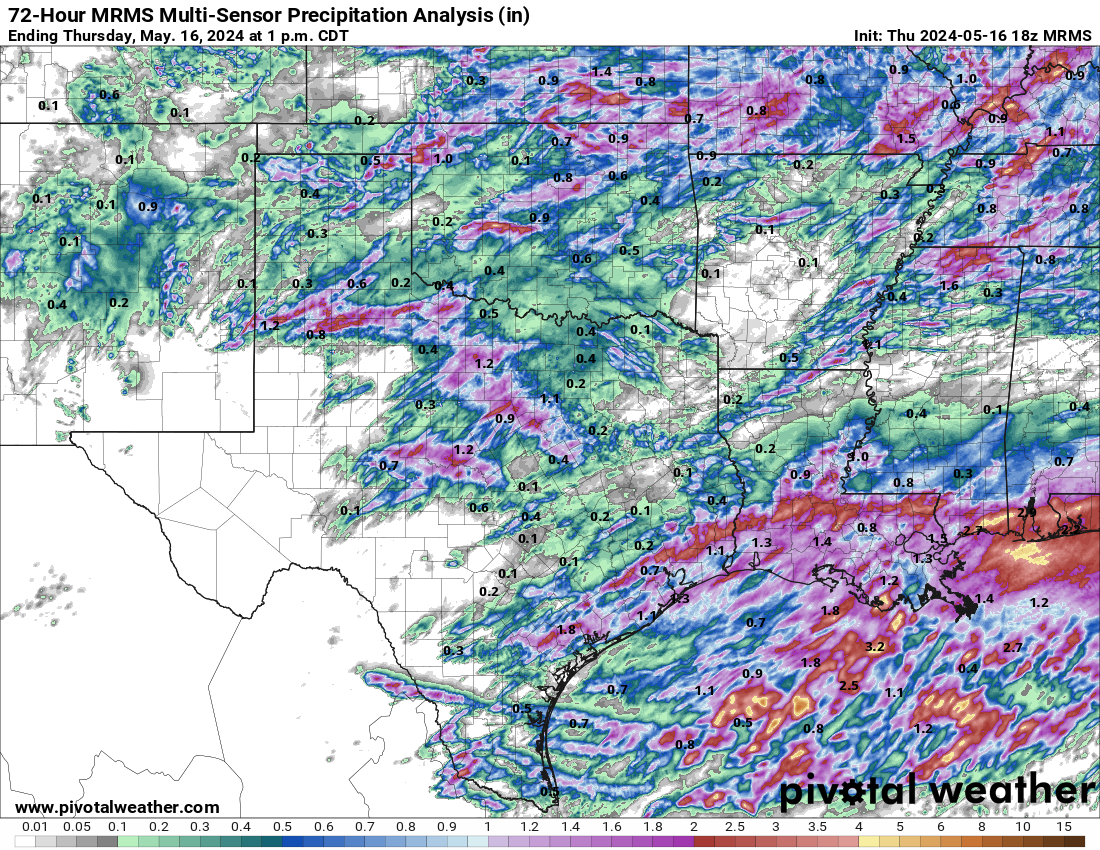
Theirs some rainfall amounts of up to 6" near Lake Conroe. Very hit or miss today in the area.Some places got pounded while other areas didn't receive a drop of rain.While not perfect, models did a pretty good job at depicting the rainfall disparity in the area. I received about .60" today.To my east 1-2 inches of rain fell today in the ship channel/Pasadena area and NE Houston.
-
Stratton20
- Posts: 4248
- Joined: Tue Feb 09, 2021 11:35 pm
- Location: College Station, Texas
- Contact:
Got about 1-1.5 inch here locally, next chance of rain looks to be ahead and behind our strong front, 00z NAM goes gung ho with a 1059 mb arctic high centered over colorado, unbelievable
If that verified then the CMC is onto something lolStratton20 wrote: ↑Thu Oct 26, 2023 10:22 pm Got about 1-1.5 inch here locally, next chance of rain looks to be ahead and behind our strong front, 00z NAM goes gung ho with a 1059 mb arctic high centered over colorado, unbelievable
Nam-a-Lam-a-Ding Dong


If that happened in the winter, it would be a major cold blast.Stratton20 wrote: ↑Thu Oct 26, 2023 4:17 pm lol the 18z NAM has a 1055 mb arctic high, now thats insane to see
-
Stratton20
- Posts: 4248
- Joined: Tue Feb 09, 2021 11:35 pm
- Location: College Station, Texas
- Contact:
The airmass is already colder real time compared to todays model runs, and its further south than some of the guidance, i wouldn’t be surprised to hear of a few sleet reports in our neck of the woods, this front means business, winter is making an early appearance
Looks like potentially a couple of nights in the 30s to begin November. 
Long overdue, but we finally hit or broke 1 inch of rainfall over the last day.

Long overdue, but we finally hit or broke 1 inch of rainfall over the last day.

More to come, especially NW of I-69/Hwy 59:


Presumably after the FROPA:


Is the front supposed to slow down? At this rate it looks like it would be here tonight instead of Sunday
-
brazoriatx
- Posts: 329
- Joined: Tue Nov 08, 2011 12:09 pm
- Contact:
I dont think that'd the front but I could be and probably will be wrong lol
Edit: I was wrong
Last edited by brazoriatx on Fri Oct 27, 2023 10:59 am, edited 1 time in total.
-
Stratton20
- Posts: 4248
- Joined: Tue Feb 09, 2021 11:35 pm
- Location: College Station, Texas
- Contact:
Front is moving quicker than current model guidance, NAM is 5-6 degrees colder than the GFS and Euro, and keeps lingering precipitation around for halloween, cant rule out some sleet either
For College Station I'm assuming. No chance of that down here.Stratton20 wrote: ↑Fri Oct 27, 2023 10:50 am Front is moving quicker than current model guidance, NAM is 5-6 degrees colder than the GFS and Euro, and keeps lingering precipitation around for halloween, cant rule out some sleet either
-
Stratton20
- Posts: 4248
- Joined: Tue Feb 09, 2021 11:35 pm
- Location: College Station, Texas
- Contact:
Cromagnum if youre at the coast then probably not, cant rule it out for other areas of se texas, ive seen it sleet in the mid 40’s
1.13” here yesterday
-
brazoriatx
- Posts: 329
- Joined: Tue Nov 08, 2011 12:09 pm
- Contact:
I've seen it sleet here in angleton in the 40s as well. So it is possible
-
- Information
-
Who is online
Users browsing this forum: Ahrefs [Bot], Bing [Bot], Julifwp and 67 guests
