August 2016: Rain Chances Continue.

General Weather Discussions and Analysis
User avatar
srainhoutx
Site Admin
Site Admin
Posts: 19616
Joined: Tue Feb 02, 2010 2:32 pm
Location: Maggie Valley, NC
Contact:

The Weather Prediction Center Excessive Rainfall Discussion provides to clues as to what we may expect and the subtle differences between the various guidance.

Image

Central Gulf Coast
~~~~~~~~~~~~~~~~~~

...High Risk of Excessive Rainfall Once Again Across Portions of
the Central Gulf Coast...

Abundant moisture remains in place across the Southeast, with the
exceptionally anomalous 2.5-2.75+ inch PW values along the central
Gulf Coast, including an observed 2.71" per the KLIX 00Z 08/12
RAOB. These values are between 3-4 standard deviations above the
norm (approaching record values) per the SREF and GEFS. The best
description of this system is that of a sheared inland tropical
depression, as the upper high over the system has moseyed off to
the TX/LA border, advecting north-northeast flow over the top of
the system. The best analog is Tropical Depression Five (2010)
during its second trip into the Gulf Coast.
Given the deep high
theta-e/moist profile for optimal warm rain processes (wet bulb
zero heights a whopping 16KFT per the 00Z KLIX sounding), the
threat for heavy tropical banding rains across this area will
continue given the slow westward drift of the TUTT.

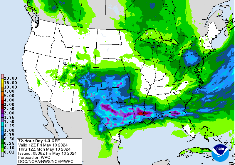
WPC maintained a fairly large swath of areal-average QPF between
3-6" across eastern LA and southern MS. However, all of the
higher-resolution CAMs indicate pockets of much higher amounts,
7-10+ inches between 12Z Fri-12Z Sat. Given the additional heavy
rains over already saturated soils (low FFG values), WPC will
maintain a fairly broad MODERATE and HIGH risk area in the day 1
Excessive Rainfall Outlook (ERO) over the central Gulf region --
similar to the day 2 ERO on Thursday.

08122016 08Z Day 1 Excessive Rainfall 94ewbg.gif
DAYS 2/3...


...SOUTHERN PLAINS INTO THE LOWER MS VALLEY...

THE DISTURBANCE OVER THE NORTHERN GULF WILL CONTINUE TO SLOWLY
PUSH WEST...AND EVENTUALLY BEGIN TO BE PICKED UP BY THE TROUGH
MOVING ACROSS THE PLAINS. A HEAVY RAIN THREAT LIKELY CONTINUES
INTO AT LEAST SATURDAY MORNING ACROSS LA. BY LATER SATURDAY THE
MID LEVEL VORTICITY CENTER IS GENERALLY FORECAST TO BECOME LESS
FOCUSED AND MORE STRUNG OUT AS IT BEGINS TO FEEL THE EFFECT OF THE
TROUGH LIFTING TO THE NORTH. SOME DIFFERENCES WITH REGARDS TO HOW
FAR WEST THE SYSTEM GETS AND THEN HOW QUICKLY IT BEGINS TO MOVE
NORTH...WHICH END UP HAVING A PRETTY SIGNIFICANT IMPACT ON QPF.
OVERALL THE NAM AND GEM HANDLE THE MID/UPPER LEVEL ENERGY
DIFFERENT THAN THE BEST CLUSTERING AND ARE THUS NOT PREFERRED. THE
0Z GFS IS THE FURTHEST WEST SOLUTION...AND THE SLOWEST TO BRING
THE SYSTEM NORTH...RESULTING IN SIGNIFICANT RAINFALL CROSS
SOUTHERN LA. THE 0Z ECMWF AND UKMET ARE A BIT EAST AND
QUICKER...AND WHILE STILL SIGNIFICANT...BOTH HAVE QPF MAGNITUDES
ABOUT HALF THE MAGNITUDE OF THE GFS AND SHIFTED NORTH ACROSS
CENTRAL AND NORTHERN LA. OVERALL THE TREND APPEARS TO BE FOR A
SLIGHTLY EAST AND QUICKER SOLUTION...WITH THE 0Z ECMWF PROBABLY
CLOSEST TO THE CURRENT MODEL CONSENSUS. GIVEN SOME LINGERING
UNCERTAINTY...WPC QPF STAYED CLOSE TO A BLEND OF THE 0Z
GFS/ECMWF/UKMET...WHICH RESULTS IN A PRETTY BROAD 2-4" ACROSS MUCH
OF CENTRAL AND WESTERN LA. BASED ON RECENT TRENDS THINK THE GFS
MAY VERY WELL BE A BIT TOO WET AND TOO FAR SOUTH. CURRENTLY WOULD
EXPECT THE BEST THREAT OF ISOLATED TO SCATTERED 4-7" AMOUNTS ON
DAY 2 (12Z SAT-12Z SUN) TO FOCUS ACROSS CENTRAL LA. OPTED TO
INTRODUCE A MODERATE RISK ON DAY 2 FOR PORTIONS OF CENTRAL
LA...WHERE THIS RAIN ON TOP OF WHAT FALLS TODAY WILL LIKELY CAUSE
CONTINUED AREAS OF FLOOD CONCERN.

HEAVY RAINFALL IS ALSO LIKELY ACROSS PORTIONS OF TEXAS THIS
WEEKEND. EXPECT AN AXIS OF STRONG LOW LEVEL CONVERGENCE TO
DEVELOP...WITH NORTHERLY FLOW BEHIND A COLD FRONT PUSHING THROUGH
THE PLAINS...AND SOUTHERLY FLOW OUT OF THE GULF ASSOCIATED WITH
THE TROPICAL DISTURBANCE. EXPECTING NEAR RECORD PRECIPITABLE WATER
VALUES TO POOL ALONG THIS CONVERGENCE AXIS OVER CENTRAL AND
EASTERN TEXAS. THIS AXIS OF VERY HIGH MOISTURE IS FORECAST TO BE
NEARLY STATIONARY. MEANWHILE EXPECT A FEW SUBTLE SHORTWAVES TO
TRAVERSE THE AREA ON THE SOUTHERN EDGE OF THE PLAINS TROUGH...WITH
THE AREA ALSO SEEING PERIODS OF INCREASED DIFFLUENCE ALOFT. THUS
WOULD EXPECT PERIODS OF CONVECTION WITHIN THIS MOISTURE AXIS.
CORFIDI VECTORS BECOME VERY LIGHT...SUGGESTING THAT NEARLY
STATIONARY CONVECTION WILL BE POSSIBLE...WITH ONLY A SLOW
SOUTHWARD PUSH OF THE FRONT HELPING PROGRESS THINGS. THUS SEEMS
LIKE A GOOD SETUP FOR HEAVY RAINFALL.

OVERALL THE TREND HAS BEEN FOR SOUTHEASTWARD SHIFT IN THE QPF AXIS
ACROSS TEXAS...WITH THIS TREND SEEN IN ALL THE DETERMINISTIC
GUIDANCE. THIS IS THE RESULT OF A QUICKER FRONTAL PROGRESSION AND
A FURTHER EAST POSITION OF THE TROPICAL DISTURBANCE. GIVEN THE
GOOD MODEL AGREEMENT AND CONSISTENT TREND...WPC ALSO SHIFTED QPF
SOUTHEASTWARD. STILL SOME DIFFERENCES IN THE AXIS OF HIGHEST
QPF...AND WPC GENERALLY FOLLOWED A CONSENSUS OF THE
ECMWF/GFS/UKMET. AMOUNTS WERE KEPT ON THE CONSERVATIVE SIDE GIVEN
THE LINGERING UNCERTAINTY.
A SLIGHT RISK WAS MAINTAINED FOR DAY 2
AND ISSUED FOR DAY 3 ACROSS PORTIONS OF CENTRAL AND EAST TEXAS.
THE SETUP DOES SEEM TO HAVE THE POTENTIAL FOR AN EVENTUAL UPGRADE
TO A MODERATE RISK WHEN CONFIDENCE IN THE EXACT LOCATION OF
HIGHEST AMOUNTS INCREASES...SO WILL HAVE TO CONTINUE TO MONITOR

08122016 8Z Day 2 Excessive Rainfall 98ewbg.gif
08122016 0830Z Day 3 Excessive Rainfall 99ewbg.gif
Carla/Alicia/Jerry(In The Eye)/Michelle/Charley/Ivan/Dennis/Katrina/Rita/Wilma/Humberto/Ike/Harvey

Member: National Weather Association
Facebook.com/Weather Infinity
Twitter @WeatherInfinity
User avatar
jasons2k
Posts: 5401
Joined: Thu Feb 04, 2010 12:54 pm
Location: Imperial Oaks
Contact:

If it ever gets here. Was supposed to start yesterday now it looks like tomorrow...unless it gets delayed again...
User avatar
srainhoutx
Site Admin
Site Admin
Posts: 19616
Joined: Tue Feb 02, 2010 2:32 pm
Location: Maggie Valley, NC
Contact:

jasons wrote:If it ever gets here. Was supposed to start yesterday now it looks like tomorrow...unless it gets delayed again...
Guess you didn't see the Flood Advisory yesterday evening in Central Harris County or hear the constant rumble of thunder around 7:00 PM.
Carla/Alicia/Jerry(In The Eye)/Michelle/Charley/Ivan/Dennis/Katrina/Rita/Wilma/Humberto/Ike/Harvey

Member: National Weather Association
Facebook.com/Weather Infinity
Twitter @WeatherInfinity
User avatar
jasons2k
Posts: 5401
Joined: Thu Feb 04, 2010 12:54 pm
Location: Imperial Oaks
Contact:

I saw the spec from afar during my evening walk amongst a forest of wilting plants.
User avatar
srainhoutx
Site Admin
Site Admin
Posts: 19616
Joined: Tue Feb 02, 2010 2:32 pm
Location: Maggie Valley, NC
Contact:

jasons wrote:I saw the spec from afar during my evening walk amongst a forest of wilting plants.
I feel your pain. My pool is just evaporating water daily and all I got was a bunch of noise of distant thunder. :D
Carla/Alicia/Jerry(In The Eye)/Michelle/Charley/Ivan/Dennis/Katrina/Rita/Wilma/Humberto/Ike/Harvey

Member: National Weather Association
Facebook.com/Weather Infinity
Twitter @WeatherInfinity
Ounce
Posts: 470
Joined: Sat Apr 17, 2010 10:18 pm
Location: Houston
Contact:

Ounce wrote:Over here at Katy Freeway and Chimney Rock, we've been getting hammered by rain, thunder, and lightning. A third of an inch in 20 minutes, according to the nearby Weatherbug site.

I thought I was hearing some white noise, but it was rain pelting the tin carport.
We ended up with 1.29" after the hour of rain.
User avatar
jasons2k
Posts: 5401
Joined: Thu Feb 04, 2010 12:54 pm
Location: Imperial Oaks
Contact:

Yeah, it was a nice little cell. I was jealous. I had a nice view and it was beautiful during the sunset. But that's all there was and when the sun went down - poof! - I watched it collapse. Seemed like there was actually more coverage on Wednesday that yesterday. I just hope the weekend pans out as planned and doesn't bust on us.
User avatar
jasons2k
Posts: 5401
Joined: Thu Feb 04, 2010 12:54 pm
Location: Imperial Oaks
Contact:

Heat Index is already 98F up here. Geez.
Ounce
Posts: 470
Joined: Sat Apr 17, 2010 10:18 pm
Location: Houston
Contact:

jasons wrote:Heat Index is already 98F up here. Geez.
Well, hang in there. The A/C still works and we don't live in the 1940's. It could be way worse.
User avatar
jasons2k
Posts: 5401
Joined: Thu Feb 04, 2010 12:54 pm
Location: Imperial Oaks
Contact:

Yes, true indeed. Funny you mention the A/C - ours has had no trouble all summer and then in the last week, it has struggled to keep the upstairs below about 79. Our spring inspection was fine, but it seemed something wasn't right. Well it turns out the equipment is just fine but our attic is not vented properly, and it's heating the ducts. The heat the last week has been just too much.

I have noticed the heat a lot more lately as we have an ongoing step/workout challenge @ work and I have been outside a lot, even in the heat of the day, adding to my step count. It's HOT. Can't even imagine life in Texas before we had A/C...
User avatar
jasons2k
Posts: 5401
Joined: Thu Feb 04, 2010 12:54 pm
Location: Imperial Oaks
Contact:

From the morning NWS-AFD - shows just how lucky those folks are who saw some rain the last few weeks - most of us continue to toast:

.Climate...

Rainfall totals so far for August are...
-College Station - trace
-Houston Intercontinental Airport - 0.00
-Houston Hobby - trace
-Galveston - trace
User avatar
srainhoutx
Site Admin
Site Admin
Posts: 19616
Joined: Tue Feb 02, 2010 2:32 pm
Location: Maggie Valley, NC
Contact:

The 12Z GFS suggests a very complicated and difficult forecast is likely regarding where the heaviest rain may fall and which neighborhoods could see the highest totals. Let me point out that the NWS Houston/Galveston Forecasters fully understand the challenges ahead and that folks are getting anxious because of what they are seeing unfolding just a short 300 miles to our East in Lafayette and Baton Rogue. Please understand that our Professional Forecasters DO feel pressure to "get it right", so let's be mindful that they are our neighbors and those of us that are weather savoy understand that weather forecasting is not an exact science. Also know that some of us personally know these Professional Forecasters in real life and that they are big supporters of our efforts here in the KHOU Weather Forum. We are fortunate to have so many folks that are paid to forecast the weather supporting and following what we do here, and for that we ALL can be proud.
08122016 12Z 54 gfs_z700_vort_scus_10.png
08122016 12Z 54 gfs_z850_vort_scus_10.png
08122016 12Z 54 gfs_z500_vort_scus_10.png
08122016 12Z GFS 108 qpf_acc_us_sc.png
Carla/Alicia/Jerry(In The Eye)/Michelle/Charley/Ivan/Dennis/Katrina/Rita/Wilma/Humberto/Ike/Harvey

Member: National Weather Association
Facebook.com/Weather Infinity
Twitter @WeatherInfinity
BlueJay
Posts: 938
Joined: Tue Mar 04, 2014 10:47 am
Location: Alden Bridge-The Woodlands, Texas
Contact:

Sure looks promising! We are toasty up here in the Woods...
David Paul
Pro Met
Pro Met
Posts: 41
Joined: Thu Jun 21, 2012 8:27 am
Contact:

Yep, the GFS has been and continues to be the most aggressive with rain totals for our area this weekend. Regardless of the exact track of the low, PWats will be exceedingly high in SE Texas over the next few days and ANY storm that develops in that atmosphere has the potential to dump 2"+ rain per hour. Will it be exactly on YOUR neighborhood...? No one can tell. Stay close to weather updates this weekend. We'll be watching it here at KHOU11 closely.
User avatar
srainhoutx
Site Admin
Site Admin
Posts: 19616
Joined: Tue Feb 02, 2010 2:32 pm
Location: Maggie Valley, NC
Contact:

08122016 mcd0552.gif
MESOSCALE PRECIPITATION DISCUSSION 0552
NWS WEATHER PREDICTION CENTER COLLEGE PARK MD
121 PM EDT FRI AUG 12 2016

AREAS AFFECTED...CENTRAL/SOUTHERN LA...SOUTHWEST MS

CONCERNING...HEAVY RAINFALL...FLASH FLOODING LIKELY

VALID 121720Z - 122330Z

SUMMARY...DANGEROUS AND LIFE-THREATENING FLASH FLOODING/RUNOFF
FROM EXTREMELY HEAVY RAINFALL WILL CONTINUE THROUGH THIS AFTERNOON.

DISCUSSION...VERY INTENSE CONVECTIVE RAINFALL CONTINUES AROUND THE
SOUTHWEST FLANK OF A LOW TO MID LEVEL LOW CENTER OVER SOUTHWEST MS
WHICH CONTINUES TO SLOWLY DRIFT WEST. CLOUD TOPS HAVE WARMED EVER
SO SLIGHTLY OVER THE LAST COUPLE OF HOURS AS SEEN IN 1-MINUTE
GOES-14 IR ANIMATIONS...BUT CLOUD TOPS ARE STILL ABOUT -75C FROM
FAR SOUTHWEST MS INTO SOUTH-CENTRAL LA WHERE PROLIFIC RAINFALL HAS
BEEN OCCURRING THROUGHOUT THE MORNING HOURS.

THE CONVECTION REMAINS HIGHLY PERSISTENT WHILE FOCUSING WITHIN A
VERY MOIST/UNSTABLE AND CONFLUENT LOW LEVEL FLOW REGIME. PWATS ARE
VERY HIGH AND NEAR ALL-TIME RECORD LEVELS CURRENTLY OVER CENTRAL
AND SOUTHERN LA AS INDICATED BY THE 12Z LIX RAOB WHICH HAD A 2.78
INCH PW OF RECORD. LOW PRESSURE AT LEAST IN THE 850/500 MB LAYER
HAS BEEN SHOWING EVIDENCE OF STRENGTHENING THIS MORNING WHICH IS
HELPING TO FURTHER CONCENTRATE AND ORGANIZE THE CONVECTION WHILE
ALSO ENHANCING THE CONFLUENT LOW LEVEL FLOW AROUND THE SOUTHWEST
FLANK OF THE LOW CENTER.

THE 16Z HRRR/HRRRP GUIDANCE INDICATES THE POTENTIAL FOR AN
ADDITIONAL 4 TO 8 INCHES OF RAIN...WITH ISOLATED HEAVIER AMOUNTS
THROUGH LATE-AFTERNOON ACROSS PORTIONS OF CENTRAL AND SOUTHERN LA.
IN SOME CASES...THIS WILL BE ON TOP OF ALREADY EXTREMELY HEAVY
RAINFALL AMOUNTS THAT HAVE OCCURRED. DANGEROUS AND
LIFE-THREATENING FLASH FLOODING/RUNOFF WILL BE LIKELY AS A RESULT.

ORRISON

ATTN...WFO...JAN...LCH...LIX...SHV...
Carla/Alicia/Jerry(In The Eye)/Michelle/Charley/Ivan/Dennis/Katrina/Rita/Wilma/Humberto/Ike/Harvey

Member: National Weather Association
Facebook.com/Weather Infinity
Twitter @WeatherInfinity
unome
Posts: 3059
Joined: Fri Feb 12, 2010 6:11 pm

:cry:


Area Forecast Discussion
National Weather Service Houston/Galveston TX
1246 PM CDT Fri Aug 12 2016

.AVIATION...
Main change to the forecast is to pull mentions of showers and storms - it appears subsidence over our area due to the low over Louisiana will be too strong to allow much in the way of convection. While it may not be totally dry, any showers that manage to pop up will be few and far between, if one will be over any site, it's impossible to say with confidence. Otherwise, should look for MVFR cigs over the usual suspects again tonight. End of period may start to be influenced by encroaching rainfall from Gulf low, but will leave fleshing out the specifics to future
cycles.
houstonia
Posts: 138
Joined: Sun Jun 14, 2015 6:51 pm
Location: Houston, Texas (Southwest side; Sharpstown)
Contact:

Inconceivable! :x :x
unome wrote::cry:

Area Forecast Discussion
National Weather Service Houston/Galveston TX
1246 PM CDT Fri Aug 12 2016

.AVIATION...
Main change to the forecast is to pull mentions of showers and storms - it appears subsidence over our area due to the low over Louisiana will be too strong to allow much in the way of convection. While it may not be totally dry, any showers that manage to pop up will be few and far between, if one will be over any site, it's impossible to say with confidence. Otherwise, should look for MVFR cigs over the usual suspects again tonight. End of period may start to be influenced by encroaching rainfall from Gulf low, but will leave fleshing out the specifics to future
cycles.
User avatar
Rip76
Posts: 1788
Joined: Mon Feb 15, 2010 12:38 am
Location: The Woodlands
Contact:

Puts sprinklers back out.
User avatar
srainhoutx
Site Admin
Site Admin
Posts: 19616
Joined: Tue Feb 02, 2010 2:32 pm
Location: Maggie Valley, NC
Contact:

ECMWF is somewhat similar in tracking the 850mb Vort, but a tad NW of the GFS. Will need to watch things very closely beginning tomorrow and continuing throughout Sunday into early Monday.
Attachments
08122016 12Z 72 ecmwf_uv850_vort_scus_4.png
08122016 12Z 72 ecmwf_T850_scus_4.png
Carla/Alicia/Jerry(In The Eye)/Michelle/Charley/Ivan/Dennis/Katrina/Rita/Wilma/Humberto/Ike/Harvey

Member: National Weather Association
Facebook.com/Weather Infinity
Twitter @WeatherInfinity
unome
Posts: 3059
Joined: Fri Feb 12, 2010 6:11 pm

Short Range Forecast Discussion
NWS Weather Prediction Center College Park MD
240 PM EDT Fri Aug 12 2016

Valid 00Z Sat Aug 13 2016 - 00Z Mon Aug 15 2016

...Significant flash flood potential expected to continue for portions of the Gulf Coast and lower Mississippi valley...

...Hot and humid conditions expected to continue into the weekend for much of the East Coast...

An area of low pressure that originated in the tropics will continue to drift slowly west across the lower Mississippi valley through Saturday morning before merging with a frontal system Saturday afternoon. The area of low pressure will continue to focus widespread showers and thunderstorms across the Gulf Coast and lower Mississippi valley through Saturday, with the continued threat of heavy rains over areas that have already received copious amounts of rainfall. The result will be a continued significant flash flooding potential across these areas through Saturday. After the low merges with the frontal boundary Saturday afternoon, the threat of heavy rainfall is expected to expand along the front from Saturday afternoon into Sunday, extending from the southern plains to the Northeast. The most substantial risk of flash flooding on Sunday is forecast to be across portions of the mid-Mississippi valley.

Along the Eastern Seaboard, high pressure at the mid and upper-levels will expand through the weekend, keeping hot and humid conditions in place with only very isolated showers and thunderstorms during the afternoon and evening. High temperatures are forecast to be 5 to 15 degrees above average across much of the eastern U.S. on Saturday and Sunday, with manyareas rising well into the 90s. These temperatures will combine with the high humidity to result in dangerous heat index values. Heat advisories as well as excessive heat watches and warnings have been issued for portions of the Mid-Atlantic and Northeast.

High pressure will also remain place across the West through the weekend, keeping most areas dry with above average temperatures. Afternoon high temperatures are expected to be 5 to 15 degrees above average.

Ryan

Image
Post Reply
  • Information
  • Who is online

    Users browsing this forum: Ahrefs [Bot], Bing [Bot] and 95 guests