
July - Hot & Muggy To End The Month
here we go, forecasts are changing, NWS has lots of rain
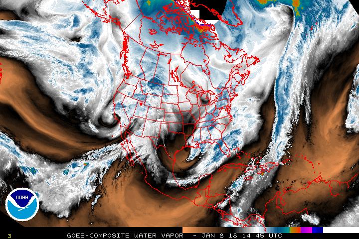
I'm liking the redesign of the GOES satellite server so far http://www.goes.noaa.gov/
I'm not liking the dry air slot or the prospect of yet another week of watering, I hope the rain materializes
I'm not liking the dry air slot or the prospect of yet another week of watering, I hope the rain materializes
-
Texas Pirate

75 miles South of Galveston??? that does not help us in Galv. County.Rip76 wrote:If they can hold together, looks like a line of storms about 75 miles south of Galveston ready to move in.
*Looking at radar*

Higher PW air is reaching the coast as noted by showers across the nearshore waters. Coastal areas should see overnight development keep streaming inland and then die out. Areas south of I-10 look wet on Sunday...areas to the north of I-10 are more questionable. Still concerned that the blow up of offshore convection tonight may "rob" inland areas of moisture and retard heating with dense cirrus blow off on Sunday with rainfall amounts ending up very low. On the other hand this is a very tropical air mass and a couple heavy showers over a location could drop an inch or two quickly.

Somewhat (dare I say it) optimistic this morning.
I was outside for a bit, and I could see the leading edge of the moisture move-in overhead. It's a little ahead of the line of storms along US 59 on radar. Further NW, if you look close on GR2, you can make out a thin line with a shower or two from Katy to Tomball -- that's it. Anyway, that's quickly surging north (maybe a bit ore north than expected?) and it's only 8AM.
Plus, I noticed the mid-high level clouds streaming in on the southern jet. It had a slight easterly component to it - again, a good sign for rain. It's an old rule of thumb in Texas, but with the jet now having an easterly component, it will help draw in some of that moisture that's been sitting south east of us for days.
And the last thing - the radar loop. You can see the trough axis in that blob in the gulf - and today it's drifting west instead of just sitting there. It is roughly due south of Galveston and slowly drifting west. This is about to place the Houston area on the east, instead of west side of the axis.
Water vapor confirms this too - and in the last few frames a surge of moisture from the east is about to wrap-in over us. Another critical element falling into place.
All in all, after much waiting, I think it may rain today, finally.
Jason i could'nt have said it better,i too am optimistic we'll see some rain out of this system.

Love this atmosphere, but it seems scared to move over land.
-
redneckweather
- Posts: 1022
- Joined: Mon Feb 08, 2010 7:29 pm
- Location: Montgomery, Texas
- Contact:
Looks like most of the rain will stay east of I-45.
Had a few pop up light showers in Stafford this morning. Nothing to write home about though. sigh... Didn't even see a rainbow even though the sun was out when the showers popped up. Come on rain!
-
srainhoutx

- Site Admin

- Posts: 19615
- Joined: Tue Feb 02, 2010 2:32 pm
- Location: Maggie Valley, NC
- Contact:
Well, it does appear the trough axis has moved inland across NE Mexico and Coastal Texas/SW Louisiana. The upper level trough that kept Coastal Texas dry has indeed lifted NE and an easterly fetch of high PW’s above 2 inches has arrived. Enjoy the next few days of increased rain chances because it does appear we heat up and turn hot by the end of the week. There are some indications that more tropical type air mass will return during the week of the 15th. The Bermuda Ridge does appear to be rather dominant keeping any tropical wave activity heading generally WNW across the Caribbean and eventually the NW Caribbean and possibly the Gulf of Mexico. We will see.


- Attachments
-
Carla/Alicia/Jerry(In The Eye)/Michelle/Charley/Ivan/Dennis/Katrina/Rita/Wilma/Humberto/Ike/Harvey
Member: National Weather Association
Facebook.com/Weather Infinity
Twitter @WeatherInfinity
Member: National Weather Association
Facebook.com/Weather Infinity
Twitter @WeatherInfinity

Latest QPF still looks like extreme southeast Texas and Beaumont (Golden Triangle) area look to receive the most moisture from 94L. Granted, it's not at lot, but it shows a 1.25"-1.50" at most. Possible higher amounts in certain areas where training occurs.
EDIT: Although, that big area of convection East/Southeast of Galveston sure seems be moving at a good pace W/NW. Maybe it just might make it inland enough to provide more moisture than what the QPF shows for central TX on up to Southeast Texas.
- 1.8.PNG (11.71 KiB) Viewed 5983 times
Last edited by djmike on Sun Jul 07, 2013 11:56 am, edited 1 time in total.
Mike
Beaumont, TX
(IH-10 & College Street)
Beaumont, TX
(IH-10 & College Street)
Yuck.
-
redneckweather
- Posts: 1022
- Joined: Mon Feb 08, 2010 7:29 pm
- Location: Montgomery, Texas
- Contact:
Just some scattered showers here and there but that will be about it. Count your blessings if you get rain today.
-
tireman4

- Global Moderator

- Posts: 4471
- Joined: Wed Feb 03, 2010 9:24 pm
- Location: Humble, Texas
- Contact:
Be patient young grasshoppers. The moisture is slowly moving this way.....do not give up hope...the HGX Morning Discussion...
.UPDATE...
SCATTERED LIGHT SHOWERS TO COME ONSHORE THROUGH THE REMAINDER OF
THE MORNING...NO MORE THAN A FEW HUNDREDTHS TO A TENTH OF AN INCH
OF ACCUMULATION FROM MANY OF THESE QUICKLY NORTH-PASSING CELLS. AS
THE DAY HEATS UP INTO THE 90S...THIS 2 INCH PWAT AIR MASS OVER THE
COASTAL COUNTIES WILL CONTINUE TO CREEP FURTHER INLAND SO EXPECTING
PRECIPITATION TO BETTER FILL IN THROUGH THE EARLY EVENING. PROG
SOUNDINGS SHOW A NEAR-SATURATED COLUMN AS FAR NORTH AS THE CITY
BY TOMORROW MORNING. THUS...FEEL THAT AT LEAST HIGH END CHANCE
POPS ARE WARRANTED THROUGH TOMORROW AFTERNOON. WARM PROFILES MAKE
FOR SKINNY CAPES...LIMITED STORM COVERAGE. RELATIVELY LOWER AREAWIDE
(OVERALL) QPF DUE TO THE WIDELY-SCATTERED NATURE ON CONVECTION...
LOCALIZED POCKETS OF OVER AN INCH OVER THE SOUTHERN THIRD OF THE
CWA IS STILL NOT OUT OF THE QUESTION. 31
Thanks Tire..read this earlier
Just wondering, with all the cloud cover, wouldn't daytime heating be a problem?
Just wondering, with all the cloud cover, wouldn't daytime heating be a problem?
-
tireman4
- Global Moderator
- Posts: 4471
- Joined: Wed Feb 03, 2010 9:24 pm
- Location: Humble, Texas
- Contact:
Now this is me, a neophyte and historian answering this, not a pro or amateur met. I think the the cap is easily broken today by the moisture content and lower heating values. That is me. The mets on board can correct me if I am wrong.

Day time heating really isn't an issue considering temps are already around the 90 degree mark.

Looks like most of the action is above I-10. Along Galveston Bay the clouds form and head north
SusieinLP wrote:Looks like most of the action is above I-10. Along Galveston Bay the clouds form and head north
That should change as the complex of rain currently in the gulf moves in land