
Excellent discussion from Lubbock this afternoon:
AREA FORECAST DISCUSSION
NATIONAL WEATHER SERVICE LUBBOCK TX
358 PM CST SUN FEB 24 2013
.SHORT TERM...
DEEPENING UPPER LEVEL STORM SYSTEM CURRENTLY ENTERING SOUTHERN NEW
MEXICO CONTINUES TO AMPLIFY AND PUSH TOWARD WEST TEXAS...SETTING THE
STAGE FOR A SIGNIFICANT WINTER STORM FOR THE EXTREME SOUTHERN TEXAS
PANHANDLE AND CENTRAL TO NORTHERN PORTIONS OF THE SOUTH AND ROLLING
PLAINS.
THIS EVENING...DUAL THREATS WILL IMPACT THE AREA AS HEIGHTS ALOFT
BEGIN TO FALL AHEAD OF THE AFOREMENTIONED UPPER LOW AS SURFACE
CYCLOGENESIS ENSUES OVER THE SOUTH AND ROLLING PLAINS. THE SHORTER
FUSED OF WHICH WILL BE ACROSS THE ROLLING PLAINS AND EXTREME
SOUTHEASTERN PANHANDLE IN THE FORM OF THUNDERSTORMS. STEEPENING
LAPSE RATES...STRONGLY SHEARED PROFILES...AND IMPRESSIVE OMEGA
VALUES WILL CONTRIBUTE TO STORMS DEVELOPING ALONG A PACIFIC
FRONT/DRYLINE. KEPT CHANCES PULLED WEST ACROSS A GOOD CHUNK OF THE
ROLLING PLAINS WITH INITIALLY BACKED SURFACE WINDS AHEAD OF THE
DEEPENING SURFACE LOW. A FEW STORMS MAY PRODUCE SOME ISOLATED LARGE
HAIL...BUT THIS THREAT SHOULD BE LIMITED BY ONLY A FEW HUNDRED J/KG
OF CAPE. FARTHER NORTHWEST...SNOW WILL BEGIN TO DEVELOP AND
OVERSPREAD THE AREA. TEMPERATURES WILL FALL BELOW FREEZING FROM
NORTHWEST TO SOUTHEAST...WITH AREAS NORTH AND WEST OF A MEMPHIS TO
JUSTICEBURG LINE SEEING ALL SNOW BY MIDNIGHT. LOCATIONS SOUTH AND
EAST WILL TRANSITION TO ALL SNOW DURING THE OVERNIGHT HOURS AS A
POLAR FRONT IS DRAGGED ACROSS THE AREA BY AN EAST/NORTHEASTWARD
MOVING SURFACE LOW.
MONDAY...THE HEAVIEST SNOW AMOUNTS LOOK TO TAKE PLACE MONDAY MORNING
IN THE 12-18Z WINDOW. THIS WILL BE THE TIME WHEN THE H50 LOW
TRAVERSES THE AREA. THIS LOW LOOKS TO CUT THROUGH THE SOUTH AND
ROLLING PLAINS...BRINGING HEAVY SNOW AT TIMES ON ITS NORTHWEST SIDE
IN VICINITY OF THE DEFORMATION ZONE. ISENTROPIC ANALYSIS SHOWS
ABUNDANT LIFT HERE WHERE A TROWAL AXIS WILL WRAP AROUND THE LOW
ENCOMPASSING THE EXTREME SOUTHERN PANHANDLE AND NORTHERN/CENTRAL
SOUTH/ROLLING PLAINS. IN ADDITION...EXTREMELY IMPRESSIVE 12 HOUR H50
HEIGHT FALLS OF NEAR 200 METERS WILL TAKE PLACE BY AROUND
12Z...FURTHER OWING TO THE SYSTEM/S INTENSITY.
WITH THE CONTINUED TRENDING FOR THE LOW TO MOVE FARTHER AND FARTHER
SOUTH...HAVE INCLUDED THE TOP THREE ROWS OF COUNTIES IN THE BLIZZARD
WARNING IN EFFECT FROM 9 PM SUNDAY EVENING TO 6 PM MONDAY EVENING.
BLOWING SNOW WILL COMMENCE OVERNIGHT ACROSS THE CENTRAL TO WESTERN
PORTIONS OF THE EXTREME SOUTHERN PANHANDLE AND NORTHERN SOUTH PLAINS
AS WINDS RAMP UP WITH PASSAGE OF THE POLAR FRONT. THIS WILL CONTINUE
THROUGHOUT THE AFTERNOON ACROSS THE AREA AFFECTED BY THE BLIZZARD
WARNING...AS WINDS OF UP TO 35 TO 45 MPH COMBINE WITH GUSTS UPWARDS
OF 60 MPH AT TIMES. STORM TOTAL SNOWFALL AMOUNTS WILL RANGE FROM 6
INCHES AND ABOVE ACROSS THE EXTREME SOUTHERN PANHANDLE...TO 3 TO 6
INCHES ACROSS THE NORTHERN TO CENTRAL SOUTH AND ROLLING PLAINS.
THE MORE SOUTHERN TRACK ALSO SEEMS TO WARRANT AN ADVISORY FOR YOAKUM
TO STONEWALL COUNTIES GIVEN THE STRENGTH OF THE LOW AND ASSOCIATED
WRAP AROUND SNOWFALL. TOTAL SNOWFALL AMOUNT HERE WILL BE IN THE 1 TO
3 INCH BALLPARK. WINDS WILL LIKELY REACH ADVISORY LEVEL CRITERIA
HERE AS WELL...BUT WILL JUST MENTION THIS IN THE WINTER WEATHER
ADVISORY PRODUCT TO AVOID MULTIPLE HEADLINES AND CONFUSION.
OVERALL...EXPECT A RAW DAY WITH TEMPERATURES IN THE 30S...OVERCAST
SKIES...AND BLOWING SNOW.
February-Comfortable Days/Cool Nights To The Month
-
srainhoutx

- Site Admin

- Posts: 19616
- Joined: Tue Feb 02, 2010 2:32 pm
- Location: Maggie Valley, NC
- Contact:
- Attachments
-
Carla/Alicia/Jerry(In The Eye)/Michelle/Charley/Ivan/Dennis/Katrina/Rita/Wilma/Humberto/Ike/Harvey
Member: National Weather Association
Facebook.com/Weather Infinity
Twitter @WeatherInfinity
Member: National Weather Association
Facebook.com/Weather Infinity
Twitter @WeatherInfinity
-
txflagwaver

- Posts: 411
- Joined: Wed Feb 03, 2010 2:37 pm
- Location: Seabrook/Kemah
- Contact:
So rain for our area tonight or is it all North and East? Is there a thread for just local weather and forecasts?

Excellent point. Unless you read this thread carefully you'd think the Houston/Galveston area was in for a major winter storm, not just the possibility of maybe a strong thunderstorm or two, wind, and cooler temps.txflagwaver wrote:So rain for our area tonight or is it all North and East? Is there a thread for just local weather and forecasts?
This is the KHOU weather board.
-
Andrew
- Site Admin
- Posts: 3440
- Joined: Wed Feb 03, 2010 9:46 pm
- Location: North-West Houston
- Contact:
At the same time the board has branched off to a much larger community than before. We have members from Oklahoma, Arkansas, Louisiana and all places in between.
For Your Infinite Source For All Things Weather Visit Our Facebook
-
Paul Robison
I'm more concerned about the winds after the front comes through and the red-flag warning. What kind of damage could we see out of that? Anyone have ideas?
.
updated nws graphical site, very easy to use http://preview.weather.gov/graphical/
current hgx discussion http://forecast.weather.gov/product.php ... glossary=0
000
FXUS64 KHGX 250001
AFDHGX
AREA FORECAST DISCUSSION
NATIONAL WEATHER SERVICE HOUSTON/GALVESTON TX
601 PM CST SUN FEB 24 2013
.DISCUSSION...
SEE 00Z AVIATION DISCUSSION.
&&
.AVIATION...
LIGHT SHOWERS BEGINNING TO DEVELOP AS A WARM FRONT LURKS OFFSHORE.
CIGS EXPECTED TO LOWER TO MVFR/LIFR BY 06Z. PATCHY FOG WILL ALSO
BE POSSIBLE OVERNIGHT AS THE FRONT MOVES NORTH. EAST WINDS WILL
BECOME SOUTHEAST. ON MONDAY...A STRONG FRONT WILL CROSS THE AREA.
FCST SOUNDINGS SHOW QUITE A BIT OF INSTABILITY AND WIND ENERGY.
HAVE ADDED A TEMPO GROUP FOR ALL TAF SITES FOR THUNDER. WINDS IN
THE WAKE OF THE FRONT WILL BECOME WEST AND INCREASE. GUSTS ON
MONDAY AFTN WILL EXCEED 30 KNOTS AT TIMES. WRAP AROUND CLOUDS WILL
AFFECT THE NORTHERN TAF SITES IN THE AFTN WHILE SOUTHERN TAF SITES
WILL LIKELY BECOME VFR. 43
&&
reg flag warning for se tx http://forecast.weather.gov/wwamap/wwat ... %20warning
Red Flag Warning
URGENT - FIRE WEATHER MESSAGE
NATIONAL WEATHER SERVICE HOUSTON/GALVESTON TX
313 PM CST SUN FEB 24 2013
...STRONG WESTERLY WINDS AND LOW RELATIVE HUMIDITIES MONDAY...
.A COLD FRONTAL PASSAGE EARLY MONDAY WILL INITIATE STRONG
WESTERLY WINDS AND SIGNIFICANTLY LOWER RELATIVE HUMIDITIES.
TXZ163-164-176>179-195>200-210>214-226-227-235>238-250515-
/O.UPG.KHGX.FW.A.0001.130225T1800Z-130226T0100Z/
/O.NEW.KHGX.FW.W.0002.130225T1800Z-130226T0100Z/
AUSTIN-BRAZORIA-BRAZOS-BURLESON-CHAMBERS-COLORADO-FORT BEND-
GALVESTON-GRIMES-HARRIS-HOUSTON-JACKSON-LIBERTY-MADISON-MATAGORDA-
MONTGOMERY-POLK-SAN JACINTO-TRINITY-WALKER-WALLER-WASHINGTON-
WHARTON-
313 PM CST SUN FEB 24 2013
...RED FLAG WARNING IN EFFECT FROM NOON TO 7 PM CST MONDAY FOR
MOST OF SOUTHEAST TEXAS...
THE NATIONAL WEATHER SERVICE IN HOUSTON/GALVESTON HAS ISSUED A
RED FLAG WARNING...WHICH IS IN EFFECT FROM NOON TO 7 PM CST
MONDAY. THE FIRE WEATHER WATCH IS NO LONGER IN EFFECT.
* AFFECTED COUNTIES... HOUSTON...TRINITY...MADISON...WALKER...
SAN JACINTO...POLK...BURLESON...BRAZOS...WASHINGTON...
GRIMES...MONTGOMERY...LIBERTY...COLORADO...AUSTIN...WALLER...
HARRIS...CHAMBERS...WHARTON...FORT BEND...JACKSON...
MATAGORDA...BRAZORIA...GALVESTON.
* WIND...20 TO 25 KNOTS...GUSTING TO NEAR 35 KNOTS.
* HUMIDITY...15 TO 25 PERCENT.
* IMPACTS...ANY FIRES THAT DEVELOP WILL LIKELY SPREAD RAPIDLY.
OUTDOOR BURNING IS NOT RECOMMENDED.
PRECAUTIONARY/PREPAREDNESS ACTIONS...
A RED FLAG WARNING MEANS THAT CRITICAL FIRE WEATHER CONDITIONS
ARE EITHER OCCURRING NOW...OR WILL SHORTLY. A COMBINATION OF
STRONG WINDS...LOW RELATIVE HUMIDITY...AND WARM TEMPERATURES WILL
CREATE EXPLOSIVE FIRE GROWTH POTENTIAL.
&&
$$
power outages might be a concern with high winds
this site has links for all states http://vielmetti.typepad.com/vacuum/201 ... -maps.html
locally of course, here's centerpoint http://gis.centerpointenergy.com/outage ... index.html they even have a NexRad layer available for their map, but it's static
this site has links for all states http://vielmetti.typepad.com/vacuum/201 ... -maps.html
locally of course, here's centerpoint http://gis.centerpointenergy.com/outage ... index.html they even have a NexRad layer available for their map, but it's static
-
Paul Robison
Does NOAA expect winds over 60mph in our area? Or will 40 mph winds be enough to put most of the area in the dark?
Since our weather forum is branching out to a much wider audience, which, by the way, I think is a huge compliment to the amazing wealth of knowledge provided by our members - I think it would be beneficial to either break the forum into regional sections, or at least start multiple monthly threads for the various areas referenced. It gets a little difficult to find out what's going on in Houston when I'm mostly seeing posts about north Texas, and have to skim through so many posts to find out what the weather is going to do in HGX. That's just my 2 cents though.
-
TexasBreeze
- Posts: 942
- Joined: Sun Sep 26, 2010 4:46 pm
- Location: NW Houston, TX
- Contact:
That's a good idea to split the topics or forum to different regions. Makes it easier to find the posts you want.
-
drmasommer
- Posts: 2
- Joined: Fri Feb 05, 2010 11:50 am
- Contact:
Please split the threads. The discussions should focus on the KHOU region unless the weather far to the north will have a critical and direct impact on the Houston region.
-
srainhoutx
- Site Admin
- Posts: 19616
- Joined: Tue Feb 02, 2010 2:32 pm
- Location: Maggie Valley, NC
- Contact:
With our current platform we can certainly accomplish what has been suggested. As we continue to grow and our membership and viewers of our weather community expands, we will never forget our 'roots' as a SE Texas based weather board that a Houston CBS affiliate television station funds and supports our efforts. We'll work on a solution that will provide the best of a ever growing Regional Weather Community as well as focus attention to our local weather as we do in providing Jeff's e-mail updates and major weather events that extend beyond our Region as we do in our Hurricane Central area as well as the in depth coverage of Super Storm Sandy. With growth comes some growing pains. And in the grand scheme of things, that is a positive problem not a negative. We have been working behind the scene for months to make improvements and upgrades for the expansion of what once was a little local weather community. Together we have built a weather board that we all can be proud of. Our weather community is now monitored by major media outlets from Coast to Coast. That is direct reflection on the quality of information from our knowledgeable members and the contributions our Pro Mets add that lends credibility to this great weather community. After all, we are one of the longest lasting weather boards on the web dating back to 2001.
Carla/Alicia/Jerry(In The Eye)/Michelle/Charley/Ivan/Dennis/Katrina/Rita/Wilma/Humberto/Ike/Harvey
Member: National Weather Association
Facebook.com/Weather Infinity
Twitter @WeatherInfinity
Member: National Weather Association
Facebook.com/Weather Infinity
Twitter @WeatherInfinity


To make it simple, just have one thread about weather outside of Houston that could cover discussion about north TX and all 49 other states and then the other just Houston locally. I don't want this forum to turn into a storm2k page. There is so many pages and topics each day it can drive me crazy. Just my two cents. But honestly, what we have going on now doesn't bother me.
Blake
Boomer Sooner
Boomer Sooner
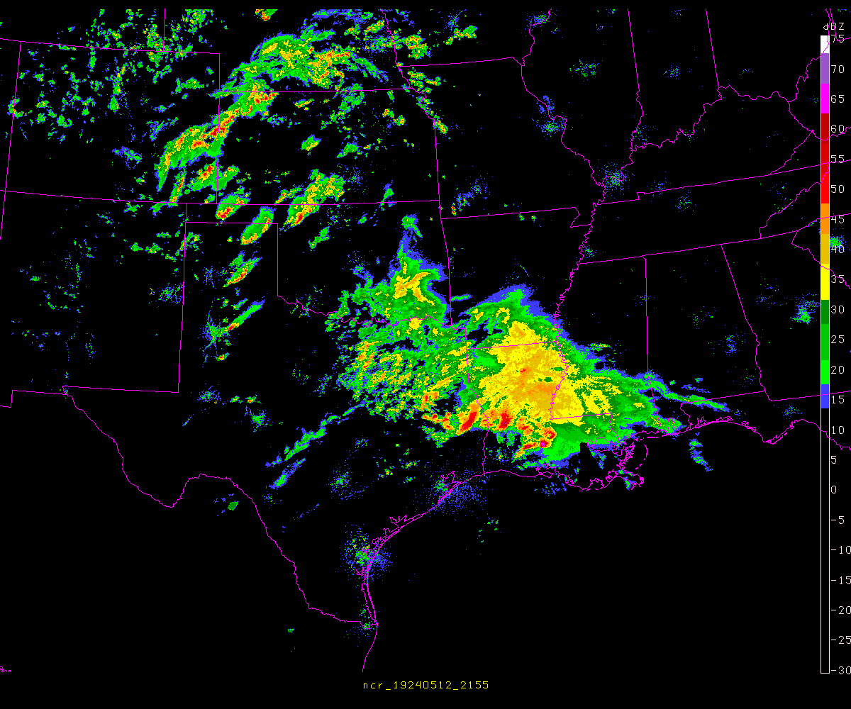
line is starting to build west of the dfw area
http://wdssii.nssl.noaa.gov/web/wdss2/p ... loop.shtml
http://wdssii.nssl.noaa.gov/web/wdss2/p ... loop.shtml
-
srainhoutx
- Site Admin
- Posts: 19616
- Joined: Tue Feb 02, 2010 2:32 pm
- Location: Maggie Valley, NC
- Contact:
Looks like a Watch may be forthcoming for portions of Central Texas...unome wrote:line is starting to build west of the dfw area
http://wdssii.nssl.noaa.gov/web/wdss2/p ... loop.shtml
http://www.spc.noaa.gov/products/md/md0213.html
Carla/Alicia/Jerry(In The Eye)/Michelle/Charley/Ivan/Dennis/Katrina/Rita/Wilma/Humberto/Ike/Harvey
Member: National Weather Association
Facebook.com/Weather Infinity
Twitter @WeatherInfinity
Member: National Weather Association
Facebook.com/Weather Infinity
Twitter @WeatherInfinity
go to link for watch status reports http://www.spc.noaa.gov/products/watch/ww0039.html
SEL9
URGENT - IMMEDIATE BROADCAST REQUESTED
SEVERE THUNDERSTORM WATCH NUMBER 39
NWS STORM PREDICTION CENTER NORMAN OK
1035 PM CST SUN FEB 24 2013
THE NWS STORM PREDICTION CENTER HAS ISSUED A
SEVERE THUNDERSTORM WATCH FOR PORTIONS OF
NORTHWEST AND WEST-CENTRAL TEXAS
EFFECTIVE THIS SUNDAY NIGHT AND MONDAY MORNING FROM 1035 PM UNTIL
600 AM CST.
HAIL TO 1.5 INCHES IN DIAMETER...THUNDERSTORM WIND GUSTS TO 70
MPH...AND DANGEROUS LIGHTNING ARE POSSIBLE IN THESE AREAS.
THE SEVERE THUNDERSTORM WATCH AREA IS APPROXIMATELY ALONG AND 70
STATUTE MILES EAST AND WEST OF A LINE FROM 50 MILES SOUTH
SOUTHEAST OF SAN ANGELO TEXAS TO 80 MILES NORTH NORTHWEST OF
MINERAL WELLS TEXAS. FOR A COMPLETE DEPICTION OF THE WATCH SEE
THE ASSOCIATED WATCH OUTLINE UPDATE (WOUS64 KWNS WOU9).
REMEMBER...A SEVERE THUNDERSTORM WATCH MEANS CONDITIONS ARE
FAVORABLE FOR SEVERE THUNDERSTORMS IN AND CLOSE TO THE WATCH
AREA. PERSONS IN THESE AREAS SHOULD BE ON THE LOOKOUT FOR
THREATENING WEATHER CONDITIONS AND LISTEN FOR LATER STATEMENTS
AND POSSIBLE WARNINGS. SEVERE THUNDERSTORMS CAN AND OCCASIONALLY
DO PRODUCE TORNADOES.
DISCUSSION...TSTMS HAVE RECENTLY DEVELOPED NEAR THE INTERSECTION OF
A SWD-MOVING COLD FRONT AND AN EWD-MOVING PACIFIC FRONT OVER THE LOW
ROLLING PLAINS WITH ADDITIONAL STORM DEVELOPMENT ANTICIPATED SWD
ALONG THE PACIFIC FRONT INTO THE CONCHO VALLEY. A STRONG...SLY LLJ
WILL CONTINUE TO ADVECT AN INCREASINGLY MOIST BOUNDARY LAYER BENEATH
VERY STEEP MIDLEVEL LAPSE RATES /REFERENCE 00Z MAF SOUNDING/...
CONTRIBUTING TO MUCAPE VALUES APPROACHING 1000 J/KG WITHIN THE WARM
SECTOR. GIVEN THE STRONG FORCING FOR ASCENT AND VERTICAL SHEAR
ATTENDANT TO THE DEEP-LAYER CYCLONE MOVING INTO THE SRN PLAINS...THE
SETUP WILL PROMOTE SEVERE STORMS CAPABLE OF LARGE HAIL AND DAMAGING
WIND GUSTS.
AVIATION...A FEW SEVERE THUNDERSTORMS WITH HAIL SURFACE AND ALOFT
TO 1.5 INCHES. EXTREME TURBULENCE AND SURFACE WIND GUSTS TO 60
KNOTS. A FEW CUMULONIMBI WITH MAXIMUM TOPS TO 400. MEAN STORM
MOTION VECTOR 24035.
...MEAD
-
Paul Robison
Sorry for trolling, but I do want to know this:
Could tomorrow's expected near-40mph wind gusts produce damage similar to hurricane irene?
NOTE from the washington post:
As Hurricane Irene bears down on the region, the National Weather Service forecasts sustained winds of 30 to 40 mph in the District and the suburbs Saturday night into Sunday, with gusts up to 50 mph. Ocean City can expect much more bluster — sustained wind up to 90 mph and gusts even faster.
Just how much damage will all this blowing cause?
At 20 mph, trees will sway and leaves may strip off.
At 30 mph, dead branches can fall. If you’re daring — or dumb — enough to walk outside, prepare to grab one of those swaying trees to keep upright. Lawn furniture will blow around unless it’s heavy or well-secured.
But stuff doesn’t really start to fly until the wind blows even harder.
At 40 mph, branches start to rip off trees, even “well-secured branches,” said James B. Elsner, a geography professor at Florida State University who studies hurricanes.
Um, no. It will be a breezy day around here, but nothing that we haven't seen a couple of times each winter after a strong front.
-
Andrew
- Site Admin
- Posts: 3440
- Joined: Wed Feb 03, 2010 9:46 pm
- Location: North-West Houston
- Contact:
Nothing close to Irene will happen or anything to that intensity. Just some stronger than normal winds.Paul Robison wrote:Sorry for trolling, but I do want to know this:
Could tomorrow's expected near-40mph wind gusts produce damage similar to hurricane irene?
NOTE from the washington post:
As Hurricane Irene bears down on the region, the National Weather Service forecasts sustained winds of 30 to 40 mph in the District and the suburbs Saturday night into Sunday, with gusts up to 50 mph. Ocean City can expect much more bluster — sustained wind up to 90 mph and gusts even faster.
Just how much damage will all this blowing cause?
At 20 mph, trees will sway and leaves may strip off.
At 30 mph, dead branches can fall. If you’re daring — or dumb — enough to walk outside, prepare to grab one of those swaying trees to keep upright. Lawn furniture will blow around unless it’s heavy or well-secured.
But stuff doesn’t really start to fly until the wind blows even harder.
At 40 mph, branches start to rip off trees, even “well-secured branches,” said James B. Elsner, a geography professor at Florida State University who studies hurricanes.
For Your Infinite Source For All Things Weather Visit Our Facebook
And of course, the thin line of storms that looked encouraging about an hour ago has now fallen apart to nothing but sprinkles and continuing to lose its punch as it approaches central TX. Looks like we'll get dry slotted again Portastorm! 
Blake
Boomer Sooner
Boomer Sooner