
July: Hot & Humid To End The Month


Skies are finally clearing up here in San Marcos. Low deck of clouds all morning and real drizzly. Just not my kind of weather. But sun is finally out with some blue skies. Hopefully we can get some more rain here this evening.
Blake
Boomer Sooner
Boomer Sooner
-
MontgomeryCoWx

- Posts: 2624
- Joined: Wed Dec 14, 2011 4:31 pm
- Location: Weimar, TX
- Contact:
Montgomery County starting to fill in... Lake Conroe getting some good rains right now.
Team #NeverSummer
-
redneckweather
- Posts: 1058
- Joined: Mon Feb 08, 2010 7:29 pm
- Location: Montgomery, Texas
- Contact:
MontgomeryCoWx wrote:Montgomery County starting to fill in... Lake Conroe getting some good rains right now.
Yep, like I said. The radar will start to fill in up that way around early afternoon.
Gotta love reverse psychology. lol
-
srainhoutx

- Site Admin

- Posts: 19688
- Joined: Tue Feb 02, 2010 2:32 pm
- Location: Maggie Valley, NC
- Contact:
FLOOD ADVISORY
NATIONAL WEATHER SERVICE HOUSTON/GALVESTON TX
146 PM CDT TUE JUL 10 2012
TXC039-071-157-167-201-321-102045-
/O.NEW.KHGX.FA.Y.0069.120710T1846Z-120710T2045Z/
/00000.N.ER.000000T0000Z.000000T0000Z.000000T0000Z.OO/
FORT BEND TX-GALVESTON TX-CHAMBERS TX-HARRIS TX-BRAZORIA TX-
MATAGORDA TX-
146 PM CDT TUE JUL 10 2012
THE NATIONAL WEATHER SERVICE IN LEAGUE CITY HAS ISSUED A
* URBAN AND SMALL STREAM FLOOD ADVISORY FOR...
SOUTHEASTERN FORT BEND COUNTY IN SOUTHEAST TEXAS...
NORTHERN GALVESTON COUNTY IN SOUTHEAST TEXAS...
CHAMBERS COUNTY IN SOUTHEAST TEXAS...
SOUTHEASTERN HARRIS COUNTY IN SOUTHEAST TEXAS...
BRAZORIA COUNTY IN SOUTHEAST TEXAS...
MATAGORDA COUNTY IN SOUTHEAST TEXAS...
* UNTIL 345 PM CDT
* AT 130 PM CDT...DOPPLER RADAR INDICATED A PERSISTENT AREA
OF TRAINING RAINFALL CENTERED ALONG A LINE FROM ROUGHLY
MATAGORDA TO WEST COLUMBIA TO MANVEL TO LEAGUE CITY TO OAK ISLAND.
WHILE RAINFALL RATES FOR MUCH OF THIS AREA ISN`T PARTICULARLY HIGH
FOR SOUTHEAST TEXAS...WE ARE BEGINNING TO SEE POCKETS OF 1.5 INCH
PER HOUR RATES AT TIMES. THIS IS FALLING ON INCREASINGLY SATURATED
GROUNDS AND MAY BEGIN TO RUNOFF AND CREATE MINOR STREET AND FEEDER
ROAD FLOODING.
* SOME LOCATIONS THAT WILL EXPERIENCE MINOR FLOODING INCLUDE
PASADENA...BAYTOWN...LEAGUE CITY...TEXAS CITY...PEARLAND...LA
PORTE...FRIENDSWOOD...DEER PARK...ALVIN...BAY CITY...ANGLETON...
DICKINSON...SOUTH HOUSTON...LA MARQUE...SANTA FE...BACLIFF...
PALACIOS...WEBSTER...WEST COLUMBIA...NASSAU BAY...TAYLOR LAKE
VILLAGE...SWEENY...FRESNO...EL LAGO...MANVEL...WINNIE...BRAZORIA...
WILD PEACH VILLAGE...KEMAH...AND ANAHUAC.
Carla/Alicia/Jerry(In The Eye)/Michelle/Charley/Ivan/Dennis/Katrina/Rita/Wilma/Humberto/Ike/Harvey
Member: National Weather Association
Facebook.com/Weather Infinity
Twitter @WeatherInfinity
Member: National Weather Association
Facebook.com/Weather Infinity
Twitter @WeatherInfinity
-
MontgomeryCoWx
- Posts: 2624
- Joined: Wed Dec 14, 2011 4:31 pm
- Location: Weimar, TX
- Contact:
Western Montgomery County getting hammered by a slow moving cell.
Lake Conroe and Woodlands people should be happy.
Lake Conroe and Woodlands people should be happy.
Team #NeverSummer

Looks like it is shaping up to be an interesting late afternoon/evening across SE Texas with these developing storms to the North of Houston. I suspect tonight we may have some sort of nocturnal event shaping up in our CWA. Gonna be keeping an eye on the radar tonight.
~~~When Thunder Roars Go Indoors~~~
~~~Turn Around Don't Drown~~~
~~~Run From The Water, Hide From The Wind~~~
~~~Turn Around Don't Drown~~~
~~~Run From The Water, Hide From The Wind~~~
-
MontgomeryCoWx
- Posts: 2624
- Joined: Wed Dec 14, 2011 4:31 pm
- Location: Weimar, TX
- Contact:
Looks like I've picked up 1.5 inches in the last hour.
Team #NeverSummer

Still nothing East of I-45...again...and everything moving towards me is quickly dying....again.....ugh....this is like a sick joke at this point....sprinklers when I get home for sureMontgomeryCoWx wrote:Western Montgomery County getting hammered by a slow moving cell.
Lake Conroe and Woodlands people should be happy.
They might as well exclude Montgomery County between I-45 and US59 & south of 242. It hasn't rained there in 2 weeks, why change now?Ed Mahmoud wrote:HGX disco- they are considering an FFW, some concern for nocturnal rains West of 45 and South of 10

I know just how you're feeling, Jason. I've been saying the same sort of stuff for over a week now. And when I do, my wife always says, "we'll get ours". To which I reply "yeah, rightjasons wrote:They might as well exclude Montgomery County between I-45 and US59 & south of 242. It hasn't rained there in 2 weeks, why change now?
But then this afternoon we got 1.5" in just a little over an hour. How great. So hang in there, bud... you'll get yours.


Interesting they mention nocturnal rains. They can get very heavy. Webberville near Austin got over 10 inches of rain last night.Ed Mahmoud wrote:HGX disco- they are considering an FFW, some concern for nocturnal rains West of 45 and South of 10
http://radar.weather.gov/lite/N0R/HGX_loop.gif
Came home to .08"
Sprinklers running - must water-in my summer lawn treatment that I spread...oh...4 days ago.
Sprinklers running - must water-in my summer lawn treatment that I spread...oh...4 days ago.
-
biggerbyte
- Posts: 1407
- Joined: Thu Feb 04, 2010 12:15 am
- Location: Porter, Texas. (Montgomery County)
- Contact:
Nothing here either. Most everything just goes poof as it reaches Porter.
I work in Conroe and it absolutely POURED over there, but not much appears to have fallen here at my place either.
No rain, no rainbows.
check out the experimental thunderstorm forecast 04Z-12Z
http://www.spc.noaa.gov/products/exper/enhtstm/
(sorry for the lrg pic, have never figured out how to get the resize to work)
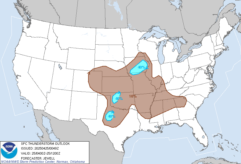
http://www.spc.noaa.gov/products/exper/enhtstm/
(sorry for the lrg pic, have never figured out how to get the resize to work)
-
weatherguy425
- Pro Met

- Posts: 830
- Joined: Wed Feb 03, 2010 7:45 pm
- Location: Atlanta, Georgia
- Contact:
A few showers beginning to parallel the coast. Both RAP and HRRR show initiate between 10PM in midnight in our coastal and southwestern Counties.


4" in the Sagemont/Pearland area.
Code: Select all
000
FXUS64 KHGX 110221
AFDHGX

AREA FORECAST DISCUSSION
NATIONAL WEATHER SERVICE HOUSTON/GALVESTON TX
921 PM CDT TUE JUL 10 2012

.UPDATE...
HAVE LOWERED POPS THROUGH THE REST OF THE EVENING AS CONVECTION
HAS DIMINISHED ACROSS THE REGION. ONLY OTHER CHANGES THIS EVENING
WERE TO BUMP THE MIN TEMPS UP A DEGREE OR SO ACROSS THE NORTHERN
HALF OF THE REGION. 38

&&

.PREV DISCUSSION... /ISSUED 651 PM CDT TUE JUL 10 2012/

DISCUSSION...
SEE BELOW FOR 00Z TAF PACKAGE.

AVIATION...
CONVECTION HAS DIMINISHED QUITE A BIT FOR TERMINALS KIAH AND
SOUTHWARD. PER COORDINATION WITH CWSU HAVE REMOVED SHOWER MENTION
FOR THE MOST OF THE EVENING HOURS. KCLL..KUTS..AND KCXO STILL HAVE
SOME VCTS OR VCSH OCCURRING/DEVELOPING UPSTREAM AND WILL CONTINUE
VC MENTION THIS EVENING. DID INTRODUCE SOME MVFR FOG AND CIGS AT
KCLL PER MOS AND PERSISTENCE FROM LAST NIGHT. WILL CONTINUE TO
EVALUATE OTHER SITES FOR PCPN AND CIG/VIS TRENDS. 04

PREV DISCUSSION... /ISSUED 349 PM CDT TUE JUL 10 2012/

DISCUSSION...
COMING REALLY CLOSE TO PULLING THE TRIGGER ON A FLASH FLOOD WATCH
FOR AREAS WEST OF I-45 AND SOUTH I-10. DECIDED TO LET EVENING
SHIFT TAKE A SECOND LOOK AT THINGS AND MONITOR TRENDS. TRAINING
RAINFALL TODAY OVER THIS GENERAL REGION...MOST OF IT LIGHT TO
MODERATE. BUT THERE WERE TIMES WHEN RATES WENT TO 1.5-2"/HR AND
THEY ARE NOW FALLING OVER INCREASINGLY SATURATED GROUNDS.

TONIGHT...SIMILAR TO YDAY EXPECT CONTINUE SHRA/TSTMS INLAND
THIS EVENING INDUCED BY HEATING. AND LIKE LAST NIGHT...SUSPECT
NOT ALL WILL DISSIPATE WITH THE LOSS OF HEATING CONSIDERING HIGH
PW`S BETWEEN 2.2-2.4" SITUATED ACROSS THE AREA. SEVERAL MODELS
SHOWING QUITE A BIT OF RAINFALL REDEVELOPING OUT TOWARD OUR SW
ZONES AND THE MATAGORDA BAY AREA OVERNIGHT. GENERALLY HAVEN`T PUT
A LOT OF STOCK IN MODEL TIMING/QPF AS LATE AS TRACK RECORD OF SUCH
HASN`T BEEN THE BEST. BUT IT`S A BIT CONCERNING WHEN SEVERAL ARE
ON THE SAME PAGE AND SOME WITH HIGH AMOUNTS. IT WOULD BE IN A
FAVORABLE AREA AT NIGHT AS WELL WITH THAT ARE BEING SITUATED IN
THE BASE OF THE TROF AXIS. THIS PART OF SE TX CAN PROBABLY TAKE A
GOOD AMOUNT OF RAIN BEFORE SIGNIFICANT PROBLEMS ARISE. PROBLEMS
WOULD BE WITH TRAINING 2-3" AMOUNTS PER HOUR - ESP IF THEY SPREAD
CLOSER TO THE METRO AREA. AGAIN - WILL LET THE EVENING CREW
MONITOR SHORT TERM TRENDS.

SO ANOTHER GOOD SHOT OF PRECIP TOMORROW AND A BIT LESS ON THURS.
MOISTURE VALUES PROGGED TO SUBSIDE AND TROF AXIS WEAKEN AND
TEMPORARILY PUSH A BIT SE IN THE DAYS TO COME. HOWEVER...STILL
ANTICIPATE FAIRLY DECENT COVERAGE DURING THE AFTN HOURS EACH DAY
GOING INTO THE WEEKEND. 47

MARINE...
NOT A LOT OF CHANGES TO THE GOING FCST TRENDS. A WEAK SURFACE TROUGH
WILL KEEP A LIGHT WIND REGIME IN PLACE THROUGH THE WEEKEND. AN UPPER
LEVEL TROUGH WILL ALSO KEEP SCATTERED STORMS IN THE FCST THROUGH THE
END OF THE WEEK. BRIEF GUSTY WINDS/ELEVATED SEAS ARE POSSIBLE IN AND
NEAR ANY THUNDERSTORM ACTIVITY. 41

&&

.PRELIMINARY POINT TEMPS/POPS...
COLLEGE STATION (CLL)      74  88  74  91  74 /  50  60  40  50  30
HOUSTON (IAH)              74  87  74  90  74 /  60  70  40  50  30
GALVESTON (GLS)            78  86  79  88  80 /  60  70  40  50  30

&&

.HGX WATCHES/WARNINGS/ADVISORIES...
TX...NONE.
GM...NONE.
&&

$$

DISCUSSION...38
AVIATION/MARINE...04

Showers and thunderstorms developing pretty much like what was advertised by most of the high resolution models yesterday afternoon and evening. Activity continues to slowly increase in coverage and spread inland out of our coastal counties where rain rates up to 2-3 inches per hour have been noted in some of the cells. A quick radar cross-section through the cells clearly indicates warm-cloud processes which supports very high rain rates with this activity through the morning. In the short term, the heaviest rainfall has fallen across far-eastern Matagorda and southwestern Brazoria counties with showers and storms continuing to develop over those areas. Will have to closely watch how things unfold through the morning as the activity develops/spreads closer to the metro area. Might be quite a messy commute.