
Search found 19375 matches
- Fri Apr 23, 2010 8:11 pm
- Forum: Weather Forum
- Topic: April Weather Discussion.
- Replies: 614
- Views: 300228
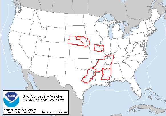
Re: April Weather Discussion. SPC: Slight Risk Friday & Satu
Rather large extentsion W with that Slight Risk area.
- Fri Apr 23, 2010 7:55 pm
- Forum: Weather Forum
- Topic: April Weather Discussion.
- Replies: 614
- Views: 300228
- Fri Apr 23, 2010 7:23 pm
- Forum: Weather Forum
- Topic: April Weather Discussion.
- Replies: 614
- Views: 300228
Re: April Weather Discussion. SPC: Slight Risk Friday & Satu
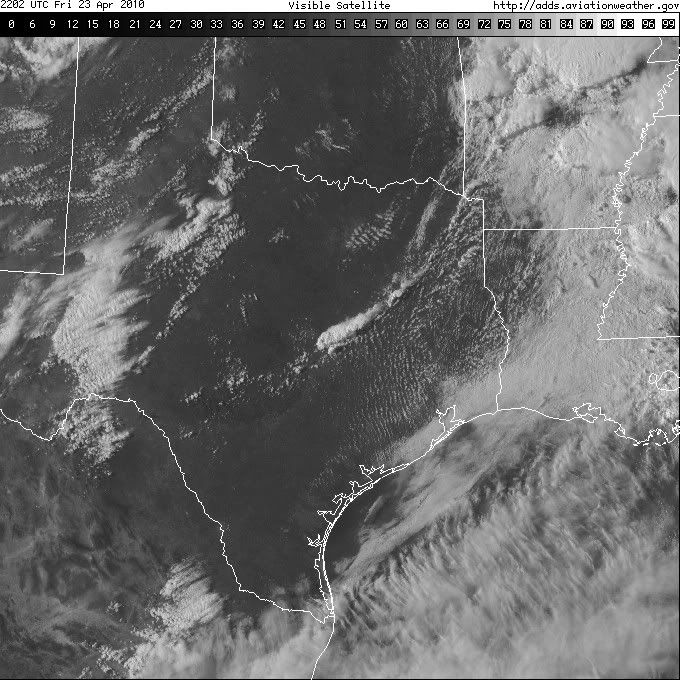
SEVERE WEATHER STATEMENT NATIONAL WEATHER SERVICE HOUSTON/GALVESTON TX 720 PM CDT FRI APR 23 2010 TXC313-240030- /O.CON.KHGX.TO.W.0005.000000T0000Z-100424T0030Z/ MADISON TX- 720 PM CDT FRI APR 23 2010 ...A TORNADO WARNING REMAINS IN EFFECT UNTIL 730 PM CDT FOR MADISON COUNTY... AT 714 PM CDT...NATIO...
- Fri Apr 23, 2010 7:04 pm
- Forum: Weather Forum
- Topic: April Weather Discussion.
- Replies: 614
- Views: 300228
Re: April Weather Discussion. SPC: Slight Risk Friday & Satu
ticka1 wrote:You have a link to the chaser's online Srainhoutx?srainhoutx wrote:Chasers near Centerville at this time.
Here you go ticka1. Bill Tabor is just S of Centerville...
http://www.severestudios.com/livechase
- Fri Apr 23, 2010 6:50 pm
- Forum: Weather Forum
- Topic: April Weather Discussion.
- Replies: 614
- Views: 300228
Re: April Weather Discussion. SPC: Slight Risk Friday & Satu
Chasers near Centerville at this time.
- Fri Apr 23, 2010 6:30 pm
- Forum: Weather Forum
- Topic: April Weather Discussion.
- Replies: 614
- Views: 300228
Re: April Weather Discussion. SPC: Slight Risk Friday & Satu
Storms re-developign out west of Austin. BULLETIN - EAS ACTIVATION REQUESTED SEVERE THUNDERSTORM WARNING NATIONAL WEATHER SERVICE AUSTIN/SAN ANTONIO TX 624 PM CDT FRI APR 23 2010 THE NATIONAL WEATHER SERVICE IN AUSTIN SAN ANTONIO HAS ISSUED A * SEVERE THUNDERSTORM WARNING FOR... EXTREME NORTHEASTER...
- Fri Apr 23, 2010 6:07 pm
- Forum: Weather Forum
- Topic: April Weather Discussion.
- Replies: 614
- Views: 300228
Re: April Weather Discussion. SPC: Slight Risk Friday & Satu
BULLETIN - EAS ACTIVATION REQUESTED TORNADO WARNING NATIONAL WEATHER SERVICE FORT WORTH TX 604 PM CDT FRI APR 23 2010 THE NATIONAL WEATHER SERVICE IN FORT WORTH HAS ISSUED A * TORNADO WARNING FOR... LEON COUNTY IN NORTHEAST TEXAS... * UNTIL 700 PM CDT * AT 604 PM CDT...STORM SPOTTERS AND DOPPLER RAD...
- Fri Apr 23, 2010 5:44 pm
- Forum: Weather Forum
- Topic: April Weather Discussion.
- Replies: 614
- Views: 300228
Re: April Weather Discussion. SPC: Slight Risk Friday & Satu
AREA WEATHER UPDATE NATIONAL WEATHER SERVICE FORT WORTH TX 533 PM CDT FRI APR 23 2010 ...WARNING DECISION UPDATE FOR NORTH TEXAS... CONCERNING STORMS DEVELOPING ALONG A TEMPLE TO PALESTINE LINE. THIS LINE APPROXIMATELY DENOTES A STALLED OUT FRONTAL BOUNDARY. LATEST SPC MESOANALYSIS INDICATES SUFFICI...
- Fri Apr 23, 2010 5:35 pm
- Forum: Weather Forum
- Topic: April Weather Discussion.
- Replies: 614
- Views: 300228
Re: April Weather Discussion. SPC: Slight Risk Friday & Satu
Ft. Worth NWS: "A well defined hook is developing west of Cameron in Milam county" BULLETIN - EAS ACTIVATION REQUESTED TORNADO WARNING NATIONAL WEATHER SERVICE FORT WORTH TX 529 PM CDT FRI APR 23 2010 THE NATIONAL WEATHER SERVICE IN FORT WORTH HAS ISSUED A * TORNADO WARNING FOR... NORTHER...
- Fri Apr 23, 2010 5:20 pm
- Forum: Weather Forum
- Topic: April Weather Discussion.
- Replies: 614
- Views: 300228
- Fri Apr 23, 2010 3:27 pm
- Forum: Weather Forum
- Topic: April Weather Discussion.
- Replies: 614
- Views: 300228
Re: April Weather Discussion. SPC: Slight Risk Friday & Satu
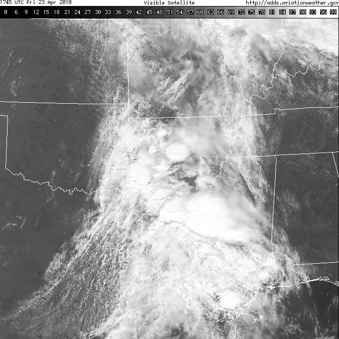
HGX thoughts this afternoon... AREA FORECAST DISCUSSION NATIONAL WEATHER SERVICE HOUSTON/GALVESTON TX 317 PM CDT FRI APR 23 2010 .DISCUSSION... THE UPPER LOW CHURNING OVER EASTERN CO TO MOVE EAST TONIGHT... DRAGGING A MAIN BOUNDARY (COOL FRONT) ACROSS CENTRAL AND EASTERN TEXAS THROUGH TOMORROW MORNI...
- Fri Apr 23, 2010 1:24 pm
- Forum: Weather Forum
- Topic: April Weather Discussion.
- Replies: 614
- Views: 300228
Re: April Weather Discussion. SPC: Slight Risk Late Week!
Intersting note concerning tomorrow for areas outlined in the Moderate Risk to our N and E... CONCERNING THE TORNADO OUTBREAK SCENARIO...THE THINKING IS THAT A CLUSTER OF TORNADIC SUPERCELLS WILL ORGANIZE NEAR THE SABINE RIVER IN FAR NE TX AROUND 12Z SATURDAY AND MOVE ENEWD ACROSS NRN LA INTO ERN AR...
- Fri Apr 23, 2010 1:04 pm
- Forum: Weather Forum
- Topic: April Weather Discussion.
- Replies: 614
- Views: 300228
- Fri Apr 23, 2010 12:25 pm
- Forum: Weather Forum
- Topic: April Weather Discussion.
- Replies: 614
- Views: 300228
Re: April Weather Discussion. SPC: Slight Risk Late Week!
Appears dry line has stalled just N and W of Austin/San Antonio.
- Fri Apr 23, 2010 11:51 am
- Forum: Weather Forum
- Topic: April Weather Discussion.
- Replies: 614
- Views: 300228
Re: April Weather Discussion. SPC: Slight Risk Late Week!
I a bit more 'fine tuning' by the SPC with both Slight and Moderate Risk Areas. Of note is that some SPC WRF data suggests Super Cell Structures near Austin later today. http://i228.photobucket.com/albums/ee298/srainhoutx/04232010day1otlk_1630.gif DAY 1 CONVECTIVE OUTLOOK NWS STORM PREDICTION CENTER...
- Fri Apr 23, 2010 10:34 am
- Forum: Weather Forum
- Topic: April Weather Discussion.
- Replies: 614
- Views: 300228
Re: April Weather Discussion. SPC: Slight Risk Late Week!
HGX Mid Morning Update...still some questions concerning the capping... AREA FORECAST DISCUSSION NATIONAL WEATHER SERVICE HOUSTON/GALVESTON TX 1023 AM CDT FRI APR 23 2010 .UPDATE... PERIODIC LIGHT RAIN OVER THE NEXT HOUR OR TWO...WIDESPREAD ACTIVITY DWINDLING DOWN TO MORE SCT/ISO POCKETS OF -SHRA. M...
- Fri Apr 23, 2010 8:22 am
- Forum: Weather Forum
- Topic: April Weather Discussion.
- Replies: 614
- Views: 300228
Re: April Weather Discussion. SPC: Slight Risk Late Week!
HGX Updated HWO...I suspect our Severe Weather folks will be active and providing great Updates during the next 24 hours... ;) HAZARDOUS WEATHER OUTLOOK NATIONAL WEATHER SERVICE HOUSTON/GALVESTON TX 752 AM CDT FRI APR 23 2010 TXZ163-164-176>179-195>200-210>214-226-227-235>238-241300- AUSTIN-BRAZORIA...
- Fri Apr 23, 2010 7:43 am
- Forum: Weather Forum
- Topic: April Weather Discussion.
- Replies: 614
- Views: 300228
Re: April Weather Discussion. SPC: Slight Risk Late Week!
SPC trims back (slightly) Moderate Risk in E and NE TX...Slight Risk remains for Houston Metro Area... http://i228.photobucket.com/albums/ee298/srainhoutx/04232010day1otlk_1300.gif http://i228.photobucket.com/albums/ee298/srainhoutx/04232010day1probotlk_1300_torn.gif http://i228.photobucket.com/albu...
- Fri Apr 23, 2010 6:39 am
- Forum: Weather Forum
- Topic: April Weather Discussion.
- Replies: 614
- Views: 300228
Re: April Weather Discussion. SPC: Slight Risk Late Week!
Also of note are the comments from the HPC this morning regarding E TX and LA... QUANTITATIVE PRECIPITATION FORECAST DISCUSSION NWS HYDROMETEOROLOGICAL PREDICTION CENTER CAMP SPRINGS MD 554 AM EDT FRI APR 23 2010 FINAL DAY 1...DAY 2 AND DAY 3 QPF DISCUSSION VALID APR 23/1200 UTC THRU APR 26/1200 UTC...
- Fri Apr 23, 2010 6:16 am
- Forum: Weather Forum
- Topic: April Weather Discussion.
- Replies: 614
- Views: 300228
Re: April Weather Discussion. SPC: Slight Risk Late Week!
SPC issues a Public Severe Weather Outlook. While capping appears to be very strong across the Houston Metro Area, past experience has showed us that we need to be mindful that our Area remains in a Slight Risk and thing can and often do change as we cannot predict any Meso scale Convective Complexe...