
Search found 5776 matches
- Tue May 14, 2024 4:17 pm
- Forum: Weather Forum
- Topic: May 2024
- Replies: 365
- Views: 18862
Re: May 2024
wpc_excessive_rainfall_dayjh3.us_sc.png Excessive Rainfall Discussion NWS Weather Prediction Center College Park MD 1201 PM EDT Tue May 14 2024 Day 3 Valid 12Z Thu May 16 2024 - 12Z Fri May 17 2024 ...THERE IS A MODERATE RISK OF EXCESSIVE RAINFALL FOR PORTIONS OF EAST TEXAS AND NORTHERN AND WESTERN...
- Tue May 14, 2024 4:16 pm
- Forum: Weather Forum
- Topic: May 2024
- Replies: 365
- Views: 18862
- Tue May 14, 2024 9:47 am
- Forum: Weather Forum
- Topic: May 2024
- Replies: 365
- Views: 18862
Re: May 2024
One last Chamber of Commerce Day before more rain and then The Big Suck.
Enjoy! Clear, dry days have been a rarity this Spring.
Enjoy! Clear, dry days have been a rarity this Spring.
- Tue May 14, 2024 12:33 am
- Forum: Weather Forum
- Topic: May 2024
- Replies: 365
- Views: 18862
Re: May 2024
A gully washer Thursday evening.

- Tue May 14, 2024 12:30 am
- Forum: Weather Forum
- Topic: May 2024
- Replies: 365
- Views: 18862
Re: May 2024
The next storm system to watch is this Thursday,we may see another MCS.It's nice having a normal Spring for once. rgem_mslp_pcpn_frzn_scus_76.png What are you seeing after though? Looks like a quiet period to me. Well Friday and or Saturday may end up stormy also as the frontal boundary will still ...
- Mon May 13, 2024 3:41 pm
- Forum: Weather Forum
- Topic: May 2024
- Replies: 365
- Views: 18862
Re: May 2024
Nasty cells headed toward West Columbia
- Mon May 13, 2024 1:22 pm
- Forum: Weather Forum
- Topic: May 2024
- Replies: 365
- Views: 18862
Re: May 2024
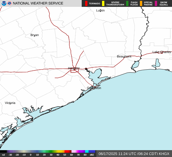
Storms are getting stronger out there as they move towards SE Texas... Screenshot 2024-05-13 at 13-15-44 NWS Radar.png ww0237_overview_wou.gif BULLETIN - IMMEDIATE BROADCAST REQUESTED SEVERE THUNDERSTORM WATCH OUTLINE UPDATE FOR WS 237 NWS STORM PREDICTION CENTER NORMAN OK 100 PM CDT MON MAY 13 202...
- Mon May 13, 2024 1:21 pm
- Forum: Weather Forum
- Topic: May 2024
- Replies: 365
- Views: 18862
- Mon May 13, 2024 1:19 pm
- Forum: Weather Forum
- Topic: May 2024
- Replies: 365
- Views: 18862
Re: May 2024
It looks like one cluster is headed for Houston along or south of I-10 and another cluster from Austin headed to CLL
- Mon May 13, 2024 11:00 am
- Forum: Weather Forum
- Topic: May 2024
- Replies: 365
- Views: 18862
- Mon May 13, 2024 10:58 am
- Forum: Weather Forum
- Topic: May 2024
- Replies: 365
- Views: 18862
Re: May 2024
Those cells are poppin with bad intentions! Unusual to see severe storms that far SW - usually capped or not enough energy.
- Sun May 12, 2024 10:41 pm
- Forum: Weather Forum
- Topic: May 2024
- Replies: 365
- Views: 18862
Re: May 2024
0Z HRRR for tomorrow. Screenshot 2024-05-12 at 21-16-51 Models HRRR - Pivotal Weather.pngScreenshot 2024-05-12 at 21-16-59 Models HRRR - Pivotal Weather.pngScreenshot 2024-05-12 at 21-17-14 Models HRRR - Pivotal Weather.png HRRR has been showing that since 0z yesterday. Looks good! I definitely wan...
- Sun May 12, 2024 2:13 pm
- Forum: Weather Forum
- Topic: May 2024
- Replies: 365
- Views: 18862
Re: May 2024
We haven't seem much rain (0.13 in) until a streamer shower just hit us from the back door. I had planned to get a little backyard mowing in. The main rain and severe weather have remained to our north - Hearne and Buffalo I’d watch later this evening for some bad stuff your way. ULL + SJT = more i...
- Sun May 12, 2024 11:50 am
- Forum: Weather Forum
- Topic: May 2024
- Replies: 365
- Views: 18862
Re: May 2024
We haven't seem much rain (0.13 in) until a streamer shower just hit us from the back door. I had planned to get a little backyard mowing in.
The main rain and severe weather have remained to our north - Hearne and Buffalo
The main rain and severe weather have remained to our north - Hearne and Buffalo
- Sat May 11, 2024 5:12 pm
- Forum: Weather Forum
- Topic: May 2024
- Replies: 365
- Views: 18862
Re: May 2024
sgpcd3cat.us_sc.png Day 3 Convective Outlook NWS Storm Prediction Center Norman OK 0237 AM CDT Sat May 11 2024 Valid 131200Z - 141200Z ...THERE IS A SLIGHT RISK OF SEVERE THUNDERSTORMS FROM CENTRAL AND EAST TEXAS INTO THE LOWER MISSISSIPPI VALLEY... ...SUMMARY... Severe thunderstorms are possible M...
- Sat May 11, 2024 1:41 pm
- Forum: Weather Forum
- Topic: May 2024
- Replies: 365
- Views: 18862
Re: May 2024
Interview in NC went well today. So well that the VP gave me a verbal notice of intent to hire and said he wanted to spend his time with me to close in on an initial offer range before I traveled home. Written one will be forthcoming Monday What is it that you do exactly if you don’t mind me asking...
- Sat May 11, 2024 1:40 pm
- Forum: Weather Forum
- Topic: May 2024
- Replies: 365
- Views: 18862
Re: May 2024
The 12z GFS even through the end of its run continues to advertise another long duration of wet weather, im also hearing that the death ridge may set up shop more over the SW US and not directly over us for the summer, that may provide us with opportunities for most rain and a steady moisture feed ...
- Sat May 11, 2024 1:37 pm
- Forum: Weather Forum
- Topic: May 2024
- Replies: 365
- Views: 18862
Re: May 2024
Interview in NC went well today. So well that the VP gave me a verbal notice of intent to hire and said he wanted to spend his time with me to close in on an initial offer range before I traveled home. Written one will be forthcoming Monday Nice - I'd move back to NC just for the weather! Good luck!
- Thu May 09, 2024 9:10 pm
- Forum: Weather Forum
- Topic: May 2024
- Replies: 365
- Views: 18862
Re: May 2024
Largely a bust here, but an impressive outflow boundary as intense cells collapsed. A DP of 67°F with the breeze never felt so refreshing. 
The rivers are flooded enough, so losing out on rain is no biggie.
The line may reform as the showers head towards Houston.
The rivers are flooded enough, so losing out on rain is no biggie.
The line may reform as the showers head towards Houston.
- Thu May 09, 2024 6:59 pm
- Forum: Weather Forum
- Topic: May 2024
- Replies: 365
- Views: 18862
Re: May 2024
There is some backbuilding streamer showers forming east of CLL and supercells bearing down Hwy 6 that don't want to take prisoners.